
|
First off, welcome to all of my new followers from the home region of the Kennebunk's and others who may have trickled in over the past few days and weeks. My mission here is simple, to have an unbiased approach to forecasting weather that is different than what you may find elsewhere. When I post something, it has meaning and potential for impact. I am not one to post clickbait and hype, if anything I try to cut through all of that and present the bottom line based on the information I can find. I am not here to compete with any other weather media whether print or television. I have been a media partner with the National Weather Service since 2016, which is the best partner to have. I am not here for scientific or political debate purposes. My one agenda is to bring an independent view of the weather, and you can figure out what to do with the information I provide. Early fall pattern taking shape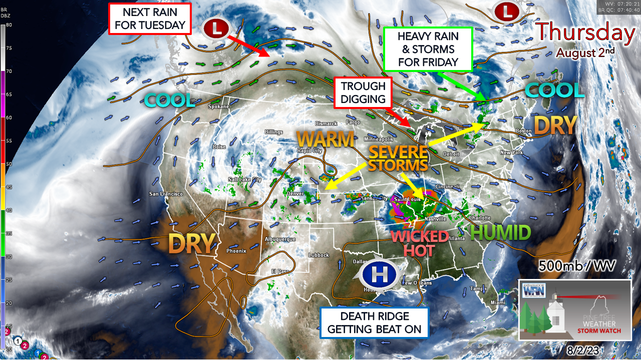 The 500mb steering level of the atmosphere with water vapor imagery shows the ongoing battle between the upper lows to the north and the strong ridge to the south. The death ridge bringing triple-digit heat over the south is getting hammered by the strong upper low over northern Quebec. The squeeze play going on is causing severe weather to the south and west as the two battle it out. The trough associated with the upper low breeds a strong surface low that will spin a warm front into Maine Thursday, and a cold front on Friday. Flash flooding a concern once again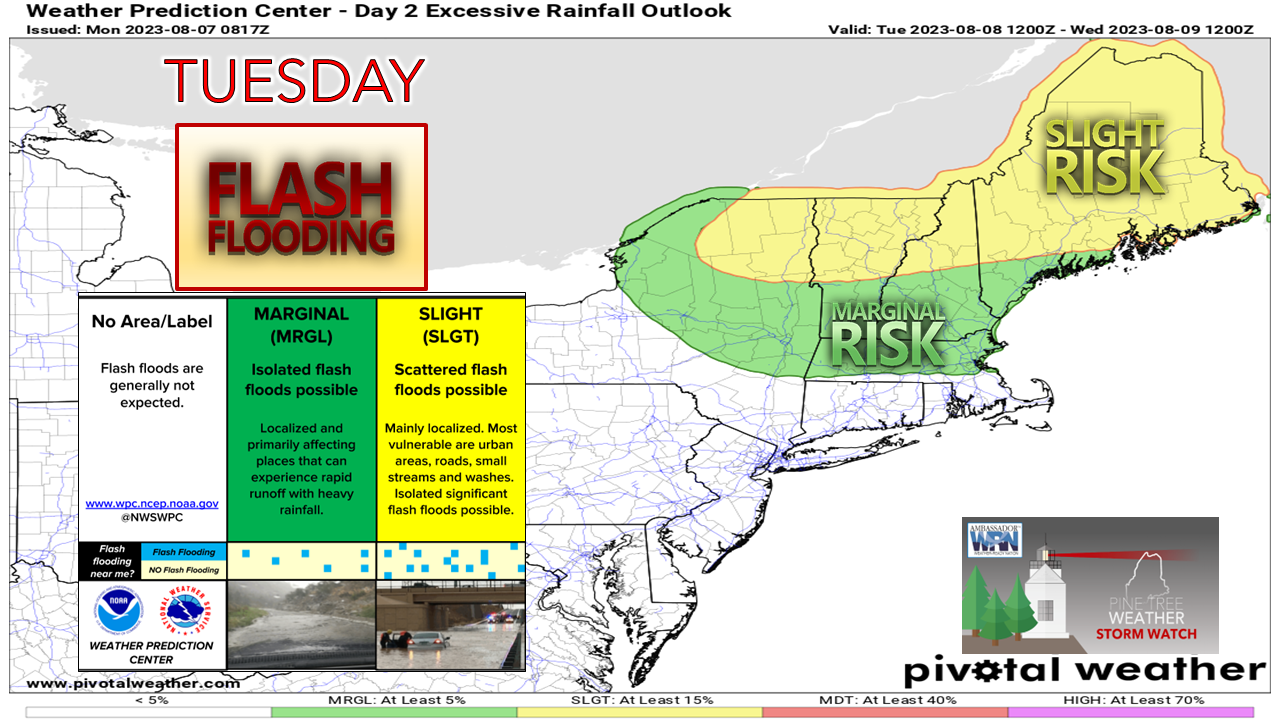 The Weather Prediction Center has a slight risk for flash flooding over most of the southern half of the state. While this airmass moving in isn't as juicy as we have experienced recently, it will raise dew points into the low to mid-60s over much of the yellow shaded region, and it is that infusion of moisture that brings the heavy rain potential. 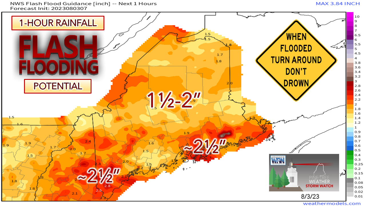 Some improvement here in the flash flood guidance as the ground has been able to dry out a bit from the lower dew points and dry conditions. It's still quite high with much of the region in the 1½-2"/hour range which can be easily achieved with the heavy rain on the way. The National Weather Service is holding off on flood watches for now. Time will tell if they change their mind, but regardless, as I have been saying for a while now, we are in a constant state of flood potential given the saturation, whether it is officially called or not. The threat of urban street flooding with the incoming rain and potential for road washouts are certainly there. Showers and storms Thursday into the overnight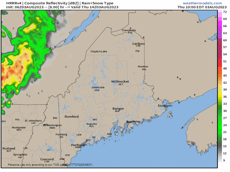 Thursday 10 AM to Friday 6 AM - A cold front tries to work in from the northwest on Thursday but ends up getting cut off by an approaching warm front heading into Friday morning. The Quebec border region sees the best chance for activity Thursday afternoon. With the warm front moving in, there is the risk of a few rumbles during the overnight over western and southern areas. Areas of heavy rain and potential for storms Friday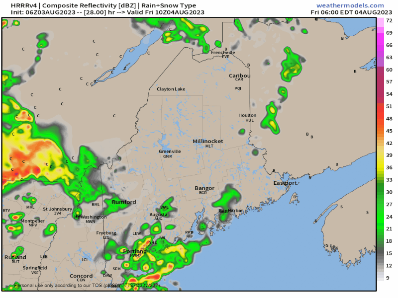 Friday 6 AM to Saturday 2 AM - With the warm front moving in, this is where things get interesting. With the elevated dew points and the approach of a cold front, the one key element here will be the sun. With much of the southern half of the state in the warm sector by Friday morning, the instability around, it won't need a whole lot of sun to ignite convective showers and potential for thunderstorms. The HRRR idea presented here is betting on the sun popping out and the strong possibility of torrential rainfall. Looking at the timing, Friday afternoon could be a rough one for travel with poor visibility and the potential for street flooding. As of early Thursday morning, the severe storm threat appears more to the west of the state over New Hampshire, Vermont, and western Massachusetts. I am not ruling that threat out for southern Maine. If the sun gets out, look out. Where there is training will be where there is flooding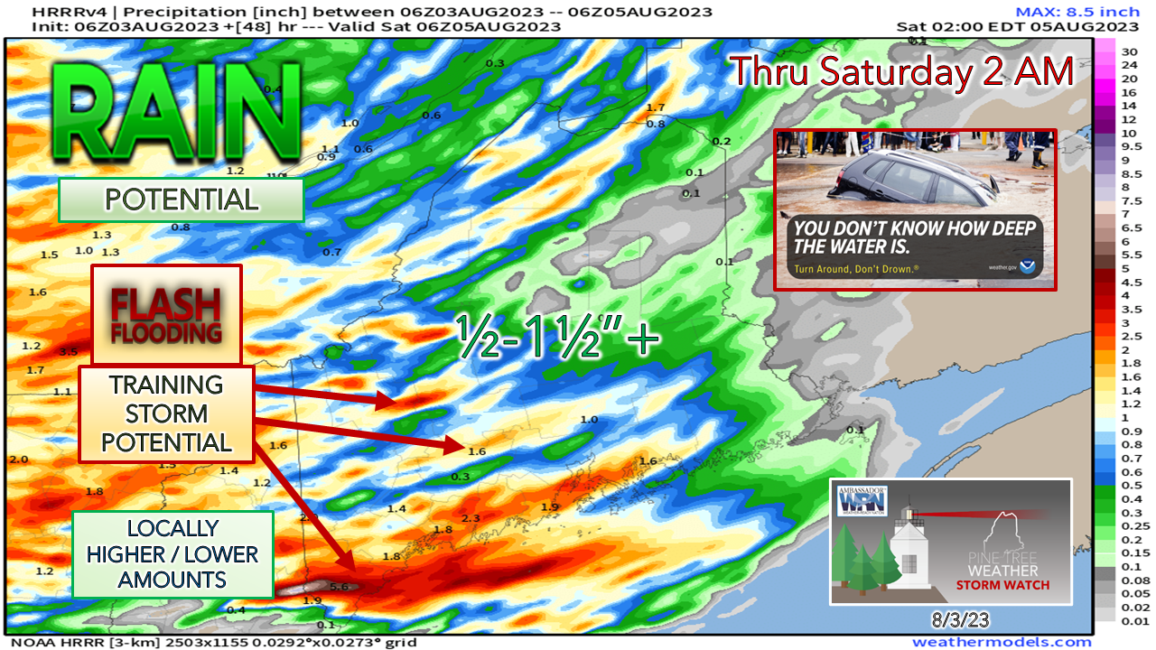 Over the years I have gotten out of the habit of showing one model idea of precipitation unless it is warranted for potential purposes, and this is one of those exceptions. Please do not focus on one specific area here and think this is carved in stone. The point here is to articulate the potential for training of heavy rain and storms. For sure, southern areas certainly have the best chance for that as the HRRR model idea suggests. I am still thinking the over/under for rainfall comes in at around 1" for much of the state, with some areas receiving less, and isolated areas a whole lot more. I wouldn't be surprised to see 4-6" rainfall amounts out of this if the sun comes out for a time. After the cold front moves through over eastern and northern areas on Saturday, the region appears dry through Monday before the next chance for rain comes on Tuesday. Pine Tree Weather is funded from followers like you. I would appreciate your financial support. Click here for how you can contribute. You may not like the weather, but I hope you like what I do, and support my efforts. Thank you! Stay updated, stay on alert, and stay safe! - Mike NOTE: The forecast information depicted on this platform is for general information purposes only for the public and is not designed or intended for commercial use. For those seeking pinpoint weather information for business operations, you should use a private sector source. For information about where to find commercial forecasters to assist your business, please message me and I will be happy to help you. |

Mike Haggett
|


