
Ice to melt off in most areas... hopefully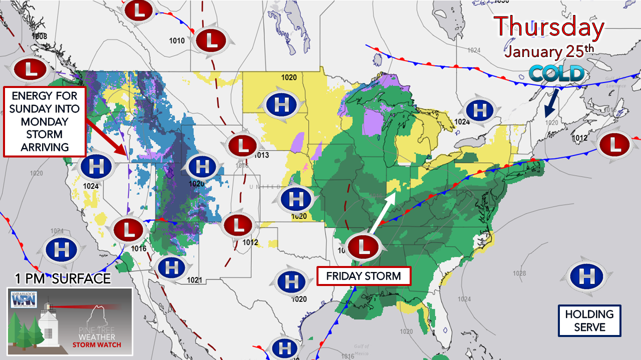 After the overnight mess clears out early Thursday morning, the sun is expect to make an appearance and de-ice the area after one of the trashier storms of the season to this point. A breeze is expected to pick up which will help dry things out a bit, which is important, because cold air makes re-entry and sets the table for Friday. Areas that do not melt may raise localized concerns as another round of junk is on the way, Cold air damming to play a role on Friday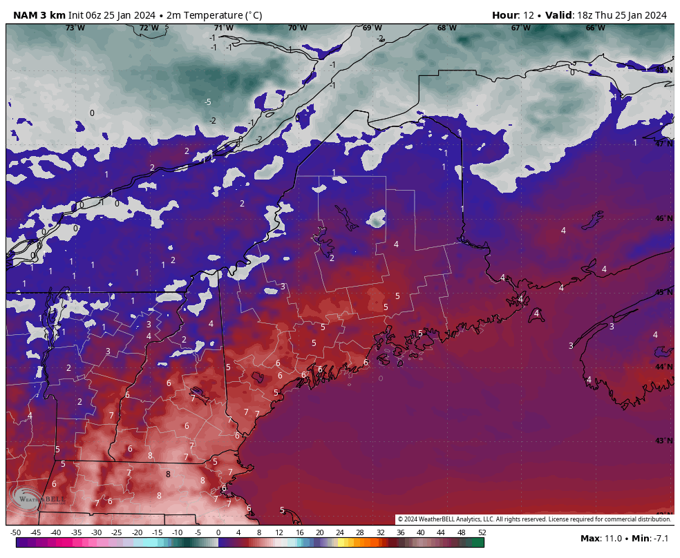 Thursday 1 PM (18z) to Friday 7 PM (Saturday 00z) - Temperature here is degrees Celsius for contrast purposes to show the at or below freezing air pouring back into the region. The best chance of the freezing rain / sleety junk is primarily over the western interior. The NAM3 model is fairly good at showing the cold at the surface of all the available short term ideas. Around the freezing line is where the best chance of the mix is possible. Timing through Saturday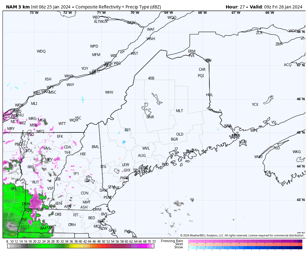 Friday 4 AM (09z) to 7 PM (00z Saturday) - Guidance has cooled its ideas somewhat in the past 24 hours, but it's still bent on a warm nose to work in aloft over western areas. This is likely to bring another round of freezing rain, with a switch to sleet in areas, and then eventually to snow as the wave departs. Southwestern coastal areas in the home office region of Kennebunk can expect a mainly rain event from this. To the north and east, it mainly snow with some mixing possible over the DownEast interior south of Bangor. 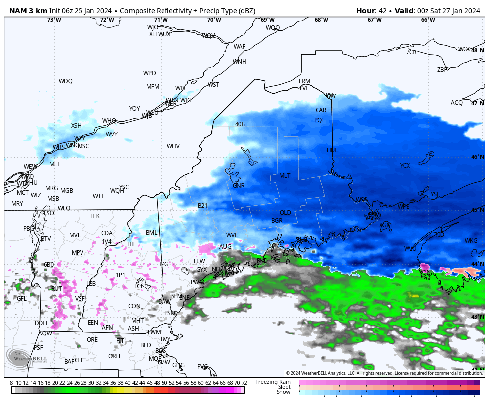 Friday 7 AM (00z Saturday) to 1 PM Saturday (18z) - As the poorly organized wave departs Friday night, a weak boundary works in Saturday morning. With residual moisture lingering from the wave could stir up areas of light snow over the interior and light ice over the south. As the morning progresses, the boundary gives the light precipitation a final shove into the Gulf of Maine. The sun is expected come out to help temperatures rise above freezing to help clean up south of the mountains and north. 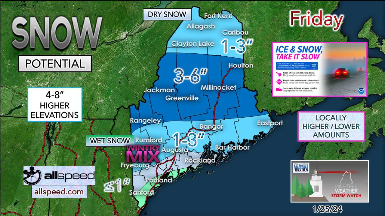 This is a sloppy mess for the western interior. Bust potential is rather high south of the mountains for snowfall given the mixing and low ratio snow. The further north, the easier this will be to deal with in the aftermath. A rough estimate of ¼ - ½" of liquid equivalent is involved here, with lesser amounts to the north. Sunday into Monday idea not dead yet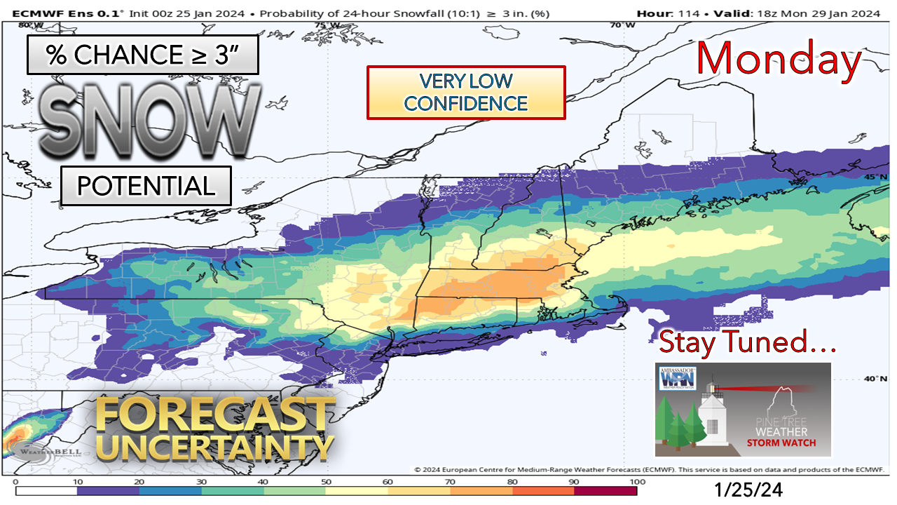 I mentioned on Facebook Wednesday afternoon that I am not a fan of the set up for snow potential with this potential storm, and I am still not. The lack of upstream blocking, an upper-level trough dropping down from the northwest, with a weak ridge sandwiched in the middle between Maine and the storm. It will boil down to timing of the approach of the trough. If it is late in arriving, it could be game on for coastal snow. If it is early, it's game over. With the upper-level energy associated with this system making landfall in the Pacific northwest Thursday morning, a clearer picture will come in the next 24 hours. I can't do this without you! Thank you to Allspeed Cyclery & Snow in Portland, Downeast Aerial Photography in Rockland, Dutch Elm Golf Club in Arundel, and Sunrise Property Services in Bridgton, for partnering with Pine Tree Weather. Special thanks to all the individuals who financially contribute. I sincerely appreciate your support. Always have MULTIPLE ways to receive weather alerts. Thank you for being part of my journey. Stay updated, stay on alert, and stay safe! - Mike PRINT MEDIA: Feel free to quote and cite my work here for your stories. Please give me the professional courtesy of knowing that you are referencing my material so I can read your final product and acknowledge it on my media and link it on the PTW IN MEDIA page here on the website. Feel free to send me a message via the Facebook page or Twitter (X) to get my phone number if necessary. Thank you! NOTE: The forecast information depicted on this platform is for general information purposes only for the public and is not designed or intended for commercial use. For those seeking pinpoint weather information for business operations, you should use a private sector source. For information about where to find commercial forecasters to assist your business, please message me and I will be happy to help you. |

Mike Haggett
|


