
Wash, rinse, repeat again, again, and again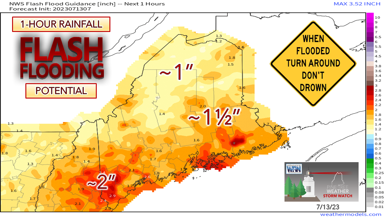 A concerned follower yesterday asked me if we're going to see a pattern change anytime soon, and the answer is no. Looking at longer term ideas through July, this onslaught of periodic torrential rain and chances for strong to severe storms is going to continue. A strong ridge out west, troughing in the east, along with a ridge over the Atlantic continuing to pump moisture into the northeast, this pattern in on repeat mode. As a result, flash flood concerns will be ongoing. Many of the rivers and streams are running at a high level. With the ground saturated, torrential downpours will create flooding quickly. We are in a state of flood watch regardless of if the National Weather Service has a posted bulletin or not.  By now many have seen the flooding in Vermont from the rain earlier in the week, and that region is going to get hit hard again on Thursday. For Maine interests, western and southern areas have some risk for flash flooding, mainly overnight into Friday morning. 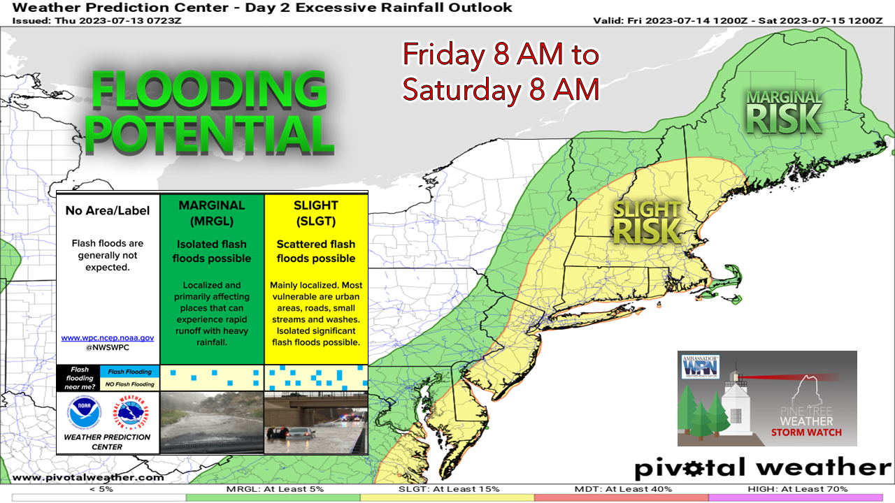 Southwestern areas are the main cause for concern for flash flooding from Friday into early Saturday. This includes the most heavily populated areas. Torrential rainfall could turn urban streets into rivers. highways into flyways due to hydroplaning, and reduced visibility. Thursday mainly dry until later in the day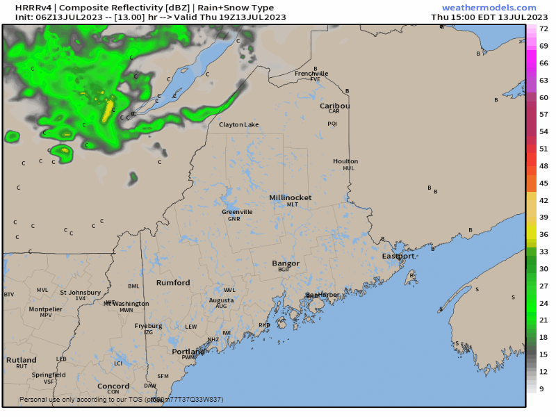 Thursday 3 PM to Friday 6 AM - The best chance for showers and storms appears over northern areas late afternoon. That said, I can't rule out a shower / storm over the rest of the region, sun dependent. Sun's out, thunder guns come out. Repeat that and remember it. A sharp frontal boundary is expected to pass through western New England in the evening and brings the potential for severe storms there. The energy from the front fizzles out as the atmosphere cools overnight, but it may hold together enough to bring a shower and/or a rumble of thunder as it passes through heading into Friday morning, Showers and strong to severe storm chances for Friday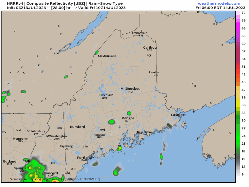 Friday 6 AM to Saturday 2 AM - Dew points rise behind the passage of the front which raises the amount of precipitable water in the air and presents the elevated risk for torrential rain and storms through the day and into Friday night. This could be a problematic flash flooding situation for southern areas if the HRRR model here is right. Folks in the north country should have their heads on a swivel and their ears on for storms there. Hurricane preparedness week This is hurricane preparedness week, and it is something to seriously consider given the wet weather pattern. I don't want to be an alarmist, but this is a growing concern of mine due to the situation we are in here. If the region gets hit with remnants of a tropical system, the effects could be substantial, or worse. There is no place for water to go at this point. The risk of widespread flooding impacts is high and will continue to be. www.noaa.gov/know-your-risk-water-wind Rainfall amounts / weekend thoughts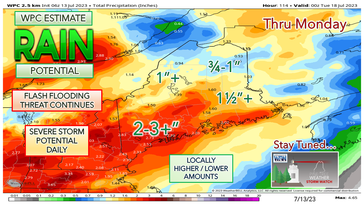 I am not impressed with what I am seeing from the short-term models and the operational ideas, so I will update potential rain chances for Saturday and Sunday as those ideas iron out. Showers and storms are likely on both days, with a better chance on Sunday. Sunday appears to be fairly breezy and there is a better chance for strong to severe storms in the afternoon. There is potential for heavy rain and storms Sunday night into Monday and may also again Tuesday into Wednesday. This pattern is relentless and brutal. Pine Tree Weather is funded from followers like you. I would appreciate your financial support. Click here for how you can contribute. You may not like the weather, but I hope you like what I do, and support my efforts. Thank you! Stay updated, stay on alert, and stay safe! - Mike NOTE: The forecast information depicted on this platform is for general information purposes only for the public and is not designed or intended for commercial use. For those seeking pinpoint weather information for business operations, you should use a private sector source. For information about where to find commercial forecasters to assist your business, please message me and I will be happy to help you. |

Mike Haggett
|


