
Pattern starting to shift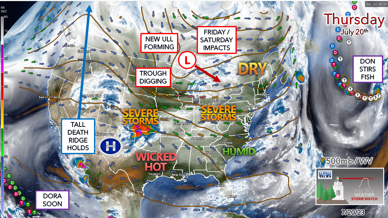 A bit of a break from the humidity for Thursday as a weak ridge of high pressure passes through the region. That break will be short lived as the weak ridge slides to the east by Friday morning, and a southwest flow pumps the dew points up. A new upper-low forms over the Great Lakes and spins up a surface low that brings the risk of a few showers and storms Friday night into Saturday. 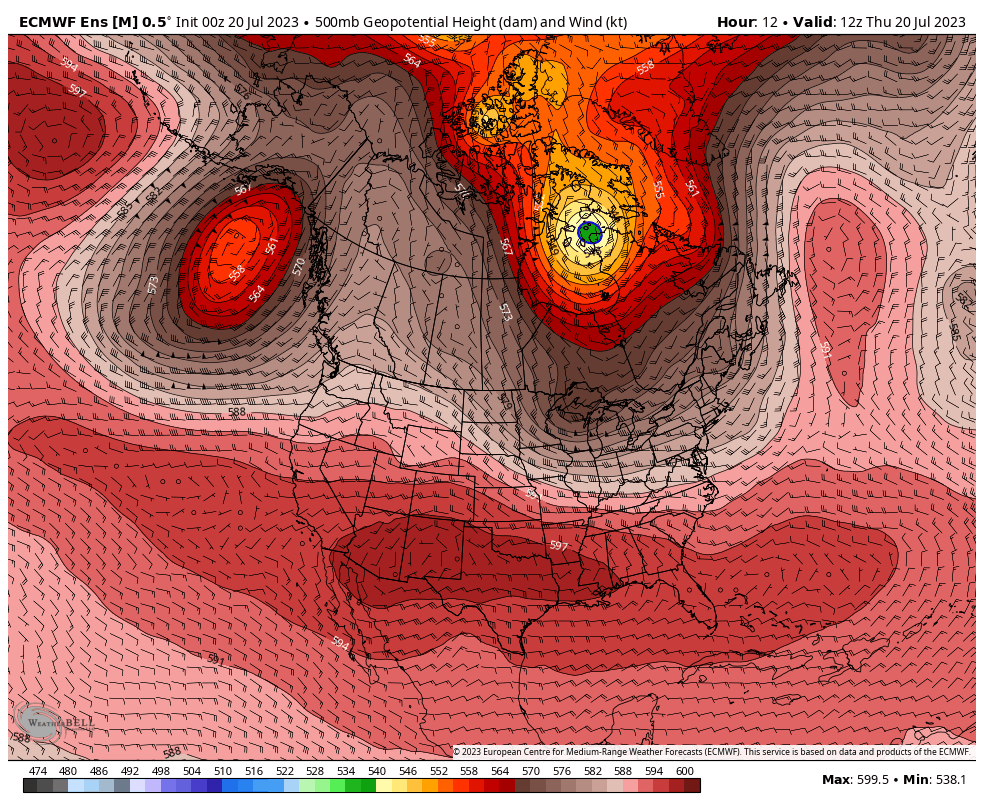 Thursday 8 AM to Monday 8 PM - A look here at the steering level of the atmosphere shows the tall death ridge over the west begins to get cut off and squeezed to the south as a strong upper-low south of Alaska moves into British Columbia. This will do a couple of things. First, bring rain to the wildfires which will dampen the ongoing flames there. Second, this will help flatten the flow to a more east-to-west zonal pattern which will cut down on the amount rain for our region into next week. We'll still have to deal with some shower and storm activity like we normally do during the summer, but not the onslaught like we've seen. Many areas will get the chance to dry out, outside of that risk of a pop-up localized dumper. A few showers and storms possible over the weekend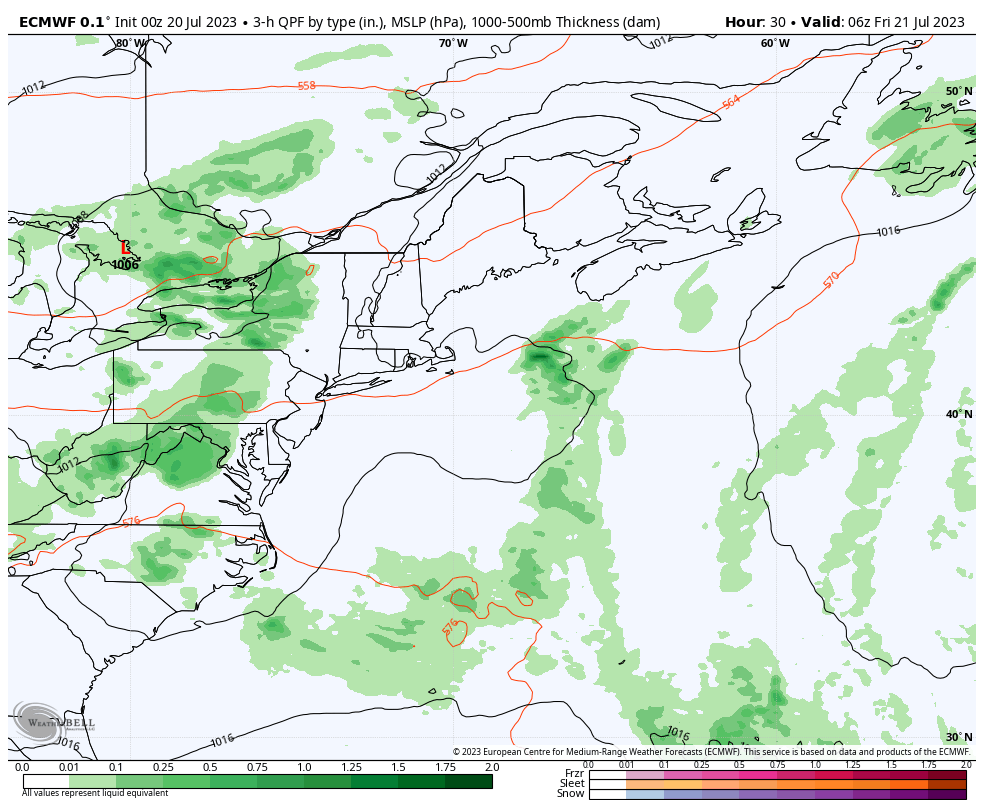 Friday 2 AM to Sunday 8 PM - The upper-low forming over the Great Lakes spins up a surface low that is rather tame by recent standards. A bit of block is expected to occur to the east, with Don partially responsible for that. The surface low spins over the St. Lawrence River valley brings as a wave of scattered showers and storms to the region Friday night into Saturday. Northern areas may get a shower or two on Sunday as the low heads northeast, where the rest of the region stays dry. Imagine that. 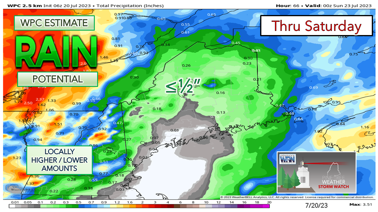 For once, the rain outlook does not have a sea of red involved with it, giving us waterlogged folks a break. While this is the general idea, there could be a few dumpers that form as the threat of storms will be around. I can't rule out the potential for a severe storm on Saturday, so it will be important to stay aware of that as you plan outdoor activities. A stretch of warm weather ahead into next week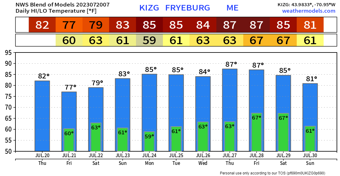 While we've dealt with rainy and seasonably cool high temperatures for most of the summer thus far, that switch is about to flip. Above normal temperatures with building dew points are on tap for next week. Coastal areas are likely to be cooler with the sea breeze. Showers and storms are possible for Tuesday, and perhaps again on Friday. Pine Tree Weather is funded from followers like you. I would appreciate your financial support. Click here for how you can contribute. You may not like the weather, but I hope you like what I do, and support my efforts. Thank you! Stay updated, stay on alert, and stay safe! - Mike NOTE: The forecast information depicted on this platform is for general information purposes only for the public and is not designed or intended for commercial use. For those seeking pinpoint weather information for business operations, you should use a private sector source. For information about where to find commercial forecasters to assist your business, please message me and I will be happy to help you. |

Mike Haggett
|


