
A day to stay on alert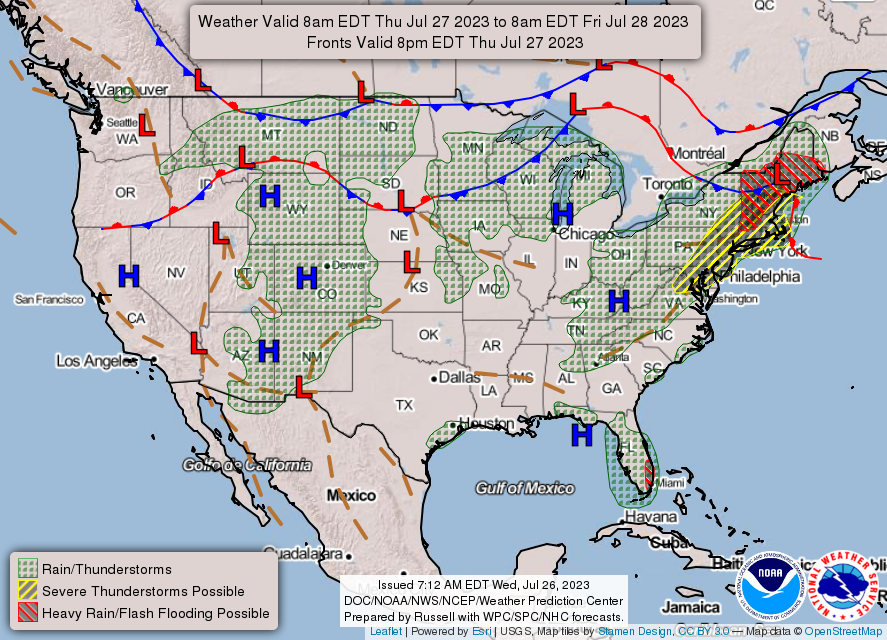 In the midst of this wet summer, the region has not experienced a less than average severe storm threat. While Thursday's threat is a conditional one, this may be one of the more concerning set ups given the dynamics here. This isn't one to easily dismiss, unless you are located in the north, where you can go about your day with rain gear handy. All areas from Jackman over to Houlton southward are in on this. It is a day to have multiple ways to receive weather alerts. Those engaging in outdoor activities shouldn't wander too far away from a sturdy shelter that can be easily accessed within a short period. 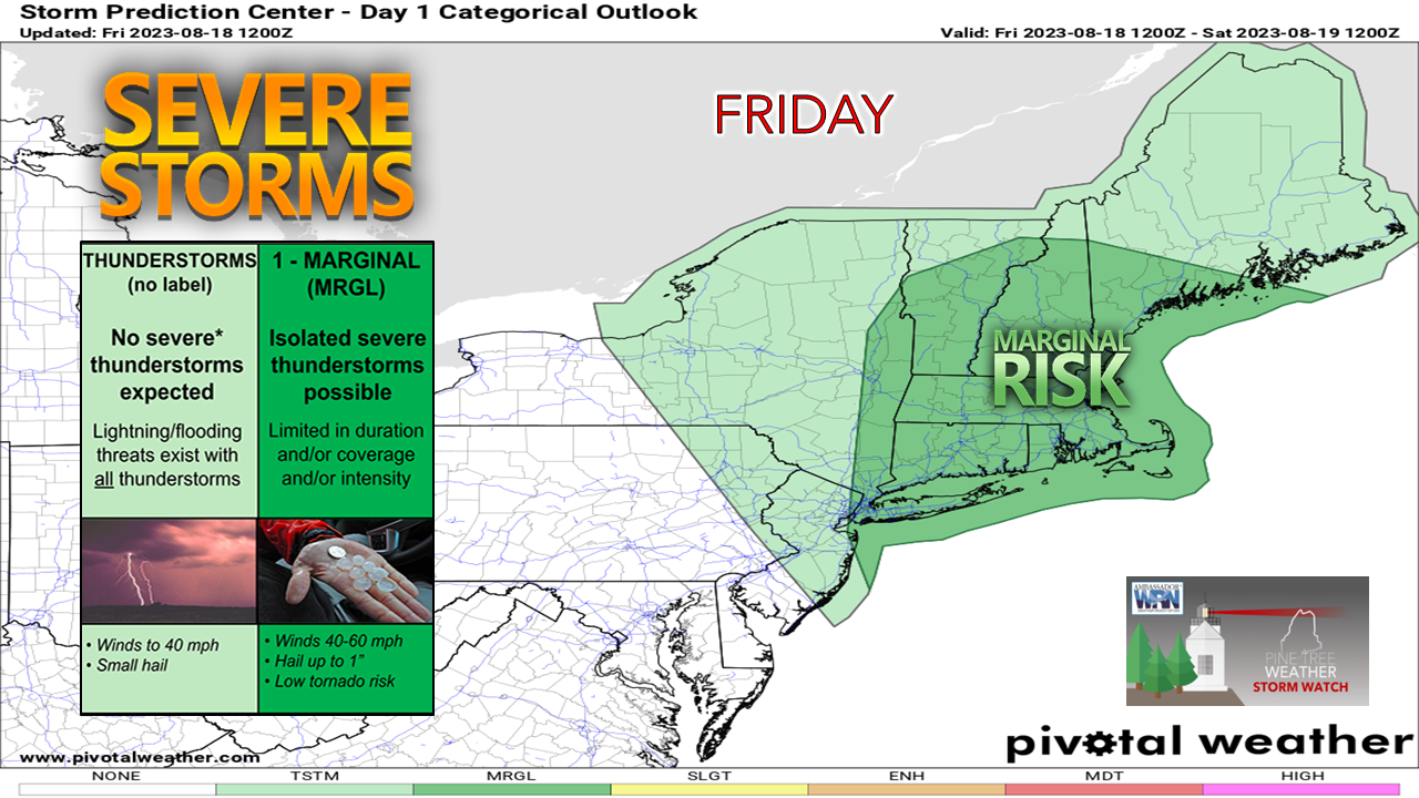 There will be plenty going on in the atmosphere for it to get crazy Thursday afternoon. A strong low level jet streak, plenty of tropical moisture, and heat. I do expect a watch will be issued. Whether that comes in the form of a severe thunderstorm watch, or a tornado watch will be determined as the day progresses. 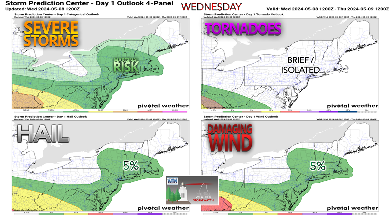 Only minor adjustments here to the Storm Prediction Center's thinking on the severe storm threat for the day by taking northern Maine out of the threat area. It is important to note here that where coastal areas are usually spared from too much calamity due to the stable marine layer, that safety net won't be there today given the wind direction and trajectory of the system moving through. Damaging wind is the real concern here. Not to minimize the potential for tornadoes, because that is a legit threat for southern areas, but straight line / microburst activity is likely. If the storm cell towers go up high enough, hail is possible. If you are located in the heat advisory zone, the greatest threat for severe weather exists there. 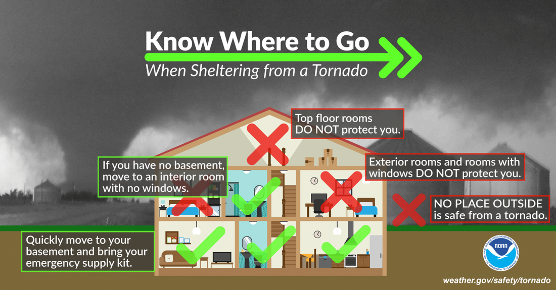 Given the dynamics, I would say there is a good chance that tornado warnings may be called. It's important to know where your safe place is. While weather can be fascinating to watch, windows are the last place to be with the threat of wind damage. Find shelter in a basement, or in a room away from windows. Grab a mattress and seek shelter in a bath tub a basement is not an option. Motor vehicles are NOT a safe place. Inside is the place to be. 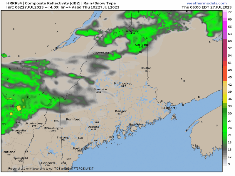 Thursday 6 AM to Friday Midnight - A warm front moves in the morning and sets the stage for a cold front to pass through in the afternoon. The hours between noon and 4 PM become critical for southern areas to look for the sun. If the sun comes out, even if for a short period, that will be all it will take to fire storms. The line of showers and storms is expected to clear southern and western areas by early evening, and eastern and northern areas by mid-evening. 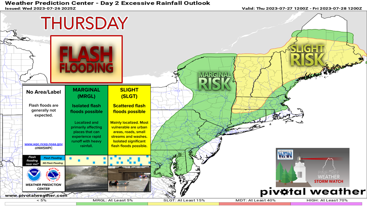 The risk of flash flooding remains high. Flood watches have been expanded into central areas and with good reason. Recent washouts in Dixfield, Jay, and the Lewiston / Auburn area could be repeated. Expect flash flood warnings to come. 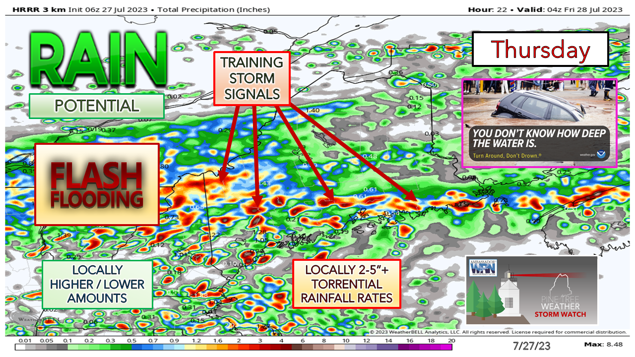 When I look at these forecast ideas that are generated by the short-term models, I am not focused on specific locations of potential impacts as to what ideas they are generating. The HRRR model idea presented here shows very loud training signals due to the streaks. That can happen anywhere south of Jackman and Houlton. I got hit by a trainer in Kennebunk on Tuesday that dumped 1.41" of rain with a peak rainfall rate of 7.11" / hour and the models missed on the location. With these tropical infused systems, they have a mind of their own. When they form, they will dump, potentially back build, and continue to dump. For those travelling, you need to be aware of that. Flooded roads are a distinct possibility, and the threat for washouts is high given all the recent rainfall. I will have updates on Twitter throughout the day. You now need an account to follow me there. Pine Tree Weather is funded from followers like you. I would appreciate your financial support. Click here for how you can contribute. You may not like the weather, but I hope you like what I do, and support my efforts. Thank you! Stay updated, stay on alert, and stay safe! - Mike NOTE: The forecast information depicted on this platform is for general information purposes only for the public and is not designed or intended for commercial use. For those seeking pinpoint weather information for business operations, you should use a private sector source. For information about where to find commercial forecasters to assist your business, please message me and I will be happy to help you. |

Mike Haggett
|


