
|
Before I get into the outlook, I will be heading out of state to Connecticut for the weekend. This is my last scheduled excursion for the year and for the winter as it appears for now. It's a weekend for me to reflect and celebrate my recovery from alcohol and drug addiction. Saturday will mark 32 years of sobriety for me, which is by God's grace is a truly a miracle. I have mixed emotions, humbled, and grateful. A part of me knows that I have no business being alive given my past, but despite myself, I am living a life that is truly second to none and accomplishing things I never imagined. You folks are a big part of that, and I thank you for being part of my journey. We're all in this together. Progressive flow continuing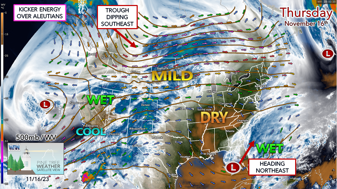 The weather pattern is becoming more active with upper lows spinning around the Arctic which are sending waves of energy through the hemisphere. Ridges and troughs are becoming more pronounced. The one key piece that is missing is atmospheric blocking. As a result, we're in a situation where we can see storms of various intensity every 3-4 days through Thanksgiving as it appears for now. After Saturday, the next system rolls in on Tuesday into Wednesday, then possibly another to wrap up the holiday weekend. There is plenty of cold air around, so the potential for snow and/or a wintry mix of junk is on the discussion table, as temperatures continue to run generally below normal. The lack of blocking means quick hitting storms, and pending on how the subtropical jet feeds into them dictates what the precipitation production will be. Rain to snow for Saturday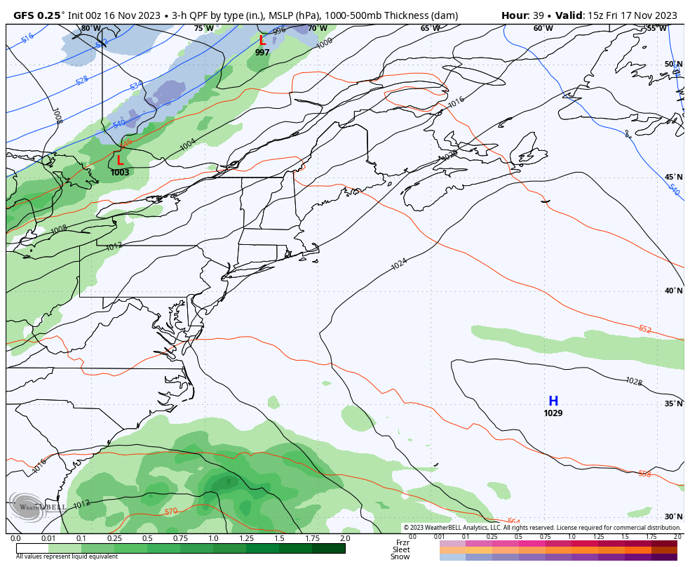 Friday 10 AM to Sunday 7 PM - It appears that the region will dodge an ocean storm brewing over Florida that tracks northeast. A cold front dropping down from western Canada gets an additional shove from energy over the Aleutians to keep the subtropical storm to the east. For those in Nova Scotia, this is shaping up to be a corker with high wind, along with heavy rain and surf. The storm is going to crank up more in its departure into Labrador on Sunday which brings snow showers for the mountains and a sub-freezing wind chill for Maine. 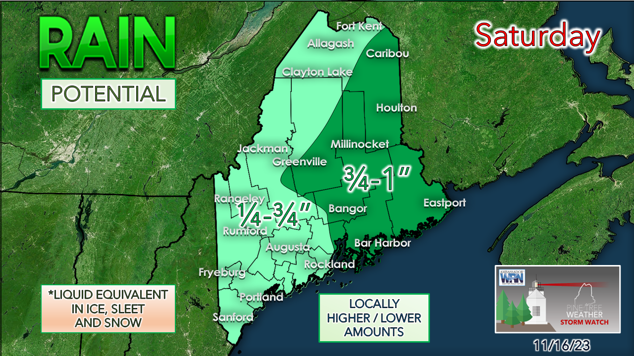 Given the later connection between the front and the ocean storm, eastern areas are likely to receive the most rainfall. The forecast trend is pushing the Atlantic low further east, and there have been signs of dry slotting working in between the two systems. If that trend continues, less rainfall is possible. Regardless, confidence is good that Washington County is likely to get the higher end totals, and southwestern areas on the lower end. 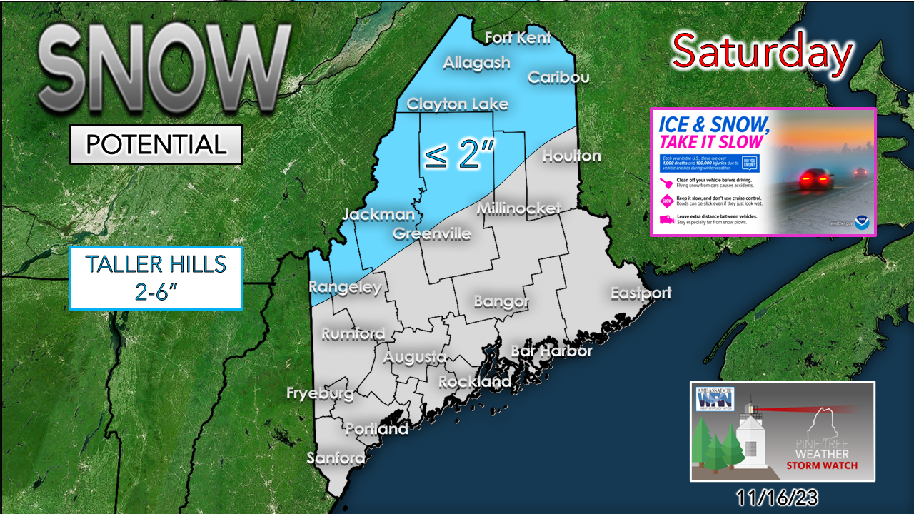 Rain changes to snow on the backside of the front which may bring an inch or two in the mountains and north. The taller hills potentially get a few inches out of this, with Katahdin in the 3-6" range. The western mountains may pick up an additional inch on Sunday as upslope showers pass through in the wake of the storm.  Saturday 7 AM to Sunday 1 PM - Expect the wind speeds to increase during the day out of the north on Saturday as the two systems come together and move northeast. Sunday will be the breezier of the two days as the wind cranks up as the storm intensifies over the Gulf of St. Lawrence. The breeze is expected to settle down Sunday night. Storm to watch heading into Thanksgiving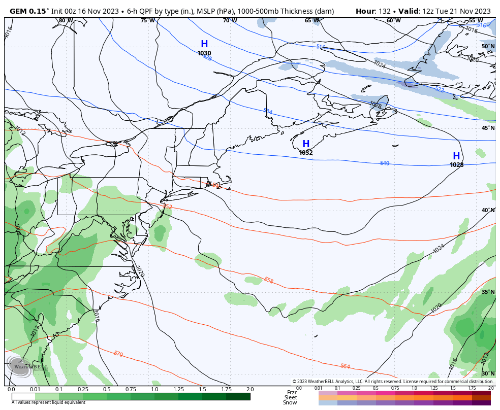 Tuesday 10 AM to Thursday 7 AM - There is confidence on a storm on the way midweek which may hamper travel along the northeastern corridor, so be aware of that if you are heading out or have folks coming to you. There is a lot of uncertainty of precipitation type and how much, along with wind potential, but all of that is out there. Fine tuning on timing and impacts will come early next week. Temperature outlook through Thanksgiving weekend After the late week warm up, cool is the rule to start next week. The ski hills will be able to make snow in earnest. Fingers crossed that the midweek storm comes in cooler and helps to build the bases, rather than rob them of the early season work. 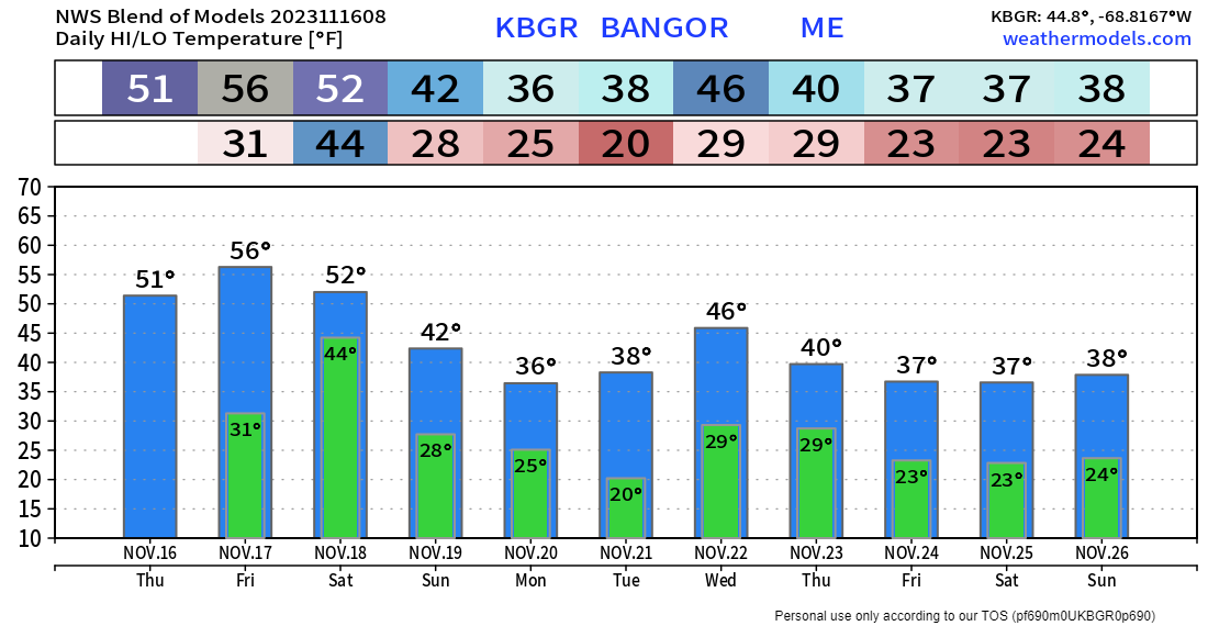 PTW is currently 56% funded for 2024 Thank you for your years of following and for your financial support. It is because of your funding that this operation continues. God bless and stay strong. Be good to yourself. I will be away Friday November 17th through Sunday November 19th. Stay updated, stay on alert, and stay safe! - Mike NOTE: The forecast information depicted on this platform is for general information purposes only for the public and is not designed or intended for commercial use. For those seeking pinpoint weather information for business operations, you should use a private sector source. For information about where to find commercial forecasters to assist your business, please message me and I will be happy to help you. |

Mike Haggett
|


