
Lee to impact a widespread area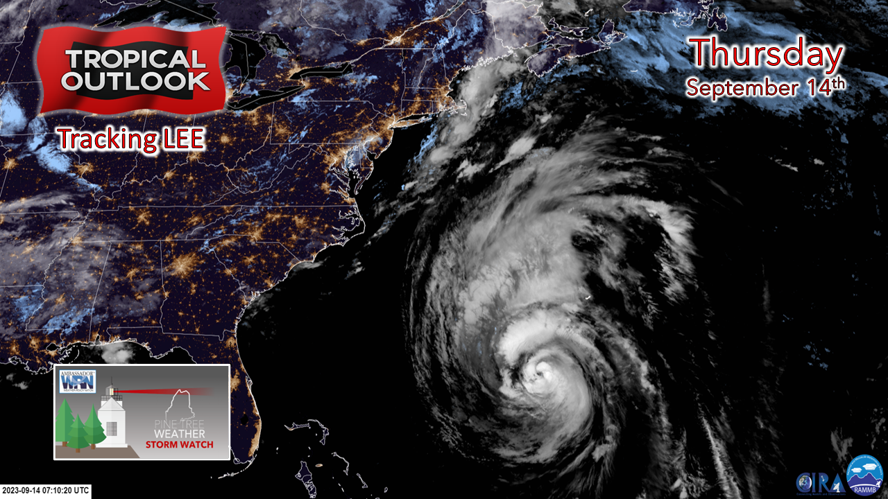 Looking at the satellite photo from around 4 AM Thursday morning, the center of Lee is holding together well, despite dealing with a moderate amount of wind shear. How well the core holds up as it increases speed in its progression northward is one of the key factors in what results it will bring to the state and the regions around it. 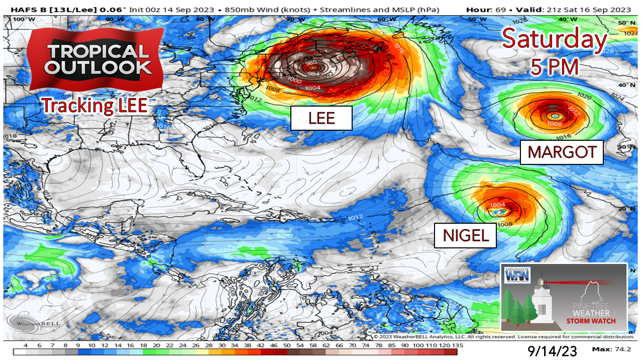 One model idea from the HAFS hurricane model shows the strong winds at the 850mb (~5000 ft) level in the atmosphere that stretches from eastern Pennsylvania to the southwest corner of Newfoundland. Margot is roughly one third the size of Lee at a slightly lower latitude. Future Nigel is on the watch list next. This is going to be a big one, and it is shaping up to bring big problems to the interior and the coastline. No place is exempt or in the clear at this point. Wind and rain ideas for now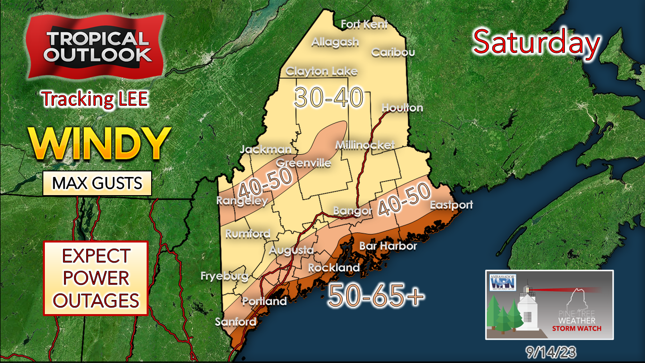 This is the idea for maximum wind gusts for now. Trees and branches will fall and cut power lines, internet service and may cause damage to cell phone towers. Speaking in confidence with a meteorologist that has covered the region for decades on the over/under for number of power outages, the conservative number is 150,000. Some of those folks will be without power for days. The duration of the high winds will be indicative of the total number of power outages. It's a bit early to get into specifics on that. Have the NOAA Weather Radio and the trusty transistor ready for a trip back to yesteryear just in case and have the batteries necessary to use them. Keep the board games and puzzle books handy, along with a good hardcover or paperback that you've been meaning to read. Between the wind knocking down trees and potential for flooding, some folks may be cut off. 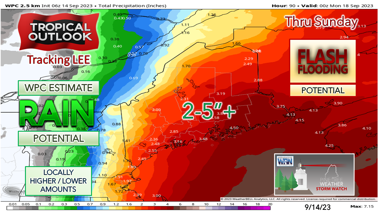 The Weather Prediction Center is currently in the 2-5" range for rainfall for much of the area, which is the number I've had in mind for the past couple of days. There will be interior flooding. There will be road and driveway washouts. There will be urban street flooding. There will be basement flooding. Prepare for it. Coastal implications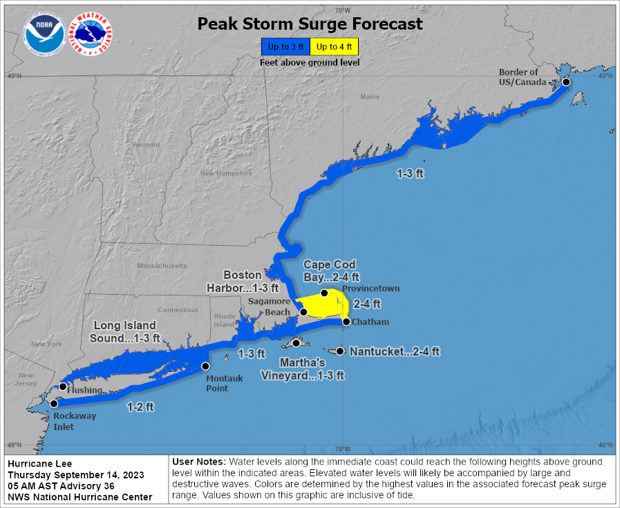 For those who live along the shorelines that may be threatened by 15-25' waves or cut off by the potential for areas of inundation, you have a decision to make whether to stay or go. The Maine Emergency Management Agency has a website set up called the Maine Hurricane Evacuation Dashboard that may help you decide. Are you not sure if you live in an evacuation zone? This will tell you. It provides the latest bulletins and forecast information and can be configured to alert you in case evacuation orders are issued. Thursday 5 AM Update from NHC The hurricane and tropical storm watches are likely to convert to warnings either by the 11 AM or 5 PM update Thursday from the National Hurricane Center. If you are in an area that isn't under a tropical storm watch does not mean that you won't experience tropical storm conditions. Don't be fooled by scientific semantics here. It's impacts. There could be wind advisories issued for interior areas that are not under a tropical storm watch. Important links here to bookmark and refer to for updates: HURRICANE LOCAL STATEMENT from NWS Caribou for northern and eastern areas. HURRICANE LOCAL STATEMENT from NWS Gray for southern and eastern areas All preparations ahead of the storm should be completed by Friday night. It would be wise to not travel on Saturday unless necessary for work or an emergency. Please respect the storm for what it is. Tropical storms can never be trusted, ever. There will be surprises. There will be areas of overperformance of wind, and rain. The forecast continues to be a moving target. I will have more on Facebook by 5:30 PM and will be passing along information on my Twitter/X feed through the day. We're going to get through this together. We just need to be smart and safe about it.  Be prepared for hurricanes by knowing what to do during a storm. Whether you’ve evacuated or are sheltering in place, know what to expect from the hazards you may face. Remain vigilant, stay up to date with the latest forecasts and alerts, and continue to listen to local officials. noaa.gov/stay-protected-during-storms Pine Tree Weather is funded from followers like you. I would appreciate your financial support. Click here for how you can contribute. You may not like the weather, but I hope you like what I do, and support my efforts. Thank you! Stay updated, stay on alert, and stay safe! - Mike NOTE: The forecast information depicted on this platform is for general information purposes only for the public and is not designed or intended for commercial use. For those seeking pinpoint weather information for business operations, you should use a private sector source. For information about where to find commercial forecasters to assist your business, please message me and I will be happy to help you. |

Mike Haggett
|


