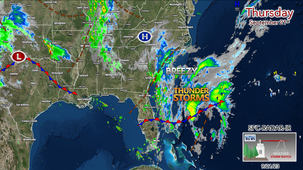
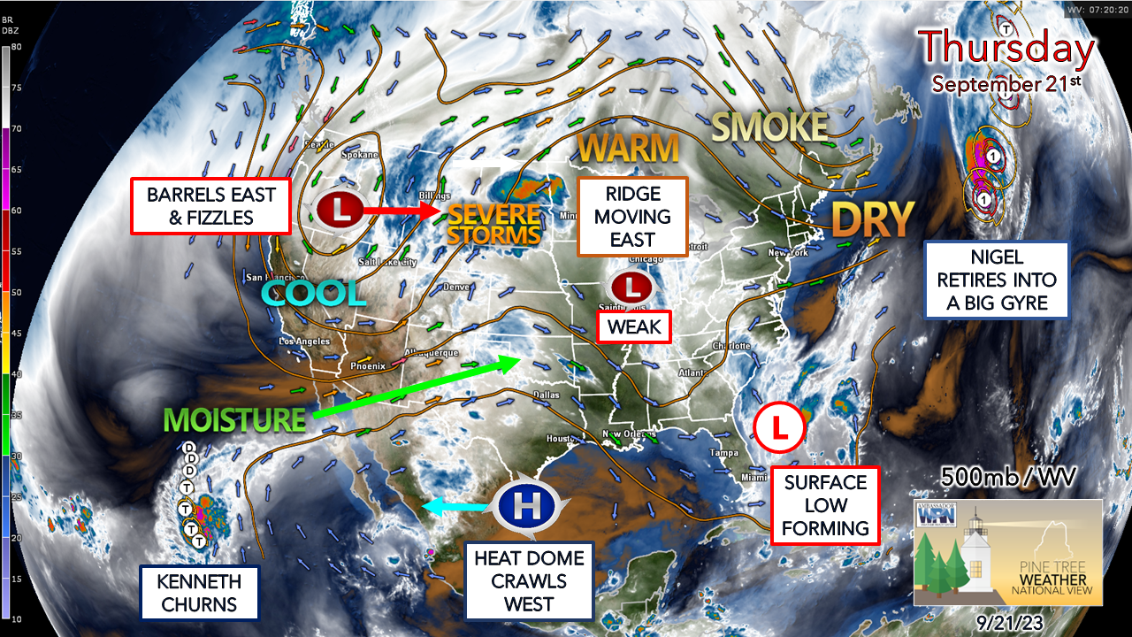
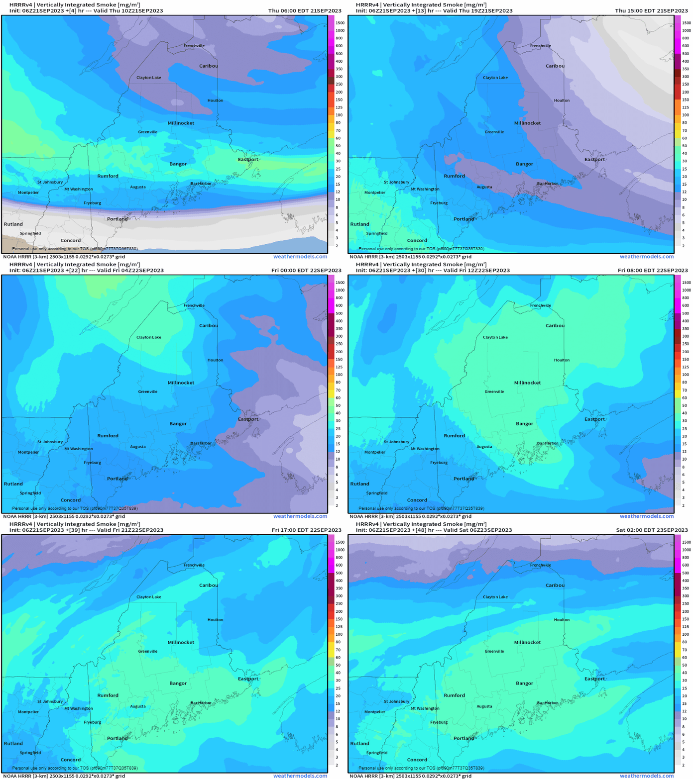
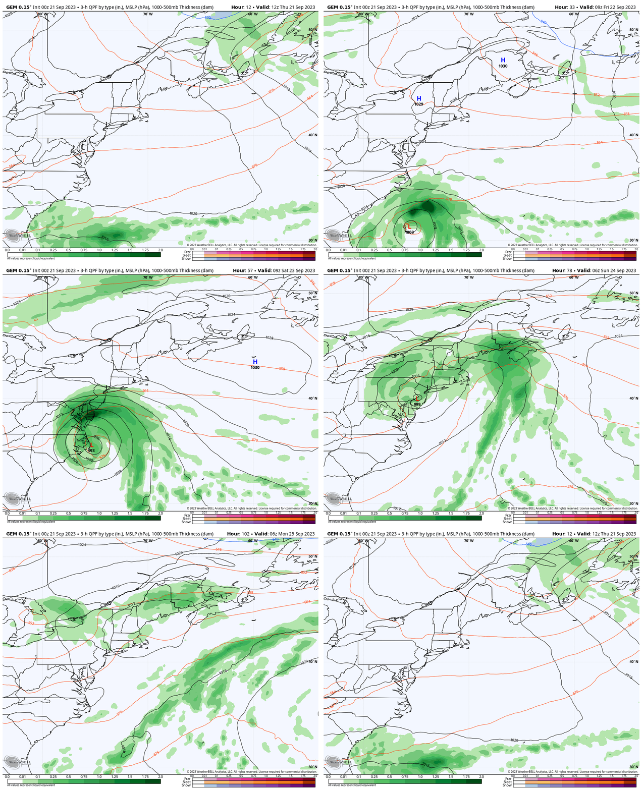
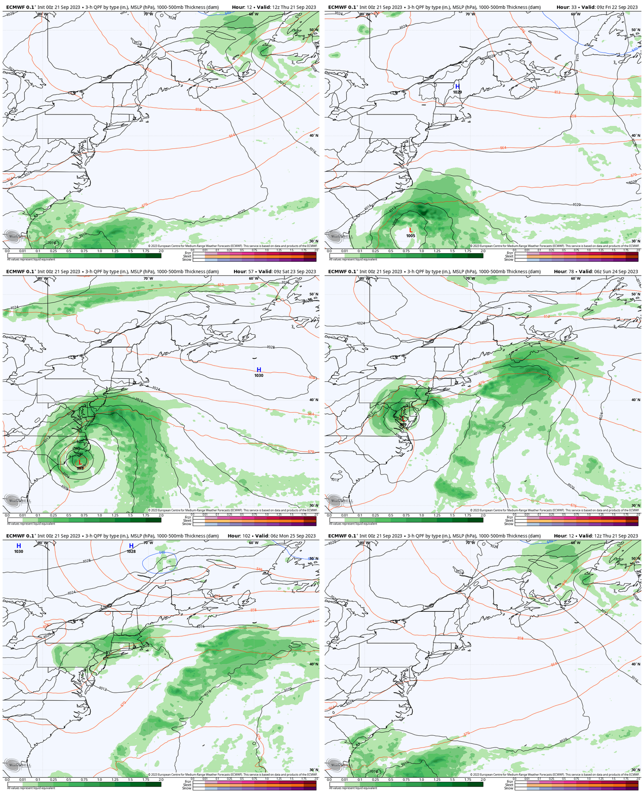
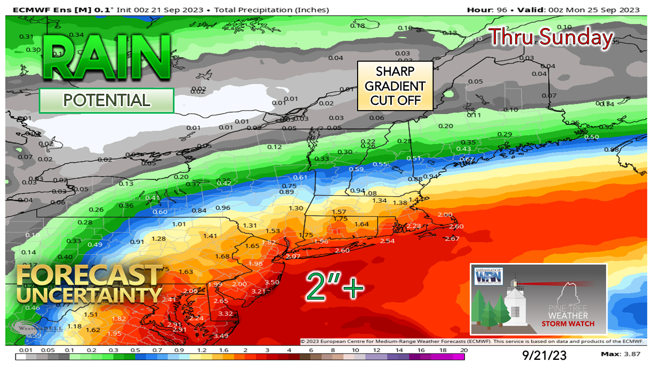
Area of interest to watch for the weekendThe surface map from 4 AM Thursday shows an unorganized area of showers and thunderstorms off the southeast coast. This has been an area of interest since last weekend and mentioned in my previous website post along with Facebook and Twitter/X mentions since. The National Hurricane Center has gone back and forth between a 10% to 40% chance of tropical development over the past couple of days. There are some signs of a depression-like feature going on with breezy conditions being reported along the coastline in that region. Looking at the setup of cold air aloft thanks to the high over western North Carolina tapping into the cool air in our region, my instincts are telling me this is likely to be a hybrid storm that will be NorEaster like and bring areas of torrential rain and gusty wind over the southeast into the MidAtlantic. How far north and how it impacts Maine is to be determined. An overview of the steering level of the atmosphere shows the set up. The ridge moving east sets up as an omega block and will dictate what happens with the developing surface low. Note how Kenneth over the Pacific is feeding upper-level moisture to the east over the heat dome high over south Texas. This adds a bit more intrigue into the equation for southeast area interests. A weak, cut-off upper low buried in the middle of the ridge may play a role in the enhancement of the surface low as well. But first... smokeFor Thursday into Friday, the sun will be muted by upper-level smoke filtering down the east side of ridge. Sunrises and sunsets will be interesting features to watch. The smoke is high enough where it won't cause any air quality issues, but it will be noticeable in the sky. Ideas on how the weekend plays outI am not a fan of passing along differing operational model ideas, but given the range of solutions, it is important to show contrast for those who have big weekend plans. This loop from Thursday 8 AM to Monday 8 PM by the Canadian GGEM is the juiciest, windier, and most impactful for the region. The model shows a slowdown of the advancing omega block, thus opening the door for the low to expand more to the north. In this solution, showers break out Saturday afternoon over the south and expand north and impact the whole state through Sunday and is slow in departure on Monday. In the same period, the European model is showing the omega block advancing east enough to cut off the storm outside of some shower activity along the coast. An advancing frontal boundary steals the main moisture hose and runs off into the Atlantic with it, leaving the surface low for dead and what is left gets picked up by another wave and gets steered out to sea, with minimal impacts outside of some coastal showers early Monday. For the record, I don't think either one of these solutions has a handle on this. The European ensemble mean differs from the operational and in my view, better indicates the potential for rainfall. I am not saying this is right either, but it's the middle of the road compared to other guidance. A sharp gradient cut off is likely here. Coastal areas have the best chance for rain for now, and until the storm gets organized later on Thursday, it's a crapshoot on what the interior gets out of this. Stay tuned. Your financial help is needed for PTW to continueYou may not like the weather, but I hope you like what I do, and support my efforts. Thank you! Stay updated, stay on alert, and stay safe! - Mike NOTE: The forecast information depicted on this platform is for general information purposes only for the public and is not designed or intended for commercial use. For those seeking pinpoint weather information for business operations, you should use a private sector source. For information about where to find commercial forecasters to assist your business, please message me and I will be happy to help you. |
Mike Haggett
|

