
Potential for "Dorian" to form by early next week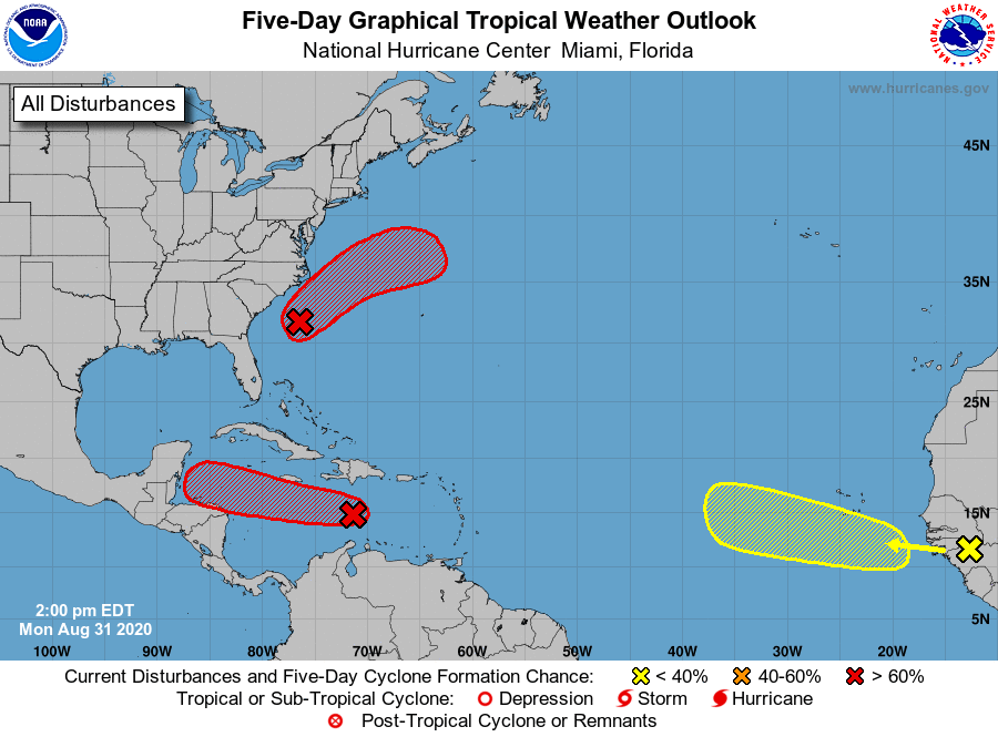 A couple things come to mind here. It's been 28 years since New England has seen an official hurricane landfall. For those that remember, it was Hurricane Bob in 1991. We've had remnants and tropical storms float through, but it's been awhile since the double red and black flags have been raised along the shorelines here. This forming system of Florida's east coast may not be the one that ends the streak, but it is something to keep tabs on for those of us in coastal New England.  This model loop runs from 8 PM Saturday through 8 AM Saturday, August 31st in 6 hour increments. A couple things to ponder here. An upper low moves over New England this weekend. A deep trough drops down from central Canada into the Midwest next week. The upper low over New England and the position of it is what would drive the storm to the east. The trough over the Midwest would be the kicker that makes sure the storm stays east, and would affect the Canadian Maritimes.  At this point, the operational models bring some surf to New England. If there is anywhere that may get clipped with precipitation and some level of wind with this storm, it would likely be Martha's Vineyard, Nantucket, and perhaps Cape Cod. As the storm heads to the Maritimes, it could bring some waves and rip currents to the shorelines. That is something to keep in mind as we head into Labor Day Weekend.  The threat to New England is non-zero at this point, meaning it will need to be tracked. Guidance has hinted of potential blocking over the Canadian Maritimes that may steer the storm to the west. I consider this to be a very low chance, but a chance nonetheless. If the storm slows down in development and in movement up the coast, and happens to connect with the trough driving into the Midwest next week, that would steer it west and bring more concern for impacts, also. Again, a very low chance on that happening. Most likely, this will stay out to sea, but there is the chance it could change. If there is anything to consider with this, it's preparation. Many generators have been idle for the summer. Storm supplies often used in winter may need to be checked on and updated. You may need batteries for your NOAA Weather Radio, or as a back up for electronic devices. You may need drinking water as what has been stored has been around for a while. While it may be quiet weather wise over Maine for the next several days, it would be good to look things over, talk to family members, and look over your property. Stay in touch with the National Hurricane Center for more official information from them over the weekend. Not much going on for Maine through midweek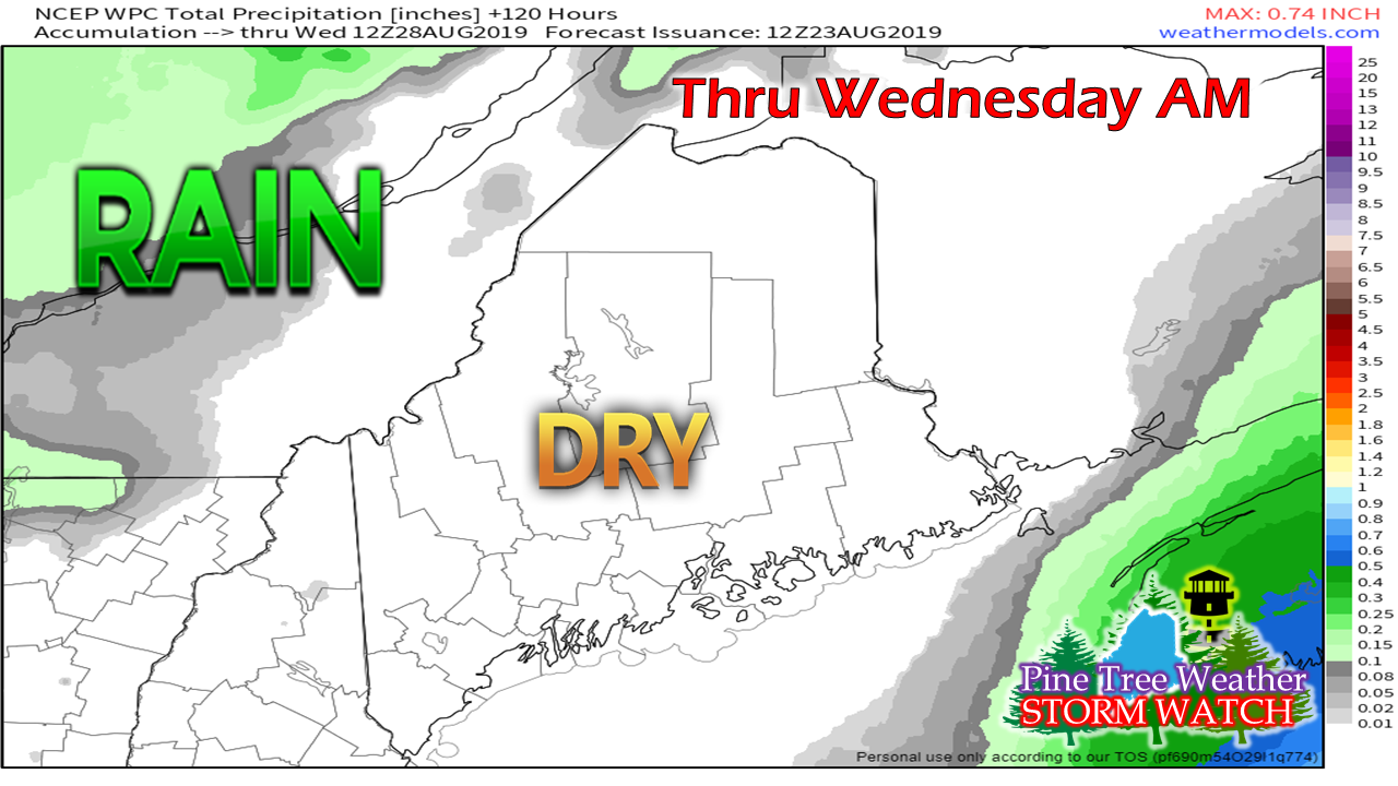 This graphic pretty much sums it up. Temperatures are likely to be a bit cool for this time of the year with 60s for the north and mountains and 70s for the coastal plain Saturday, and 70s for most areas on Sunday. The mountains and north could see temps dip into the 40s Saturday morning, with some readings in the 30s Sunday morning. The coastal plain sees overnight lows in the low 50s Saturday morning, and upper 40s to low 50s Sunday morning. Temperatures begin to moderate as we start next week.
► ► For the latest official forecasts, bulletins and advisories, please check in with the National Weather Service in Gray for western and southern areas, or Caribou for northern and eastern parts of Maine. Please consider supporting Pine Tree Weather ► ► Your financial donations are much appreciated to keep this site funded and for further development. FUNDRAISING FOR 2020 BEGINS SOON! I sincerely appreciate your support not only financially, but also in sharing my efforts with others. For more information from me, please check the Pine Tree Weather Facebook page as well as my Twitter feed. Always stay weather aware! |

Mike Haggett
|


