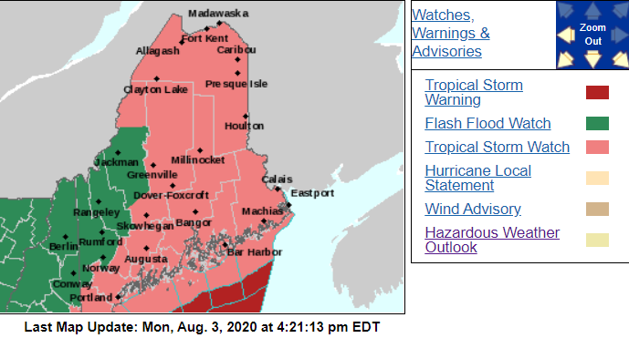
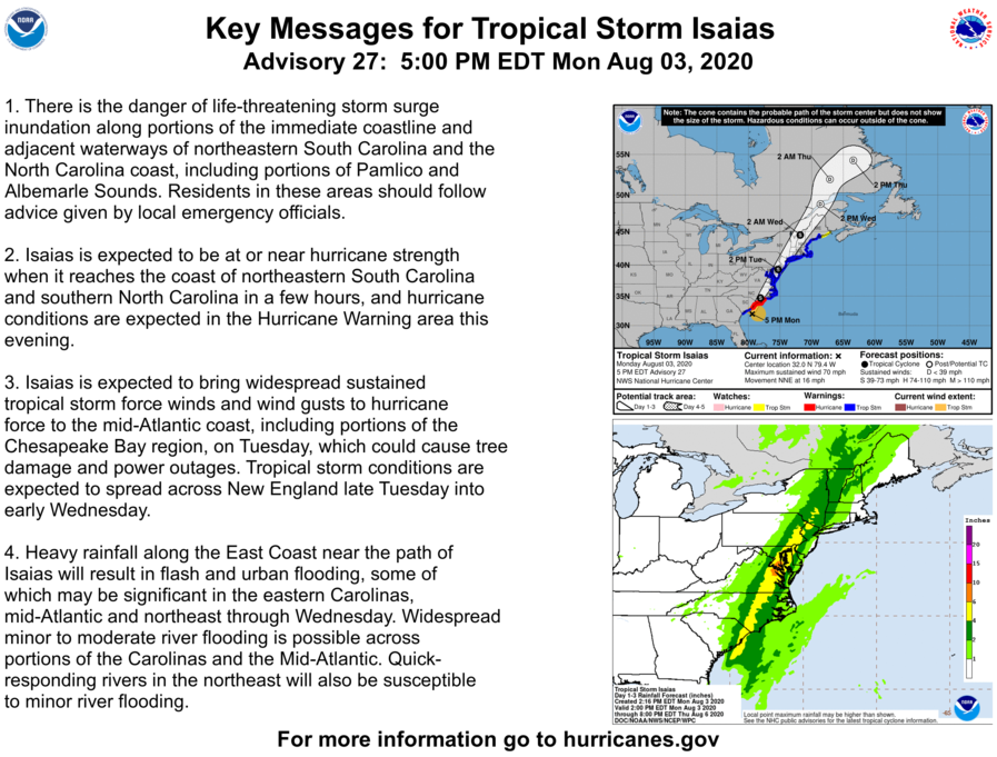
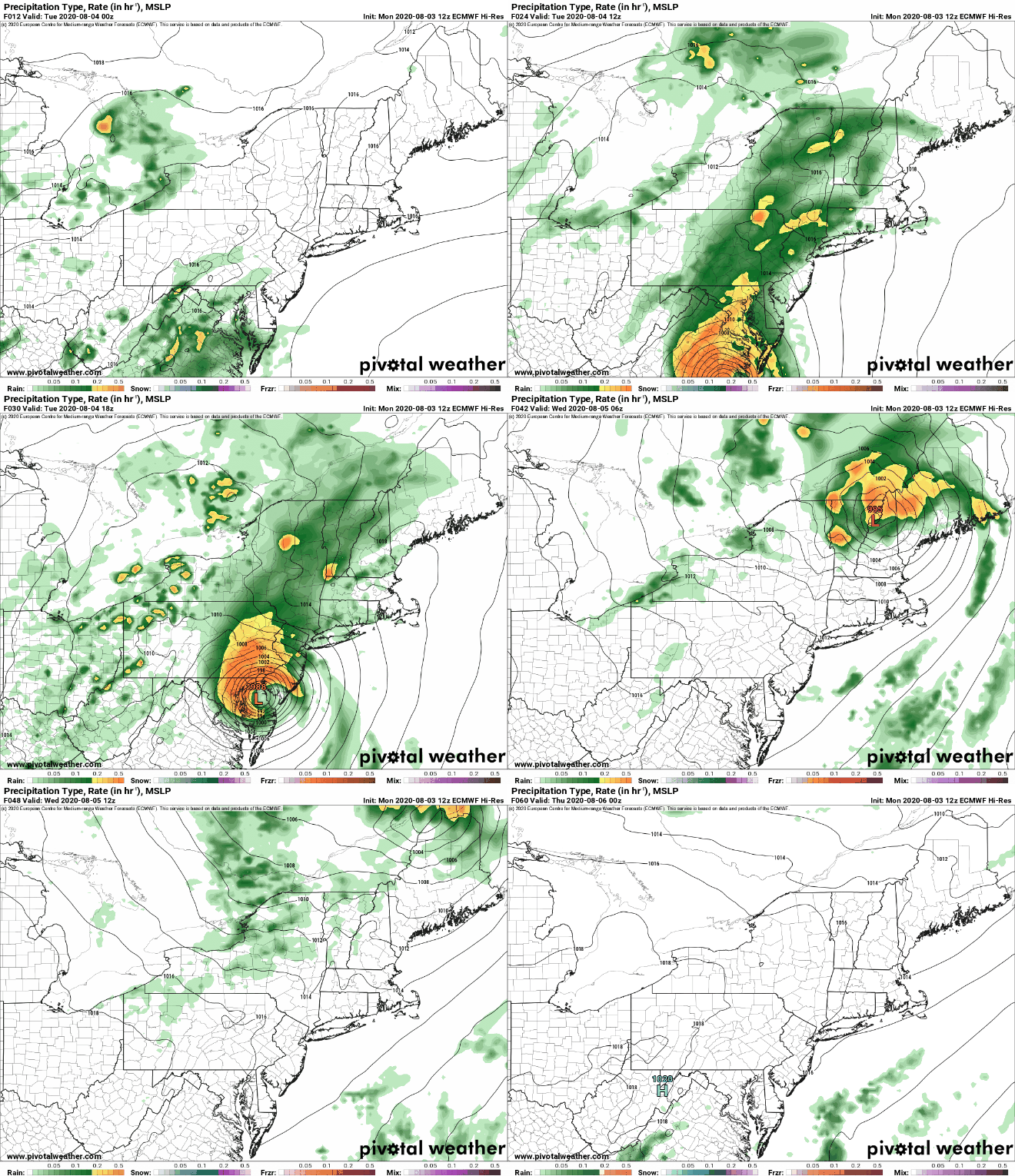
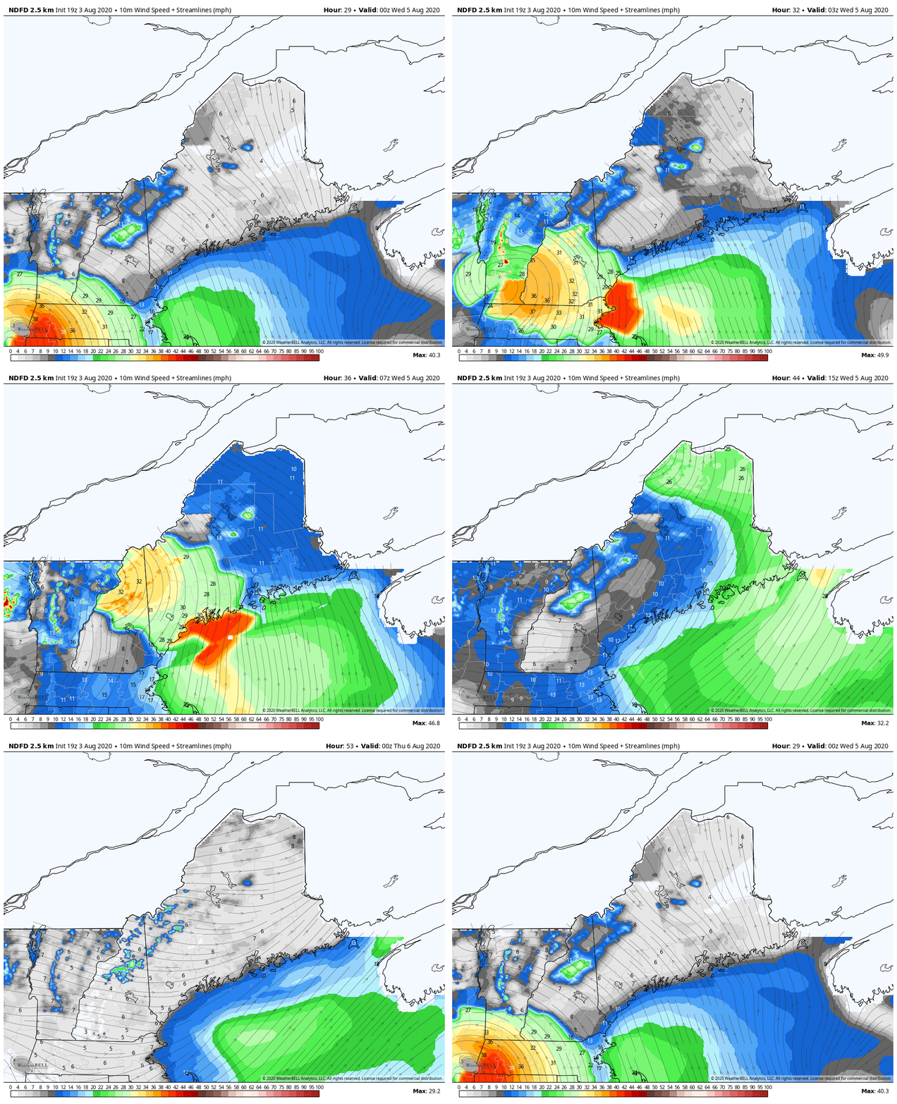
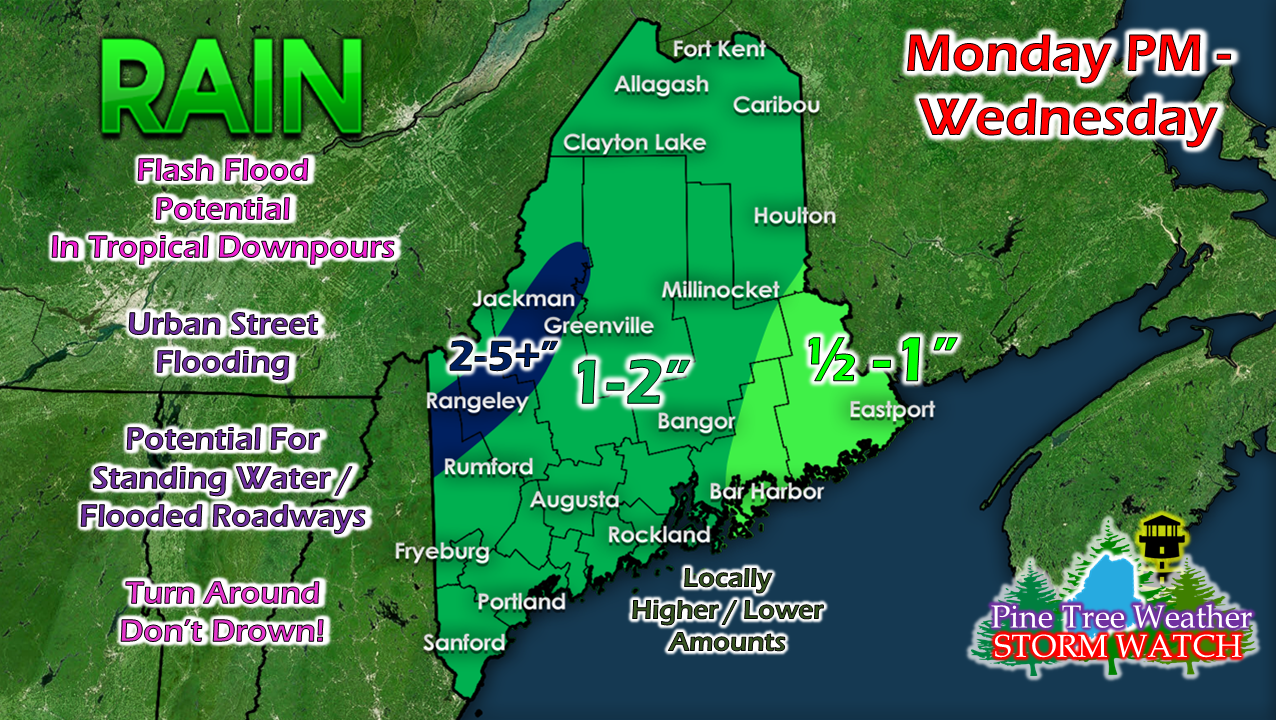
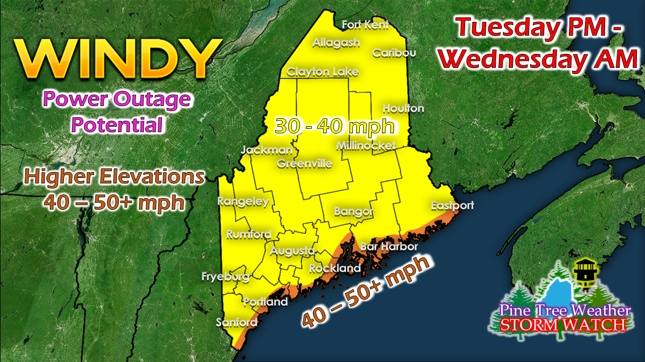
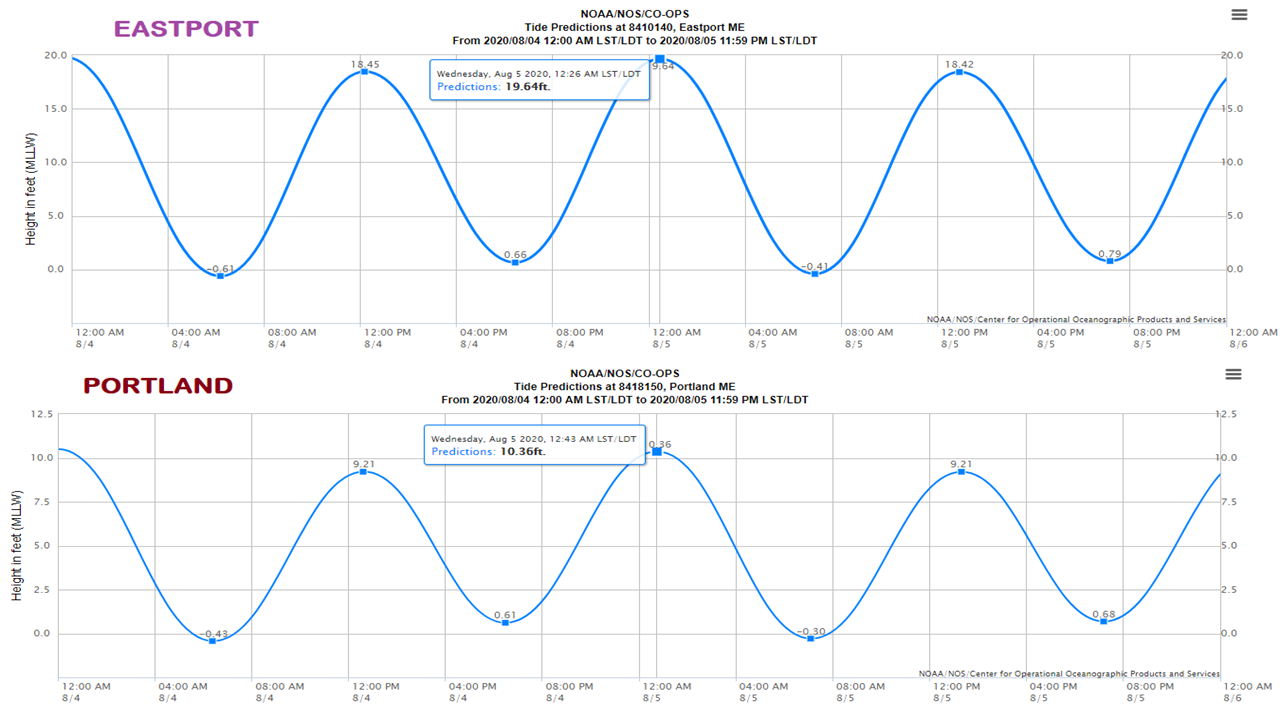
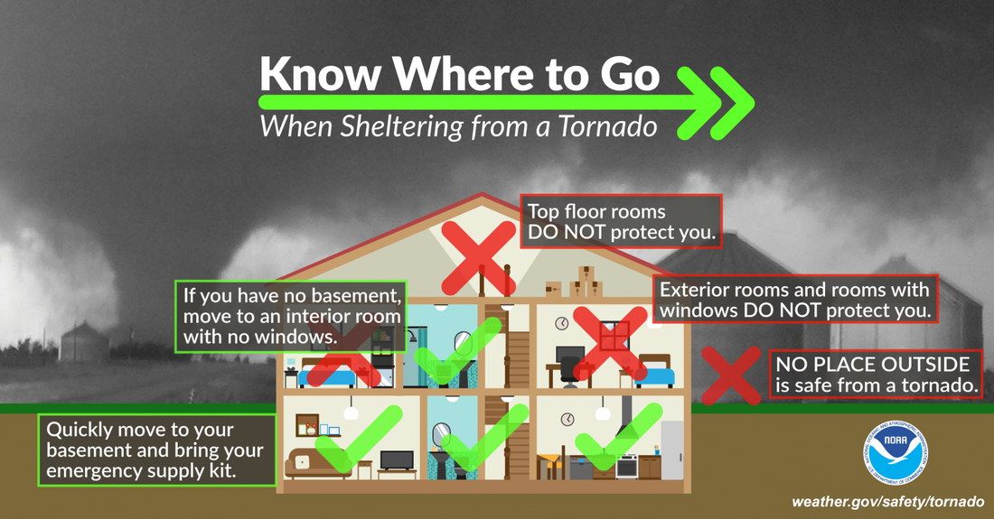
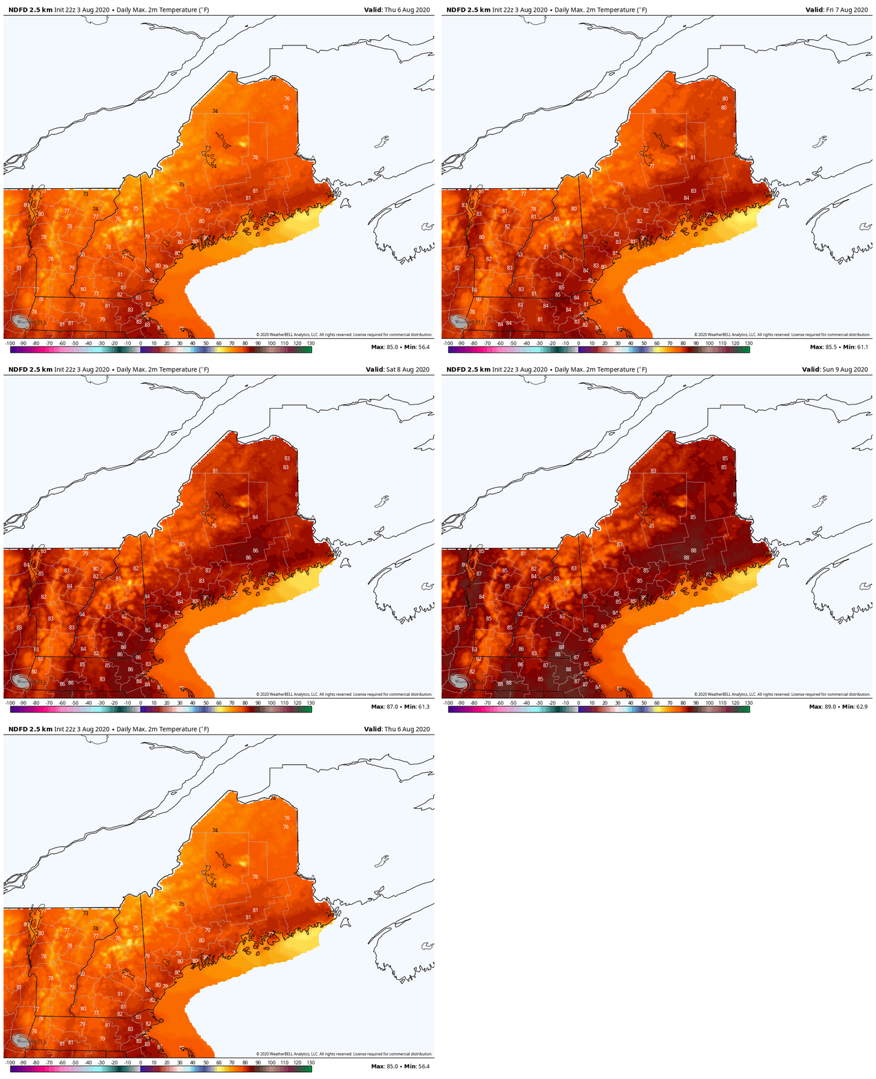
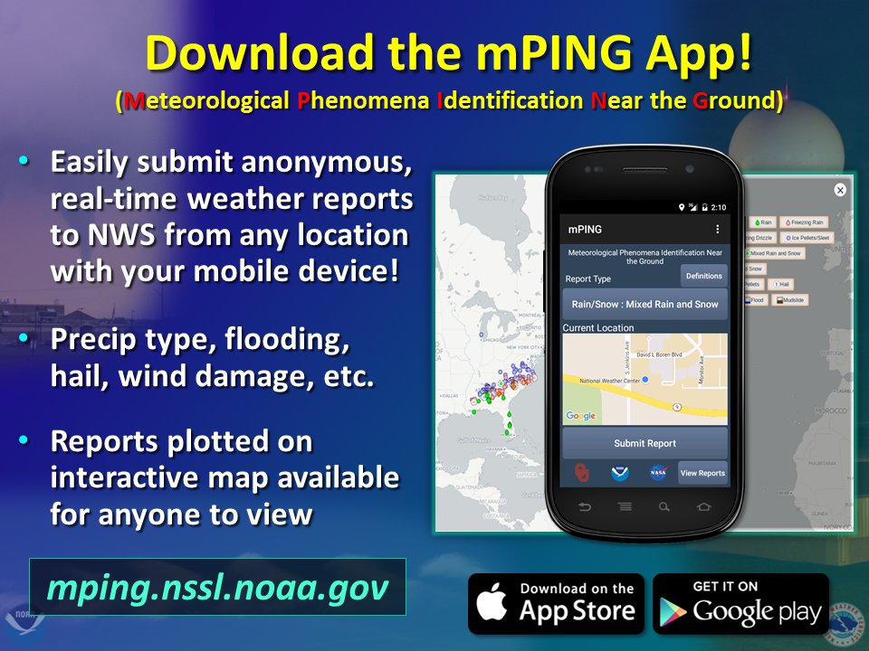
Current watches and warningsCurrently, the NWS has issued a tropical storm watch for most of Maine and a flash flood watch for parts of western Maine. A tropical storm warning can be seen off the coast, but will most likely be extended into Maine as the storm grows closer. I will cover much of what the NWS has in it's watches and warnings in this post, but if you'd like more information, don't hesitate to visit the NWS Gray or Caribou website or the NHC website. Timing of IsaiasAbove is the updated track of Isaias, rainfall forecast and key messages per the National Hurricane Center (NHC). The center of the system arrives in New Hampshire/Maine as a tropical storm by 2am on Wednesday and will weaken as it makes its way north of Maine by 2pm. The system is moving quickly, so the rainfall forecast for Maine has decreased from the last update. The key impacts to Maine will be heavy rain and gusty winds that can create power outages, tree damage, and flash flooding/street flooding. Showers will begin to move into Maine Tuesday afternoon, with the bulk of the rain arriving overnight. The rain will be heavy, with the heaviest rain expected in western Maine. However, as you can see in the GIF above, the rain doesn't linger for very long and will mostly be out of the region by Wednesday afternoon. Total rainfall forecasts can be found in the next section below. The strongest winds will work their way from southwestern Maine to northeastern Maine throughout the night on Tuesday and into the early morning hours of Wednesday. Winds up to 30-40 mph will arrive in the Portland area by 2am on Wednesday with the highest winds along the coast, then move through central Maine and into the northeast by 11am on Wednesday. The winds will weaken slightly by the time they make it to the northeast, but still in the 25-30 mph range. Localized gusts up to 40-50 mph are likely throughout the night and into the morning, with the strongest gusts expected along the coast. Impacts of IsaiasA lot of tropical moisture is being brought in with this system, so the areas that experience heavy rain could see up to 5 inches of rain. However, considering the speed of the system, it's likely that those areas see rain closer to 2-3 inches. Though the mountains and areas of higher elevation could be the ones to see up to 4-5 inches, due to the forcing from the high terrain. Meanwhile, the rest of the state will likely see 1-2 inches as the system sweeps through. Downeast will likely see the least amount of rain, but could see some heavy showers for a bit of time that can amount to an inch or two. Given the heavy rain, flash flooding is likely and will lead to localized street flooding. Though most of the heavy rain will occur overnight, if you are out and about, DO NOT drive through flooded roads, especially at night. Flooded roads are dangerous enough during the day, but nighttime will inhibit your ability to see the roadways and just how flooded they may be. ALWAYS turn around, don't drown! As I mentioned above, winds will likely be around 30-40 mph (40-50 along the coast) with gusts up to 50 in some locations. With the strength of the winds and wind gusts, power outages are definitely likely. Make sure to replace batteries in flashlights and have some candles handy, just in case. If you have a generator, do what you need to do to prepare it now. Also, it's a good idea to have some perishable foods and bottled waters handy, in case power does go out for an extended amount of time. Make sure to bring any lawn furniture into a safe location or secure it properly. A lot of you also have gardens, so it would also be a good idea to cover the garden or secure produce that could be damaged by the winds. The above image is the tide forecast for Portland and Eastport. Without surge, Portland will see tides up to about 10 ft and Eastport about 20ft. Given a 1-2 ft storm surge, this could put Portland into a minor flood stage, while only causing some splash overs in Eastport. Wave heights could get up to 7-9 ft throughout most of the coast, but if you live along the coast in southern regions, definitely prepare your home for some minor inland flooding. Tornado ThreatTornadoes are fairly rare in Maine, but with most tropical systems comes the threat of brief tornadoes. Given that the tropical storm is merging with another system, this could create atmospheric conditions that are favorable for tornadoes. However, this could be a particularly dangerous situation due to the fact that the threat for tornadoes occurs overnight. So, if you have a NOAA weather radio, make sure it is on and charged. If you don't, keep your cell phone ringer on so that you can hear if alerts come through on your phone. If a tornado warning does occur, a serious situation could unfold so make sure to get to the lowest part of your house and stay away from windows. Make sure your emergency kit is stocked and ready, just in case. Though the chance for tornadoes is currently low in our scenario, the situation can change rapidly and its good to be prepared for anything. After IsaiasTemperatures will slowly climb into the mid and upper 80s through the rest of the week as the system moves out. High pressure moves in behind the storm, so the next chance of rain doesn't come until next week. Humidity will also be relatively low, so any clean-up efforts that need to take place will be able to take place without more unfavorable weather getting in the way. Help forecast verification, and stay informed!
For more information, please follow Pine Tree Weather on Facebook and Twitter.
Thank you for supporting this community based weather information source that is funded by your financial contributions. Stay updated, stay on alert, and stay safe! Thank you so much for all of your continued support! This is my Venmo if you'd like to contribute: @Alex-Hatfield-7 Stay safe this week! - Alex :) |
Mike Haggett
|

