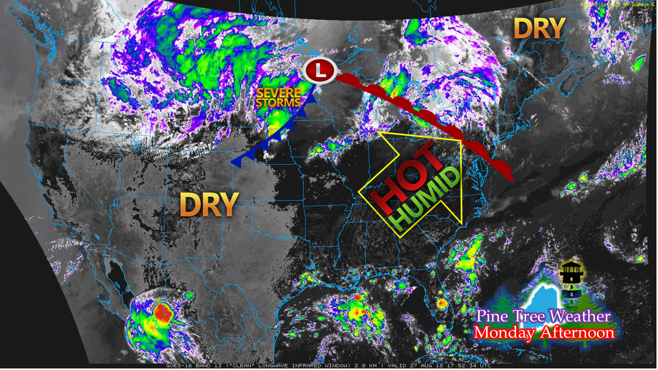
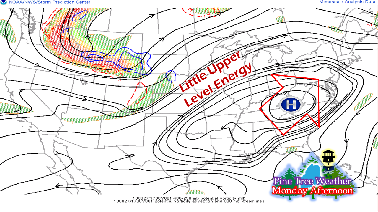
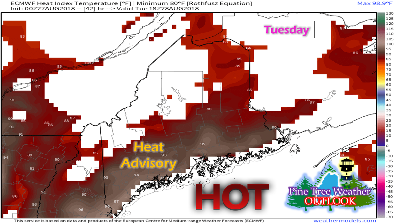
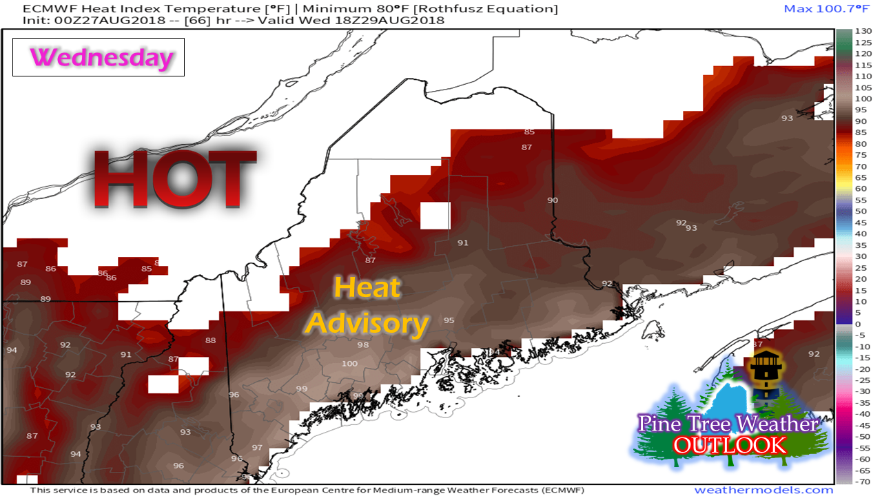
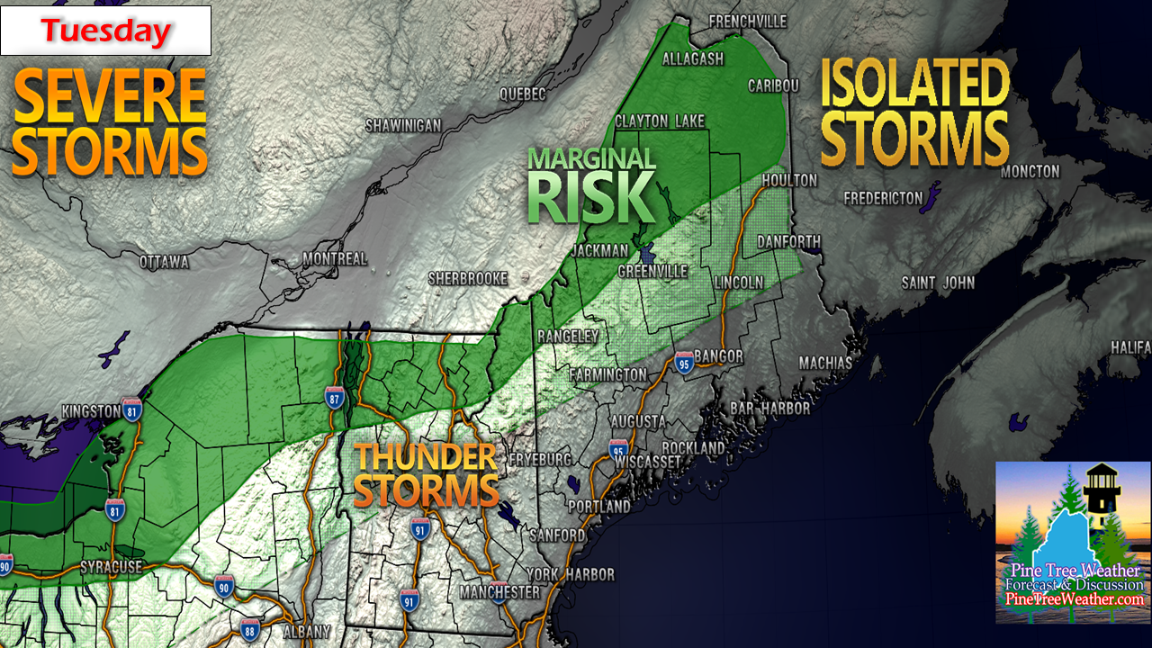
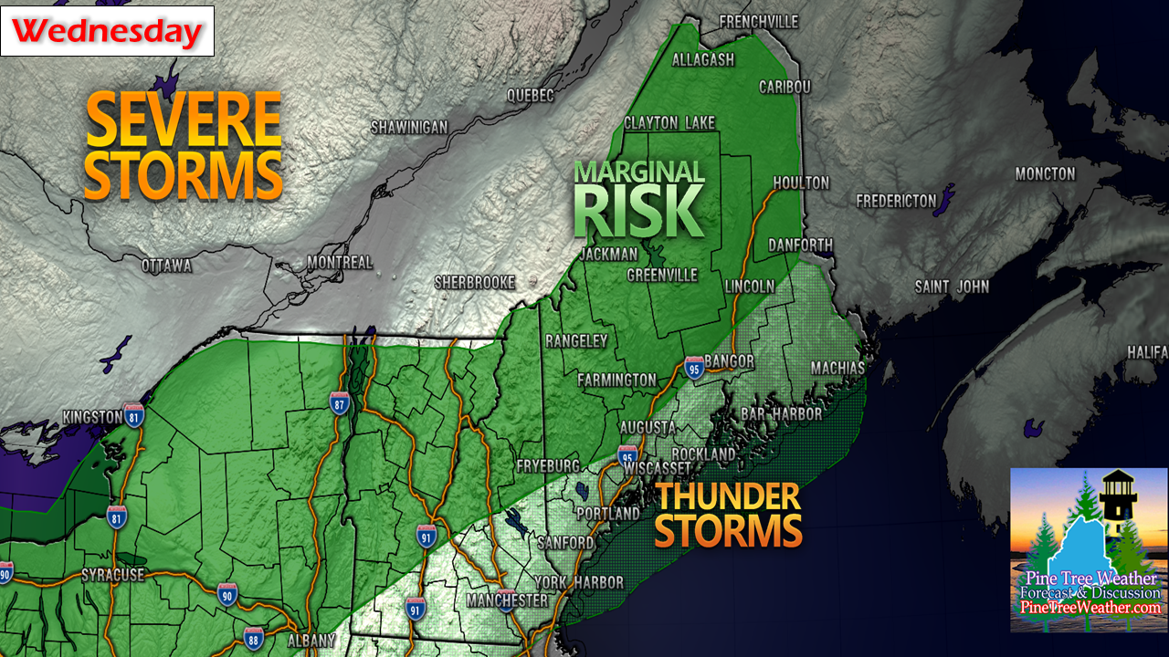
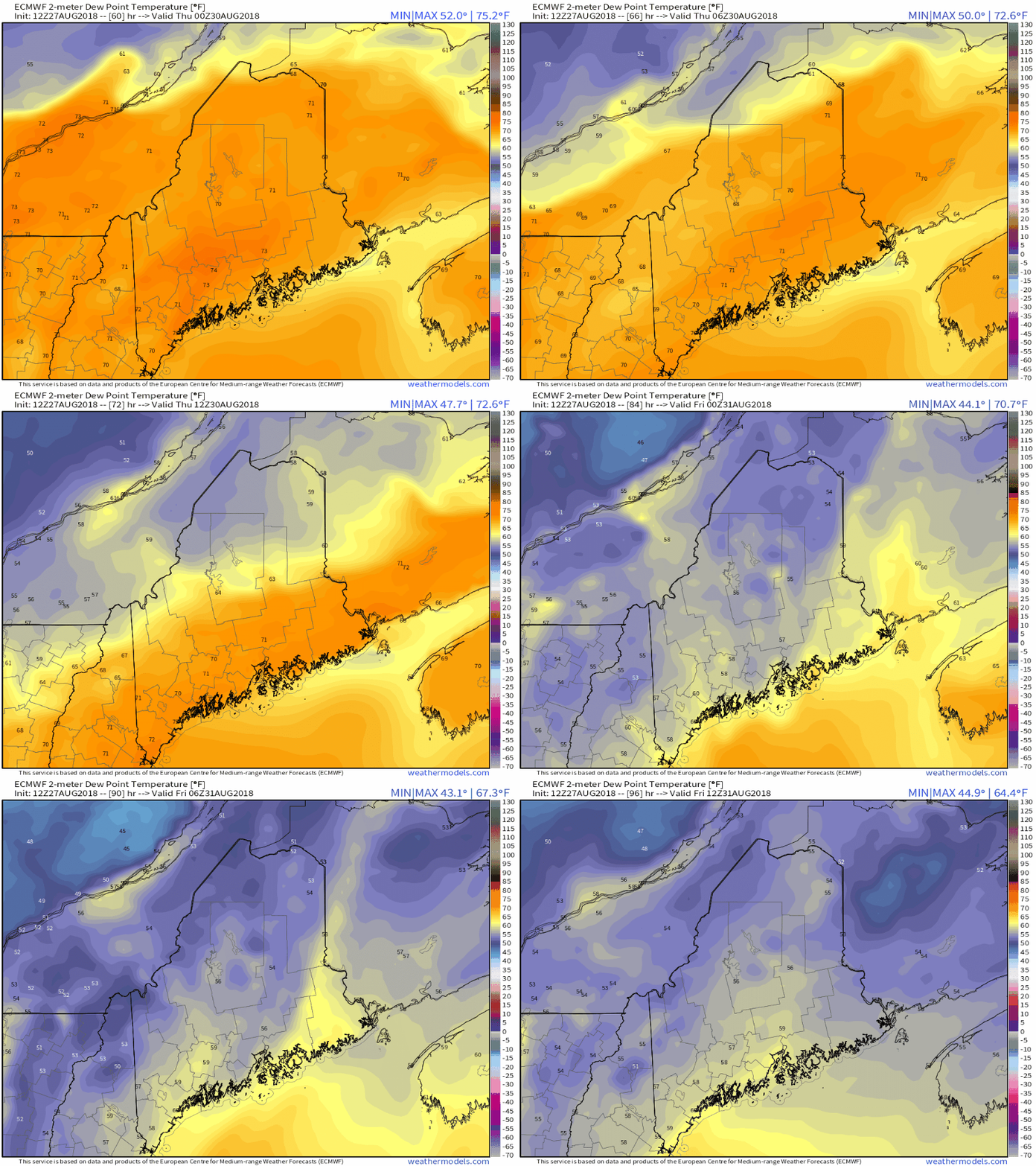
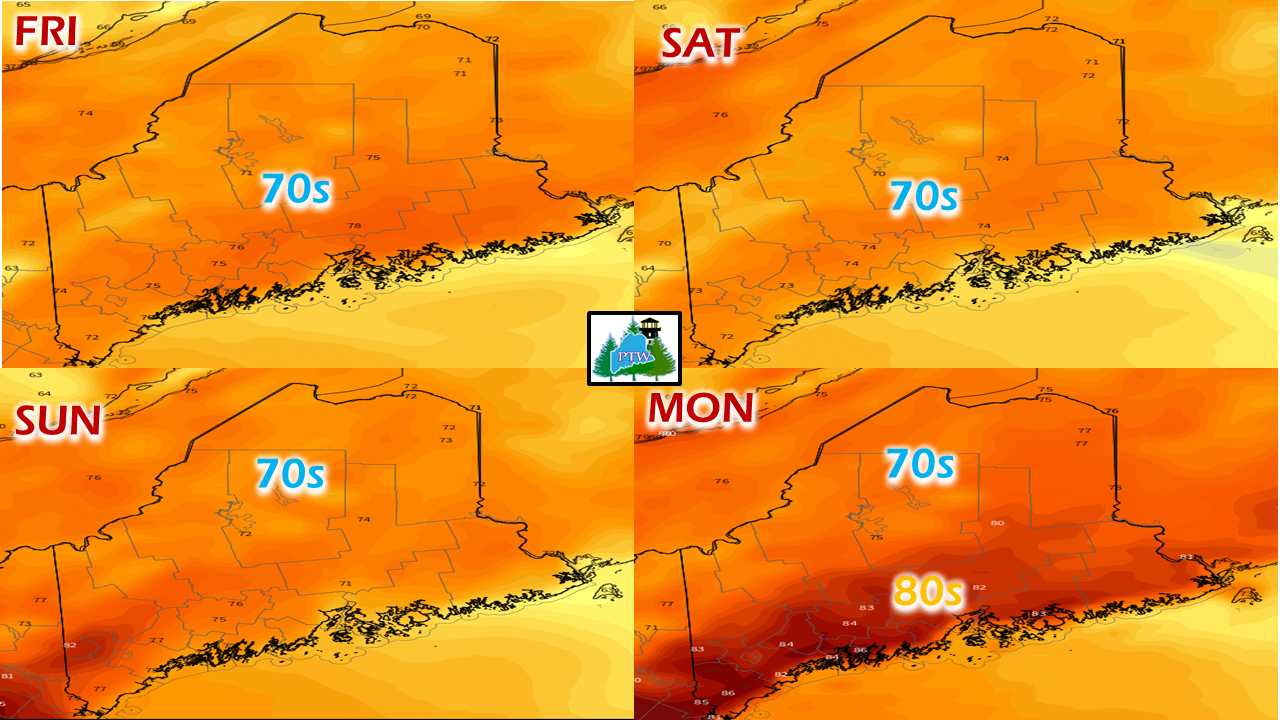
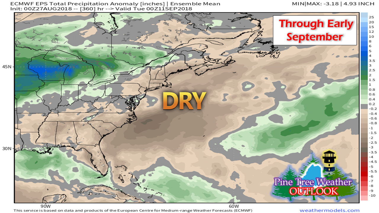
Hope you enjoyed the breakAfter the pleasant weekend with comfortable temperatures and dew points, the pattern is shifting back to July-type weather with hazy, hot and humid conditions that will grip the region through Wednesday. An approaching cold front Wednesday into Thursday will bring temperatures and dew points back down to levels experienced over the past weekend. A popular question around the coffee pot and water cooler would be "Is there any more of this heat coming?", which my reply is "We'll be above average for a while, yet". One key element missing from this water vapor image is the lack of a tropical hose. While it will be plenty humid, the lack of moisture from the south will keep the rain threat down considerably. The other feature missing is there is very little upper level energy of any value riding along the periphery of the heat dome. While showers and storms will be in the forecast through Wednesday, the lack of tropical moisture and atmospheric triggers is likely to keep the severe threat minimal. The furnace returnsTuesday's heat will primarily be along coastal areas except over the islands and shoreline areas that get a breeze off the water in a southwest direction. By Wednesday the heat will be an issue much further inland, with many areas in the mid to upper 90s, with a few triple digits sprinkled in. I suspect the Air Quality Index will be poor in the heavily populated southwestern areas, which is typical with high heat indices such as this. Some severe weather potentialWith northern areas on the periphery of the heat dome, weak disturbances will travel along the boundary and could flare up some pop up showers with some isolated strong to severe storms on Tuesday. As the ridge begins to collapse Wednesday, more areas get in on the potential for storms as a cold front approaches from the northwest. There is the chance that all areas may see some sort of activity, but at this point the severe idea appears isolated over Maine. We may have to deal with another round showers and storms on Thursday before drier air arrives in time to start the weekend. A return to lower dew points late weekAfter a yet another day of dew point temperatures around 70°, the cold front passes through the region Wednesday night and a northwest breeze will blow the humidity out to sea and bring back comfortable weather in all locations Thursday night into Friday morning. Labor Day Weekend sneak peekTemperatures and humidity appear generally comfortable over the holiday weekend. A warm front approaches the region Sunday with may bring some scattered showers and warmer temperatures for southern areas are possible as we head into Monday. Timing and details will come later this week. Dry times return in the longer rangeAs I mentioned in my Facebook update late last week, we're returning to a similar pattern as we were in late spring. It's more of a west to east zonal flow, and the result is very little moisture to work with. We may see some chances for showers and storms and a front or two that may bring a bit of water to the rain gauges, but the overall outlook for now appears below normal precipitation wise. Of course, that would change if anything tropical in nature flares up and rides up the coast, where there is always that possibility as we enter into peak hurricane season. Thank you for your support!Pine Tree Weather is still in need of your donation to keep the site and all necessary tools funded for the year ahead. You can pledge monthly on my Patreon page ($1 is all I ask) or you can contact me through message on the Facebook page or via direct message on Twitter to mail a check. I want to keep doing this, but I can't do this without your assistance. Thanks to those who have made pledges and sent me donations through the mail. I am most grateful for your generosity and belief in what I am doing here.
Please stay in touch with the National Weather Service for updated forecasts, bulletins and advisories in your area. Check in with NWS Gray for western and southern areas, and NWS Caribou for northern and eastern zones. - Mike |
Mike Haggett
|

