
Raintober continues with one more storm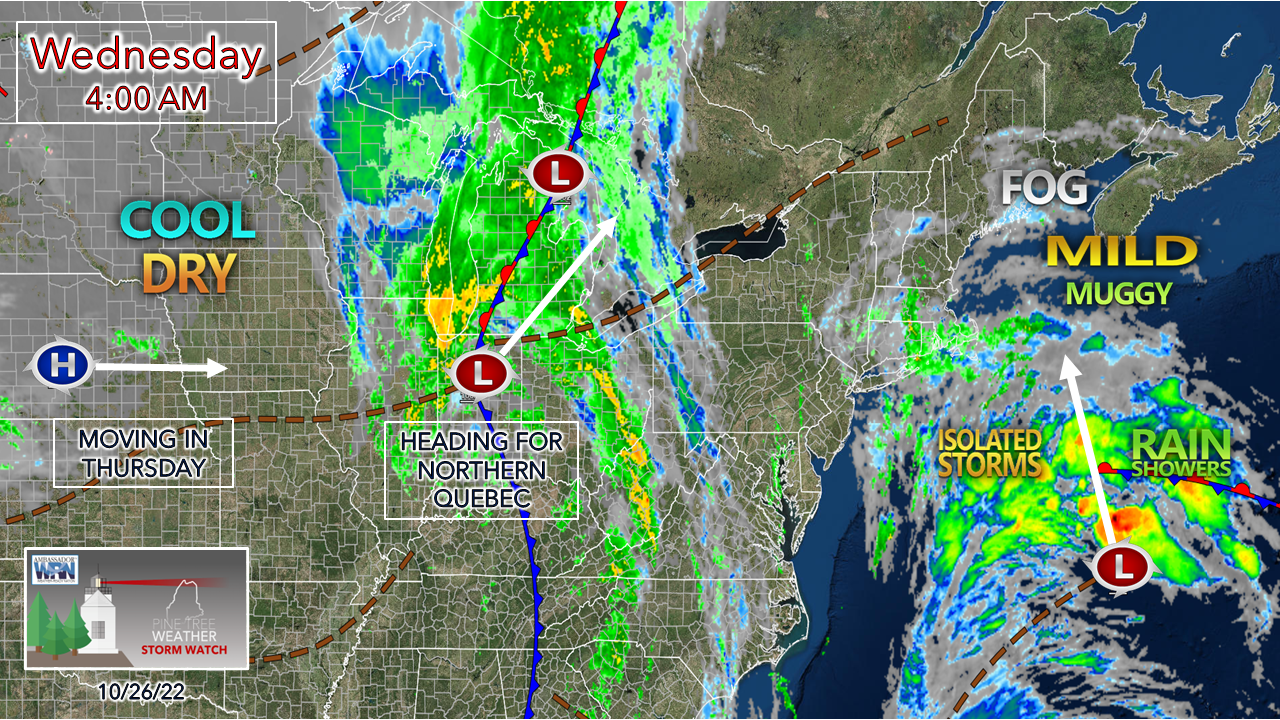 From what it appears as of early Wednesday morning, this is the last statewide rain event in the outlook through the end of October, and it appears to be another good event to add to the water supply. Tropical remnants north of Bermuda move northward towards Maine as a cold front approaches from the west. Once this passes through Wednesday night, a more seasonable stretch of weather comes to the region through the start of next week. 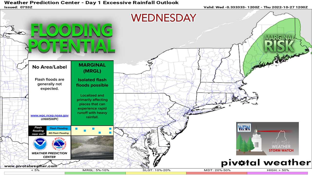 Flood watches are posted for MidCoast and eastern areas with the ground saturated from recent storms. Localized flash flooding is possible outside of those areas. With tropical systems comes the threat of heavy downpours. With the bulk of the leaves off the trees at this point, storm drains could be easily clogged from runoff of downpours. Visibility will likely be reduced at times not only due to the rain but also with areas of fog around. Hydroplaning potential is there on the faster roads where standing water is present. Take it easy on the roads as you travel and allow for extra time. 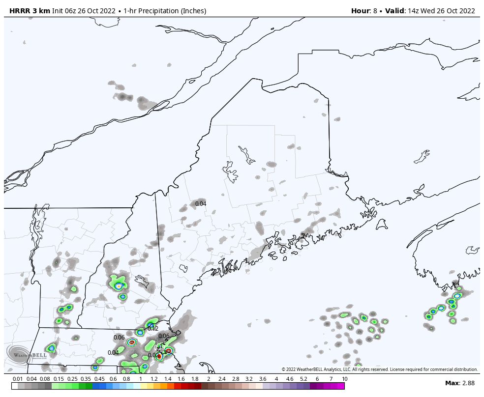 Wednesday 10 AM to Thursday Midnight - A look here at 1-hour rainfall amounts predicted by the 06z (2 AM) HRRR short term model shows the potential for localized heavy rain with potential for rainfall rates to exceed 1-3"+ per hour. A few showers pass through in the morning, but the main charge of rain passes through the region in the afternoon into early evening. While this is a quick hitter, the air being saturated with July-like dew points in the 60s running 300% over normal levels for this time of year, this will bring the chance for torrential rain in spots. The rain is predicted to end over northern areas Wednesday night, but a few trailing showers are possible in the mountains into early Thursday morning. 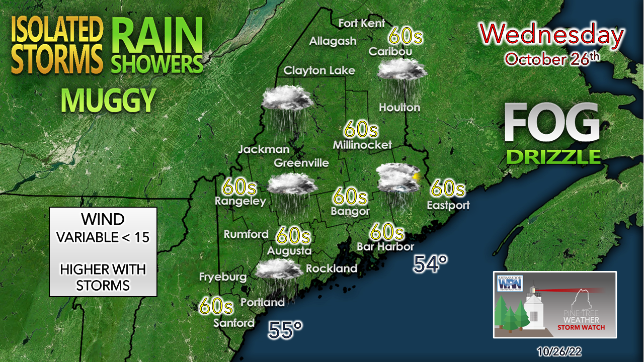 The coastal plain runs the risk of isolated thunderstorms through the afternoon. While the severe threat is very low, the tropical nature of the system could bring the potential for one. While it will be very humid for late October, it will be mild day. There is not a whole lot of wind expected with this event, outside of any gusty winds that may accompany storms and/or downpours. 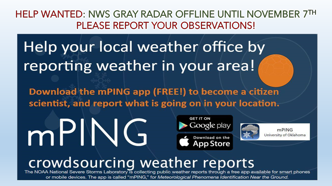 A reminder that your help is needed here. If you see rain, fog, drizzle, thunder, wind, please report it through the mPING app. It's anonymous and free, and only takes 15-30 seconds to do it. You can click on the image to take you to the website for more information.  Breezy relief comes Thursday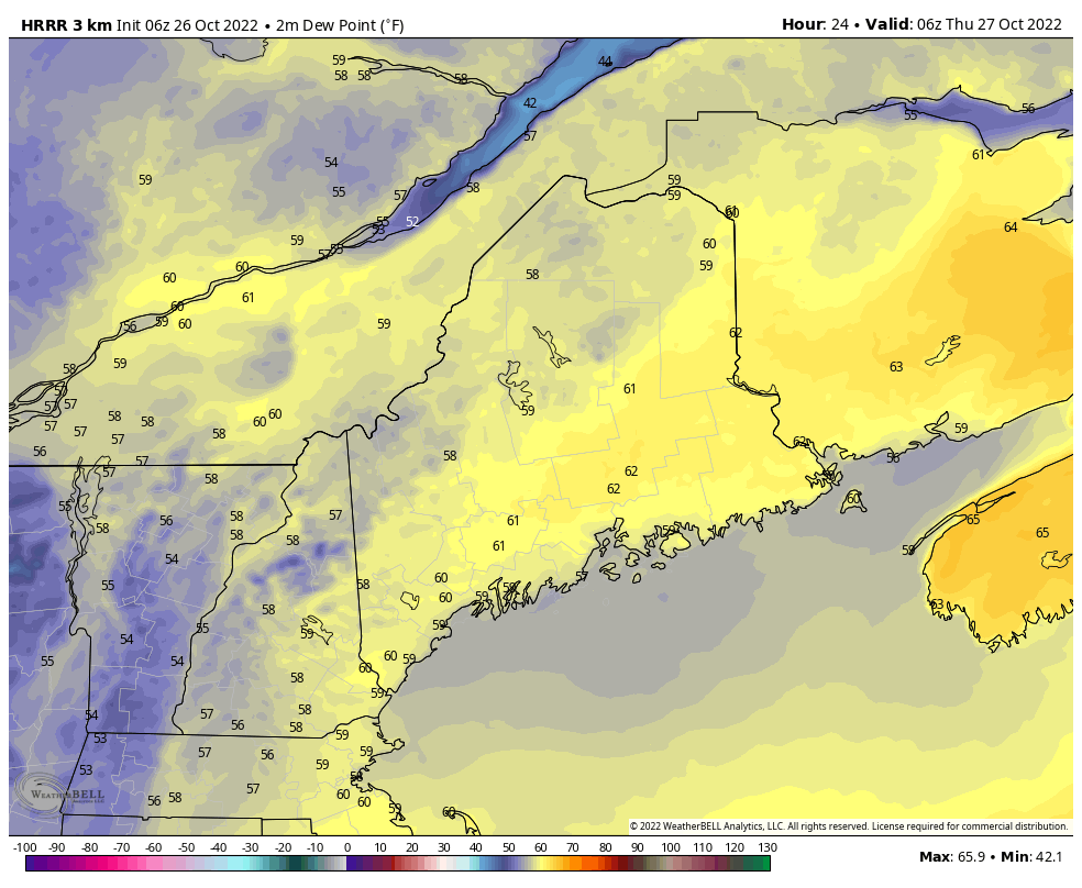 With the heavy rain comes the risk for areas of fog to start off Thursday morning. High pressure moves in and as it does, west / northwest winds increase with gusts 20-30 mph (35-40 mph higher elevations) and blows the humidity out of the area. A nice comfortable night for sleeping returns Thursday night as dew points crash into the 20s and 30s. Temperature outlook through Halloween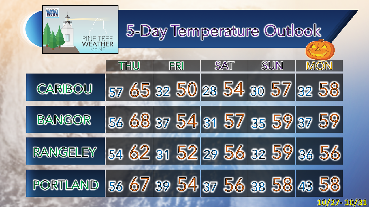 Upcoming winter SKYWARN spotter training sessions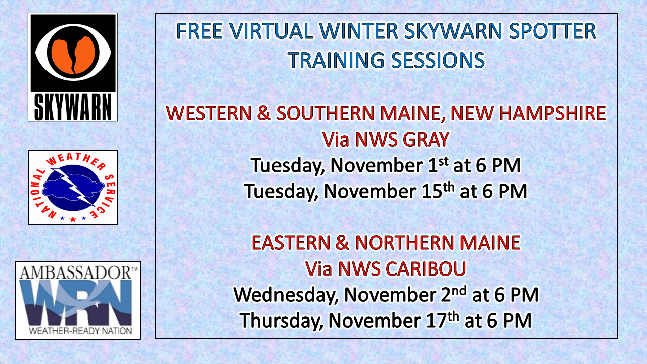 LINKS TO REGISTER: For western and southern Maine and New Hampshire, please register with NWS Gray. For eastern and northern Maine, please register with NWS Caribou. These are fast paced, fact-filled, and informative sessions for weather enthusiasts ages 16 and up, younger is good with an adult present. These sessions are completely FREE of charge. Please contribute to keep PTW going into its 11th year NOTE: The forecast information depicted on this platform is for general information purposes only for the public and is not designed or intended for commercial use. For those seeking pinpoint weather information for business operations, you should use a private sector source. For information about where to find commercial forecasters to assist your business, please message me and I will be happy to help you. |

Mike Haggett
|


