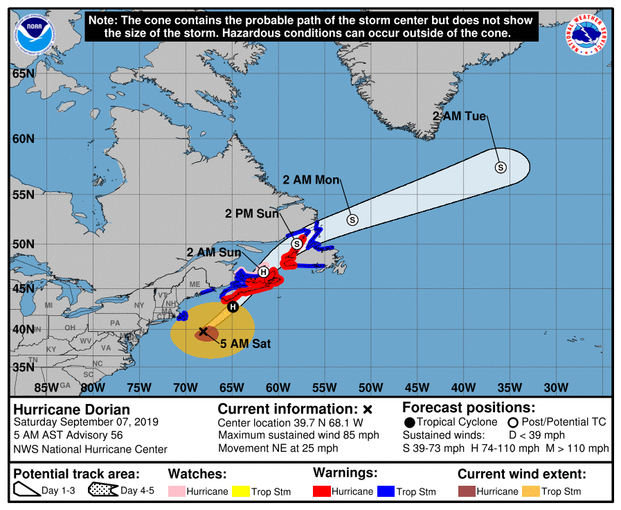
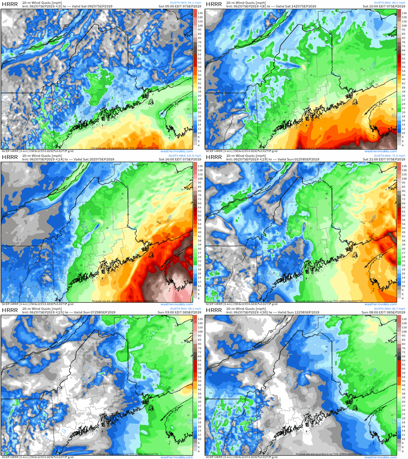
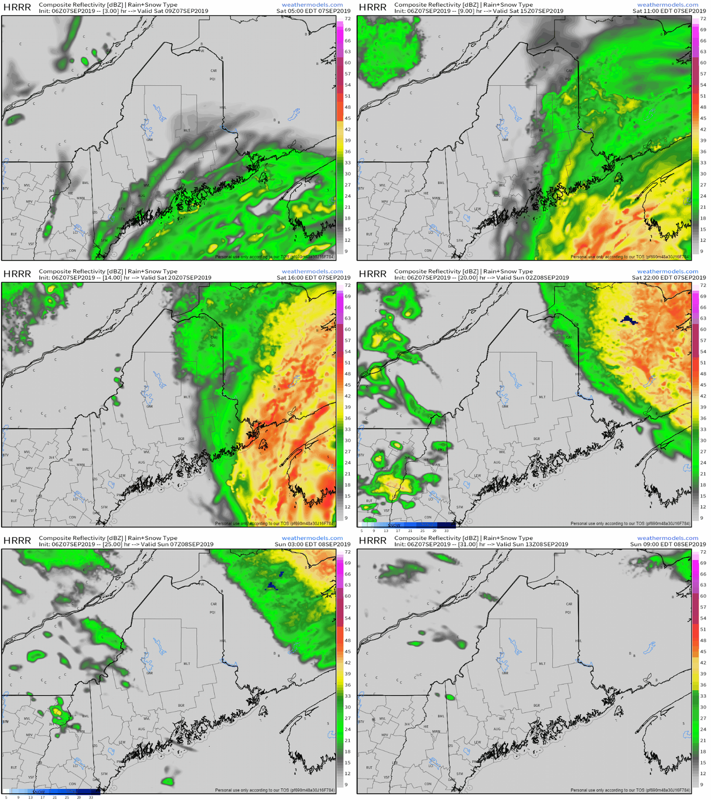
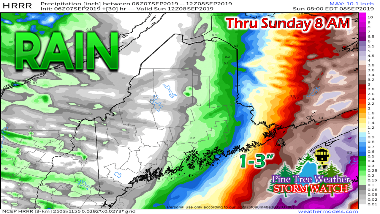
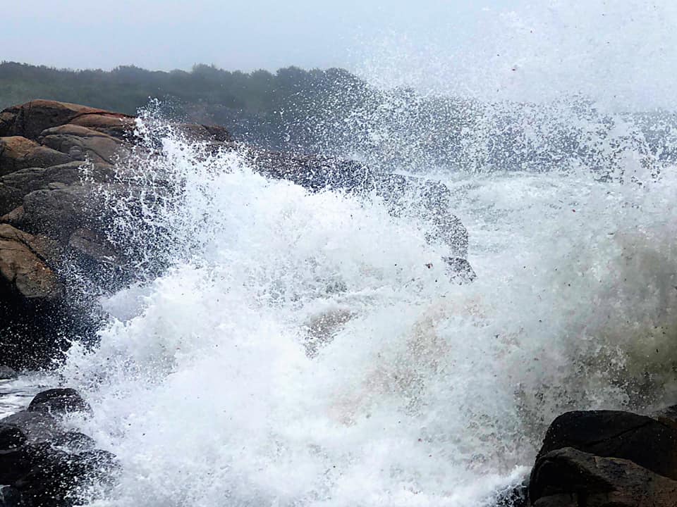
Storm passes by SaturdayTropical storm conditions have been reported over southeastern Massachusetts, both in wind gust recordings and some light damage. The buoy at Nantucket Shoals reported hurricane force wind gusts as well as 23 foot seas. As of 5 AM, the storm center is southeast of the benchmark 40°N / 70°W point and is crossing Georges Bank enroute to Nova Scotia. Please check with the National Hurricane Center for the latest update. Wind will be increasing over Maine Saturday as the storm heads into Atlantic Canada. Tropical Storm Warnings have been expanded slightly to include central Washington County, in addition to coastal Hancock and coastal Washington County that were previously warned by NHC. Gusts in the 40-50 mph range with some higher along the shorelines are possible for DownEast Maine through the day, with the stiff breeze settling down overnight into Sunday morning. Rain has turned into a bust for western and southern areas of the state as the storm tracked a bit further to the southeast. An inverted trough may bring some back side shower activity to those areas this evening. The heavy rains for DownEast areas should taper off by Saturday evening. Washington County, and the Eastport-Jonesport-Machias-Lubec region should end up with 1-3" of rainfall by Saturday evening. A High Surf Advisory continues for the entire coastline of the state until 2 AM Sunday. A Coastal Flood Statement has been issued for coastal Hancock and Washington counties for the two high tides Saturday in 6 AM and 6 PM hour for minor flooding from splash over along with 1-2' storm surge. For those heading to the shorelines to see the awesome power of the storm, please view from a safe distance as wave heights can be unpredictable. Stay on alert for bulletins and updates!►► Latest forecast from the National Hurricane Center for Dorian.
► ► For the latest official forecasts, bulletins and advisories, please check in with the National Weather Service in Gray for western and southern areas, or Caribou for northern and eastern parts of Maine. Please consider supporting Pine Tree Weather ► ► Your financial donations are much appreciated to keep this site funded and for further development. FUNDRAISING NOW FOR 2020 ... PLEASE SUPPORT! I sincerely appreciate your support not only financially, but also in sharing my efforts with others. For more information from me, please check the Pine Tree Weather Facebook page as well as my Twitter feed. Always stay weather aware! - Mike |
Mike Haggett
|

