
Active pattern through midweek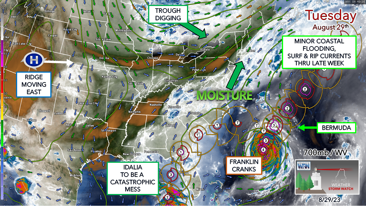 A squeeze play is setting up atmospherically over the east coast. A trough over north central Ontario runs up against the ridge over the Atlantic. While the trough will win out, the clash between the two puts New England in the convergence zone with advancing tropical moisture from the south. For north central Florida, this is a bad scene. Idalia is forecast to be a major at landfall, with 8-12' of storm surge in a region that hasn't taken a hurricane of this magnitude in a long time. Franklin is stirring the fish hard as it is the strongest hurricane with recorded pressure off the eastern seaboard since Dorian back in 2019. Bermuda gets lucky with the westward pass. Rain totals still difficult to judgeThis has been one of the more difficult forecasts I've had to deal with in while given the tropical activity and its influence on modeling, dealing with convective feedback biases that have the operational model ideas jumbled, and I am having a difficult time trusting the short-term ideas. With the arrival of the upper-level jet with plenty of moisture and low pressure forming along the frontal boundary, the timing and location of all of those pieces coming together makes this one a challenge. I am glad we're dealing with liquid here, rather than a winter junk storm. A few showers will be around for Tuesday, nothing crazy, and the dew points increase as outflow from the approaching front with the trough from the northwest heads southeast.  Wednesday Midnight to 11 PM - The main idea as of Tuesday morning is for the slug of moisture from the developing low along the frontal boundary to enter into the region Wednesday morning and move northeast during the day. While it is expected to be a quick mover, it is also expected to dump a lot of rain in a short period of time. There could be some areas of training of rainfall with locally intense downpours. For those travelling to work and school, visibility could be a challenge. The rain is expected to clear out of the area by Wednesday night. 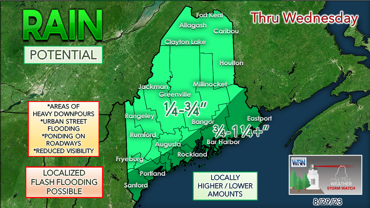 I can see the case where some areas could receive 2-3" of rainfall, and I can also see where some areas may not get much at all. The coastal plain has a good chance of seeing roughly 1" of rain, with DownEast areas having a running shot at 2". The mountains may also pick up around 1" of rainfall due to elevation. After this, we'll put the rain gauges away for a while. A prolonged dry period is on the way through Labor Day weekend and well into next week.  Stay safe while viewing the surf. Watch from a safe distance and respect the power of the water. Pine Tree Weather is funded from followers like you. I would appreciate your financial support. Click here for how you can contribute. You may not like the weather, but I hope you like what I do, and support my efforts. Thank you! Stay updated, stay on alert, and stay safe! - Mike NOTE: The forecast information depicted on this platform is for general information purposes only for the public and is not designed or intended for commercial use. For those seeking pinpoint weather information for business operations, you should use a private sector source. For information about where to find commercial forecasters to assist your business, please message me and I will be happy to help you. |

Mike Haggett
|


