
A bit of history being made this summer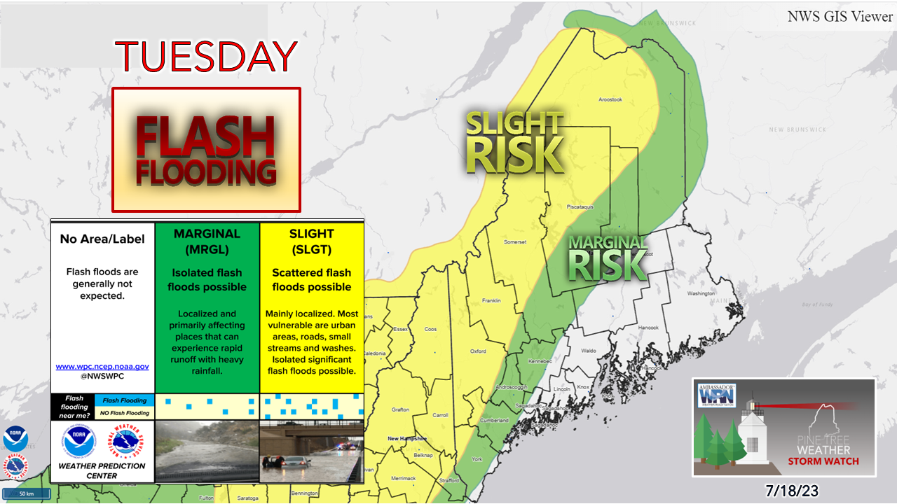 The perpetual risk of flash flooding continues. While Tuesday does not appear as bad compared to Sunday, there are some areas that may get hit, mainly over the interior and north. Torrential rainfall with the threat of some snarky storms is possible with the shortwave passing through the region. 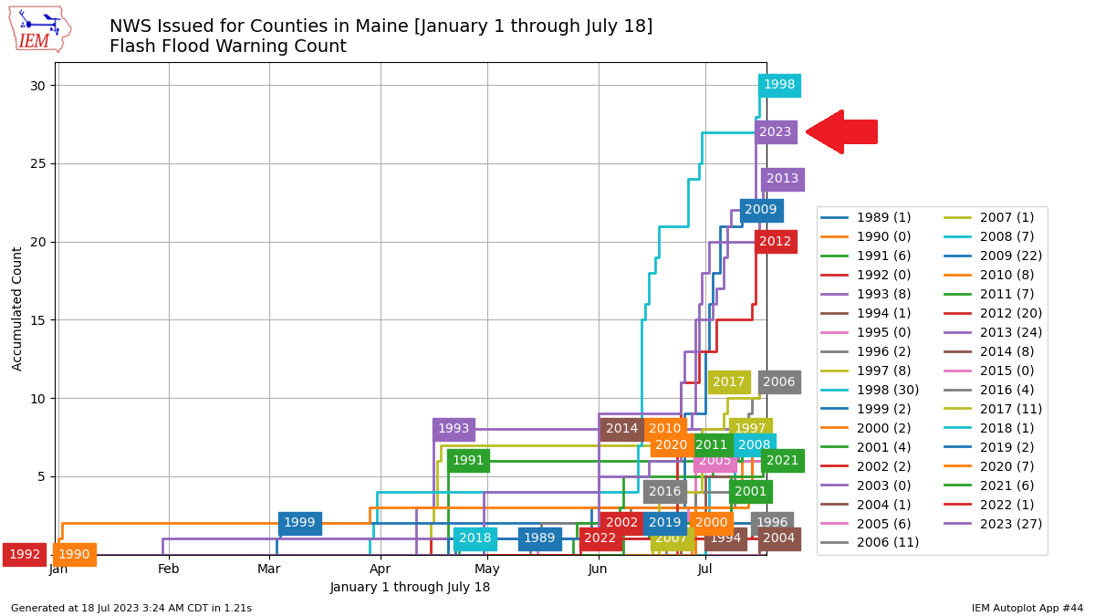 If you think your NOAA Weather Radio and/or your phone has blown up with flash flood warnings more than normal this summer, you are correct. To this point of the year, the combined tally of flash flood warnings issued between the Gray and Caribou offices is at 27, the second most at this point in the year since 1998 in the history recorded since 1989. All but 4 of those 27 were issued by the Gray weather office alone, which indicates the continuous onslaught of the heaviest rain over western and southern areas of the state. Unhealthy air quality due to smoke and ozone for the day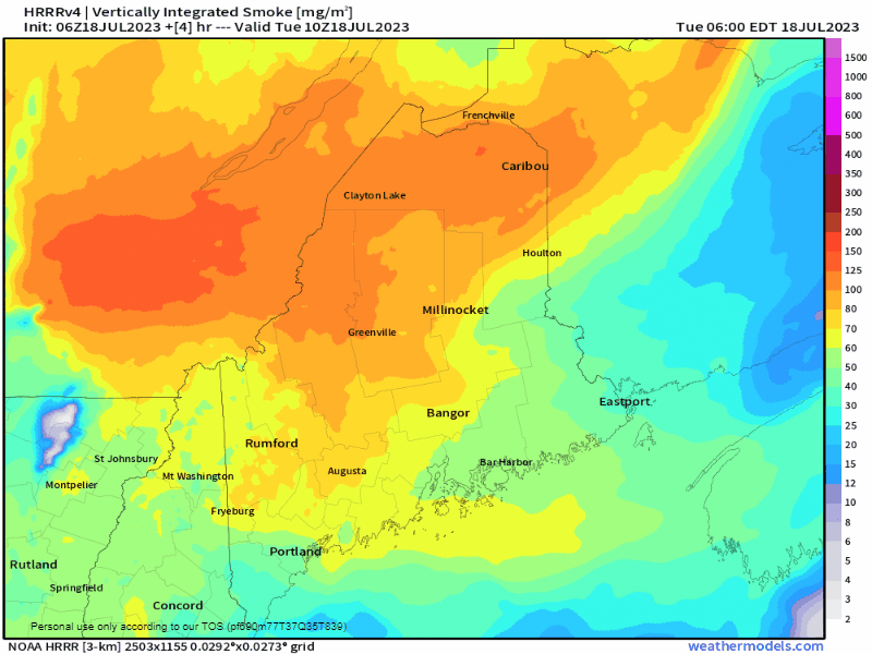 Tuesday 6 AM to Wednesday 6 AM - The wildfires over western Canada continue to rage on and send smoke into the atmosphere. With shortwave passing through, that will help clean up the air quality into Wednesday 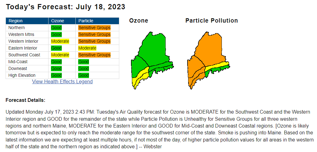 There is an air quality alert posted for much of the state per the Maine Department of Environmental Protection for an unhealthy level due to smoke and ozone. Folks with respiratory issues should take it easy for the day. Conditional severe storm threat Tuesday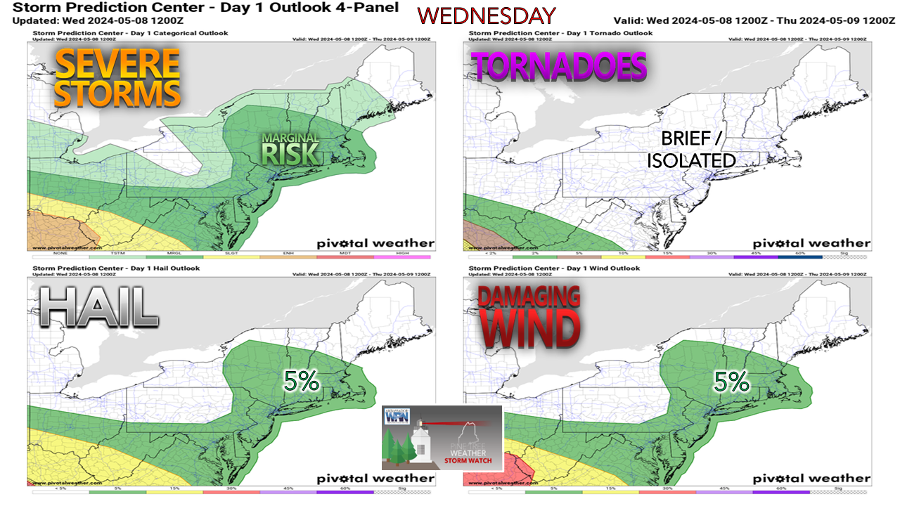 Where the sun is out, expect the thunder guns to come out. The main threats of the day are torrential rainfall, damaging wind, and hail. Cloud cover may cut the threat, but there is the risk of getting hit with dissipating remnants of a storm downstream. Timing / rainfall amounts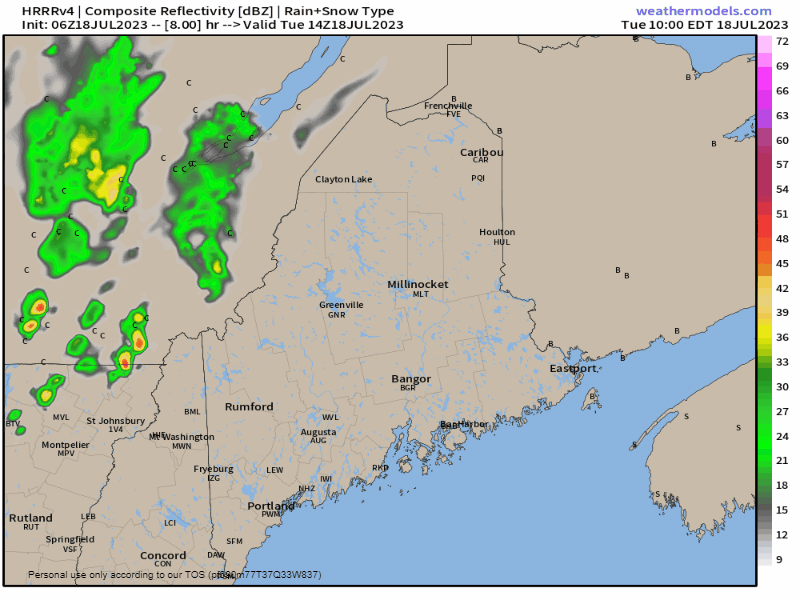 Tuesday 10 AM to Wednesday 6 AM - After a quiet start, the atmosphere heats up with the shortwave frontal boundary on approach. The combination of the two initiates showers and the threat of strong to severe storms through the afternoon and into the evening. As the short-term guidance depicts here, there are three distinct waves of activity passing through the region during the day, and some areas over the interior may get hit all three times. Cloud debris from the first wave may lessen the severe storm threat, but it is important to stay on alert for heavy rain. 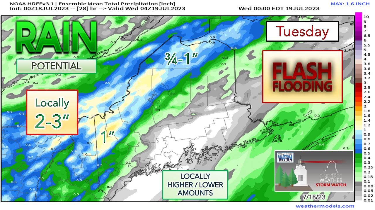 Given the waves passing through, some areas could see 2-3" of rainfall, primarily in the mountains and the Quebec border region, and totals could run higher than that in isolated locations. All areas could get hit with some shower activity as the waves pass through overnight. Isolated showers and storms on tap for Wednesday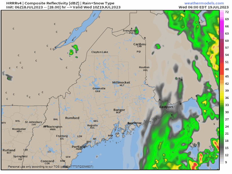 Wednesday 6 AM to Thursday Midnight - High pressure moves into the region and gives interior areas a bit of a break from the humidity as the dew points drop down to the upper-50s, but the coastal plain remains a bit sticky. A weak wave passes through the region and may spin up a stray shower or storm in the afternoon. The region gets a bit of a break on Thursday, but I can't rule out a stray shower or storm. the chance for showers and storms increases on Friday and are expected to remain a threat over the weekend. Expect warmer weather heading into next week.  Pine Tree Weather is funded from followers like you. I would appreciate your financial support. Click here for how you can contribute. You may not like the weather, but I hope you like what I do, and support my efforts. Thank you! Stay updated, stay on alert, and stay safe! - Mike NOTE: The forecast information depicted on this platform is for general information purposes only for the public and is not designed or intended for commercial use. For those seeking pinpoint weather information for business operations, you should use a private sector source. For information about where to find commercial forecasters to assist your business, please message me and I will be happy to help you. |

Mike Haggett
|


