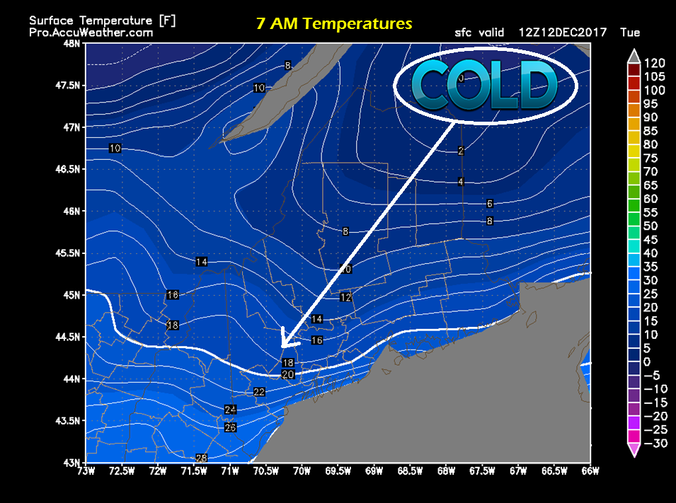
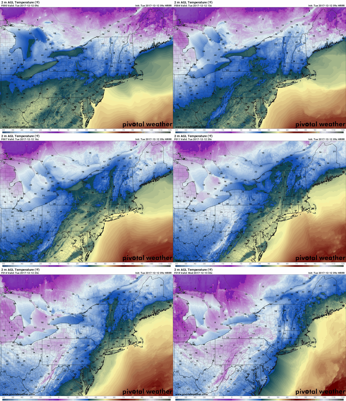
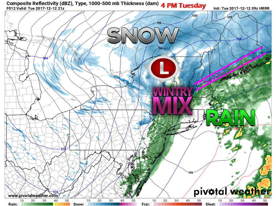
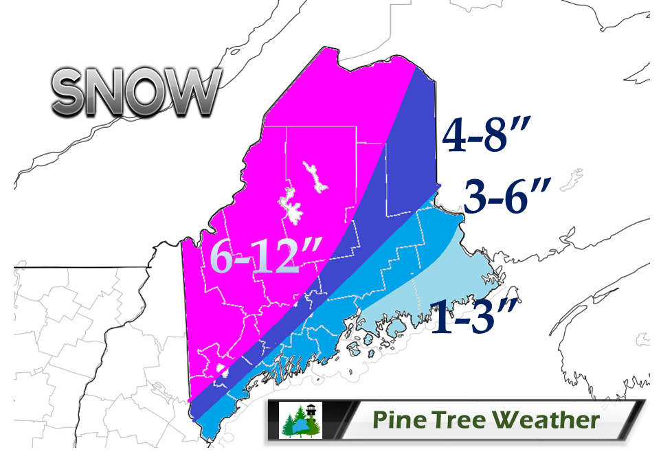
Cold air damming likely to affect outcomeI am going to get right out ahead of this now and say that the cold is likely going to prove me and other forecasters wrong once again. Guidance does a very poor job handling it. I know this. I hammer that point home often in my discussions. I took the bait, and I will pay for taking the hook. Looking over observations, Aroostook County was at or below zero at the 7 AM recording point. The Isle of Shoals and Portland weather buoys were in the mid-20s. The cold air is damming, and it does not appear to go down without a fight. Guidance is beginning to catch onto this idea. The 9z (4 AM) HRRR model is showing a later time for the southwest coast to rise above freezing. This means more snow will fall before the changeover to rain. It could be 4 PM this afternoon or later before the entire coast sees liquid. Given the projected track of the storm, eastern Maine has a better chance of seeing rain move further inland than western areas. Due to the trend, I have modified the snowfall map accordingly. The higher amounts in the mountains and north is for higher elevations. Areas along Route 2, Lewiston and Waterville can expect a half a foot. Shoreline areas will be on the low end. I am thinking 3-4" for Portland, Augusta, and Bangor. DownEast areas along the Airline can expect 2" or so before the changeover.
I am not afraid to admit my errors. Models fooled me on this one. I will make adjustments. I will update later today. - Mike |
Mike Haggett
|


