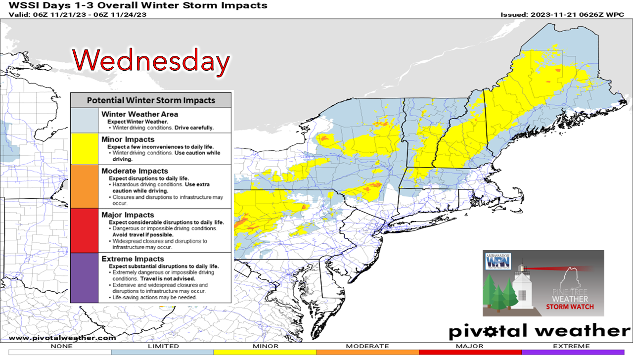
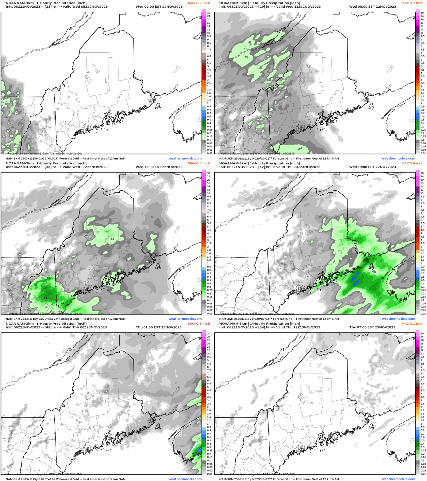
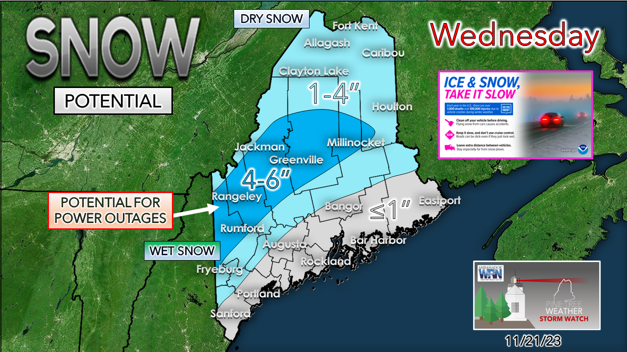
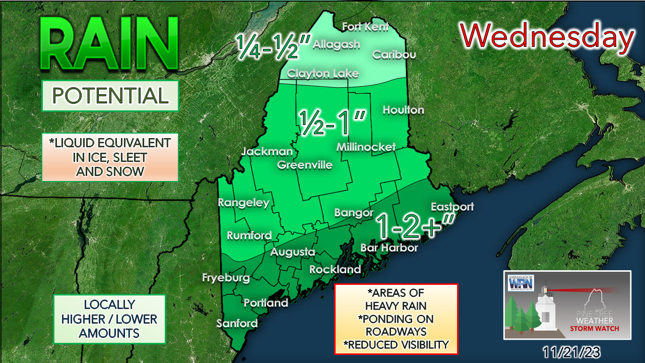
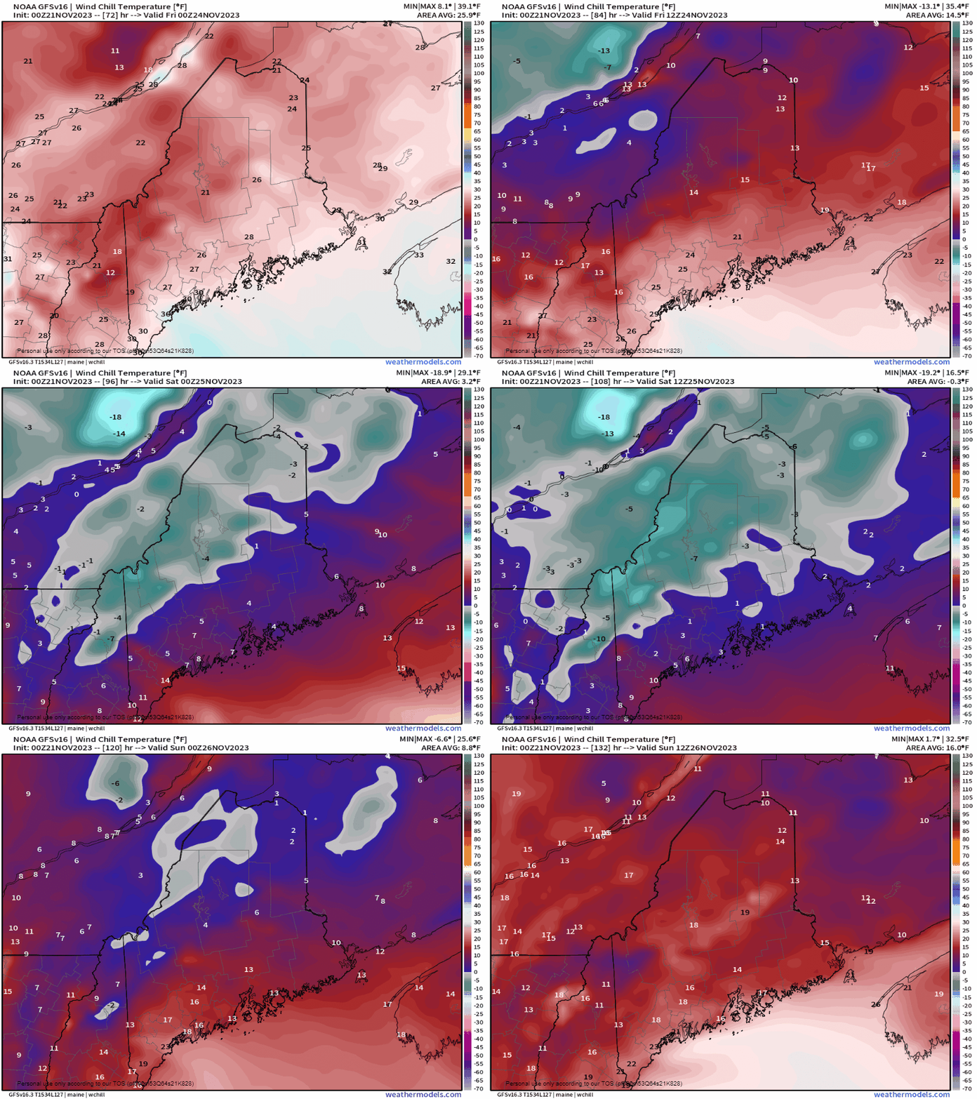
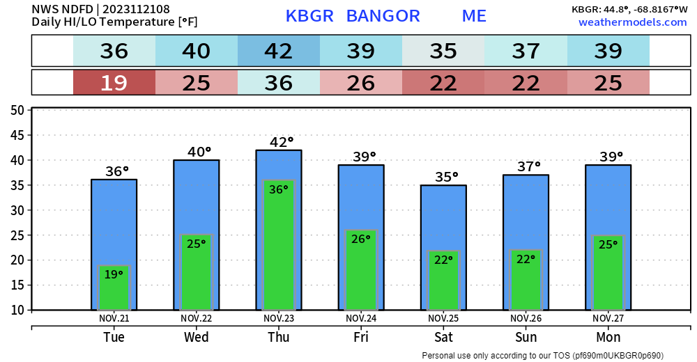
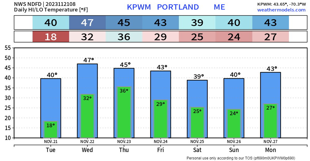
A rough day of travel aheadCold air has settled in overnight which is a key ingredient for what is on the way to the region overnight into Wednesday. A Winter Weather Advisory has been posted for Oxford, Franklin, and Somerset Counties by NWS Gray. Northern areas could see the same bulletin issued at some point during the day. This is a tricky set up with the coastal front. I can see where there are all kinds of bust potential on the snow side over the western foothills into areas just to the north of Bangor. Guidance wants to introduce more in the way of a junky mix of sleet and freezing rain with the forecast track a bit closer to the shorelines which may reduce snowfall in the mountains. Regardless of what falls from the sky, travel is likely to see impacts everywhere. TimingWednesday Midnight to Thanksgiving 7 AM - Not to cause alarm this is loop of hourly liquid equivalent precipitation that I am using here. The emphasis here is to show the potential for heavier precipitation to pass through the state. As warmer air works aloft against the cold and the juice from the southwest overloads the atmosphere, rain and/or snowfall rates are expected to become heavy at times. The main concern comes in the afternoon as low pressure intensifies in its departure. All areas could see snow to start off. For the coast, snow flips to rain soon after precipitation begins as southeast wind flow drags in warm air off the water. By the Wednesday morning commute, rain is expected over southern areas, with snow falling rather vigorously at times over the interior. As the heating of the day coincides with the heaviest of precipitation, old friend cold air damming plays a role over the interior. This is when the junky mix may show itself as precipitation is about to wrap up. The region should be clear of precipitation by early Thanksgiving Day. Precipitation outlookI've tweaked this a bit from Monday's post. Bust potential is there given the closer track to the shorelines which not only introduces the junky mix but also affects the snowfall ratio. With more water content that means less in the way of inches. The slop factor is high for western areas. The ski hills may benefit from fluffier snow early on, but that becomes compacted as the day progresses as the moisture content increases. The concerns for some isolated power outages continue over the western mountains in the combination of sticky snow and wind. The coast gets rain, and a good dose of it. The closer to the shorelines, the higher the amounts are possible. DownEast Maine could see 2" or more from Bar Harbor on up into Eastport. A few claps of thunder are possible given the dynamics, whether in rain or snow areas. Outlook through early next weekThanksgiving is expected to be a breezy day as northwest winds crank up. Starting on Friday, temperatures fall as high pressure continues to work in under continued breezy conditions, with the wind chill below zero over the interior and single digits for the coast to start on Saturday. As the wind subsides Saturday night, the feels like temperatures modify a bit warmer to start on Sunday. The next chance for rain and snow comes Monday into Tuesday next week. PTW is 66% funded and needs your supportThank you for your years of following and for your financial support. It is because of your funding that this operation continues. God bless and stay strong. Be good to yourself. Have a safe and wonderful Thanksgiving. Stay updated, stay on alert, and stay safe! - Mike NOTE: The forecast information depicted on this platform is for general information purposes only for the public and is not designed or intended for commercial use. For those seeking pinpoint weather information for business operations, you should use a private sector source. For information about where to find commercial forecasters to assist your business, please message me and I will be happy to help you. |
Mike Haggett
|

