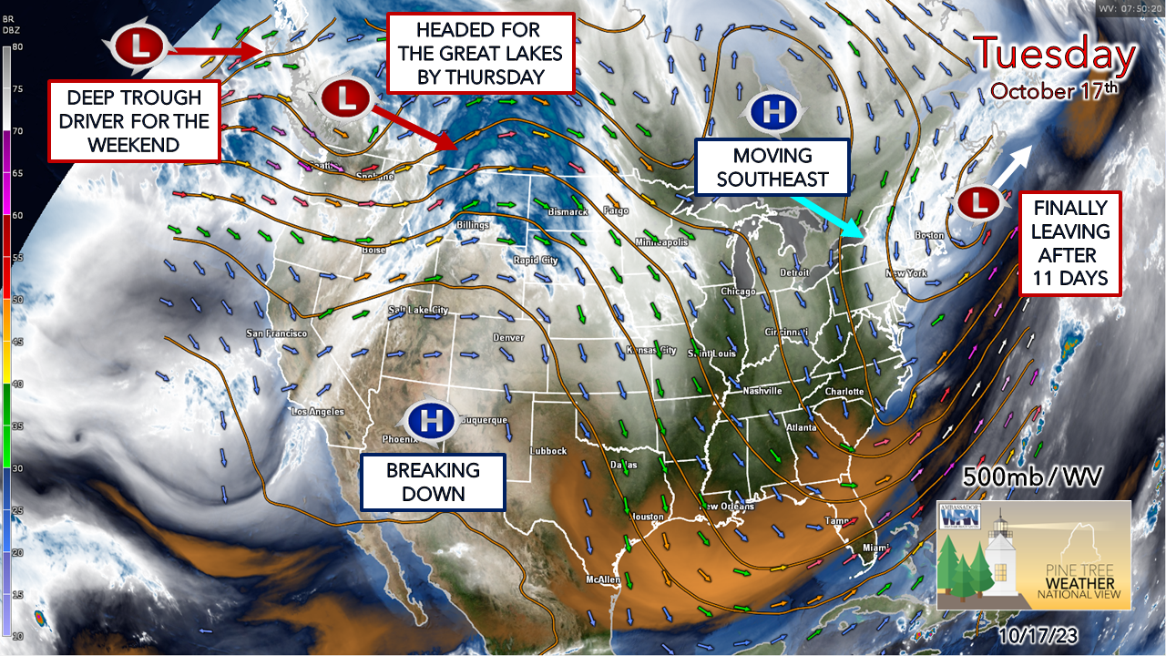
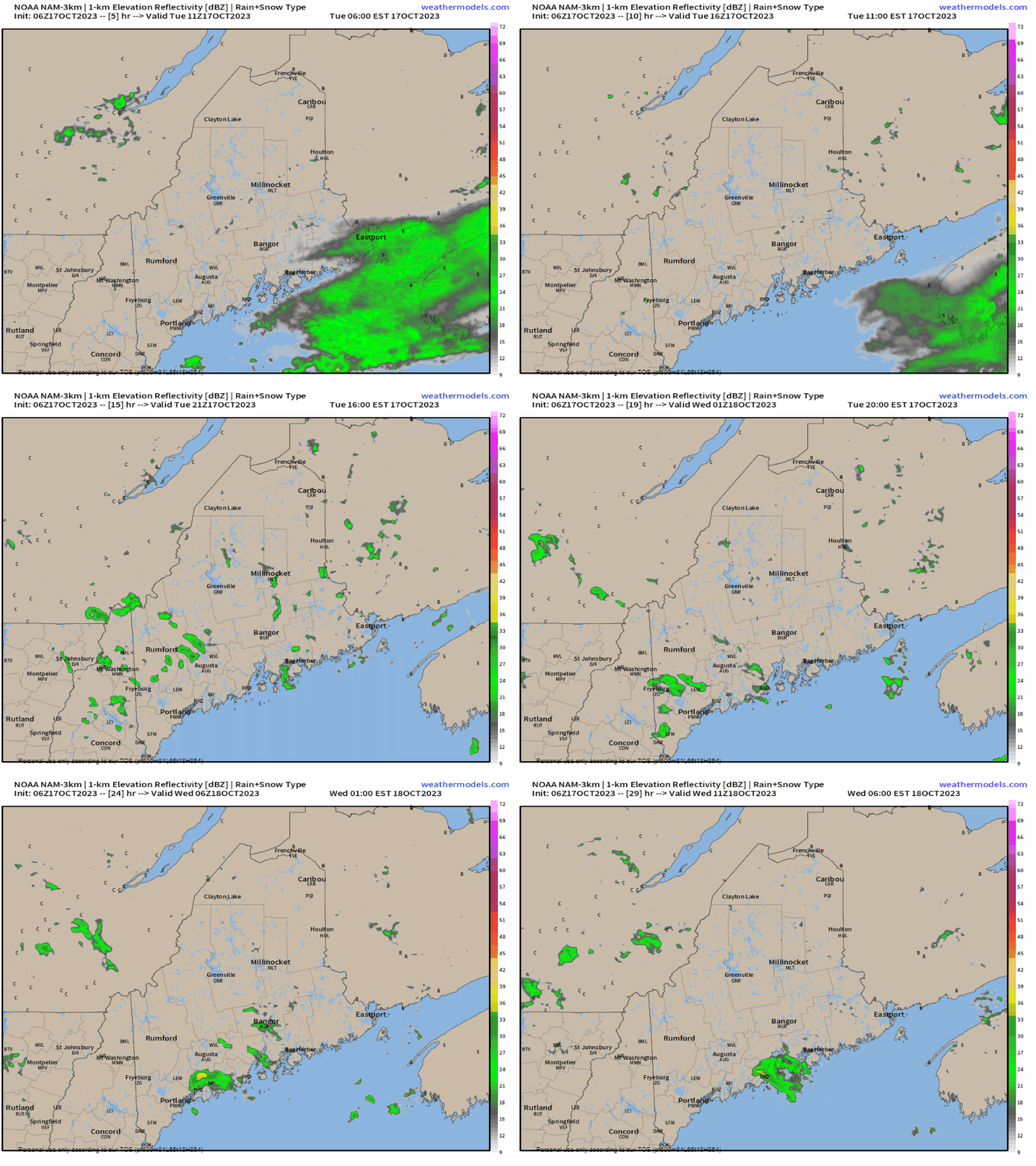
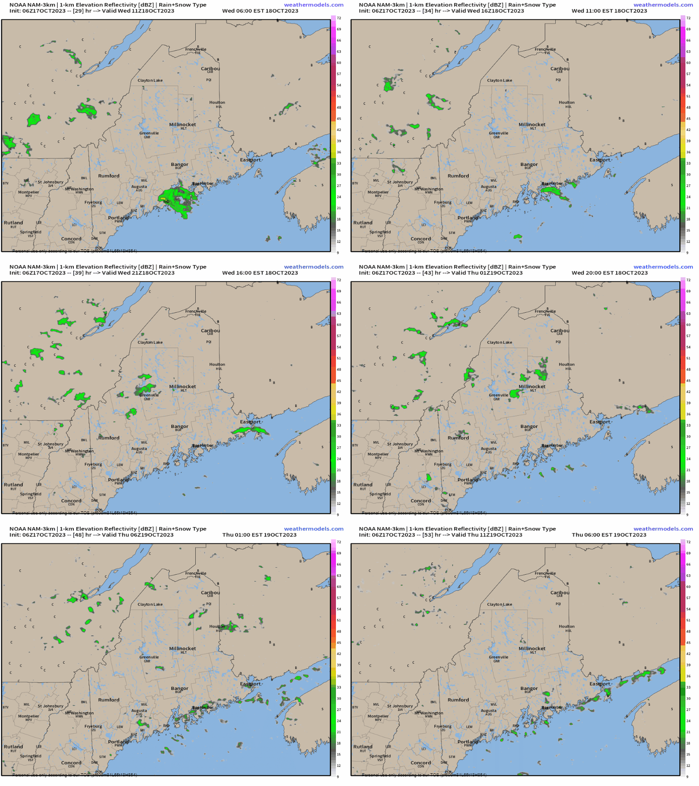
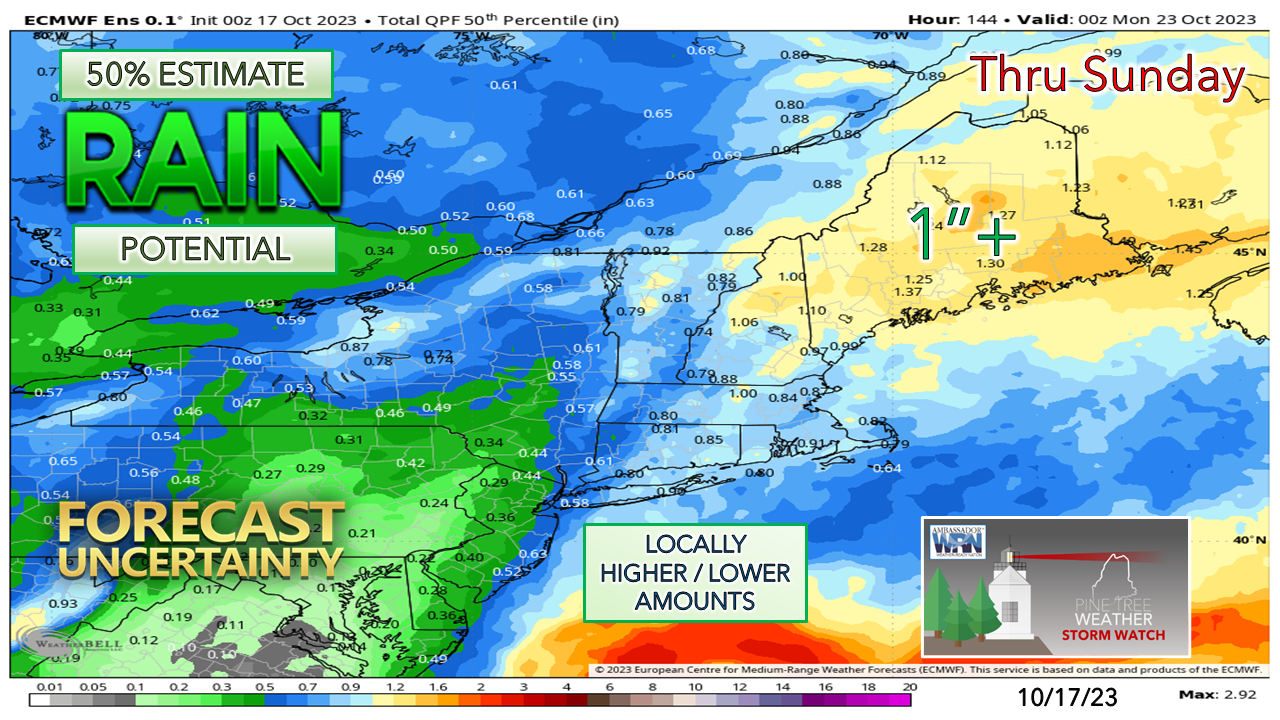
A temporary pattern shift on the wayThe upper-low that has been around since the region dealt with the remnants of Phillipe back on October 7th is -finally- leaving the region. The north Atlantic has been at a virtual standstill due to blocking ridge to the west of the British Isles which is breaking down to allow the trough to escape to the northeast. Ridging over Hudson Bay is breaking down but will slide into the region Wednesday and will provide the state with through Thursday and provide a bit of a warmup. A weak upper-low arrives over the Great Lakes heading into the latter part of the week. An upper-low in the Gulf of Alaska rides over the ridge to the west and does the deep dive to the south and sets up the boundary along the eastern seaboard for the weekend. A few showers around TuesdayTuesday 6 AM to Wednesday 6 AM - With cold air aloft along with energy from the departing upper-low spinning overhead, the heat from the sun may pop a few showers across the region through the day. There could be some graupel mixed in given the low-level cool pool, so if you see "soft hail" from supercooled rain drops, that is what that is. As the atmosphere cools down, the risk of showers subsides overnight into early Wednesday. Ridge moving in may bring isolated showers WednesdayWednesday 6 AM to Thursday 6 AM - As warmer air aloft overruns the cold air with the ridge moving in, that may pop an isolated shower Wednesday into Wednesday night. Outside of the risk of a shower early Thursday, the region takes a break as the system over the Great Lakes begins to organize itself and moves east on Friday. Phasing to dictate how much rain fallsAt this point, it's not a matter IF the region gets rain, but how much, and if the region deals with a wet and windy NorEaster or a simple frontal boundary with weak lows riding along it. This idea presented here from the European ensemble mean indicates at 50% chance of 1" or more of rainfall through Sunday evening. When the forecast begins to indicate a better level certainty will come when the energy associated with the upper-low over the Gulf of Alaska makes landfall Wednesday afternoon. By Thursday, the weather balloons will have sampled it to get a better read on the potential of the northern jet phasing with the subtropical jet, and thus iron out what happens. The rough idea of timing as of Tuesday morning is for showers to arrive Friday afternoon over southern areas and expand statewide into Saturday morning. The end time is uncertain at this point. The boundary may stall due to the north Atlantic ridge strengthening and keep rain chances going through Sunday. Stay tuned. I need your financial support to continue into 2024Thank you for your years of readership and for your financial support. It is because of your funding that this operation continues. I will be away on vacation from October 21st to October 28th resuming updates around Halloween. My last update here will be on Thursday. Stay updated, stay on alert, and stay safe! - Mike NOTE: The forecast information depicted on this platform is for general information purposes only for the public and is not designed or intended for commercial use. For those seeking pinpoint weather information for business operations, you should use a private sector source. For information about where to find commercial forecasters to assist your business, please message me and I will be happy to help you. |
Mike Haggett
|


