
|
For those following along, I am planning on two updates a day regarding Lee through the end of the week. My morning updates will be posted here, evening updates will be posted on Facebook. You'll want to check both locations, and my Twitter / X feed for odds and ends there in between. To shift west or not shift west, that is the question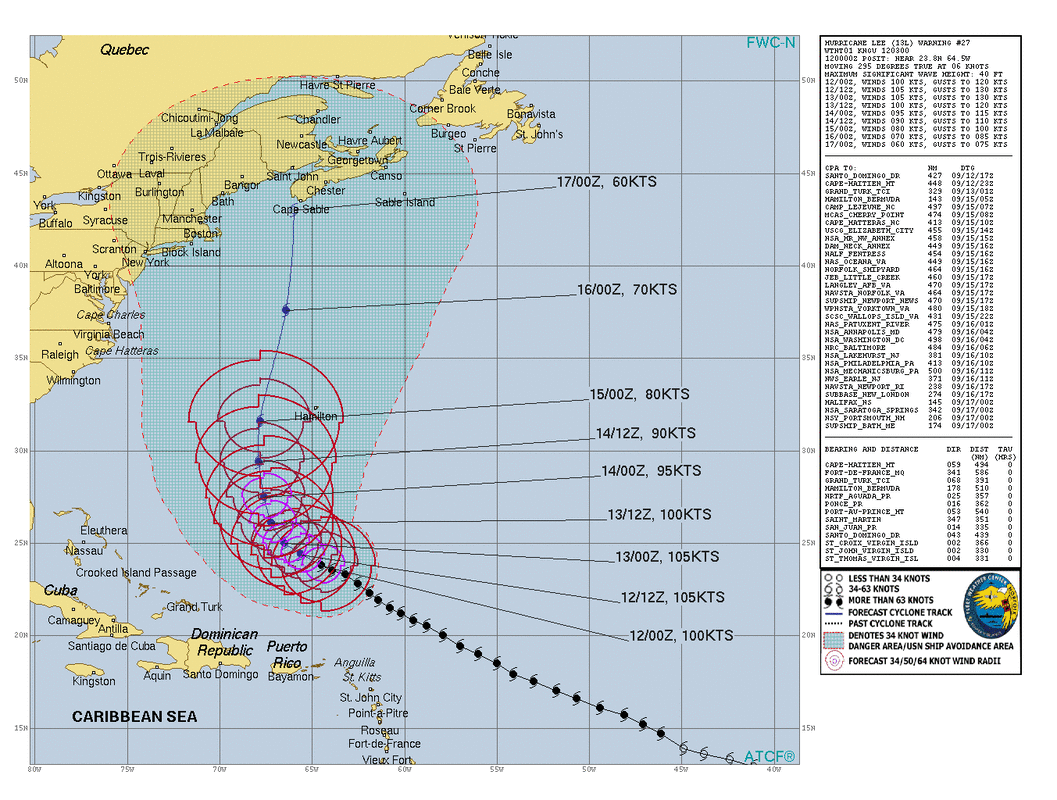 The US Navy posts these wonderful tropical storm charts which better articulate the potential impact region of expanding systems as they advance into the mid-latitudes. This isn't to say the whole blue shaded region is going to be impacted, but it does indicate that it could. The forecast in the fine print on left predicts Lee to come within 206 nautical miles of the Portsmouth Naval Shipyard and within 174 nautical miles of Bath Iron Works. One could only wish that the Cutler submarine monitoring station was listed on here, as it would be roughly 50-60 nautical miles away from there as it passes by. Too close for comfort. I am going to cut to the chase here and say that eastern and northern areas are likely to receive the brunt of Lee's offerings given the forecast track by the Navy and NHC. That said, that doesn't mean western and southern areas are going to escape. I said on Facebook Monday evening that I expect this to be a bad storm, and I am sticking to it. It's all a matter of how bad it will get. The track continues to have wiggle room, which is typical with the storm five days away from reaching the area. The final approach is likely to be dictated by the development of high pressure over Newfoundland Friday into Saturday, and how strong it gets. 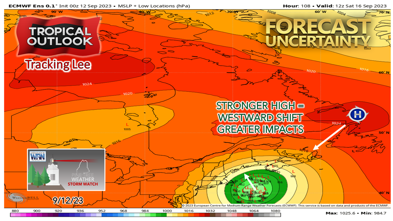 Much like winter with NorEasters, there usually is a strong blocking high that develops to the northeast ahead of rapidly intensifying areas of low pressure. The two work in tandem with each other. Tropical systems work the same way. You can't have a strong low without a strong high somewhere. This from the European model is an eye opener. I didn't need much coffee at 3 AM after seeing this. Most of the ensembles steer Lee into Maine. The operational does as well. This would make what is shaping up to be an already bad storm very bad if that is the case. This would affect the entire state in a significant way. 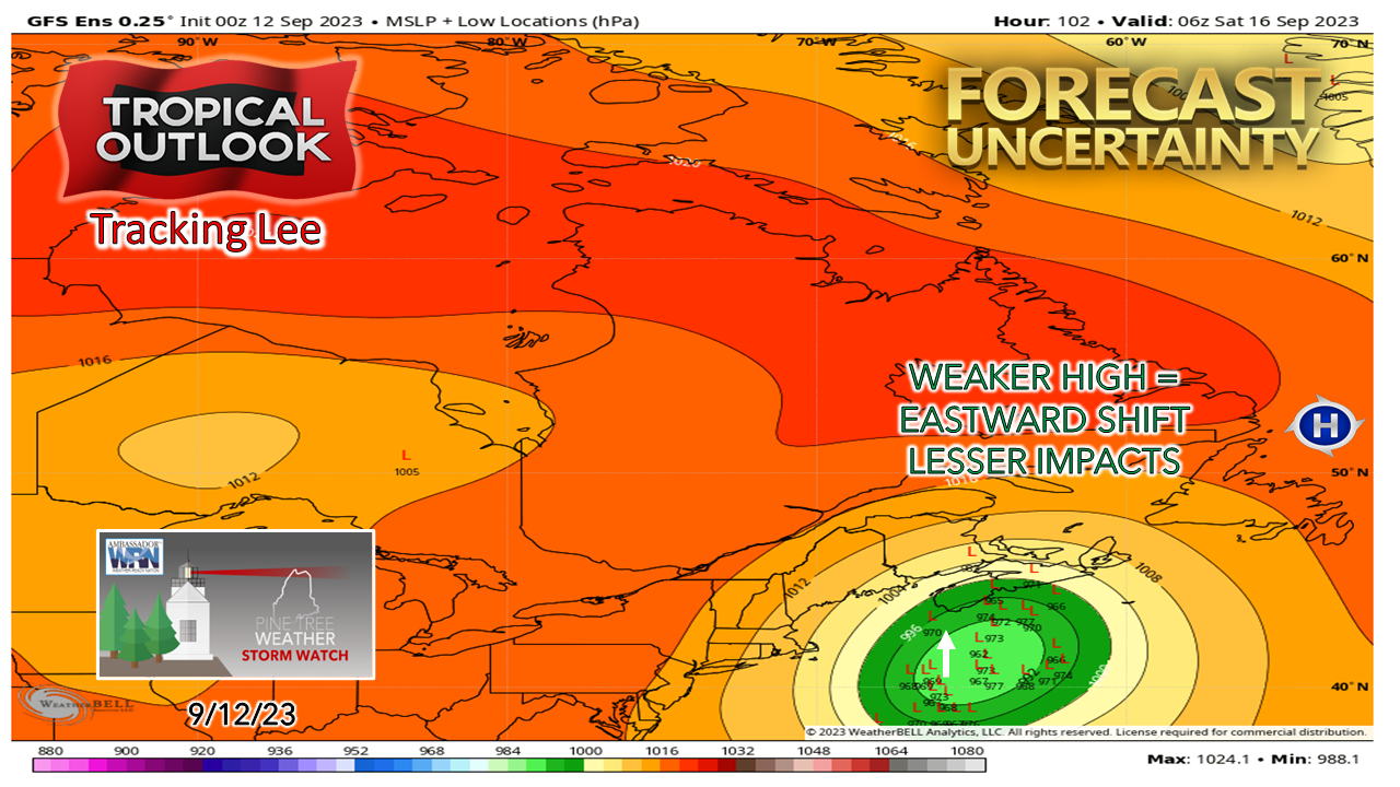 On the flip side, the GFS idea has the high considerably weaker from the ensemble point of view, allowing Lee to hit Nova Scotia, pass through the Bay of Fundy and into the Gulf of St. Lawrence. Eastern and northern areas of Maine could still get hit hard in this scenario. along with the entire coast. It's worth repeating again... It's not whether or not we are going to get hit with this storm, it's a matter of figuring out how bad of a hit we get. 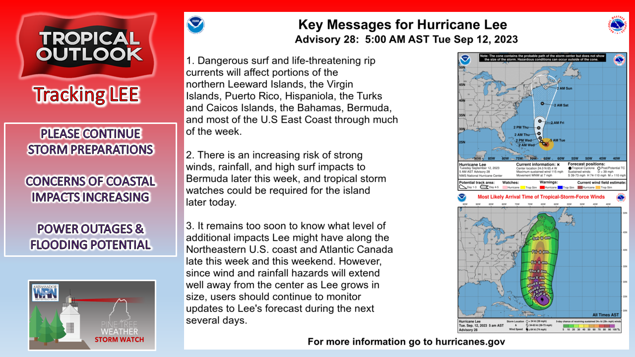 For now, the National Hurricane Center is maintaining its track of landfall somewhere around Yarmouth, Nova Scotia late Saturday night. Impacts of the storm are starting to appear in the form of long wave swells entering the Gulf of Maine as of early Tuesday morning, and those seas are going to continue to build. The National Weather Service is already predicting waves of 10 feet for exposed areas along the southwest coast to upwards of 17 feet for DownEast areas, and that is quite conservative, but that is taking into consideration the chance of a more easterly track. Prepare for power outages, and the potential for outages for several days. Prepare for flooding from rainfall. Prepare for coastal flooding and battering. Prepare, prepare, prepare. Get moving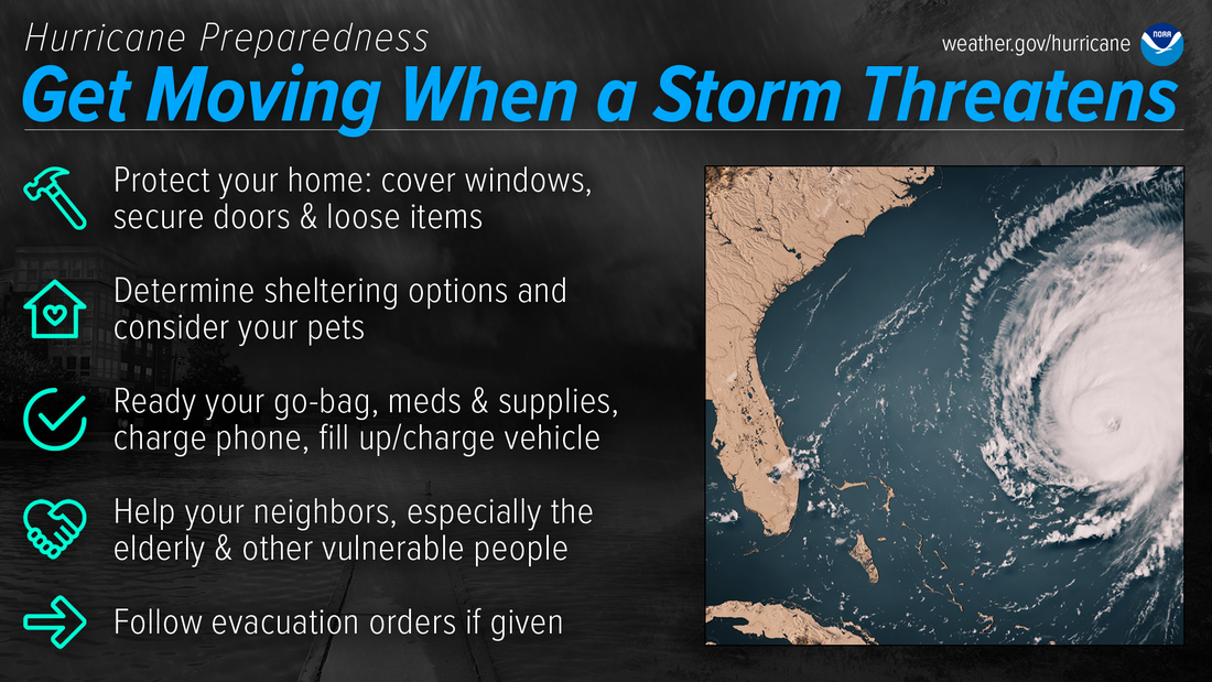 Do you know what to do when a storm threatens? Be prepared for hurricanes by taking the time now to understand the actions needed when time is of the essence. noaa.gov/get-moving-when-storm-threatens Pine Tree Weather is funded from followers like you. I would appreciate your financial support. Click here for how you can contribute. You may not like the weather, but I hope you like what I do, and support my efforts. Thank you! Stay updated, stay on alert, and stay safe! - Mike NOTE: The forecast information depicted on this platform is for general information purposes only for the public and is not designed or intended for commercial use. For those seeking pinpoint weather information for business operations, you should use a private sector source. For information about where to find commercial forecasters to assist your business, please message me and I will be happy to help you. |

Mike Haggett
|


