
Idea shifts northward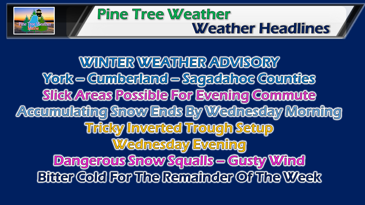 The region escapes impacts for the morning commute, but road conditions and travel could be interesting for the evening commute for southern areas. The County takes a break on this one, and may escape without snow both days, or receive very little. The trend has shifted a bit more to the north, so adjustments have been made. Snow, and perhaps a mix for the southwest coast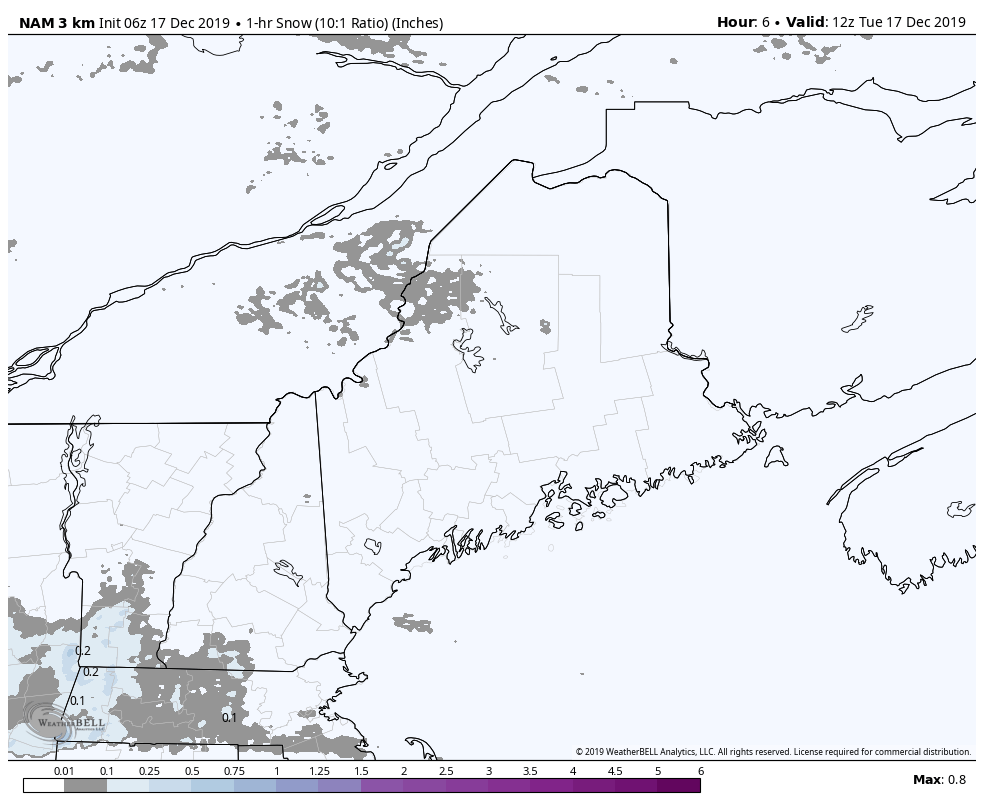 Hourly projected snow accumulations through midday Wednesday continues to show manageable amounts. There is a bit of a concern for a a bit of heavy snowfall (up around 1" per hour) early to mid afternoon, and hopefully will be out of the way by the time the evening commute arrives. 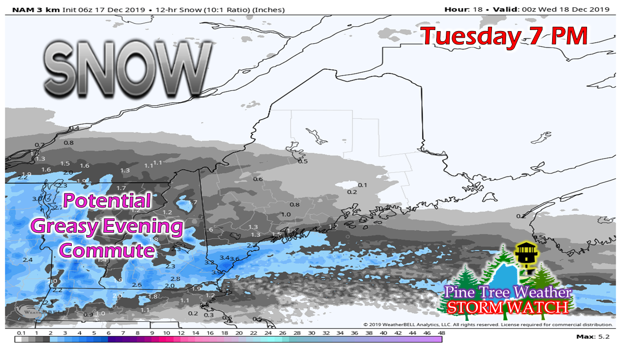 The chance is good for an inch or more on the ground for southwestern areas by this evening, with 3" a fair bet for York County by 7 PM this evening. 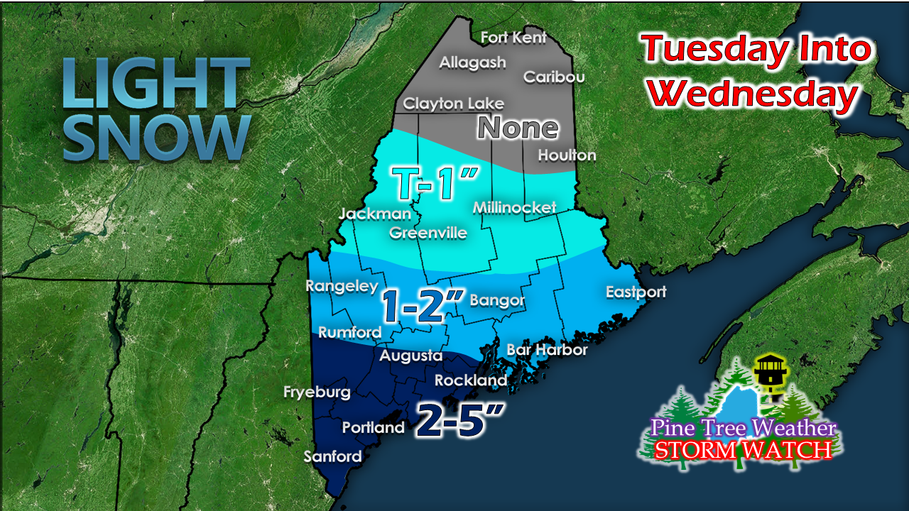 The passage of the front has slowed down by a few hours and as a result, more moisture will be able to sneak in ahead of it. The result of that is a move northward of the forecast snowfall. Southwest coast and MidCoast areas could be dealing with slushier snow as warm air off the ocean may add more water content to it. I can't rule out a potential for a coastal front to form and bring a mix of rain, sleet or freezing rain in for Portland south around the evening drive. This continues to appear to be a mainly snow event, and any mixing will be short lived as it appears at this point. For York County: Guidance is hinting at potential band of snow that will ride along the boundary. If that indeed occurs, it would not surprise me to see 6-8" total. The idea at this point of where that could happen is roughly Lebanon to Kennebunk south. Far southern parts of the county (Kittery, Eliot, York) could be the jackpot area for this one. Norlun surprise potential Wednesday night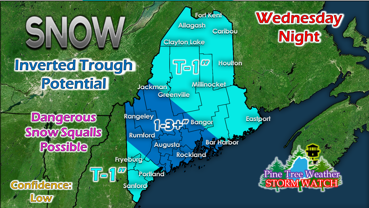 What you see here is my best idea at this point of a potential Norlun (inverted) trough set up and where it may have the greatest impact. This could shift more north or south. If the thin line of banding sets up, it could bring a surprise 6". With the arctic front driving this, snow squalls are likely in areas. They could be locally intense. These will happen during the night, could come on very fast and cause impacts on the roads. If you are traveling Wednesday evening, be on the watch for snow squall warnings. The Big Chill arrives Thursday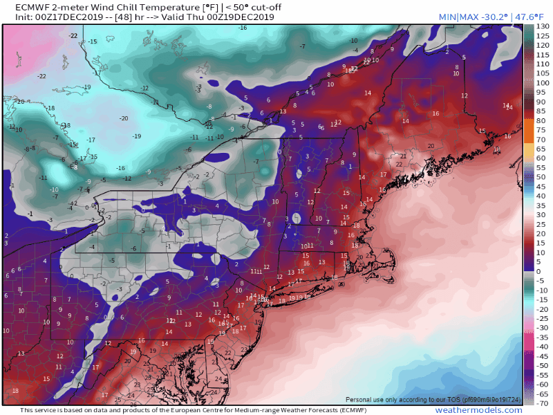 The arctic front that drives the snow squalls and inversion through Wednesday night brings in the coldest air of the season thus far. Thursday will be a bitter cold day, with some modification as the breeze settles on Friday. Temperatures will be below normal through the remainder of the week. For now, the weekend looks good, and it may be clear through Christmas. ► ► For the latest official forecasts, bulletins and advisories, please check in with the National Weather Service in Gray for western and southern areas, or Caribou for northern and eastern parts of Maine. Please help finish up the funding for the year ahead! ► ► $300 shortfall for the year ahead! You can help keep Pine Tree Weather going with a donation of any amount now through VENMO @PineTreeWeather, a monthly donation on Patreon or messaging me on Facebook or Twitter to send a check in the mail. Thank you for your support!
For more information from me, please check the Pine Tree Weather Facebook page as well as my Twitter feed. Always stay weather aware! - Mike |

Mike Haggett
|


