
Spring storms are tricky forecasts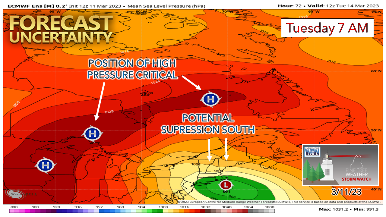 The key factor in the storm Tuesday is pointing to the influence of high pressure to the north. Operational model ideas are factoring that idea, and thus ideas are trending south. If this trend continues, this will reduce impacts over interior areas and change the focus more to southern areas. 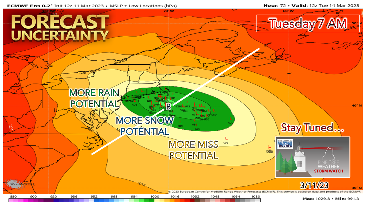 Ensemble ideas are very scattered as the time of storm potential approaches. As a forecaster, I find this unnerving, but not surprising. It does make it difficult to nail down specifics. The idea of a track at this point indicates a northward jog towards Cape Cod and then a track due to the east. It's important to note here that the storm appears to develop rather quickly, I am not expecting a "bombogenesis" situation where the central pressure drops 30mb in 24-hour period. It may get into the 20-25mb range, but I don't believe that this one is going to get out of hand. There will still be impacts, but it may not be as bad as ideas once presented. With the ensemble mean hanging right around the benchmark "B" (40° N / 70° W), that idea brings less snow for the interior and brings heavier precipitation to the south. 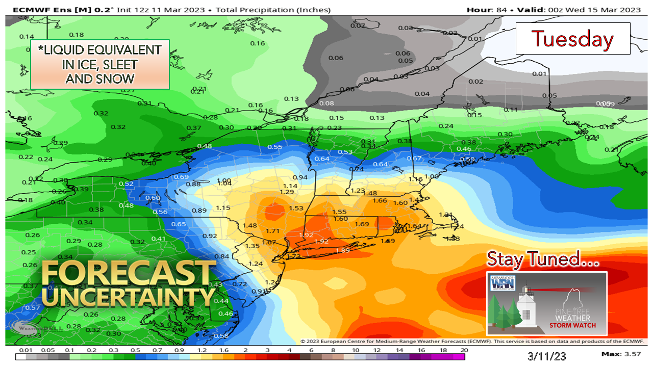 This is NOT snow, but liquid equivalent in rainfall. I outlined in Friday's post the challenges presented of forecasting snow. I rarely ever trust model ideas for snowfall in most events, and given the parameters here for marginal temperatures, I don't trust them in this situation at all. The best chance for accumulating snow over southwestern areas will be Monday night into Tuesday morning. After that, it will depend on where the storm is located. I will say with fair confidence that the idea of double-digit snowfall amounts appears to be going away. The only way that changes is if the storm track moves north, and for now, I am not seeing it. The fine tuning comes on Sunday. I will have a full post on what to expect for impacts, snowfall, and wind by Sunday evening. Stay tuned! Thank you as always for your support! Pine Tree Weather is funded from followers like you. I would appreciate your financial support. Click here for how you can contribute. You may not like the weather, but I hope you like what I do! Please hit the like button on Twitter and Facebook, and share! Stay updated, stay on alert, and stay safe! - Mike NOTE: The forecast information depicted on this platform is for general information purposes only for the public and is not designed or intended for commercial use. For those seeking pinpoint weather information for business operations, you should use a private sector source. For information about where to find commercial forecasters to assist your business, please message me and I will be happy to help you. |

Mike Haggett
|


