
Sunday Morning Update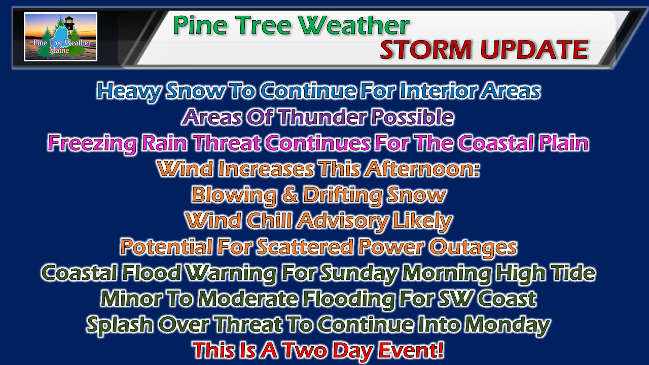 A lot going on with this event. No real changes in the forecast ideas published Saturday evening, however. I can't stress enough the fact this is a two day event, with effects that will linger into Tuesday. Timing still on track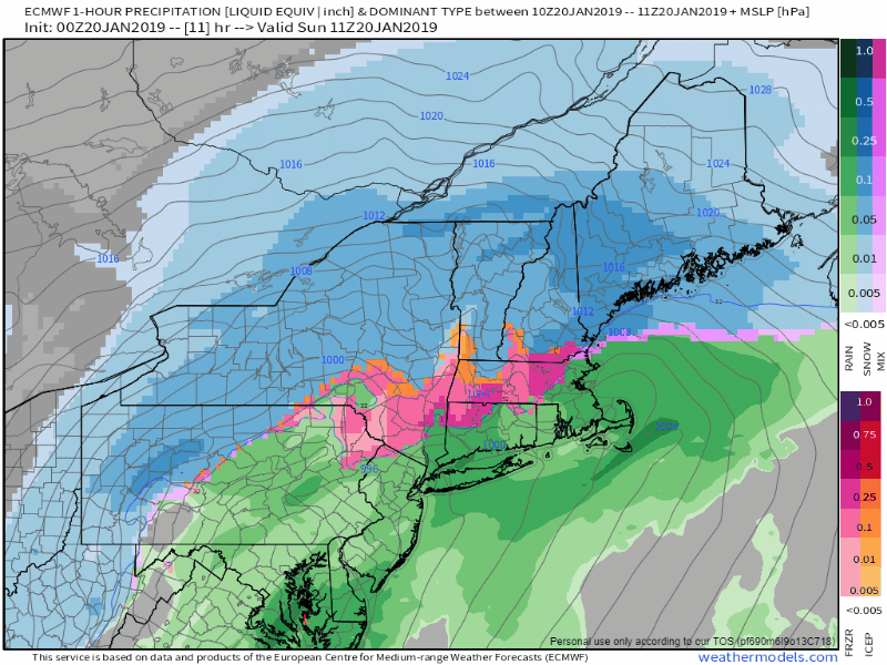 The main event is well underway. Expect areas of the coastal plain to see a change to sleet and then freezing rain. Sleet could enter into the western foothills and interior eastern areas, and could accumulate an inch or two on top of the snow. Freezing rain will be the main concern for the shorelines from Kittery on up to Eastport this afternoon, where a quarter inch of accretion is possible along the immediate shorelines, lesser amounts inland. As the storm passes to the northeast, any areas of freezing rain along the coast will turn back to light snow or snow showers this evening, and will linger through Monday. Northern Maine may not see the snow machine shut off completely until early Tuesday morning. Wind chill to affect clean up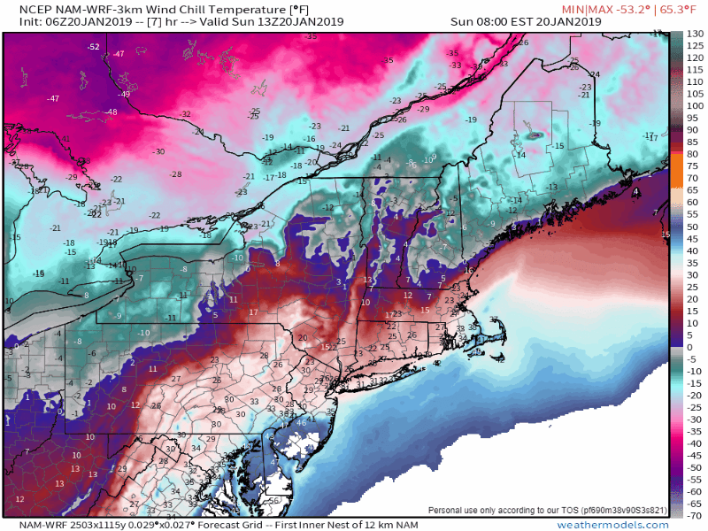 After the bulk of precipitation has fallen, the wind out of the north-northwest increases and will usher in brutally cold air. Much of the region will be dealing with a double-digit below zero wind chill factor well into Tuesday before the wind finally settles down. If it isn't the chill of the air, it's the wind speed of 20-30 mph, in some cases up to 40 mph which will keep the snow blowing and drifting into Tuesday, diminishing by evening. Precipitation ideas remain the same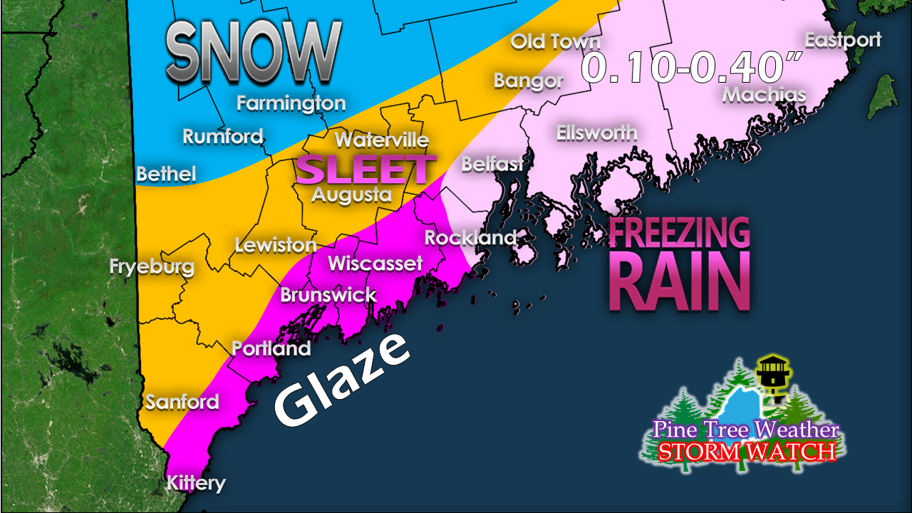 Again, immediate shorelines along the southwest coast may see 1/4" of accretion as temperatures in the single digits / low teens will allow for any liquid to stick. The main concern for the most accretion is coastal Washington County, where under 1/2" is possible. For the coastline into the western foothills into interior Washington County, 1-2" of sleet is possible on top of the snow. If you get the itch to go clean up, the best thing to do is wait until the bulk of the precipitation ends Sunday night. 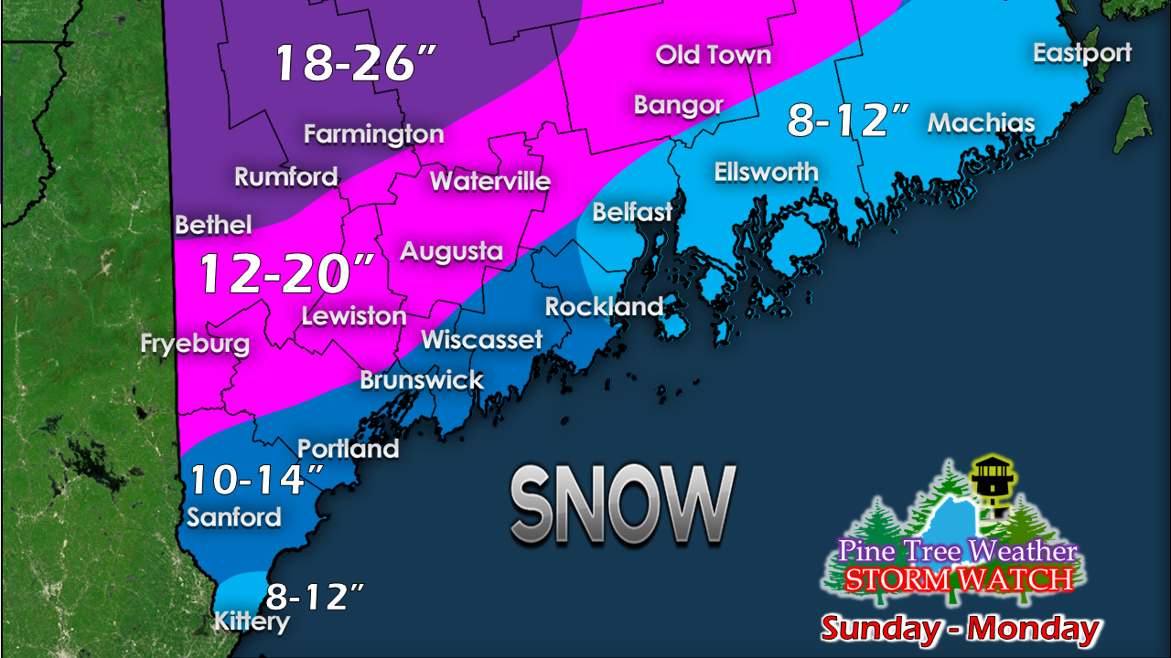 No changes to snowfall idea for the southern half of the state. 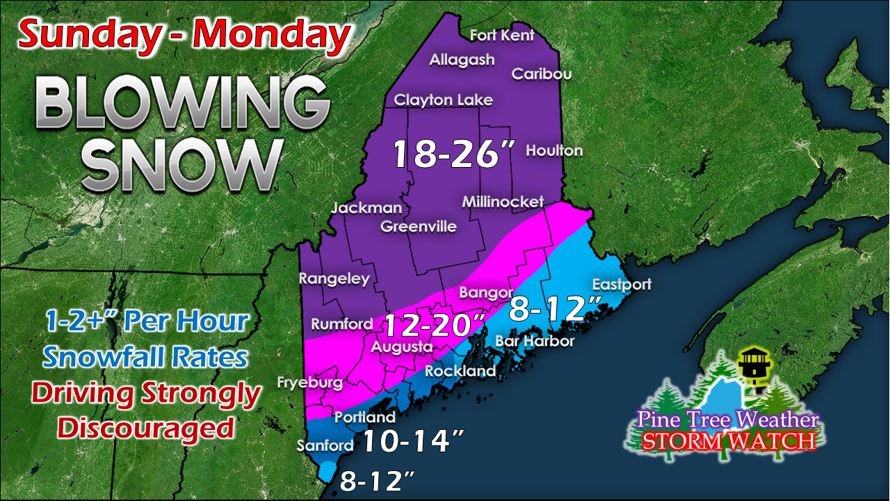 Just a minor adjustment here for northern Maine due to observations and track. Another big snow for the mountains and north. Looking ahead to Wednesday / Thursday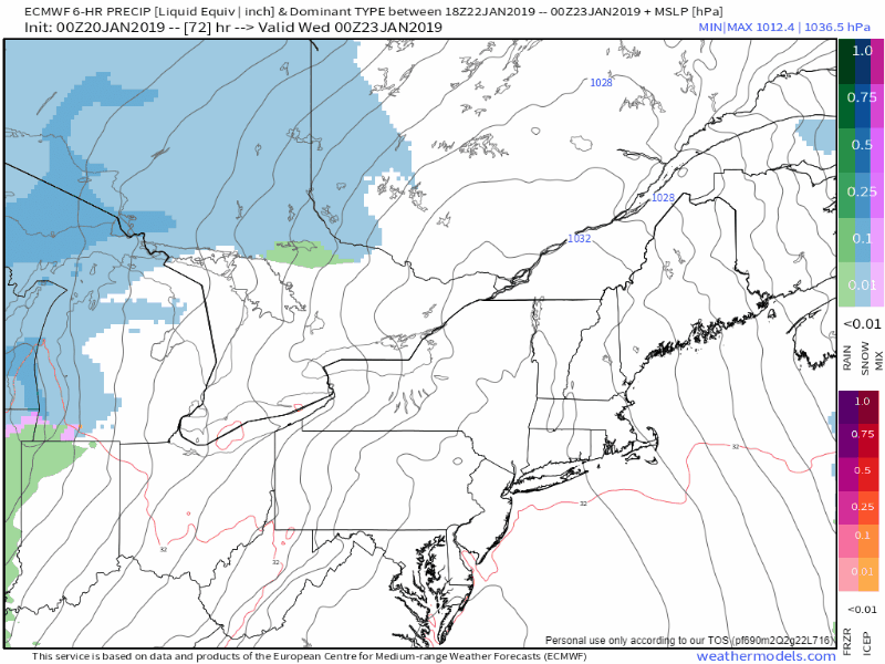 Yet another chance to a mixed bag event for the state. This model run may be on the warm side, but the idea of the coast seeing rain is possible at this point. I will keep my eye on this and advise as the week unfolds. Stay Updated!► ► For the latest official forecasts, bulletins and advisories, please check in with the National Weather Service in Gray for western and southern areas, or Caribou for northern and eastern parts of Maine. For more information from me, please follow the Pine Tree Weather Facebook page and my Twitter feed. ► Your financial donations are much appreciated to keep this site funded and for further development. I sincerely appreciate your support not only financially, but also in sharing my efforts with others. Always stay weather aware! - Mike |

Mike Haggett
|


