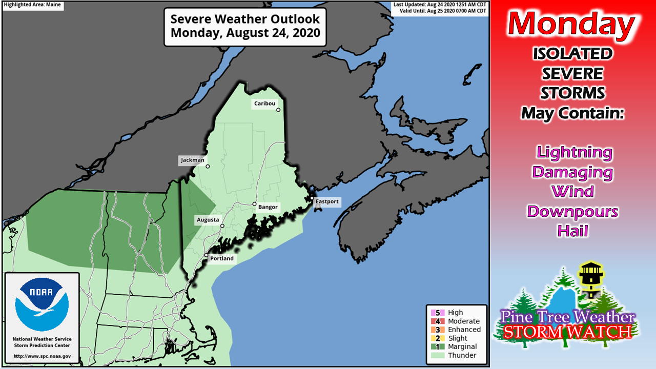
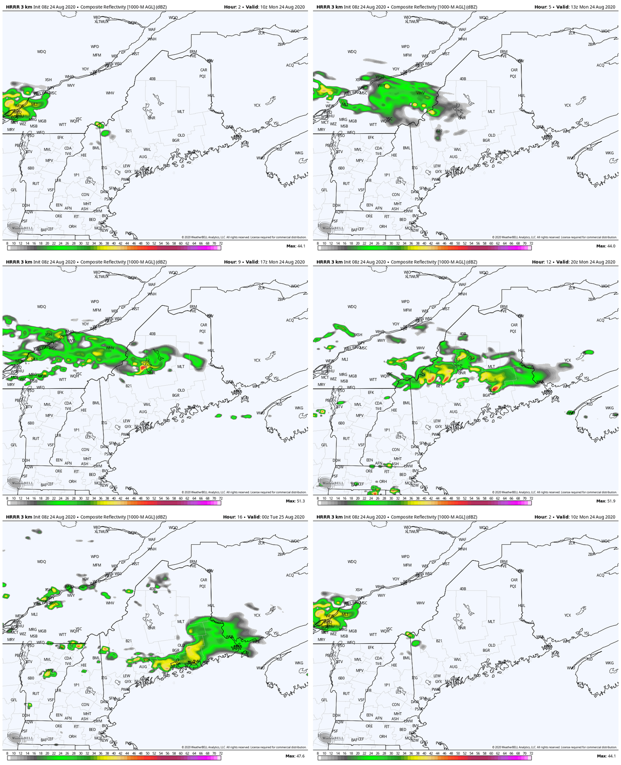
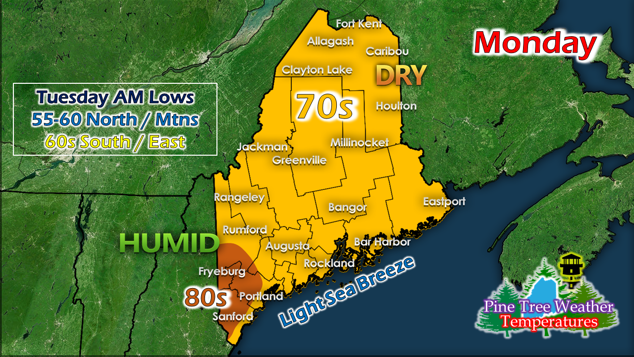
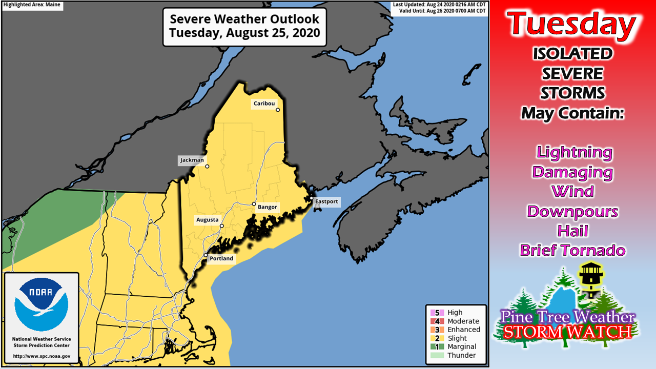
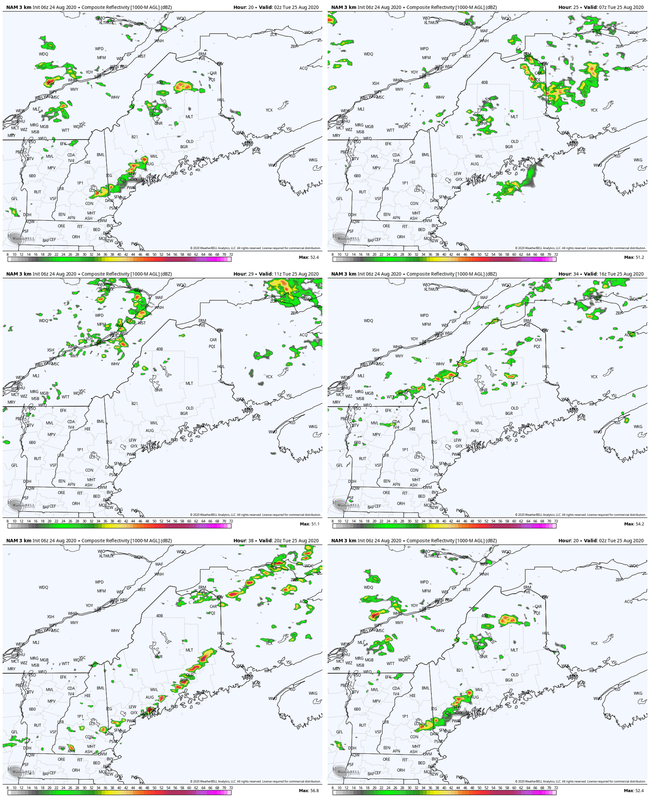
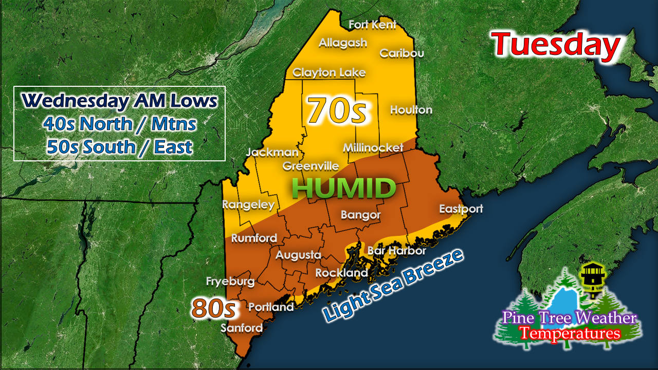
Isolated rumbles possible statewide MondayThe recent rounds of showers & storms with impacts have been mainly to the southwest of the state over the past weekend. As I noted in Friday's post, the best source for storm initiation for southern areas is the sea breeze front, and that has verified with the activity over the past couple of days. Weak warm fronts are fickle in this part of the planet, due to the ocean nearby, and the elevation inland, along with any high pressure to the north. That has added to the forecast challenge of late. A strong cold front is approaching the region. With the humidity, there is plenty of fuel available for any storms that develop. As cold air creeps in aloft, the heat of the surface rises to meet it. Add wind shear to the mix, storms ignite. A few morning showers with a chance for rumble are possible Monday morning. Where the boundary of the warm front sets up, along with where the sea breeze front forms, will dictate who gets what and when. The above loop of the HRRR thinks central parts of the state could see the most activity. That all depends on what the warm front decides to do. What I am saying here is the area of impact could change pending on the where the boundaries set up. Areas of showers and isolated storms are expected through the afternoon and into the evening. Cloud cover will have the final say on storm activity. It will again be a sticky day with dew points in the 60s, and could push 70° in areas to the southwest, Cloud dependent severe threat TuesdayStorm Prediction Center has been steadfast in this idea for Tuesday for three days now. As the headline indicates, this is cloud cover dependent. Here is why... Showers and perhaps a rumble or two could occur head of the frontal boundary Monday night into Tuesday morning. Any cloud debris that hangs around from that will limit the chances for convection. The bottom line here is if you see sunshine for a time Tuesday, expect a storm to come. If you are stuck in the clouds all day, you may get a shower, perhaps a rumble, but not much more than that. With the southwest flow building in ahead of the cold front, it will be another sticky stay from the south to north. The frontal boundary passes through in the afternoon, and drier, cooler air filters in behind for a comfortable evening statewide. It will be a cool night for interior areas. Wednesday will be a nice day with temperatures in the 60s / 70s. Most areas see 40s for overnight lows, with mid to upper 30s possible for the mountain valleys. Thursday appears a bit warmer and dry with 60s / 70s once again. The next rain chance is possible Saturday.
For more information, please follow Pine Tree Weather on Facebook and Twitter.
Thank you for supporting this community based weather information source that is funded by your financial contributions. Stay updated, stay on alert, and stay safe! - Mike |
Mike Haggett
|

