Toasty times through the rest of the week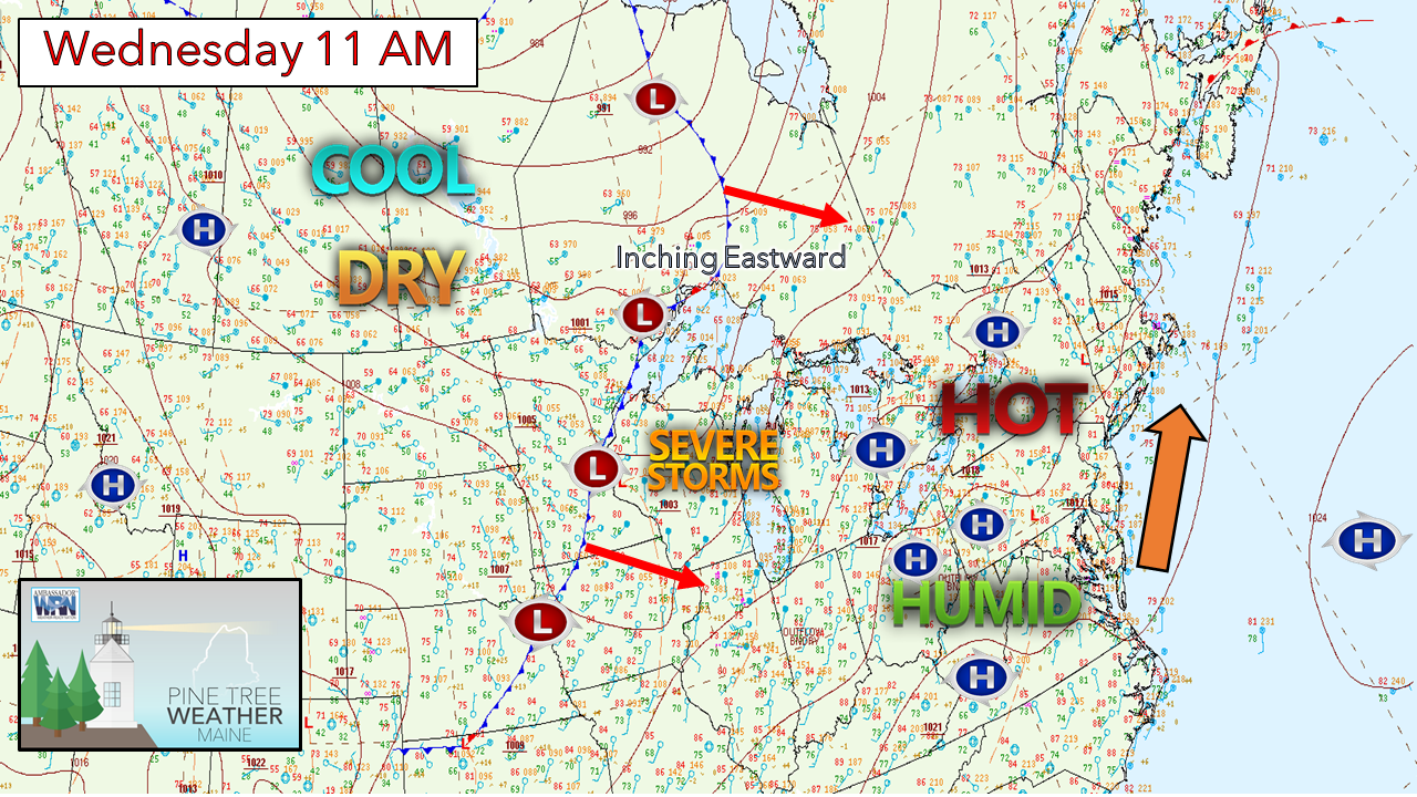 Our old friend the Bermuda High is cranking in the heat and humidity into the state, and that will be a part of the forecast through Friday. A long wave cold front is moving eastward. A weak cold front ahead of it is on tap to pass through the region late Thursday afternoon into the evening, which may bring showers and strong to severe storms over interior areas. It appears that Saturday is when the humidity breaks, and refreshing air is expected to arrive in all areas by Sunday morning. Hottest day of summer Thursday, PM storms possible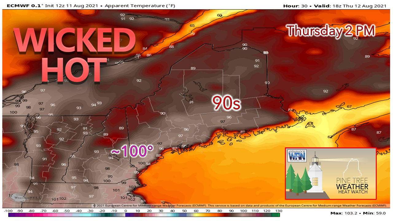 It's been since June since the region has seen indices reach triple digits, and that appears likely for the interior coastal plain from York County, and potentially for central and eastern areas. The shorelines from Harpswell eastward find benefit of a southwest flow over 64° ocean temperature on up to cooler waters DownEast are likely to escape the blast furnace, but areas of fog & drizzle may dampen an enjoyable day at the beach. 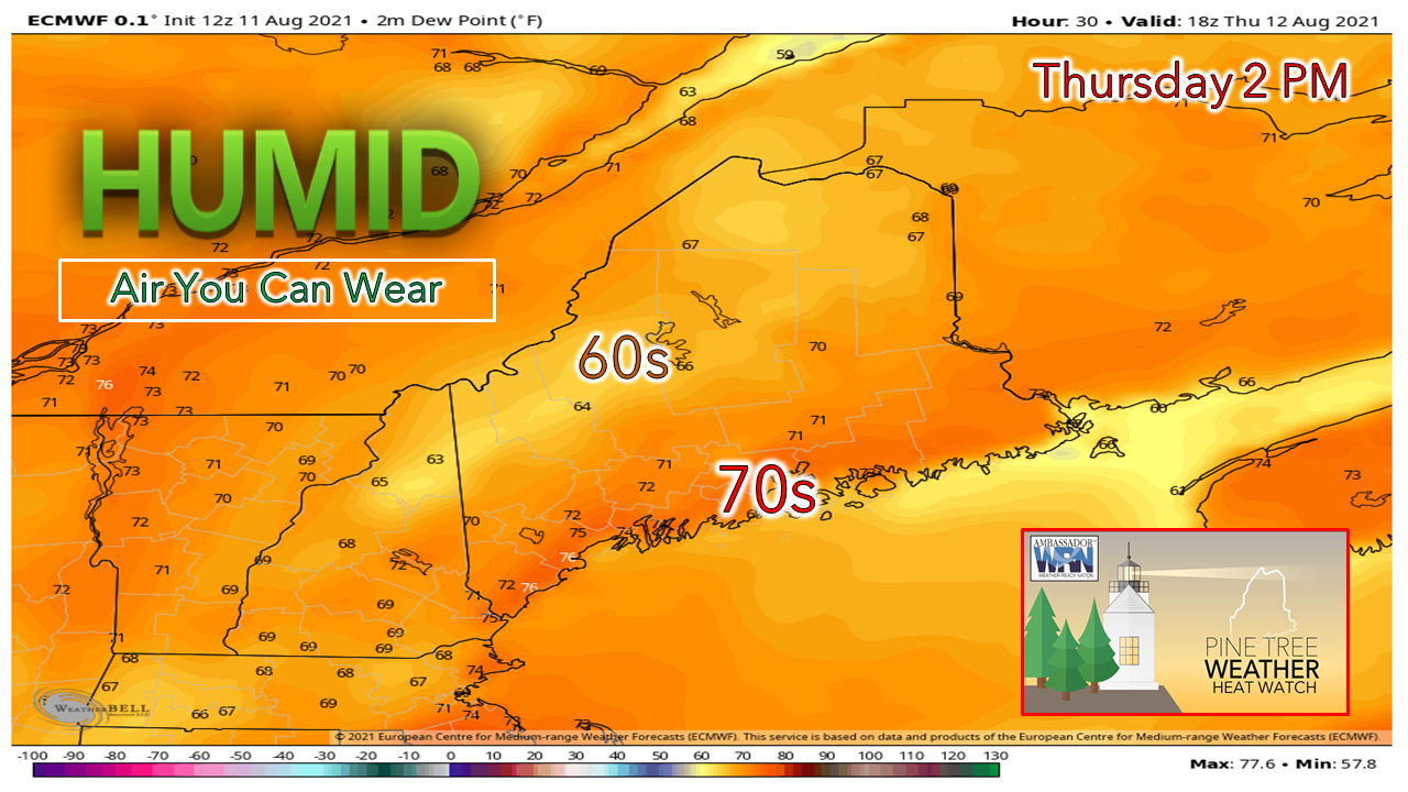 In conjunction with the heat comes humidity levels which could classify as being gross. Part of southern Maine may see dew points climb into the mid-70s, which means "air-you-can-wear". With the tropical humidity comes poor air quality as the Maine Department of Environmental Protection has issued an advisory for the southwest coast, MidCoast and DownEast areas. If you are headed to the beach to find relief, go early. High tide will be in the 2 PM hour, so set up above the high-water mark and plan a day of it, while other scramble to find a spot as the tide rolls in. 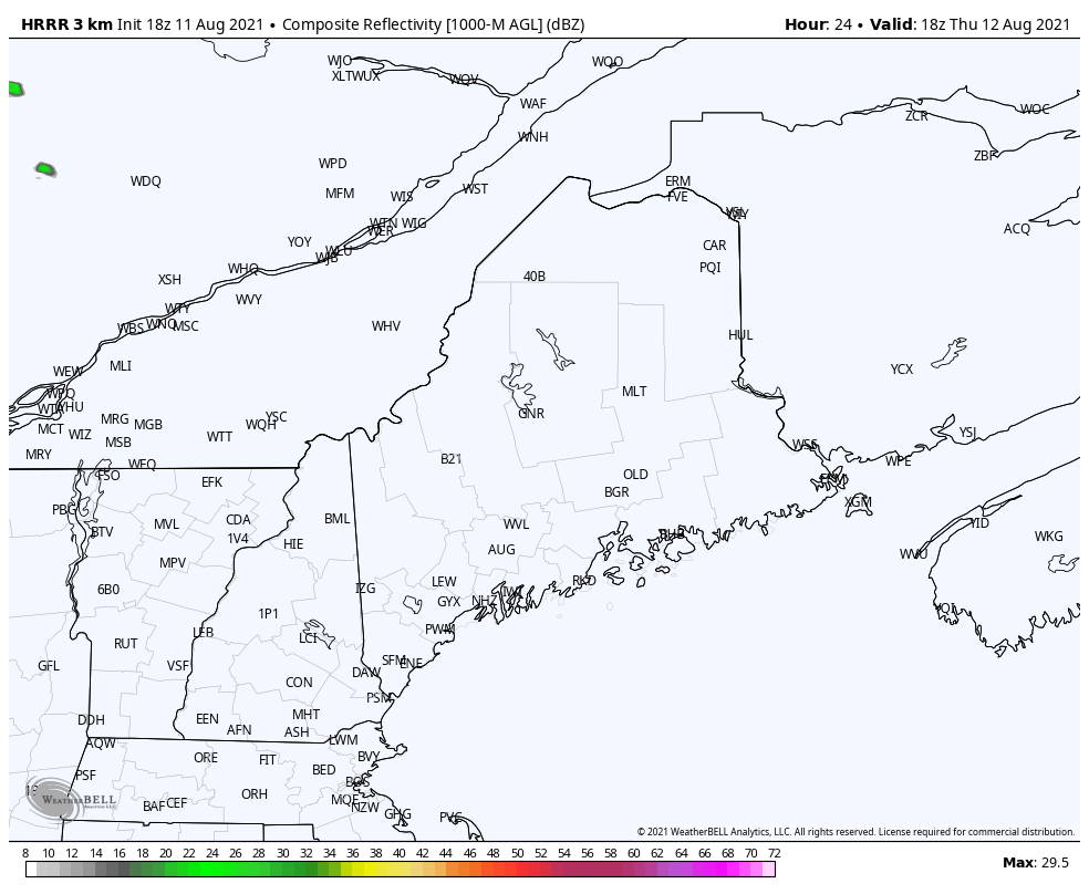 The aforementioned weak cold front may trigger some showers and strong to severe storms over interior areas as we head into Thursday evening. Heads up for those camping in the north as storms may contain damaging wind and torrential downpours which could cause localized flash flooding. Stay on alert, and make sure you can receive alerts. Friday a bit cooler, but it may not feel like it After the frontal boundary passes through Thursday night, it may knock the dew points down a couple of degrees, but it does appear to be another hot and sticky affair. As the long wave cold front enters into the Eastern Townships of Quebec and upstate New York Friday afternoon, outflow ahead of it may trigger a late day shower / thunderstorm over western and southern areas. Relief on the way for the weekend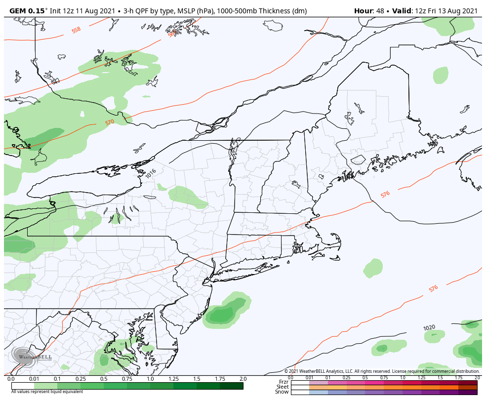 As the long wave frontal boundary advances eastward Friday night into Saturday, the moisture associated with it may dissipate. The best chance for showers and storms appears over the mountains and north where rain is desperately needed, but any benefit of the rain may be localized at best. The front appears to enter the state Saturday morning and slowly pass through during the day, and heads into the Gulf of Maine Saturday night. 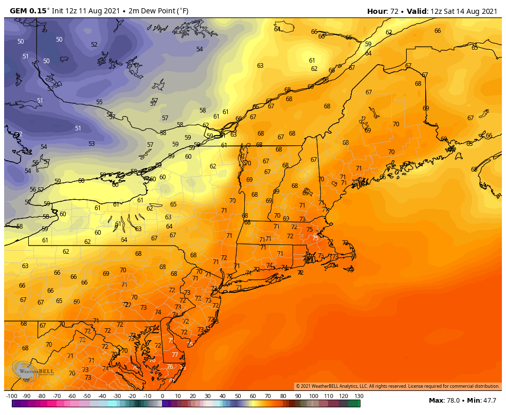 As the front passes through, dew point temperatures crash into the 50s for most areas. By Saturday evening, it would be a suitable time to open the windows and enjoy natural air conditioning as the air column clears out into Sunday morning. Watching the tropics Tracking Tropical Storm Fred as it cuts across Hispaniola. Knowing the rugged terrain that the storm is encountering, time will tell if survives. It will deal with eastern Cuba, another mountainous region before it heads for Florida. If it makes it that far, then its time for us in the northeast to start watching to see if any remnant rainfall can make it up this way. 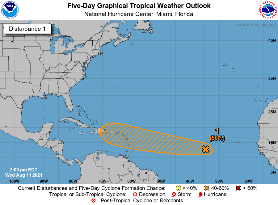 It's that time of year for long track Cape Verde storms to develop and track eastward. The National Hurricane Center is keeping watch on this system in the wake of Fred for potential development. With sea surface temperatures near their seasonal warm point, plus hints of the Bermuda High being a key feature in the forecast over the next couple of weeks, it would be wise to keep an eye on what is brewing in the tropics for potential impacts in the northeast. Know the symptoms of heat on your body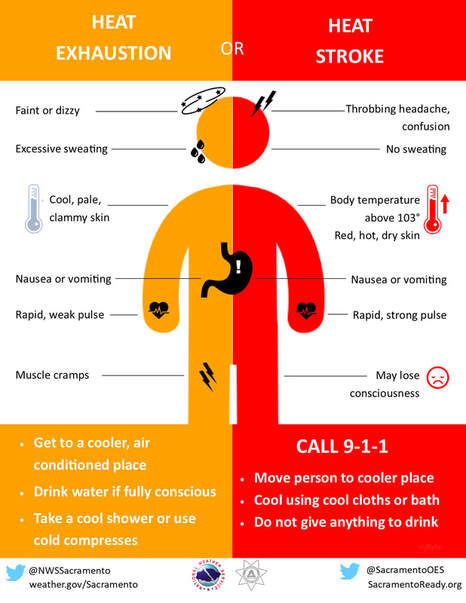 During hot and humid weather, your body's ability to cool itself is challenged. When your body heats too rapidly to cool itself properly, or when too much fluid or salt is lost through dehydration or sweating, you may experience a heat-related illness. Learn the symptoms of excessive heat exposure and the appropriate responses. weather.gov/safety/heat-illness Temperature outlook through TuesdayThe roller-coaster ride of temperatures 10-15°+ above normal level out to near normal averages as we start next week. A Bermuda High is predicted to set up once again as we head into the middle part of the week, with a strong ridge expected over eastern Canada, appear to be the main weather features that could see temperatures climb a few degrees above normal. At this point, oppressive heat and humidity does not appear to be returning anytime soon after our current wave passes through. 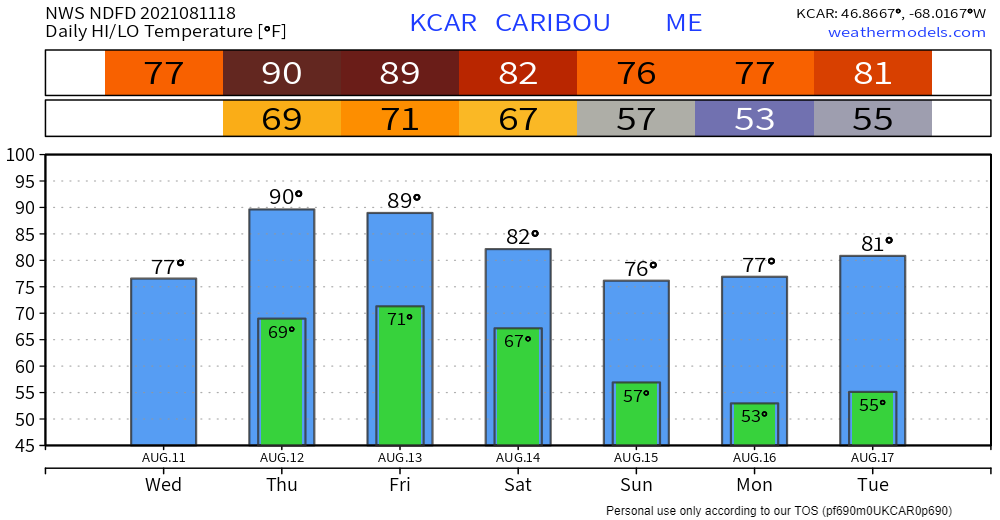 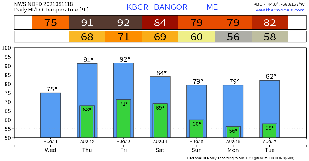 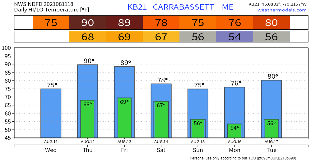 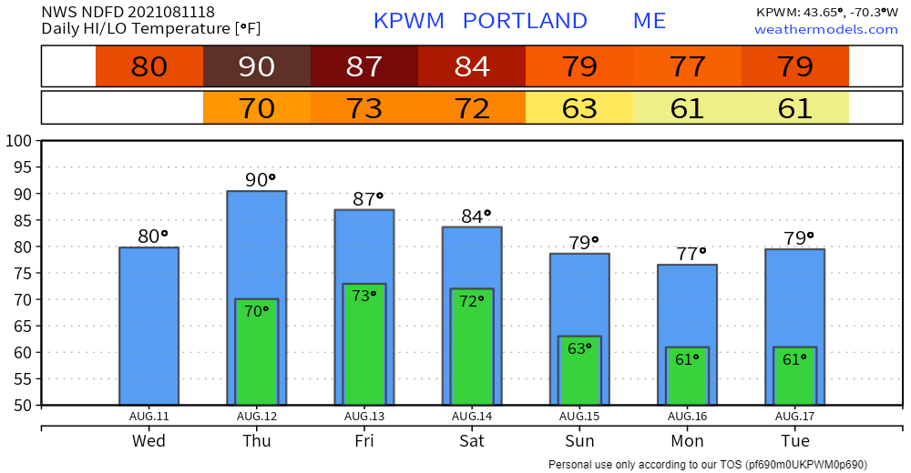 Be prepared to receive alerts and stay updated!
|

Mike Haggett
|