
Thursday storm a nuisance more than anythingThis is one of those flat, elongated slow movers that lacks a punch. It's basically a lazy warm front that tries to ignite around the benchmark 40° N / 70° W point, but it doesn't appear to have much upper-level energy working with it for it to become too out of hand. For the snow removal folks, it's another long drawn annoying event. A long day of work with not a whole lot of substance. File this under "another event overdone by models in the long range that misfires like a whoopie cushion in the end." There have been a lot of those this winter. 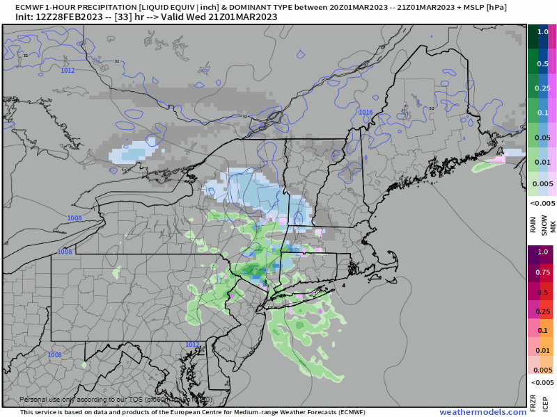 Wednesday 4 PM to Friday 1 AM - Snow showers break out over southwestern areas Wednesday night. As the frontal boundary takes its sweet time moving to the northeast, snow showers eventually make it into northern and eastern areas in the wee hours of Thursday. At that point, southwestern areas south of the foothills may see some sleet, a low chance for brief freezing rain or drizzle, and rain showers along the coast. This will make roads slick for the morning commute. A warm nose works across the coastal plain and brings a light junky mix through mid to late morning for areas south of Route 2. Closer to the coast, the better chance for rain. Precipitation is expected to end over southwestern areas by around noon. Snow for the mountains and north and a mix is expected over eastern areas until Thursday night, and finally leaving the region around midnight Friday. 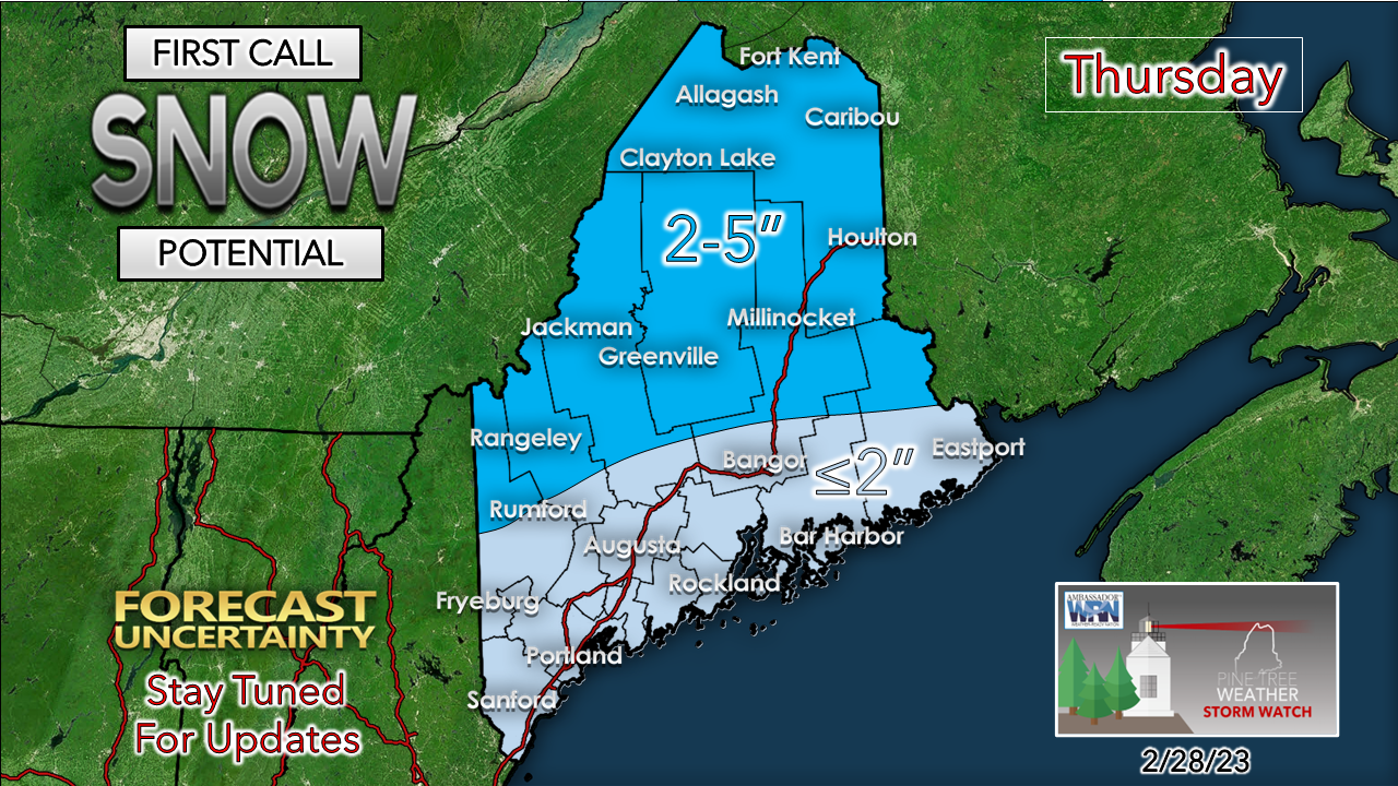 This is the idea out of the gate. I'll have an update on this Wednesday, but I don't expect this is going to change much. I don't expect much wind on the front side of this, but as the storm moves east and intensifies a bit, breezy conditions are expected to pick up on the backside Thursday night, then settles Friday morning. One more storm for Friday night into SaturdayThis is one of those set ups that raises red flags for this forecaster and makes me wonder if models are overdoing it again. 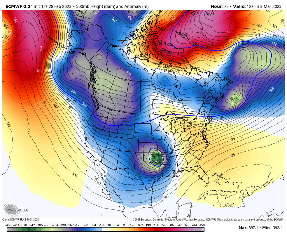 Friday 7 AM to Sunday 7 AM - Massive blocking over Greenland, a strong ridge over the eastern Pacific, a deep trough over the west, and a cut-off upper level low that runs out of gas as it heads from the southern Plains to the northeast. It's the "runs out of gas" part that has me concerned. 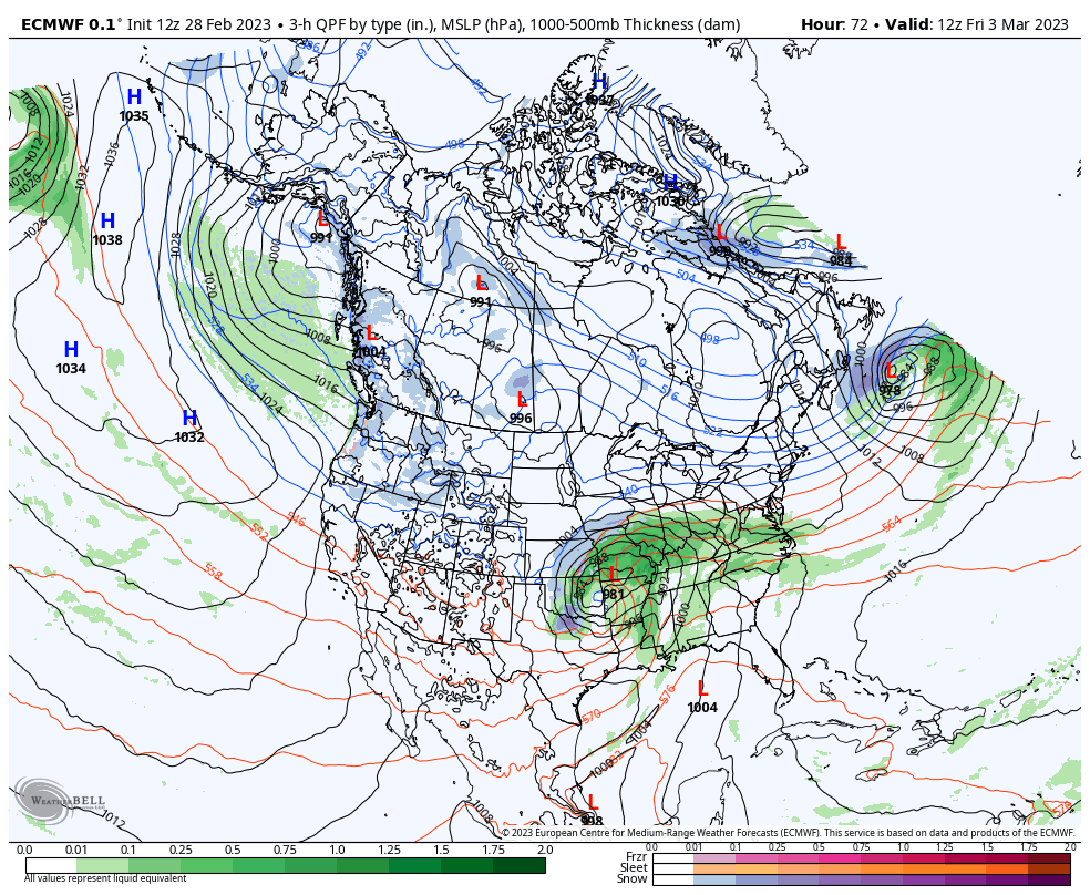 Friday 7 AM to Sunday 7 AM - Looks like we get through Friday alright with little in the way of precipitation. What will bring a blizzard over the Plains occludes (weakens) as it moves toward the Great Lakes. A secondary low tries to fire up along the frontal boundary tail and tries to siphon off the upper-level energy and spin up an ocean low. The problem is that it will run out of gas along the ridge and weaken as it gets near benchmark Saturday night. All in all, this is a juiced warm front. 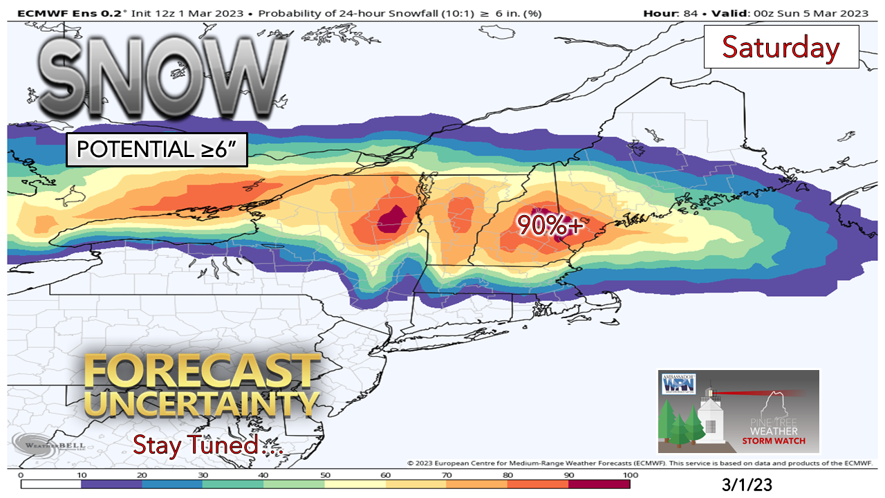 Two things going for a decent snow potential with this is the cold air locked in, along with liquid equivalent of ½-1" over southwestern areas. Northern areas may get little to nothing from this event as high pressure to the north shunts the storm to east. It's wait and see for the coast IF it stays all snow or some mixing creeps in. It's wait and see if the moisture is overdone. It's also wait and see if this sticky snow that may cause power outage concerns. Remember, this system is in the process of weakening. The wild card here is if the ocean low gets going earlier, that may enhance precipitation amounts, but that idea is low. For now, think 6"+ from Jackman to Belfast south and west, and stay tuned for fine tuning and details.  Temperature outlook through SundayThe normal high and low for March 1st in Caribou is 29° and 9°. For Portland, 38° and 21°. Expect above normal temperatures through Thursday before cooling down over the weekend. The idea at this point is for temperatures to hover around normal next week through the middle part of the month. 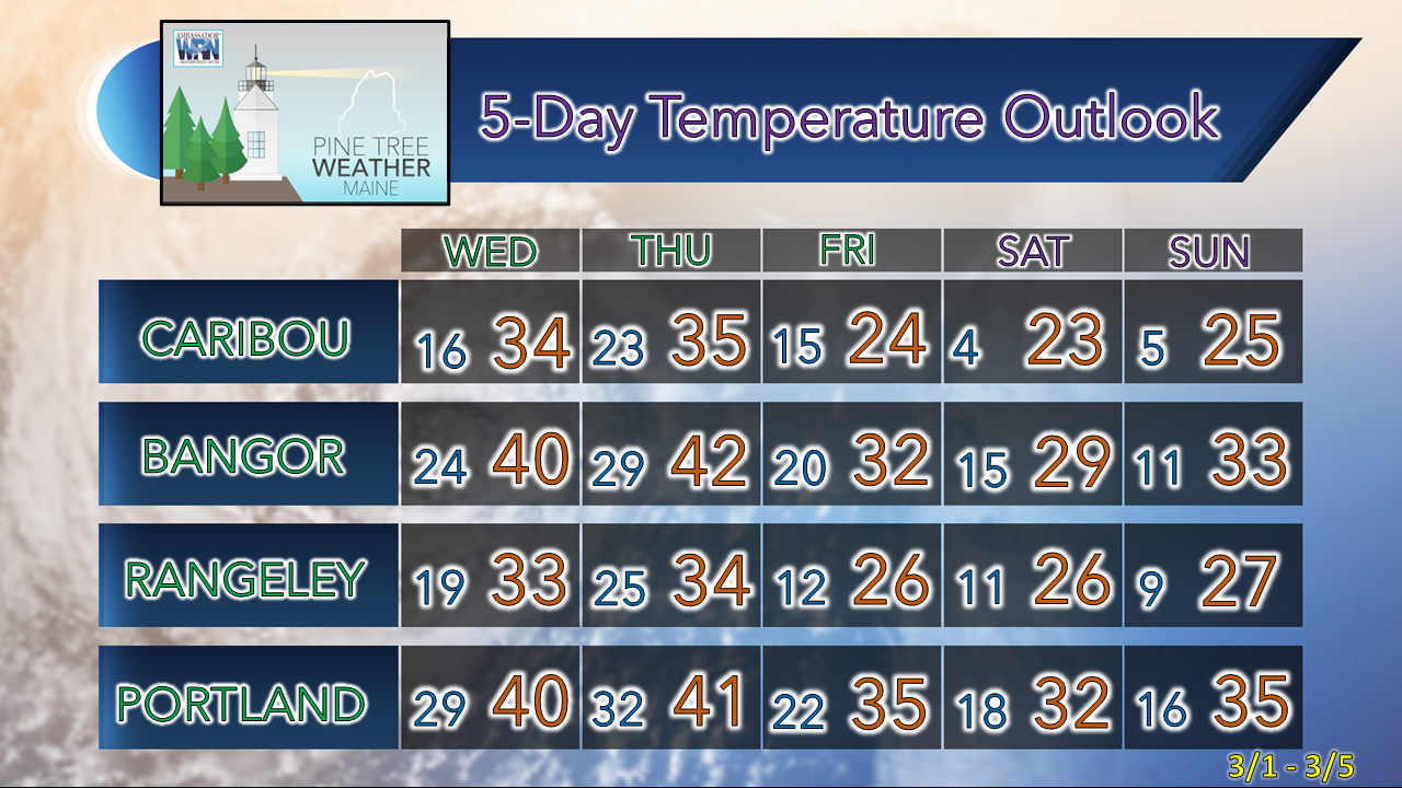 Thank you as always for your support! You may not like the weather, but I hope you like what I do! Please hit the like button on Twitter and Facebook, and share! Financial donations to fund what I do are always appreciated! Stay updated, stay on alert, and stay safe! - Mike NOTE: The forecast information depicted on this platform is for general information purposes only for the public and is not designed or intended for commercial use. For those seeking pinpoint weather information for business operations, you should use a private sector source. For information about where to find commercial forecasters to assist your business, please message me and I will be happy to help you |

Mike Haggett
|


