
Rough week ahead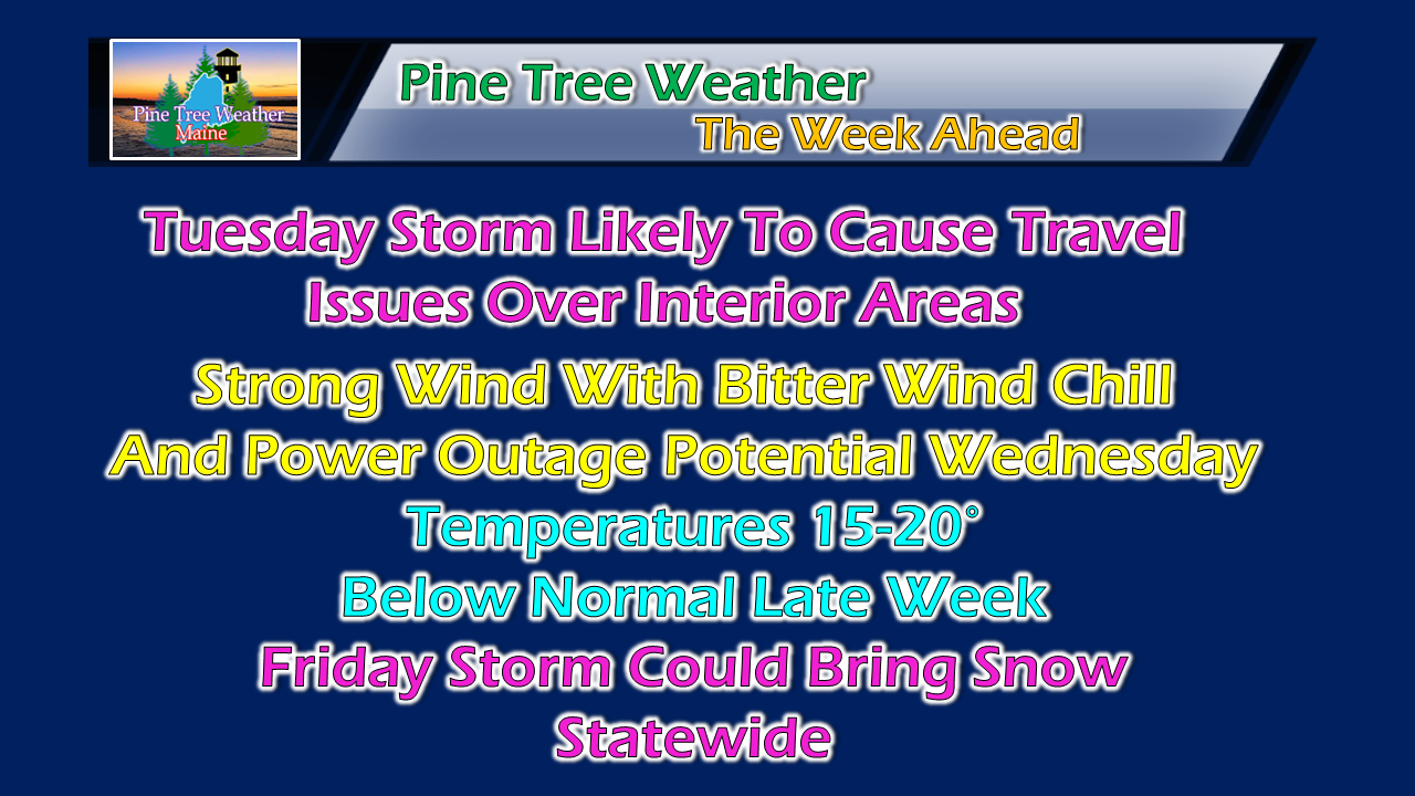 The one thing I have learned in seven years I have been doing this is what comes around, goes around. The region has been spoiled with warm falls over the past couple of years. This one could be talked about as one of cooler, and wetter by the time November closes out. This week will feature the precipitation, and the cold, and most if not all areas could see accumulating snowflakes by the weekend. Tuesday storm similar to previous storm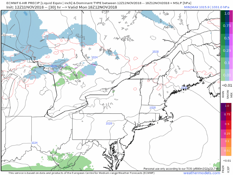 The weekend storm was double-barrel variety with a Great Lakes low transferring energy to a coastal low which bombed out over the Gulf of St. Lawrence and brought the wind Saturday night into Sunday. This one is a bit different as this is more characteristic of a NorEaster, but with more of a track closer to the coast. Consequently, this will bring another mixed bag with snow for the mountains and north, a mix for the interior, and rain for the coastline. The track depicted here has been very consistent from the Euro model. That said, there is still time for some wiggle room, and for that, the final outcome may vary a bit. 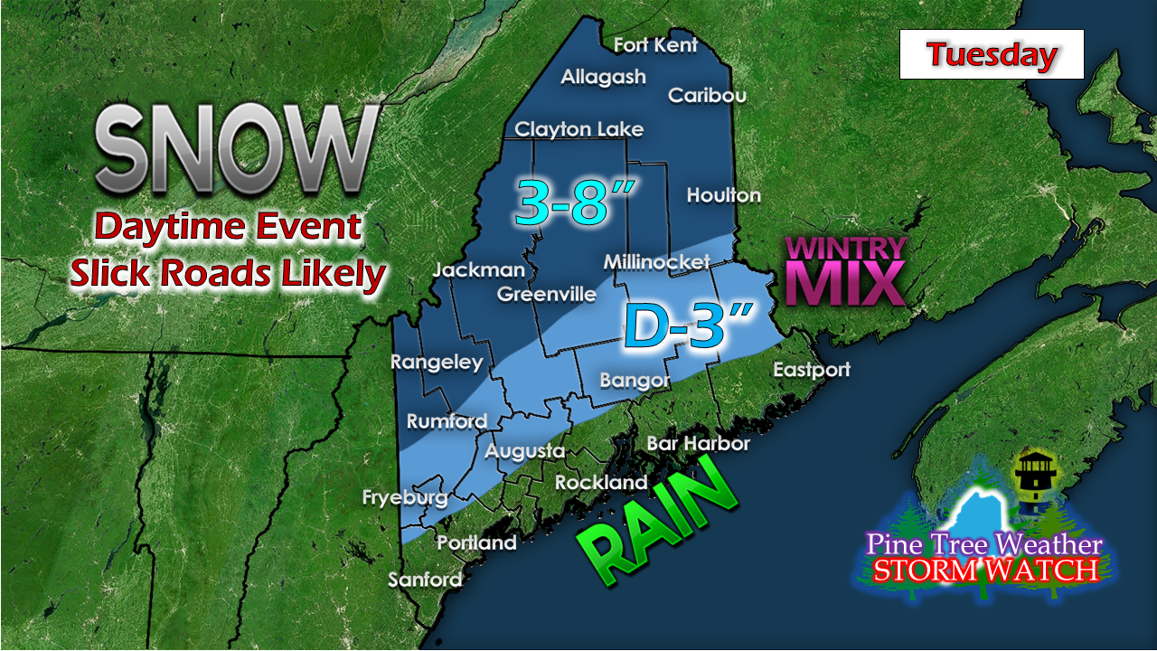 If the track moves closer to the coast, snow will move closer to the coast along with it and totals are likely to increase for the western foothills and interior DownEast. This idea is a good starting point for now. As with Friday / Saturday event, higher elevations get the higher snowfall totals. Ski country is happy with this one, not only because of amounts, it is going to hang around for awhile. After the storm passes, bitter cold blows in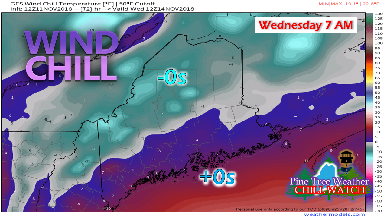 The Tuesday storm will bomb out over the Gulf of St. Lawrence and drag behind it the coldest temperatures of the season so far. Not only will it be cold, the wind is going to blow, and it will go on all day Wednesday before settling down Wednesday night into Thursday morning. 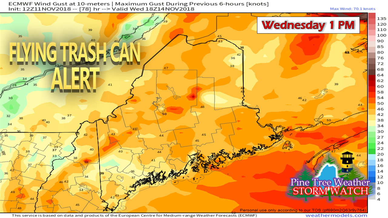 Given the consistency in ideas, chances are good that much if not all the state will see Wind Advisories be issued. If the storm amps up more than what models suggest, High Wind Warnings could happen. At the very least, anything that isn't nailed down is likely to go airborne, and spotty power outages are possible at the very least. Make sure you keep your storm supplies well stocked. Temperatures tank late week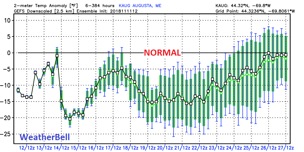 Below normal cold is about to turn into well below normal cold by Thursday. Temperatures could end up being close to 20° below normal. Temperatures appear to remain below normal right through Thanksgiving before a warm up arrives as we head into the final days of November. Friday storm could bring snow to everyone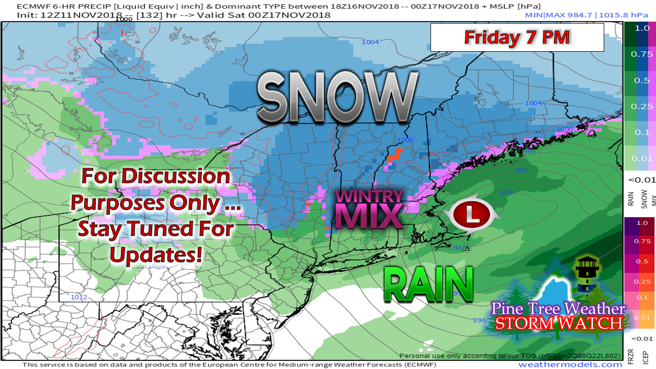 There is still some time here before we get into details on how this storm is going to play out. The one key ingredient in any statewide snow event is cold air. With that idea in firmly in place thanks to a Canadian High moving in Thursday, that increases the odds of a cold air damming set up over land like what is depicted above. For now, this is a wait and see scenario, but folks along the shorelines should have shovels ready just in case this idea comes to fruition. Outlook through Friday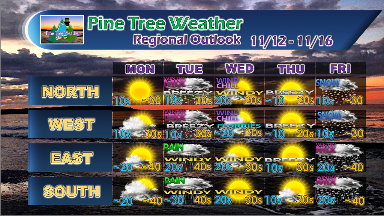 Stay tuned for forecast updates and adjustment through the week.
For the latest official forecasts, bulletins and advisories, please check in with the National Weather Service in Gray for western and southern areas, or Caribou for northern and eastern parts of Maine. For more information from me, please follow the Pine Tree Weather Facebook page and my Twitter feed. Please consider making a donation to keep Pine Tree Weather going through the year ahead. My data cost expense is increasing. The operation is 70% funded and needs your help to get through the winter. You can set up a monthly pledge on my Patreon page or send me a message from the Facebook page or direct message on Twitter to get my address to mail a check or set up bill pay. Always stay weather aware, and thank you for your support! - Mike |

Mike Haggett
|


