
|
Breezy is the word for Saturday with the wind steadily diminishing in the afternoon. Expect a mainly sunny sky with temps ranging in the 30s north to 40s south, but apparent temperatures with the wind may knock upwards of 10° off the high marks of the day. High clouds fill the sky overnight, with mid and low-level clouds on the increase for Sunday head of our next system. Slick spots of the interior possible Sunday night into Monday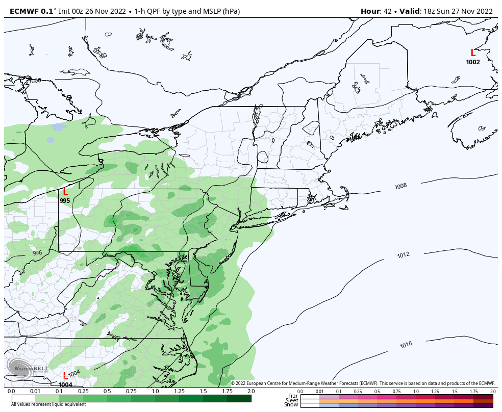 Sunday 1 PM to Monday 7 AM - Another quick hitting storm is on the way late Sunday into Sunday night. A coastal hugging track brings more liquid this time around. With cloud cover building during the day and long with a southwest wind flow keeps temperatures above freezing south of the mountains and far north heading into Sunday night. Precipitation for most areas is over by daybreak on Monday, although the upslope snow machine will kick into gear for the mountains during the day as northwesterly winds pick up on the backside of the storm. Folks travelling overnight over the interior can expect pockets of mixed precipitation with freezing rain and sleet, as well as some snow which may make travel a bit slick in spots heading into Monday morning. 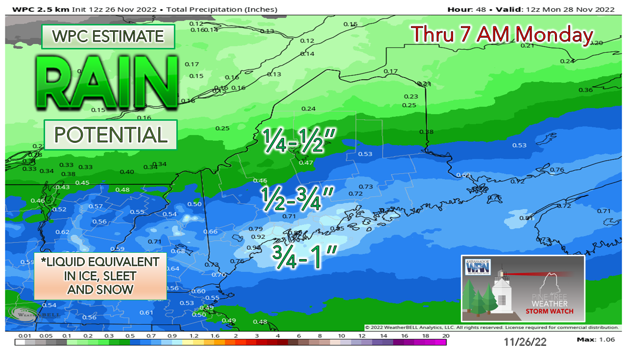 A coastal hugging track brings a bit more juice for the shorelines and the foothills, with lesser amounts over the mountains and north. 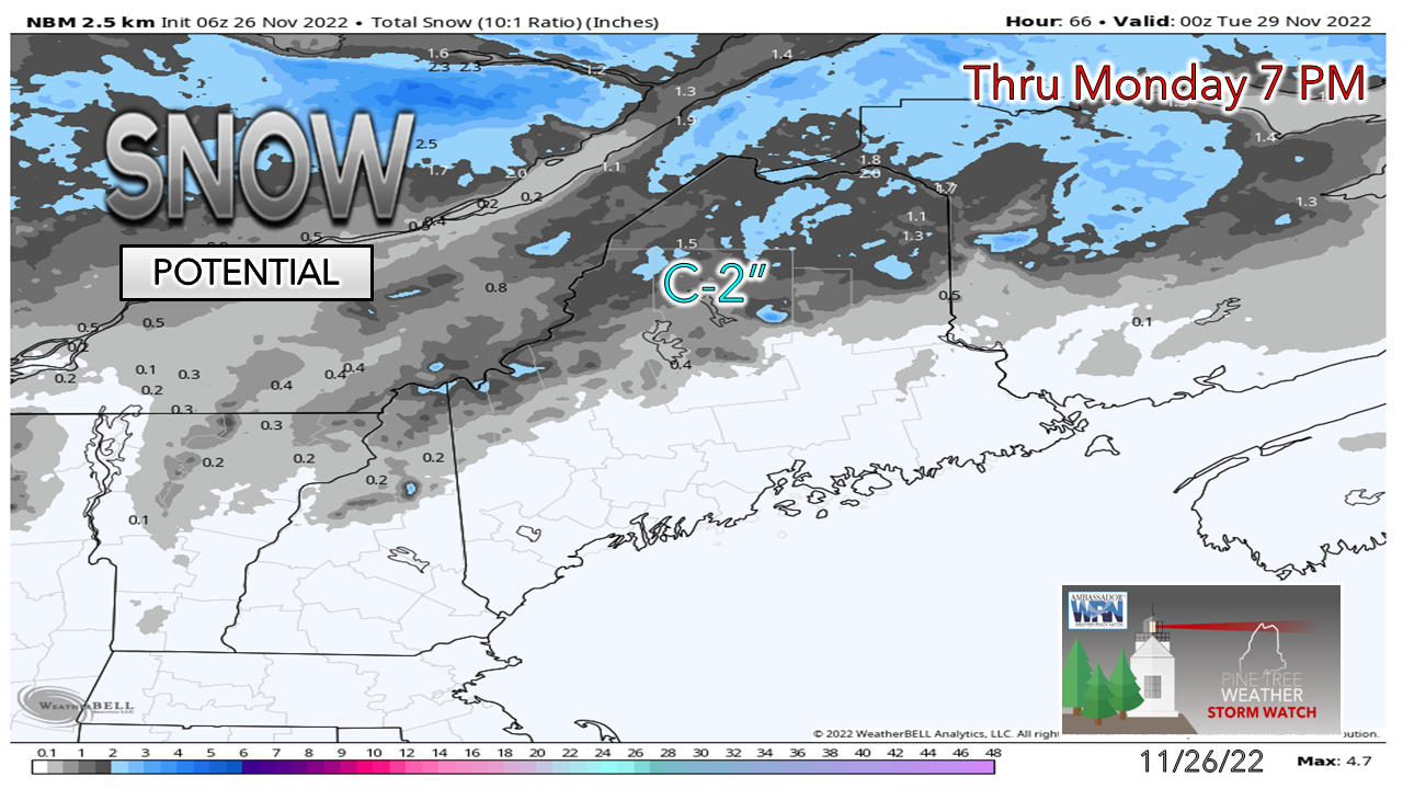 The best chance for some accumulation of snow is for the mountains and north, and most of that appears to come with the upslope snow showers during the day on Monday. High pressure moves in for Tuesday and settles the breeze. Inside runner potential Wednesday into Thursday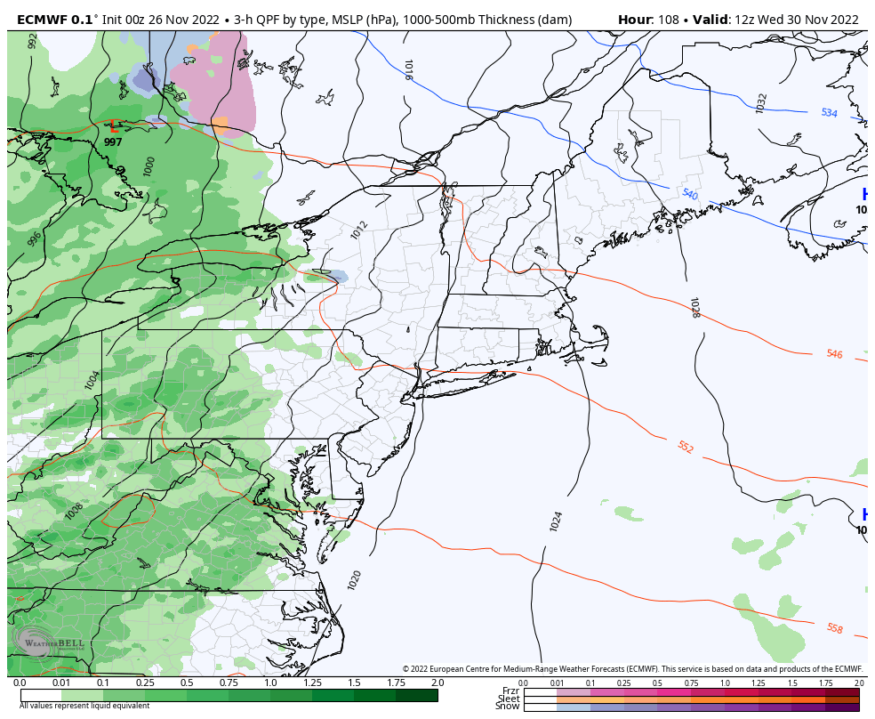 Wednesday 7 AM to Thursday 1 PM - Guidance is locked in on mainly wet event Wednesday afternoon into Thursday morning. I will through a caution flag here on precipitation amounts which appear rather generous in the liquid form, but the trend for these juicy long-range ideas have had a track record of a reduction in amounts closer to the event. This certainly would not be a good situation for the ski hills with the fragile base they are working off, but we'll see if the ideas hold up as the week unfolds. Current deficit for 2023 = $2,000 Temperature outlook through ThursdayThe normal high and low for Caribou is 35° and 21°. For Portland, it is 45° and 29°. The temperature trend cools for Tuesday, then spikes upward midweek. 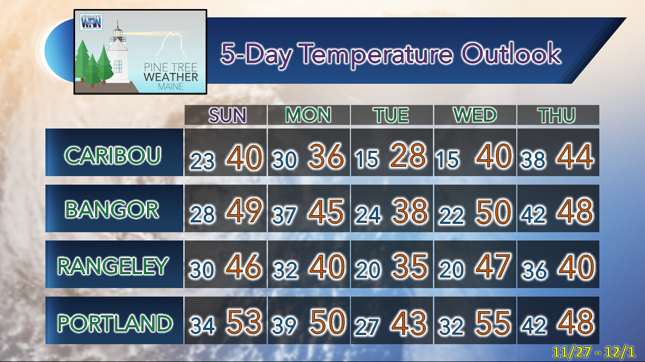 Thank you as always for your support! Stay updated, stay on alert, and stay safe! - Mike NOTE: The forecast information depicted on this platform is for general information purposes only for the public and is not designed or intended for commercial use. For those seeking pinpoint weather information for business operations, you should use a private sector source. For information about where to find commercial forecasters to assist your business, please message me and I will be happy to help you. |

Mike Haggett
|


