
Many questions to get answers for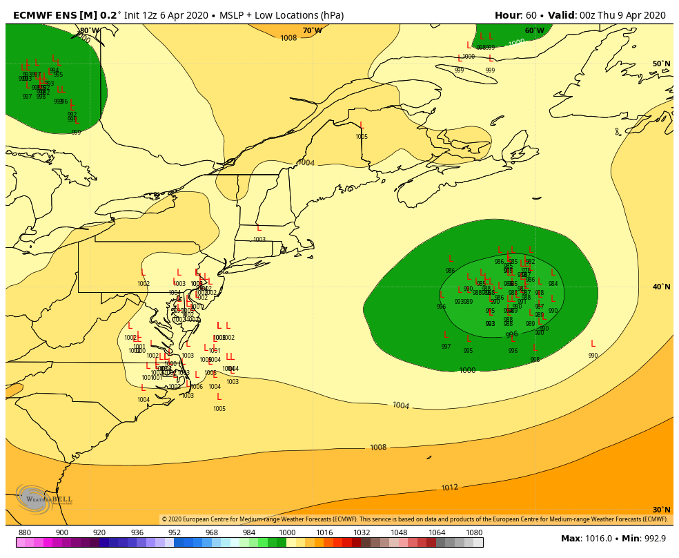 Looking ahead to late week, there is the chance for snow event for much of the state. Blocking over the north Atlantic along with cold air from Labrador seeping south sets up the potential for a heavy wet snow event for the western Maine interior and northern areas. For eastern areas, Bangor may have a better chance than Eastport or Bar Harbor. Shoreline areas from Rockland to Kittery may escape with more rain than snow. Three things at play here. The northern and southern jet streams phasing together. Upper level energy from both streams. Then cold the cold air. Needless to say, timing is everything with this one. The loop above is from the European ensembles. Those little L's indicate potential positions of an area low pressure. Typical of winter, low pressure exits the Great Lakes and then transfers energy to a rapidly developing coastal low over the Gulf of Maine. These little L's show uncertainty. As with any spring storm that hints at a solid snow event, track is important to figure out who gets what and how much. Another wrench in this is ridge moving northeast just slightly ahead of the storm. If that guidance suggestion rings true, that could make the difference on where the rain / snow line form. For now, a mix of rain and snow is possible Thursday. What happens Thursday night into Friday morning is still to be determined. That has everything to do with timing. 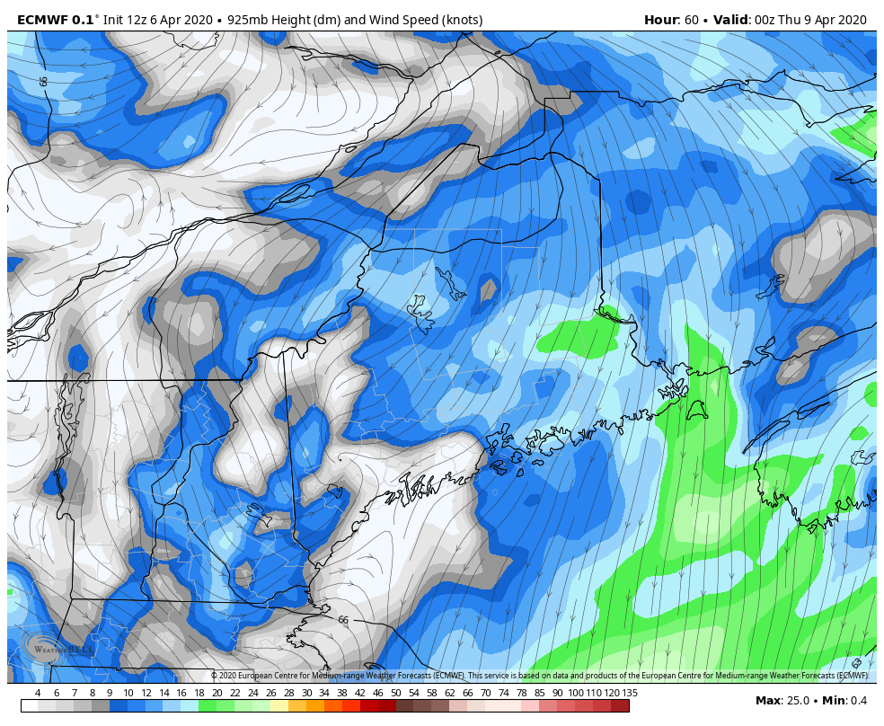 Above here are projected wind speeds at roughly 1700 feet above ground level. This means the storm could pack a concerning amount of wind if it mixes downward. Add wet snow to this, and there are potential for power outages. Fortunately, the foliage has not come in yet, which helps cut down on potential loss of service.
Another concern, astronomical tides increase as the week unfolds and into the weekend. Our shorelines could take a beating if all the pieces come together right. If you look real close in the loop, you can see the center of the storm hugging the shoreline. This could bring strong wind to the shorelines, and storm surge to possibly contend with. At this point, the best thing to do is keep your supply stock up in case of power loss. Given the environment we are in with the pandemic, send one person to the store to get needed supplies so everyone can get through in a timely manner. Make sure the generator is fueled up and ready for use. Since we are heading into mid-April, this won't hang around long. Temperatures warm up as we head into the weekend. Stay tuned for more updates. Feel free to use the many pages available on this website for many types of forecasts on rainfall, snowfall, marine, longer range CPC outlooks, and maps. Thank you as always for your support! Stay healthy and safe! ► ► For the latest official forecasts, bulletins and advisories, please check in with the National Weather Service in Gray for western and southern areas, or Caribou for northern and eastern parts of Maine. Always stay weather aware! - Mike |

Mike Haggett
|


