|
Just a quick update from me personally... I've been taking advantage of the quiet pattern to continue to study my course work, get some projects done at my office, spend time with the family and get caught up on some rest. I want to thank those who continue to support Pine Tree Weather financially through monthly donations, those that have mailed checks, and to those who contributed via VENMO. I am about 60% to goal for the year ahead to pay the bills to keep this going. I would appreciate your support to keep this going. Please see the banner below for more. For mid-November, it feels more like mid-September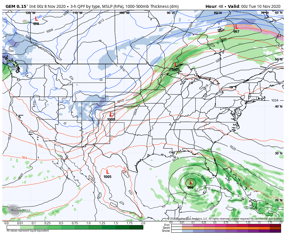 A strong Bermuda high anchoring the heart of a ridge over the east keeps the region warm and relatively precipitation free through the middle part of the week. A frontal boundary associated with a strong Colorado low works into Ontario Tuesday night into Wednesday, which brings the next chance for rain showers Wednesday into early Thursday. Tropical cyclone Eta may help feed some moisture into the frontal boundary, which if it does may bring a better chance for measurable rain amounts. For now I am rather bearish on any rain of any value out of this approaching system, with the best chance for the mountains and north. With the abnormally warm air, areas of fog are possible overnight into the early morning through the middle part of the week. Once the frontal boundary passes through the region, temperatures and dew points drop back down to seasonal normal values by the weekend.  Temperature outlook through Saturday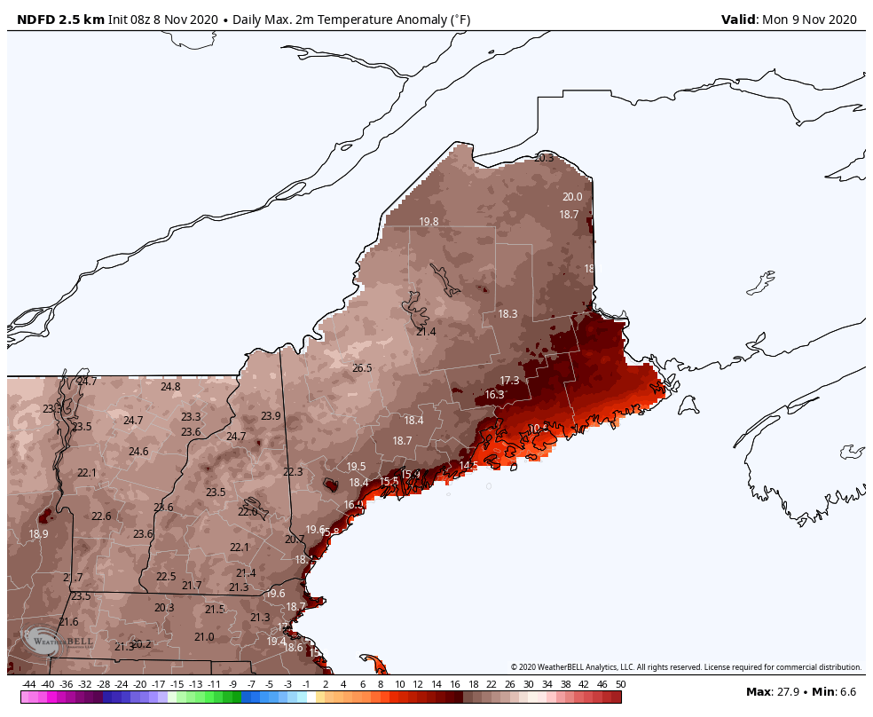 Temperatures remain torchy with daily maximums (above loop) close to 30° above normal to start the week, which could break more records. As the ridge moves east late week, temperatures return to near normal values by Saturday. Long range outlook shows a chance for rain and/or snow for the second half of next weekend. 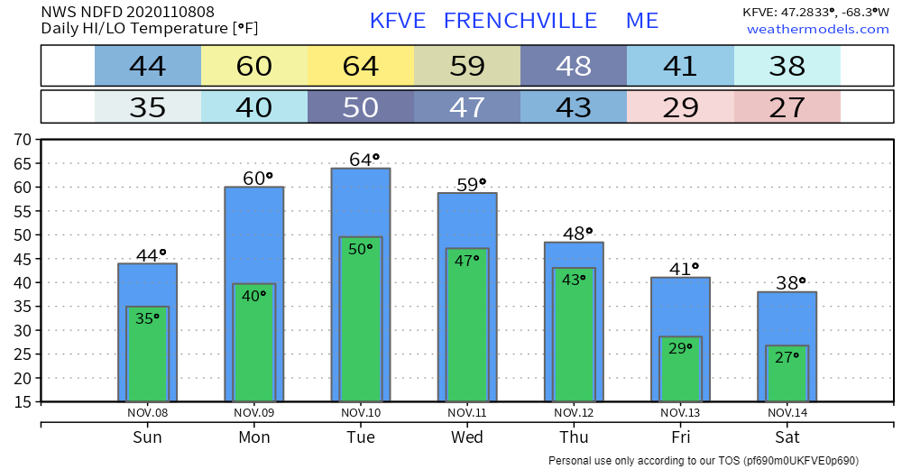 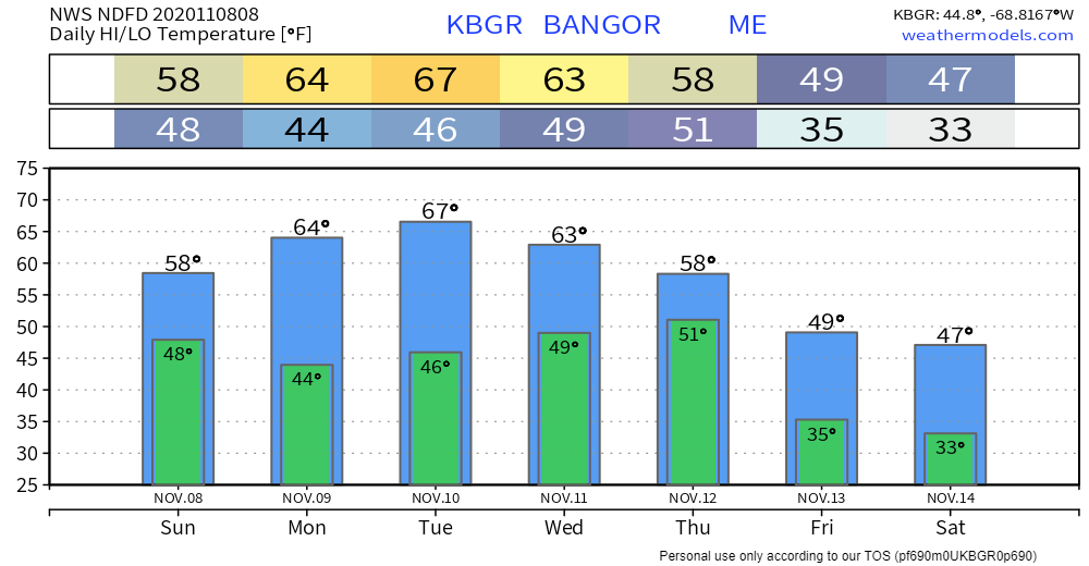 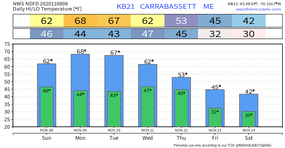 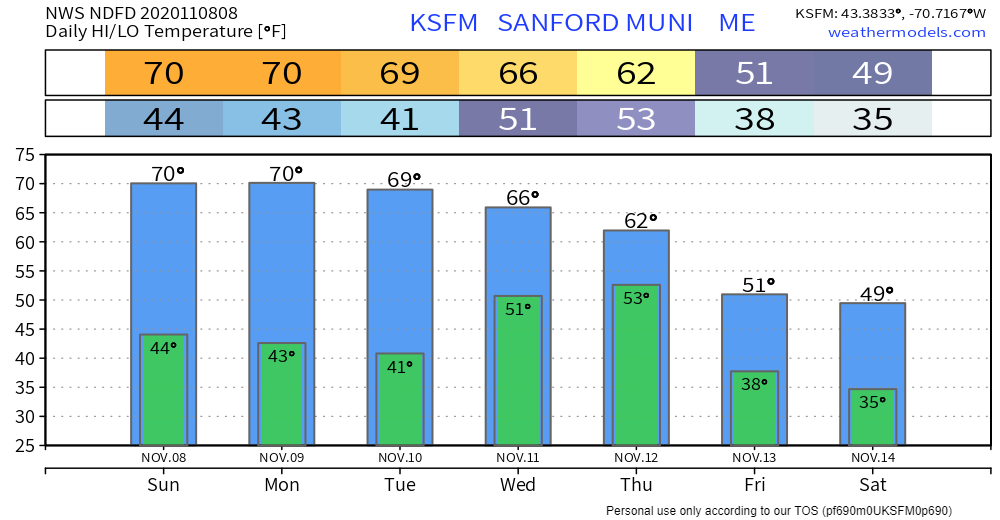 CoCoRaHS volunteers needed!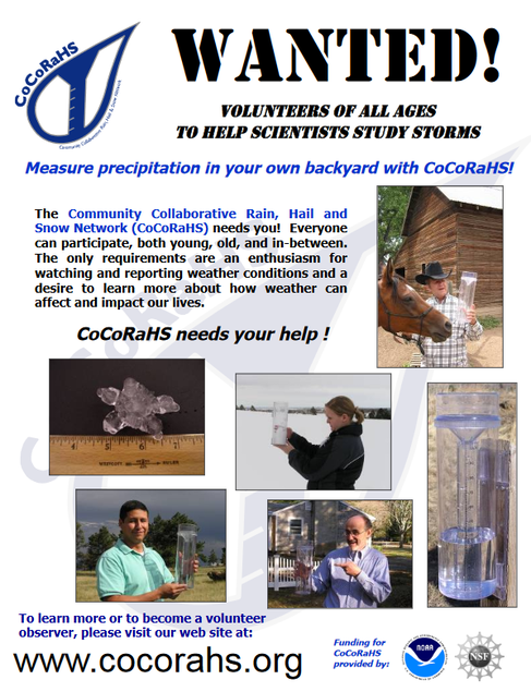 For those that live in western, northern and eastern areas, the Community Collaborative Rain Hail and Snow Network could use your help. While southwestern areas are fairly well represented, there are some glaring holes on the map for Maine where observations would be extremely helpful. Towns like Bethel, Rumford, Rangeley, Carrabassett Valley, Kingfield, Eustis, Greenville, Millinocket, Lincoln, Danforth have maybe one or no observers at all. CoCoRaHS is a great way to get involved in the weather community to help with forecast verification purposes and improve future forecasts. For more information on the program, please message me on Facebook or Twitter and I would be more than happy to help! Be prepared to receive alerts and stay updated!
For more information, please follow Pine Tree Weather on Facebook and Twitter.
** FUNDING NEEDED FOR 2021 ** Thank you for supporting this community based weather information source that is funded by your financial contributions. Stay updated, stay on alert, and stay safe! - Mike |

Mike Haggett
|