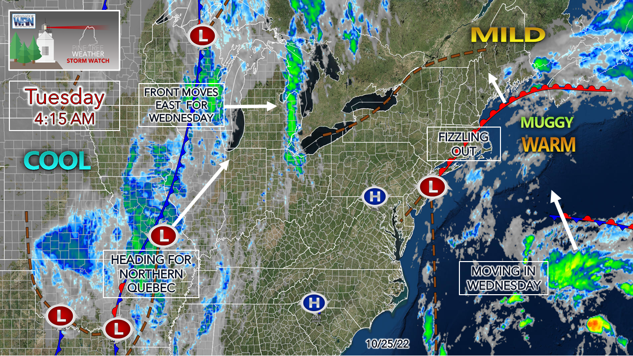
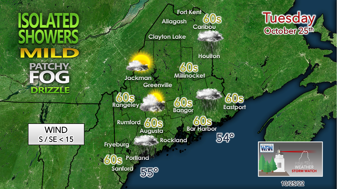
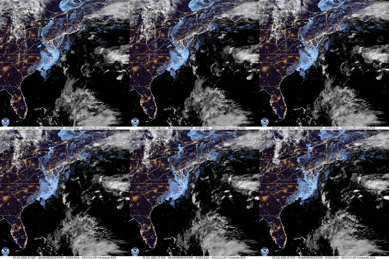
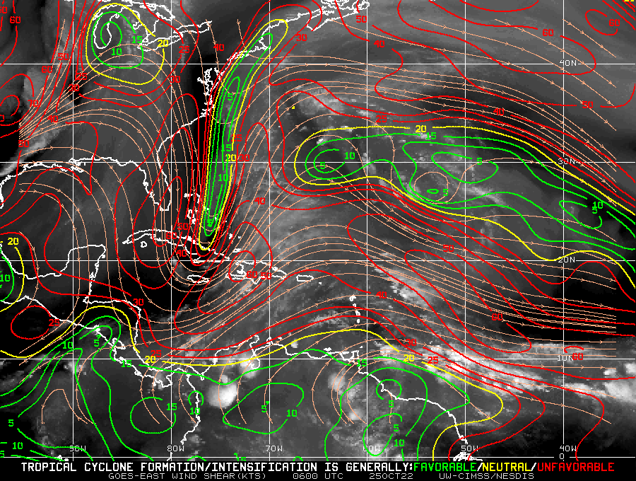
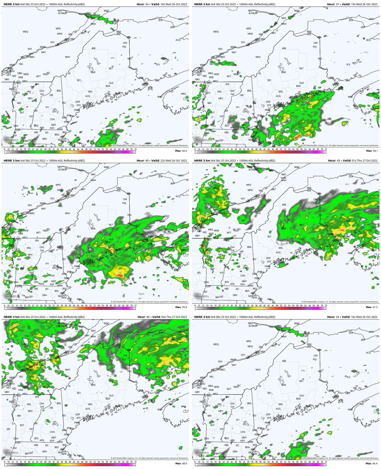
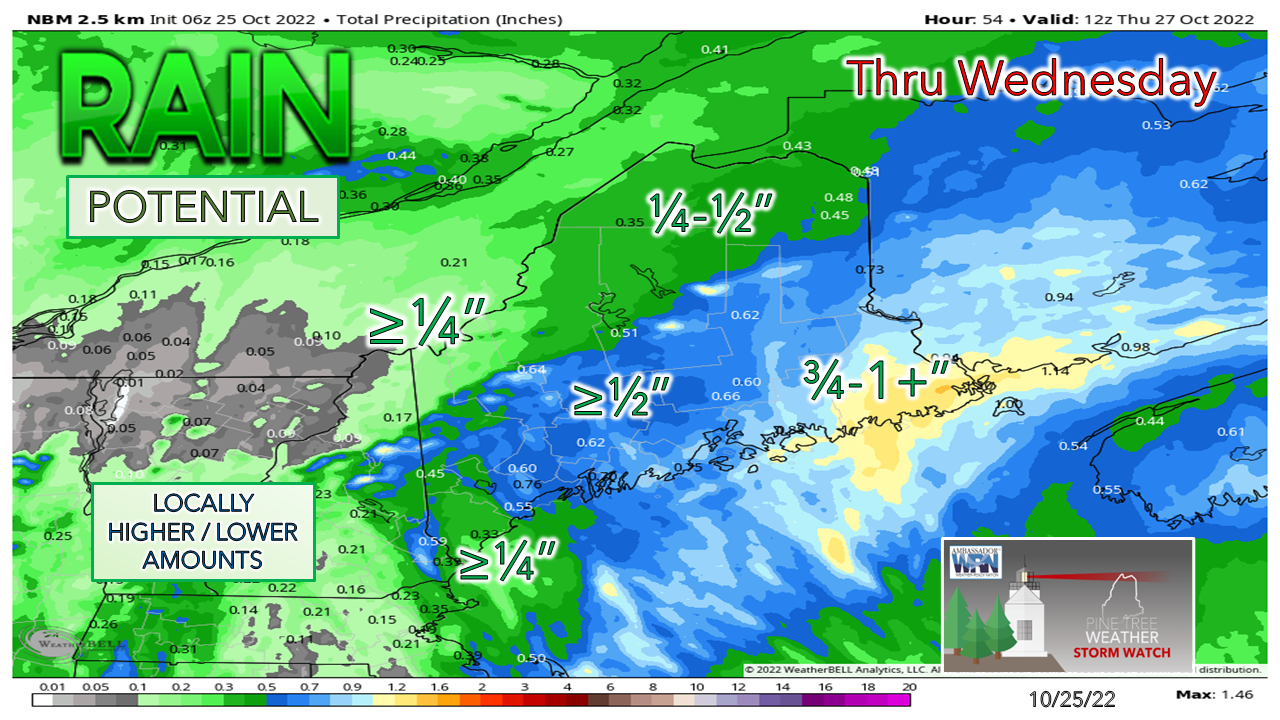
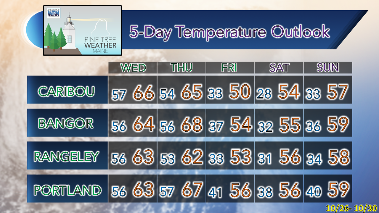
Many moving parts through WednesdayA warm front moves into the state Tuesday morning, and then fizzles out as weak low pressure near Long Island, NY washes out. A tropical disturbance from the southeast heads northwest to Maine for Wednesday. An approaching cold front from the west scoops that up and moves it out of the area by early Thursday. Mountains may see some sun, gray and damp elsewhereAs the warm front moves into the area, it elevates dew points to a summer like low 60s over the coastal plain by afternoon, before washing out. With no atmospheric forcing, the low clouds, areas of fog and drizzle hang around. A light shower or two is possible at times along the coast and up into The County. The western mountains have the best chance for sun, with the foothills seeing a chance for a few beams in the afternoon. One more round of rain WednesdayThe tropical feature due east of the DelMarVa has been the attention of the National Hurricane Center for the past few days. The system passed through Bermuda on Monday with some rain and breezy conditions to the island nation, but otherwise with little fanfare. It's not very well organized as the satellite loop indicates and looks worse than what it did at the same time in the morning on Monday. The tropical stir up is heading into hostile territory as it deals with wind shear as it heads northeast towards Maine. By the time the weakening low arrives and connects with the approaching cold front from the west, it more or less morphs into a warm front before being absorbed and whisked away. Wednesday Noon to Thursday 2 AM - Wednesday starts off with clouds, areas of fog and drizzle with a chance of a shower or two before noon. Moisture from the weakening tropical low arrives in the afternoon and appears likely to impact MidCoast, DownEast areas and points north through the evening with moderate to heavy rain and some breeze. Add the likelihood of fog around, expect reduced visibility while travelling. The east side of the disturbance is the wet side, thus DownEast areas are likely to see higher amounts. Thunderstorms are also possible, which where they occur could bring downpours. The risk for severe storms appears very low, but non-zero given the tropical nature of the moisture. Outlook through SundayOnce the rain ends Wednesday night / early Thursday, high pressure moves in and brings a breeze out ahead of it. As the wind settles, expect a return of the crisp late October starts and more seasonable temperatures and dry conditions through Monday. Thank you for supporting this community-based weather information source which operates by financial contributions from people like you. PLEASE DONATE FOR 2023! THANK YOU! Stay updated, stay on alert, and stay safe! - Mike NOTE: The forecast information depicted on this platform is for general information purposes only for the public and is not designed or intended for commercial use. For those seeking pinpoint weather information for business operations, you should use a private sector source. For information about where to find commercial forecasters to assist your business, please message me and I will be happy to help you. |
Mike Haggett
|

