|
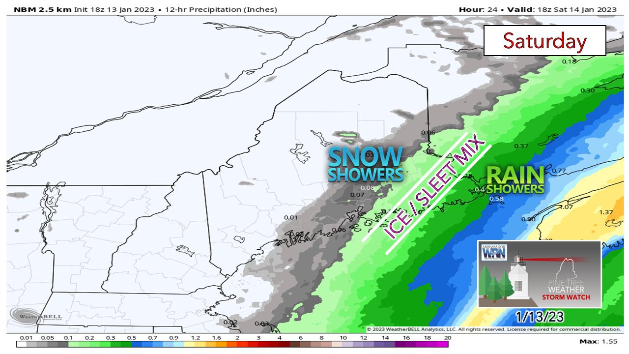
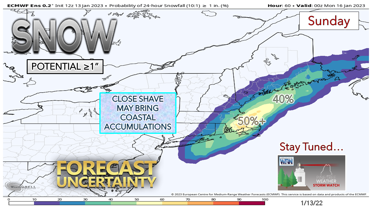
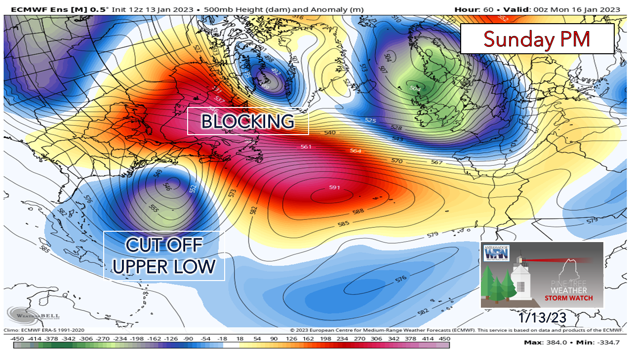
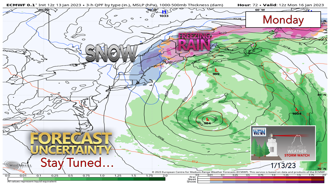
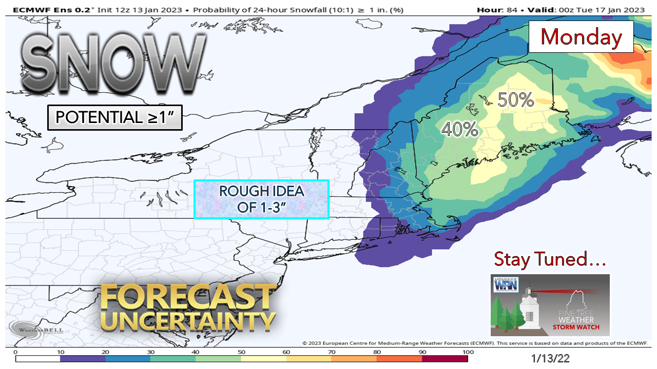
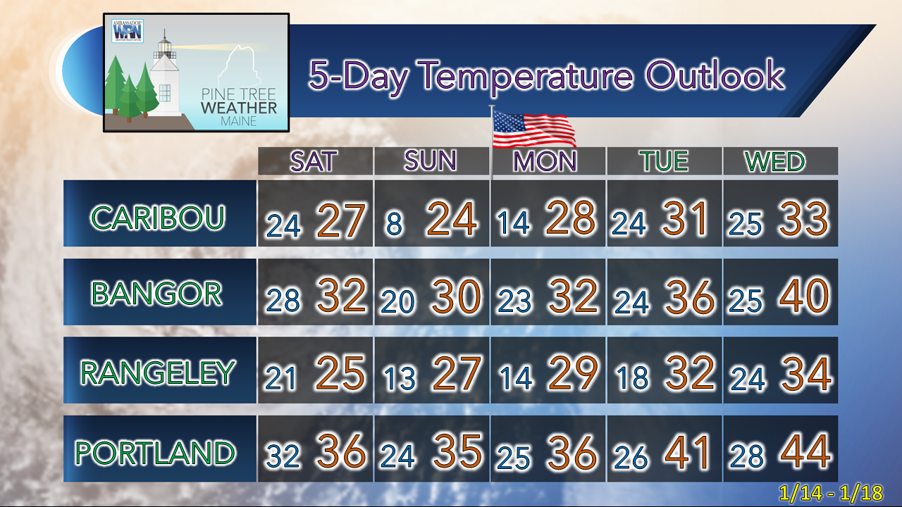
Welcome to silly season. Models are nutty. Our pattern is becoming more active. The ocean temperatures are warm in the low to mid 40s. Cold air is marginal. That means potential for more mixed precipitation / junk chances, at least through midweek. There is quite a bit of uncertainty given the traffic jam that is developing over the north Atlantic. It will be important to pay close attention to the forecast as the outlook could change rather quickly, as it has here. The general idea through Monday... subject to change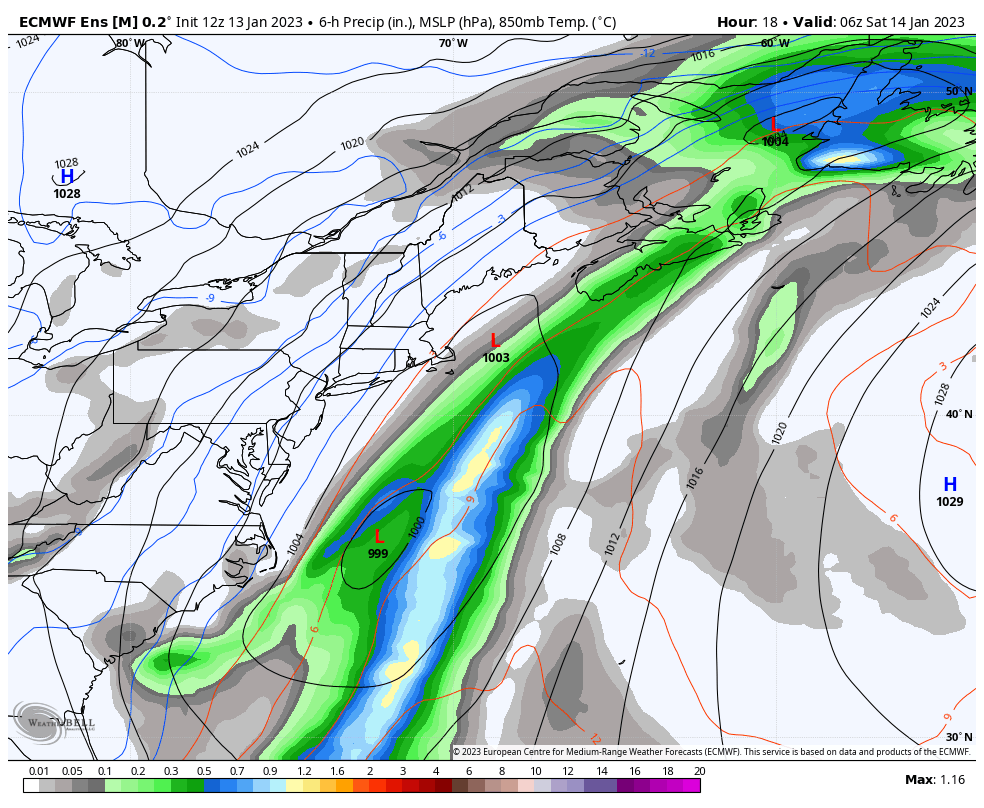 Saturday 1 AM to Tuesday 7 PM - This is the European ensemble mean outlook from Friday morning. Given the amount of variance with the deterministic models, this is the practical idea to share. This shows potential precipitation amounts, NOT precipitation type. The system that moved through the region Friday is a part of a longwave frontal boundary that is on track to stall over the Canadian Maritimes through the start of the week. Areas of low pressure form along it, and with the blocking going on the north and east in conjunction with the cut-off upper low, will bring precipitation chances to the coast Saturday and Sunday, and potential for widespread light to moderate impacts for Martin Luther King, Jr. Day on Monday. At the tail end of the loop, there is a clipper system on approach for Tuesday. Then there is another storm on tap for Friday. Silly season. Potential for a light mixed bag event |

Mike Haggett
|