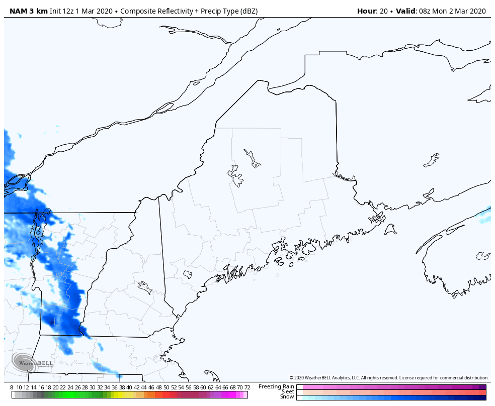
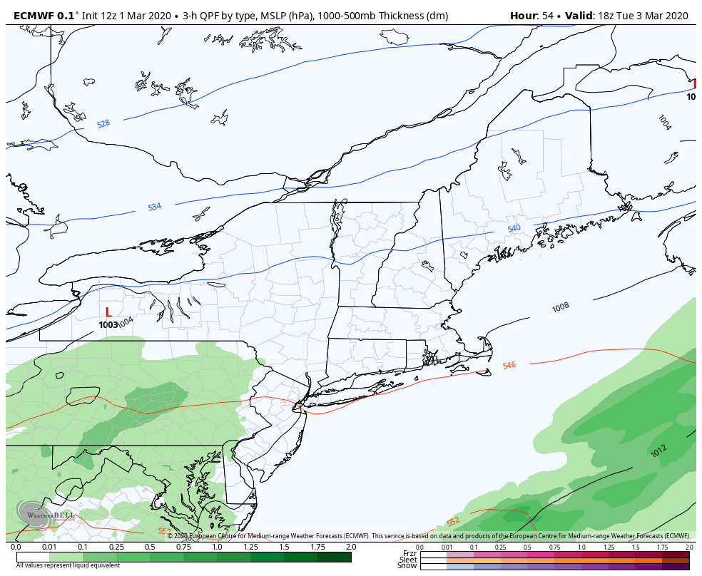
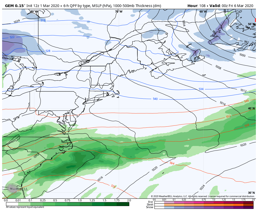
Pine Tree Weather
  • DISCUSSIONS
  • DONATE
  • MAPS
  • NWS BRIEFINGS
  • SATRAD
  • MARINE
  • SNOW / ICE OUTLOOK
  • RAIN OUTLOOK
  • CPC OUTLOOK
  • Kennebunk
  • OBSERVING WEATHER
  • Who We Are
  • My Photography
  • DISCUSSIONS
  • DONATE
  • MAPS
  • NWS BRIEFINGS
  • SATRAD
  • MARINE
  • SNOW / ICE OUTLOOK
  • RAIN OUTLOOK
  • CPC OUTLOOK
  • Kennebunk
  • OBSERVING WEATHER
  • Who We Are
  • My Photography

Unsettled at times through the week; snow threat potential late week

3/1/2020

Comments


Welcome to March

Picture
The first of March means the beginning of meteorological spring. For Maine, that means winter still has 6-7 weeks to go, under normal conditions. This winter has been anything but normal given the above normal temperatures. So far for the season, Caribou has recorded 105.4" of snow for the season, which is 22.9" above the seasonal average of 82.5", but much less than the 147" recorded at this point last year. To the south, Portland has recorded 50.5" of snow to this point, which is 4.1" above the seasonal average of 46.4". Last year at this point the Forest City recorded 51.1" of snow for the season. 

While temperatures appear to continue to be above average going into March, it's still early to call winter over. The threat for frozen precipitation continues everywhere. 

Temperature outlook for the week

Picture
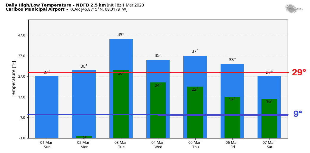
Most of the week ahead, above normal temperatures are in the offing for the north. After a below zero start on Monday , there is potential that Tuesday's projected low temperature could be warmer than the average high for the date. Temperatures steadily cool down by the end of the week.
Picture
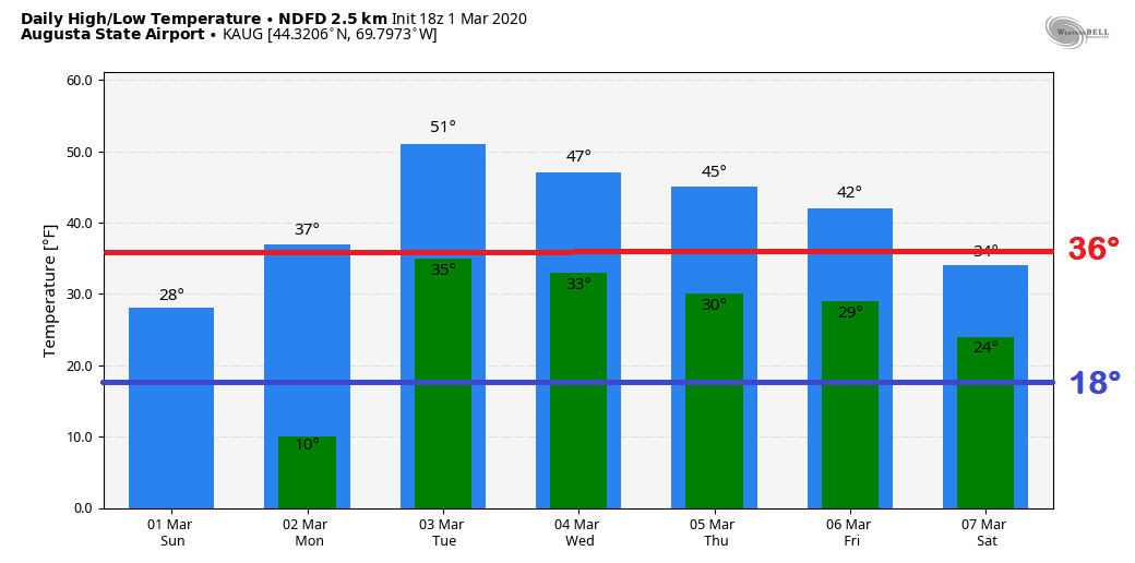
A similar trend is in store for the central part of the state. The projected high of 51° Tuesday will keep the sap on the trees flowing, with help from a couple of nights at or near freezing to help it along through midweek. Temperatures fall back below normal to start the weekend. The trend of consecutive weekends with below normal mercury readings continue. 

Chances for precipitation depend on location
​through the week

Picture
A warm front nudges in from the south on Monday. This brings the chance for snow showers and perhaps some mixed precipitation for the mountains and north through Monday night, with a chance for a shower to the south early Tuesday morning. Some northern areas and higher elevations may pick up an inch or two of snow at most, but for most it will be less than that. Expect breezy conditions out of the south with gusts 15-25 mph. Precipitation ends for most Tuesday morning as high pressure makes a brief visit, and temperatures will rise up into the 40s and 50s statewide. 
Picture
High pressure quickly moves east Tuesday afternoon, and takes the taste of spring along with it. An area of low pressure slides through the region Wednesday morning. The mountains and north may pick up a couple inches of snow with this, a mix is possible for the western foothills and a chilly rain for the coastal plain. Temperatures continue to trend cooler heading into the weekend.

Potential snow everywhere to start the weekend

Picture
This is something to keep an eye on as the week unfolds. As low pressure departs Wednesday, cooler air works into the region with high pressure on Thursday. The race is on between energy from the north meeting up with energy from the south. There is a fairly good bet the region gets a plowable snow out of this, even for the coast. It's a bit early to go into too many other details than that. Stay tuned for more on this as the week unfolds.

NOTE: This is crunch week for me with school as I have a major mid term project along with my typical lab and quiz requirements for my weekly lesson, all of which is due Friday. I am also battling a bit of a cold as it has hit my family rather hard in the past week. I will do my best to provide updates as time allows. Thank you for your understanding. 

► ► For the latest official forecasts, bulletins and advisories, please check in with the National Weather Service in Gray for western and southern areas, or Caribou for northern and eastern parts of Maine.

You can help keep Pine Tree Weather going into the future with a donation of ANY amount now through VENMO @PineTreeWeather, a monthly donation on Patreon or messaging me on Facebook or Twitter to send a check in the mail. Thank you for your support!

Always stay weather aware!

​- Mike


Comments
    Picture

    Mike Haggett
    Kennebunk, ME

    Certified Weather
    Forecaster
    Penn State '21

    American Meteorological Society

    National Weather Association

    Weather-Ready Nation 
    Ambassador
    ​
    ​SKYWARN-CWOP

    Matthew 19:26


    Support
    Pine Tree Weather

    DONATE

    Picture

    Picture

    Picture

    Picture

    Picture

    Picture

    Picture

    Picture

    Picture

    Picture

    Archives

    January 2023
    December 2022
    November 2022
    October 2022
    September 2022
    August 2022
    July 2022
    June 2022
    May 2022
    April 2022
    March 2022
    February 2022
    January 2022
    December 2021
    November 2021
    October 2021
    September 2021
    August 2021
    July 2021
    June 2021
    May 2021
    April 2021
    March 2021
    February 2021
    January 2021
    December 2020
    November 2020
    October 2020
    September 2020
    August 2020
    July 2020
    June 2020
    May 2020
    April 2020
    March 2020
    February 2020
    January 2020
    December 2019
    November 2019
    October 2019
    September 2019
    August 2019
    July 2019
    June 2019
    May 2019
    April 2019
    March 2019
    February 2019
    January 2019
    December 2018
    November 2018
    October 2018
    September 2018
    August 2018
    July 2018
    June 2018
    May 2018
    April 2018
    March 2018
    February 2018
    January 2018
    December 2017
    November 2017
    October 2017

    RSS Feed

Proudly powered by Weebly