
Precipitation mainly light overall While it will be damp at times, it won't be a total washout either day for western and southern areas, or Friday for northern and eastern areas. The mornings over the weekend will remind us it's early spring, with some chilly starts. Please do your best to get outside during this unprecedented time and enjoy the fresh air and nature around us. Thursday showers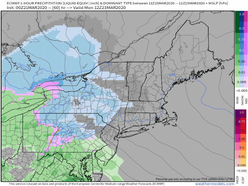 A weak area of low pressure cuts along building upper ridge and brings generally light precipitation to western and southern regions Thursday. I can't rule out some isolated snow flurry activity over parts of northern and eastern areas, but those areas should stay dry through daylight hours, but see clouds on the increase. Interior western areas may see a mix of light snow or light freezing rain for a time Thursday morning, and again perhaps Thursday night. Any snow accumulations appear less than an inch, any icing would be a trace at the worst. Temperatures for the day range in the 30s for the mountains and north and 40s elsewhere. The thermometer may only drop a few degrees Thursday night into early Friday as warm air surges in from the south, with lows in the 30s. A breeze from the south/southeast at 10-20 mph with gusts to 25 mph for the shorelines is possible Thursday into early Friday. A showery but mild Friday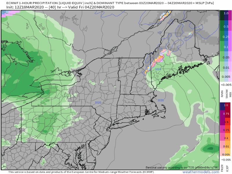 The warm front surges in from the southwest Thursday night and brings off and on shower activity to the region through Friday. The sun may poke out in areas. Where it does could see temperatures climb into the 60s. Where the sun does not break through, temperatures will range in the upper 40s to the 50s. It will be another breezy one as southwest winds build ahead of the approaching cold front, with gusts again in the 15-25 mph range. After the cold front passes through, the wind shifts to the west/northwest and gusts remain in the 15-25 mph range Friday night. The mountains can expect some snow shower activity Friday night, with accumulations of an inch or less possible. A cool weekend Clouds clear out Friday night. As they do, temperatures drop. Low temperatures Saturday morning fall to the teens north and mountains, 20s for coastal interior areas / foothills and low 30s for the shorelines. With a gusty west/northwest breeze, the air will be crisp everywhere to start off. Temperatures will be cooler Sunday morning with single digits north with teens and 20s elsewhere, but will little wind. Daily highs for both days range in the 20s for the north and mountains, 30s for the foothills coastal interior and DownEast, with 40s for southern areas.
Feel free to use the many pages available on this website for many types of forecasts on rainfall, snowfall, marine, longer range CPC outlooks and maps. Thank you as always for your support! ► ► For the latest official forecasts, bulletins and advisories, please check in with the National Weather Service in Gray for western and southern areas, or Caribou for northern and eastern parts of Maine. Always stay weather aware! - Mike |

Mike Haggett
|


