
A damp ending to the work week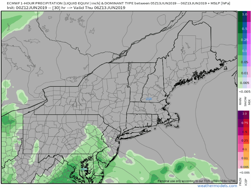 A NorEaster-esque style ocean storm works its way into Maine on Thursday, which appears to bring rainy and breezy conditions to the region. Northern areas have a dry start to the day before showers arrive in the afternoon. Eastern zones stay dry for a good part of the morning before showers arrive around noon. For western and southern areas, the sunrise may be the only time the glowing orb appears before showers arrive by roughly mid-morning. Steadier rain tapers from southwest to northeast Thursday afternoon into the evening. A cold front approaches from the northwest on Friday, which will bring another round of showers and a chance for a thunderstorm. Northern and western areas have the best chance for activity, with a hit-or-miss chance for southern and eastern areas. The front exits the region Friday night, and most areas start off dry on Saturday. Saturday the pick of the weekend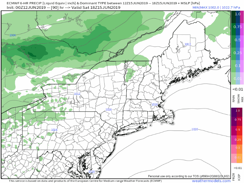 The mountains may see an isolated shower or sprinkle Saturday, but other than that, the state stays dry for the day. A ridge from the south noses into the region for Sunday. Pending on where that sets up will indicate rain chances. As for now, the northeast appears to be the boundary area, and as a result, scattered showers are in the forecast for Sunday, and a chance for showers on Monday. Rainfall estimates through the weekend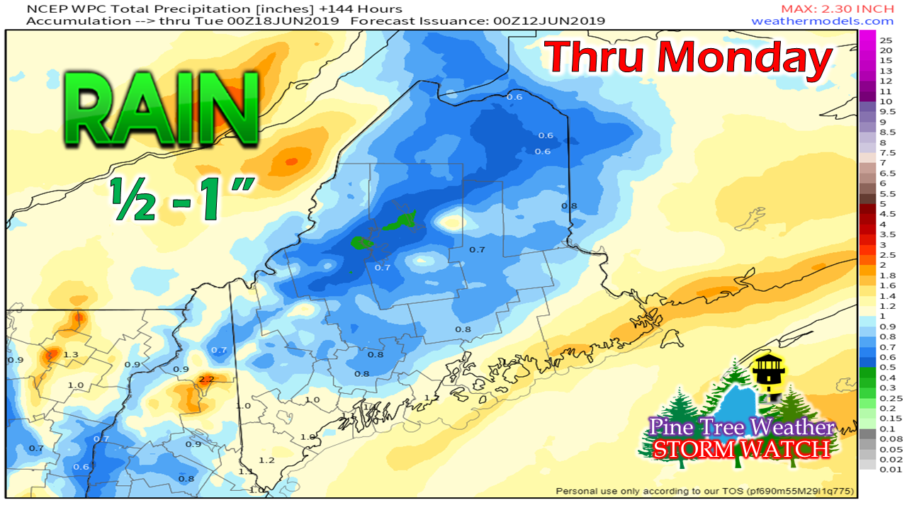 This is all subjective pending on boundary set up and impulses along it, but a general idea of ½-1" of rain can be expected through the first of next week. This could be locally higher and lower, and is likely subject to change. Summer humidity on the way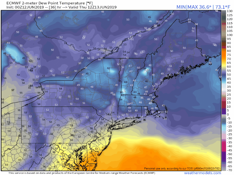 As I have mentioned in previous updates, the humidity is coming. We've seen brief spurts of it along the coast in the past couple of weeks. I recorded a dew point reading of 70° in Kennebunk Tuesday, which is the highest so far for the season. The muggy conditions will be noticeable for most areas Sunday, and for coastal areas on Monday. It's time to check the air conditioners and get the fans ready. Summer is about to arrive, and it could be a warm and sticky one. Also, with the rise in dew points comes chances for thunderstorms. Stay updated on the forecast and make sure you can be alerted in case one pops up in your area. Regional outlook through Monday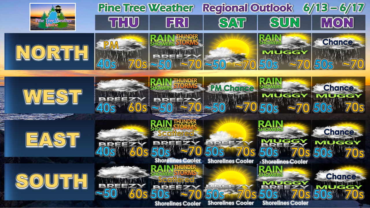 ► ► For the latest official forecasts, bulletins and advisories, please check in with the National Weather Service in Gray for western and southern areas, or Caribou for northern and eastern parts of Maine.
Please consider supporting Pine Tree Weather ► ► Your financial donations are much appreciated to keep this site funded and for further development. I sincerely appreciate your support not only financially, but also in sharing my efforts with others. For more information from me, please check the Pine Tree Weather Facebook page as well as my Twitter feed. Always stay weather aware! - Mike |

Mike Haggett
|


