The tale of two Maine's continues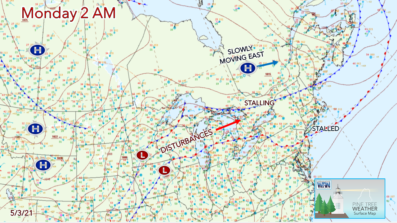 Northern areas are the place to be through Tuesday for mild temperatures and varying amounts of clouds. The further south, the cloudier and cooler. A stalled boundary south of New England and a cold front sagging south through central New England that will stall out dictates the weather pattern to start the week. Chance for showers for southern and western areas through Tuesday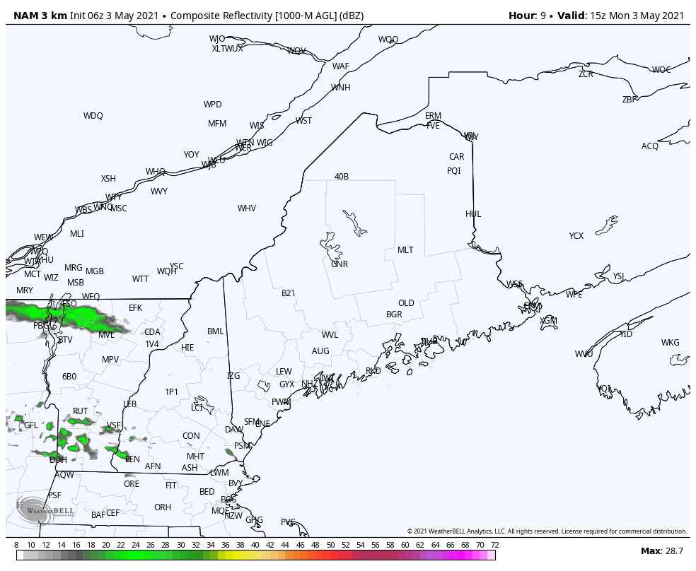 Most areas stay dry for Monday through 8 PM. A bit of forcing between the ridge to the north and trough to the south may bring some light shower activity in the afternoon over southwestern areas through early evening. 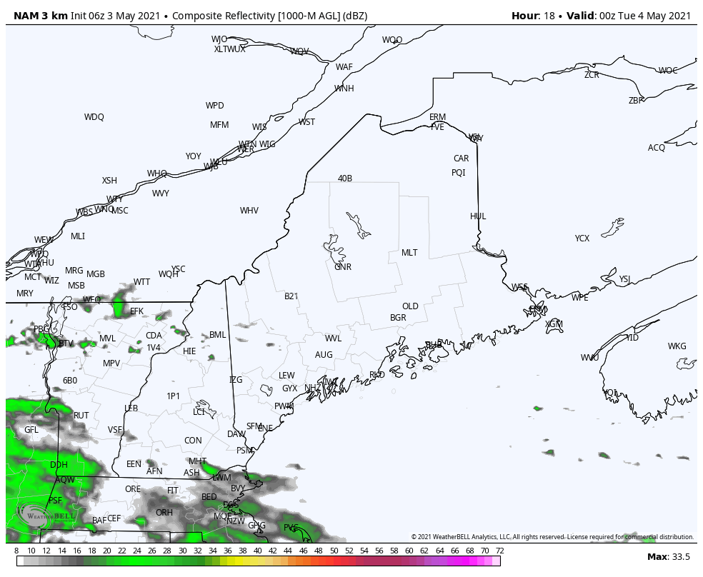 Monday night a weak wave passes through the region, bringing rainfall to southwestern areas overnight into early Tuesday morning. Accumulations range from trace amounts north of Waterville to potentially 0.20" for southern York County. 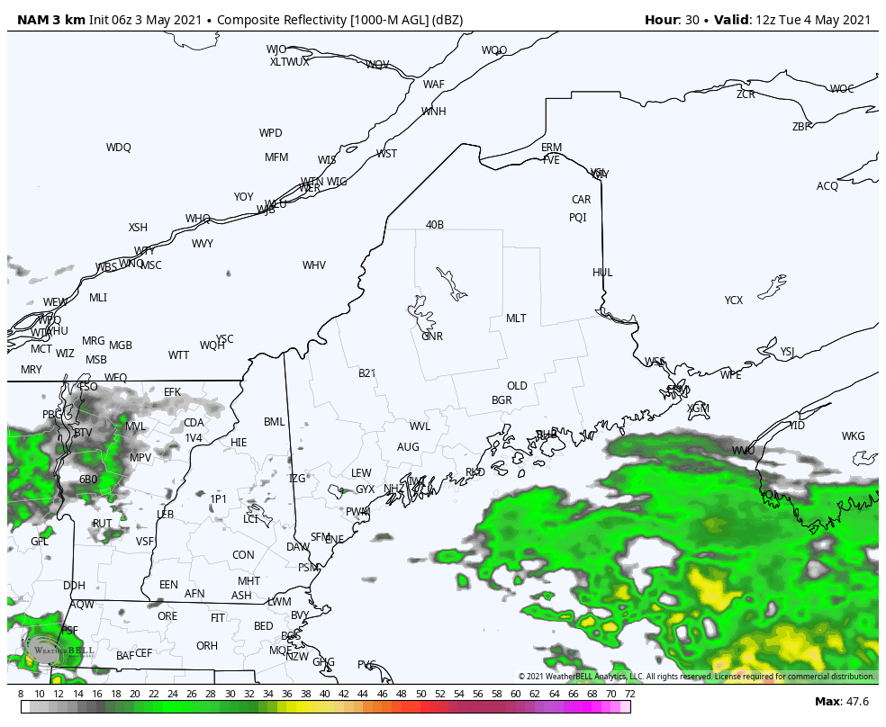 The wave passes offshore Tuesday morning. A weak disturbance brings the chance for widely scattered spot showers or sprinkles for western and southern areas through the day. Northern and eastern areas enjoy another fair day with varying amounts of sun pending on region. A decent rain on tap for all Wednesday into Thursday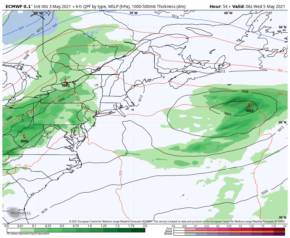 An upper-level low near Hudson Bay tracks eastward Wednesday. A long wave frontal boundary drags up moisture from the south and brings a wet day to the region. The storm slowly weakens as it moves northeast. Rain ends for most areas Thursday morning, and gusty northwest winds in the 20-30 mph help dry the region out through mid-evening. 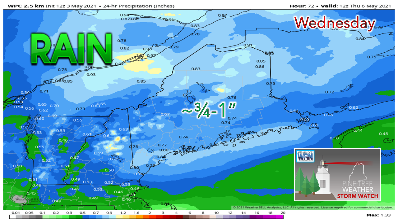 Most areas should pick up around ¾" of rain from the event, with upwards of an inch or more possible in the higher elevations and perhaps coastal areas. Forecast amounts will be fine-tuned closer to the event. Another storm possible late week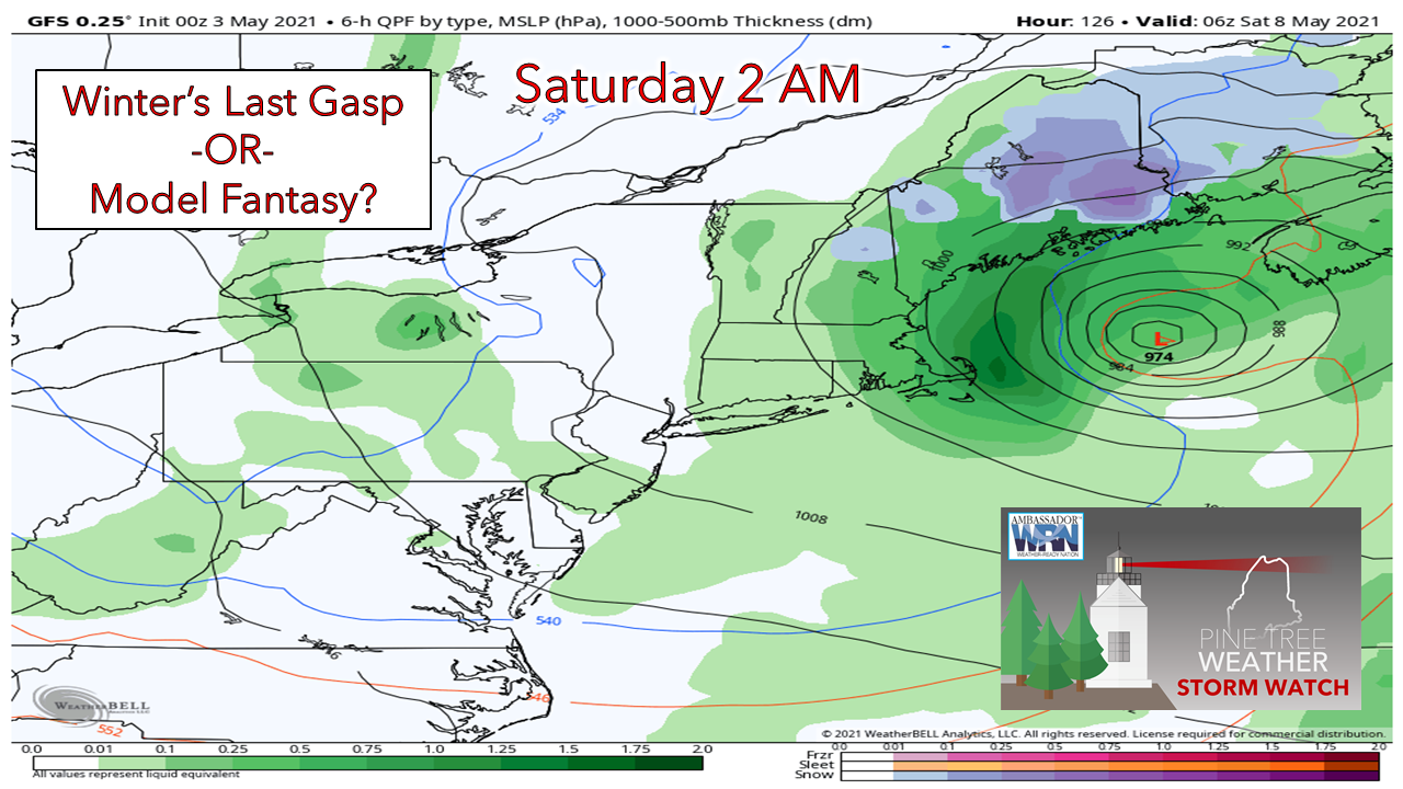 I mentioned here last week about one more shot of cold air to be concerned about before turning on the green light to gardeners, and this is it. The GFS model has been steadfast on the idea for days, and other models have hinted at a cool trough, but not as sharp. It was this time a year ago where interior areas were slapped with heavy wet snow as winter's last parting gift. Cold air still lurks to the north, so the idea isn't out of the question. It all depends on how sharply the trough digs, and if so, where and when. 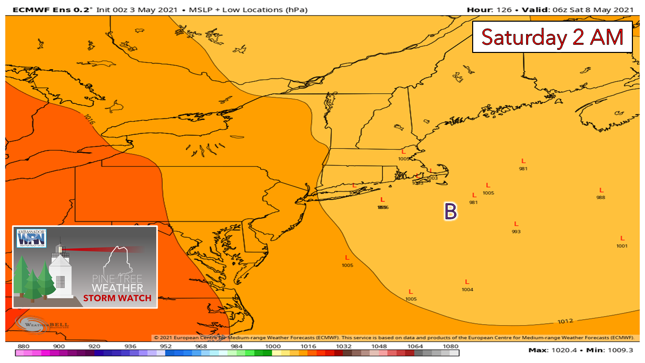 The ensemble ideas are relatively flat overall of all three of major models. At this point it is a wait and see game to see how the weekend starts off. Join the weather community as a storm spotter! Here's a wonderful way to become active in the weather community and help the US National Weather Service Gray ME, broadcast media and forecasters like myself with storm reports. This information is vital during and after an event for forecasting and alerting purposes. I can't tell you how many times I have seen the importance of these reports in the past 9+ years I have been involved. Pine Tree Weather followers have stepped up in the past and participated, and with the readership base continuing to grow, I know there are more out there. This is the spring/summer session which discusses severe weather, what to look for, and how to report it. These sessions run for about 90 minutes. They are fact filled, educational and interesting. You can get the whole family involved from the comfort and safety of home. Once completed, you will get your spotter ID, and will be ready for the season ahead. For those who trained for the winter session, this will complete your full year training. It's important to have both sessions done. The link to register is here ► https://www.weather.gov/gyx/skywarn#fragment-2a If you need more information, please contact Donald Dumont, the Warning Coordinating Meteorologist at NWS Gray via email [email protected] or message me directly. Seven-day temperature outlook through SundayDaytime high temperatures appear to run near seasonal average overall through the period. Nighttime lows appear to run at, or slightly below average. 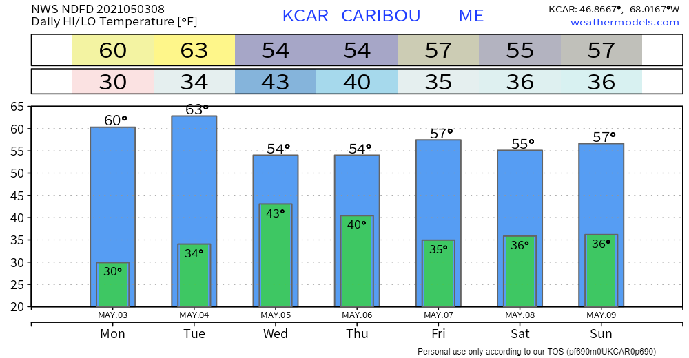 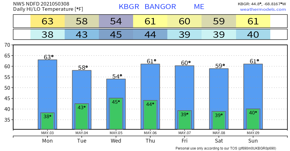 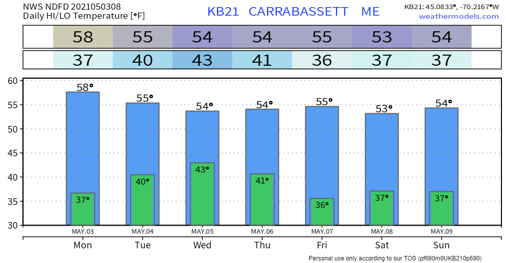 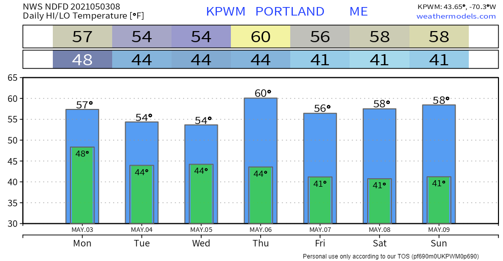 Be prepared to receive alerts and stay updated!
For more information in between posts, please follow Pine Tree Weather on Facebook and Twitter.
Thank you for supporting this community-based weather information source which operates by reader supported financial contributions. Stay updated, stay on alert, and stay safe! Thank you as always for your support! - Mike |

Mike Haggett
|