
Region is caught in a pickle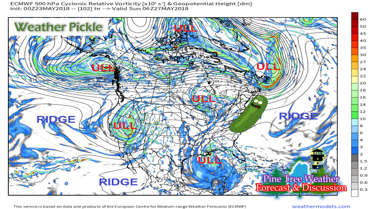 The battle between cold and warm continue over the North American continent and New England appears to be in cross hairs of it over Memorial Day Weekend. Six upper level lows are sandwiched in between three strong ridges, and the result is a frontal boundary that appears to wobble over New England beginning Friday for northern and eastern Maine, then sagging south and westward for Saturday and the rest of the weekend. The weekend does not appear to be a total loss. Showers appear light to moderate at times, but scattered and intermittent. It all depends on region and time of day. For those that are camping, expect shower activity at night Friday, Saturday and Sunday. Dry times indeed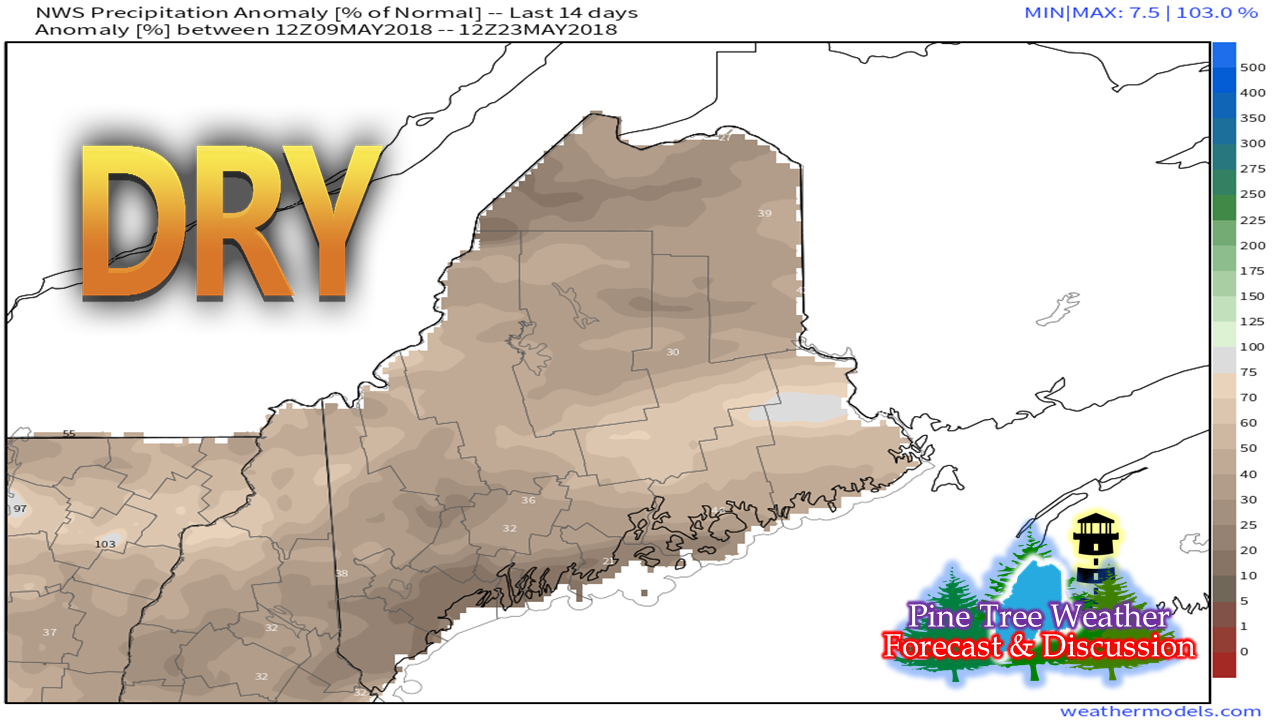 As stated with regularity this spring, wildfire concerns have ran high due to the lack of any meaningful rainfall. With the foliage blooming, it calms the threat a bit, but much of the region is still very dry. The only area where rainfall has kept close to normal in May is that in Houlton where they are currently running 0.09" deficit. Frenchville (-1.03"), Augusta (-1.64"), and Portland (-2.09") are the state's driest areas that have any long term recorded history. In fact, if the month ended today, this would be the second driest May on record for Maine's largest city with only 0.75" of rainfall recorded at the Jetport. The region could use a good soaker. We'll have to watch the Gulf of Mexico for next week to see if the area can tap into some of that moisture. The shower activity over Maine this weekend will bring some rain, but may not make much of a dent in the current monthly shortfall. Soggy for much of the Eastern United States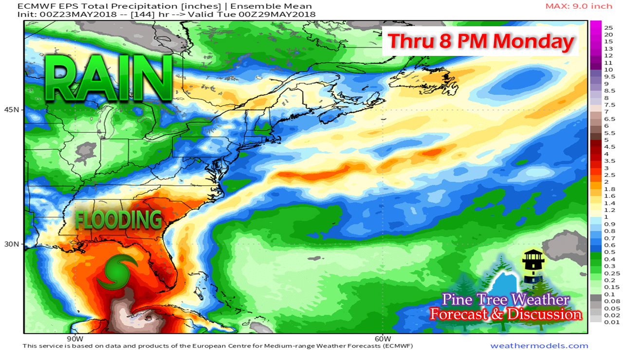 Rainfall total idea for the eastern half of the country through the weekend shows heavy rain over the southeast from tropical influence. A disturbance is being monitored by the National Hurricane Center for possible development. At this point, it appears that it is more of monsoon rain maker than anything else. With the frontal boundary meandering over New England, there is a chance for some beneficial rain. This idea may be a touch overdone, but 1/4"-3/4" is a reasonable total for much of the state between Friday and Monday evening. 5-Day Outlook - Coastal Plain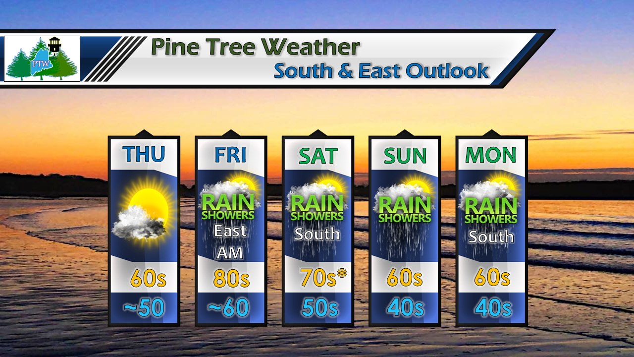 It will feel like summer Friday with widespread 80s. With dew points in the upper 50s / low 60s, it could feel a touch humid in areas, but generally warm and comfortable. Saturday, the warm area appears to be eastern Maine where the sun breaks out, whereas southern areas will stay on the cool side (50s / 60s) and deal with showers activity. Off and on showers will persist as the frontal boundary hangs around through the remainder of the weekend. 5-Day Outlook - North Country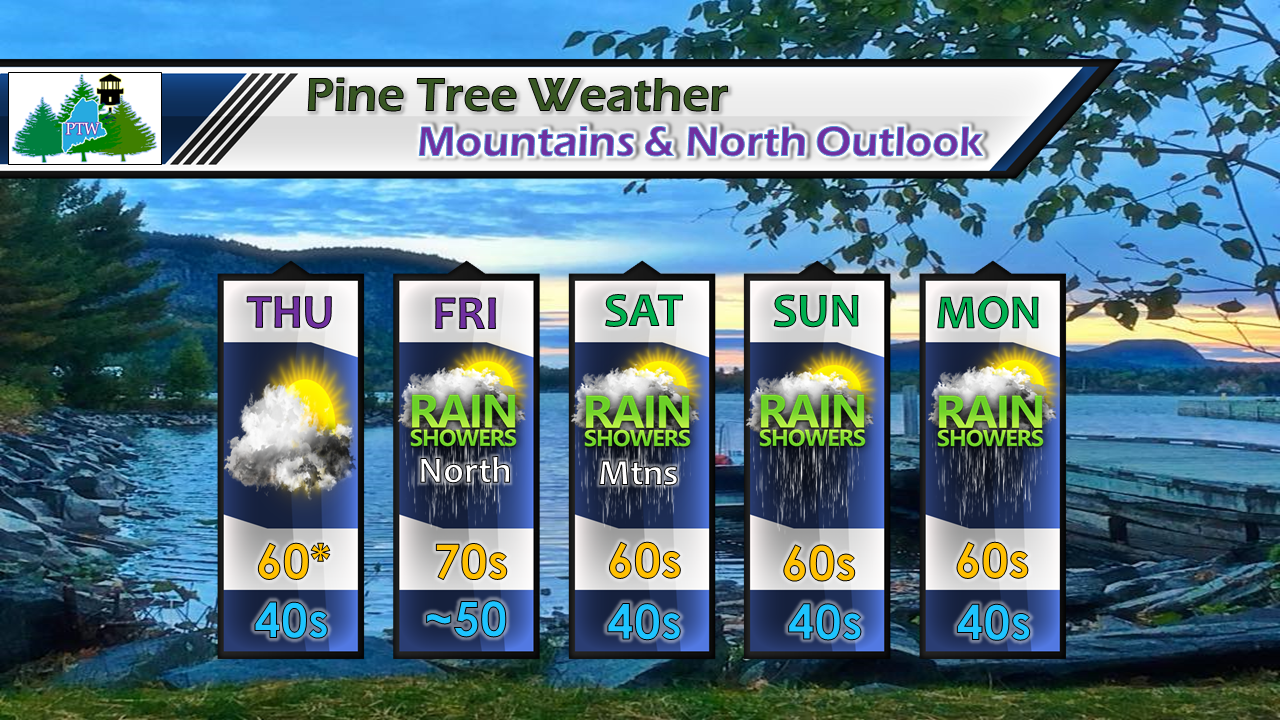 Thursday will be touch cooler for the north as clouds dominate the skyline with a weak boundary sliding southeastward from Quebec. Friday will be showery for the north, with much of the western mountains staying dry. That equation flips on Saturday, with cooler, damp conditions for western areas, where The County stays dry. Off and on showers for both regions are possible the remainder of the weekend.
As always, please consult with NWS Caribou for eastern and northern Maine, and NWS Gray for western & southern Maine for official forecasts and bulletins. Pine Tree Weather Facebook and Twitter Thanks as always for your support! - Mike |

Mike Haggett
|


