
Humidity to feel like summer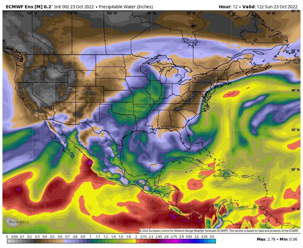 A look at the precipitable water forecast from Sunday through Friday shows the trough developing over the west and the ridge building in the east through early Thursday. A Bermuda High set up synonymous with July pumps moisture in from the southwest which raises dew points into the upper-50s to low 60s by Wednesday. A sharp cold front passes through the region on Thursday. By Friday morning, the threat of frost returns as the dew points fall back into the 20s to around 30°. A temperature whiplash watch is effect for late week. Showers on the way Sunday night into Monday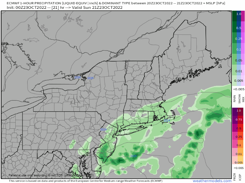 Sunday 5 PM to Tuesday Midnight - An elongated area of low pressure makes its way up the east coast on Sunday and brings a warm front north with it. The region escapes with a dry day before rain moves in after dark. Guidance ideas are struggling to solve how far north the rain goes, and how much rain the system brings. Timing is also varied with the short-term models as well. Warm fronts are "warning fronts" to me. A lot of things can happen based on the situation, season, and time of day. There is the risk of overperformance as well as the risk of bust. With the warm front moving in overnight, there is no heating of the day to enhance convective properties to enhance rainfall, but the air mass is just juicy enough that any temperature lift into the atmosphere from an abnormally warm ocean may be all it needs to bring a decent shot of rain. If timing stays on track, most of the rain is likely to be down by mid- to late morning on Monday. Expect a wet commute and have a rain jacket. 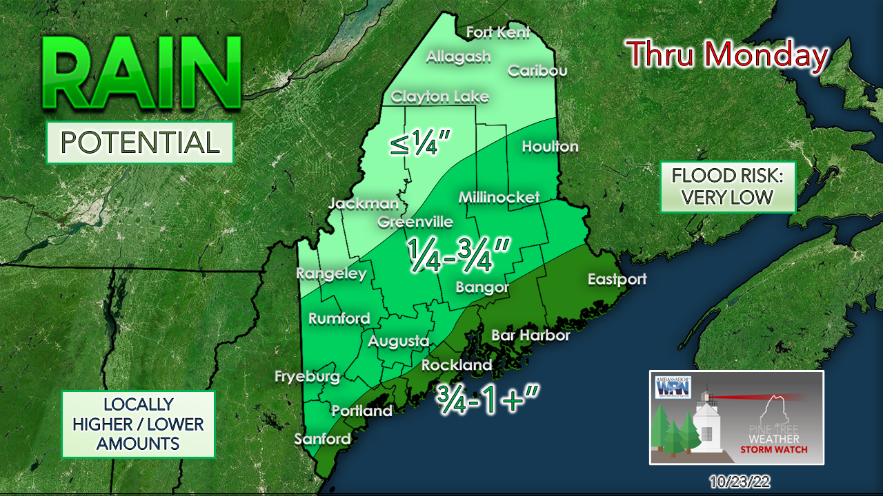 Since this is mainly a stratiform rain event, I don't expect any flooding issues. The Weather Prediction Center has the coast flagged for marginal risk for flash flooding on Friday, then backed off on it. The coast gets the best chance for rainfall. Above the Bigelow Mountains in the west and up into The County is whether measurable rain occurs or not. Odds are increasing for a wet Wednesday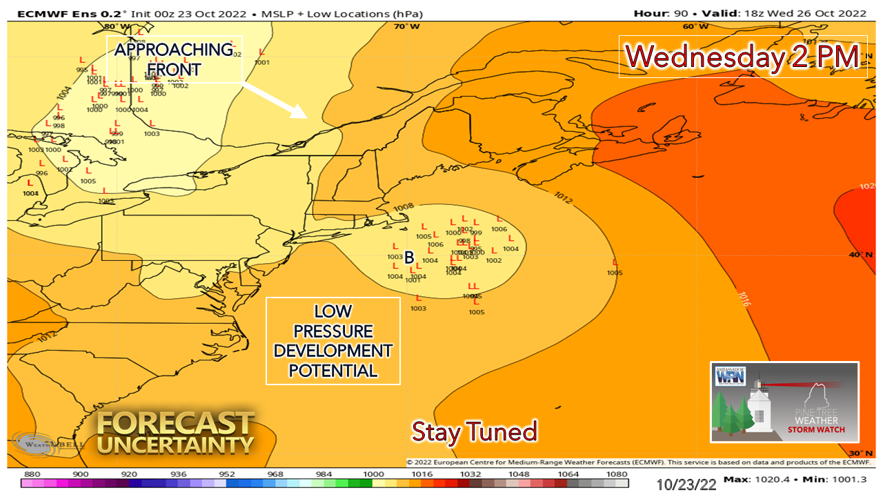 I mentioned on Facebook and Twitter on Saturday about this potential, and the overnight run of the European tightened up the clusters of potential low-pressure development right around the benchmark "B" 40° N / 70° W point. This geographic point is often referenced in winter regarding snowstorms, and it has value in this case for rain potential. With the tropical influence in the air pumping around the high to the east and assisted with the approaching front from the northwest. this set up could bring some rainfall midweek. Outlook through FridayThe average high and low temperature for October 23rd for Caribou is 50° and 34°. For Portland, 57° and 39°. Temperatures are expected to be well above normal through the week. 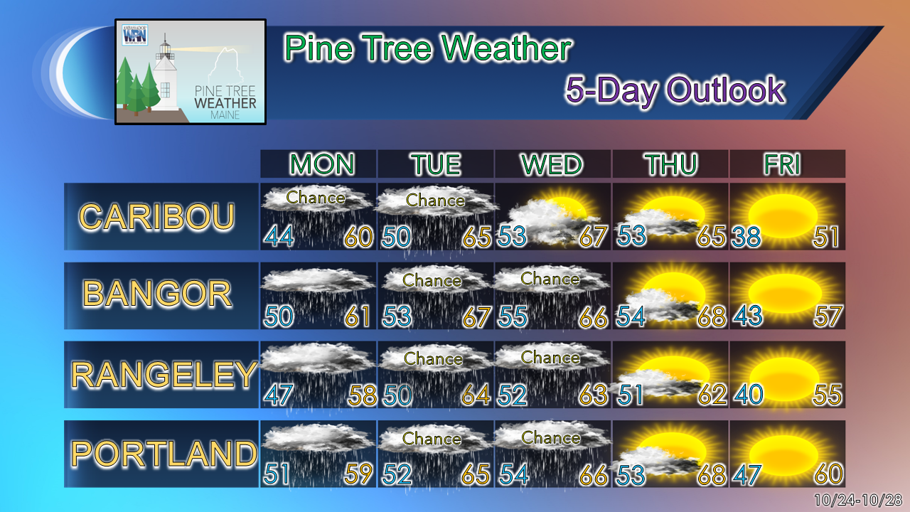 Thank you for supporting this community-based weather information source which operates by financial contributions from people like you. Stay updated, stay on alert, and stay safe! - Mike NOTE: The forecast information depicted on this platform is for general information purposes only for the public and is not designed or intended for commercial use. For those seeking pinpoint weather information for business operations, you should use a private sector source. For information about where to find commercial forecasters to assist your business, please message me and I will be happy to help you. |

Mike Haggett
|


