A mainly cloudy day for the region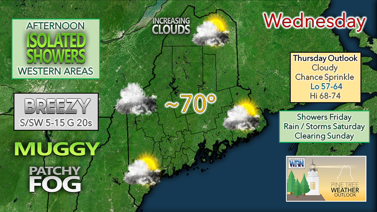 IMPACTS: Patchy fog around at times may reduce visibility in spots. Heavy rain with strong storms possible Friday night into Saturday. DISCUSSION: The region is caught in an atmospheric sandwich between a strong ridge offshore to the east and a slowly advancing upper low over the Midwest. A moist southwest flow is increasing humidity and cloud cover across the state, along with patchy fog. Northern areas have the best chance for sun to start Wednesday but will see cloud cover increase through the morning. A weak wave passes through western areas Wednesday afternoon and may trigger a light shower or sprinkle over western areas. High temperatures range around 70° for the day. A south / southwest surface flow could bring a bit of a breeze at times through the day. Patchy fog with spotty drizzle is possible overnight into Thursday morning once again as dew point temperatures nudge up a bit more. Overnight lows well above normal in the upper 50s to low 60s. Thursday appears to be a mainly cloudy day with patchy fog to start off, with isolated light showers / sprinkles along with drizzle possible. Temperatures for the day a virtual carbon copy of Wednesday at right around 70°. The chance for showers increases for Friday as the trough over the Midwest deepens and continues push the frontal boundary to the east towards New England. Friday night into Saturday brings the threat for heavy rain, along with a conditional threat for embedded strong to severe storms, which could bring damaging wind and perhaps an isolated tornado. Low level shear is forecast to be strong enough to potentially create updrafts. The best chance for storms of concern appears over western and southern areas for now. Again, this is a conditional threat, primarily based on how much cloud cover may impede development. Timing on when showers and storms end Saturday night into Sunday is still to be ironed out. At this point, southern and western areas appear to have the better chance for a mainly dry Sunday, with showers ending over eastern and northern areas by Sunday afternoon. As the front clears out, a northwest wind flow ushers in dry air, causing dew point temperatures to fall to more comfortable conditions for all by Sunday night.  Science of Valley Fog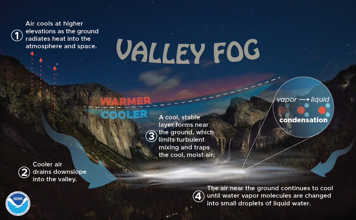 Do you know how valley fog is created? First, air at higher elevations cools down, which then drains downslope, into the valley. From there, a cool, stable layer forms near the ground, which limits turbulent mixing and traps the cool, moist air. Finally, the air near the ground continues to cool until water vapor molecules condense into small droplets of liquid water. weather.gov/safety/fog-mountain-valley Be prepared to receive alerts and stay updated!
For more information in between posts, please follow Pine Tree Weather on Facebook and Twitter.
Thank you for supporting this community-based weather information source which operates by reader supported financial contributions. Stay updated, stay on alert, and stay safe! - Mike |

Mike Haggett
|