
Slick roads in areas through Sunday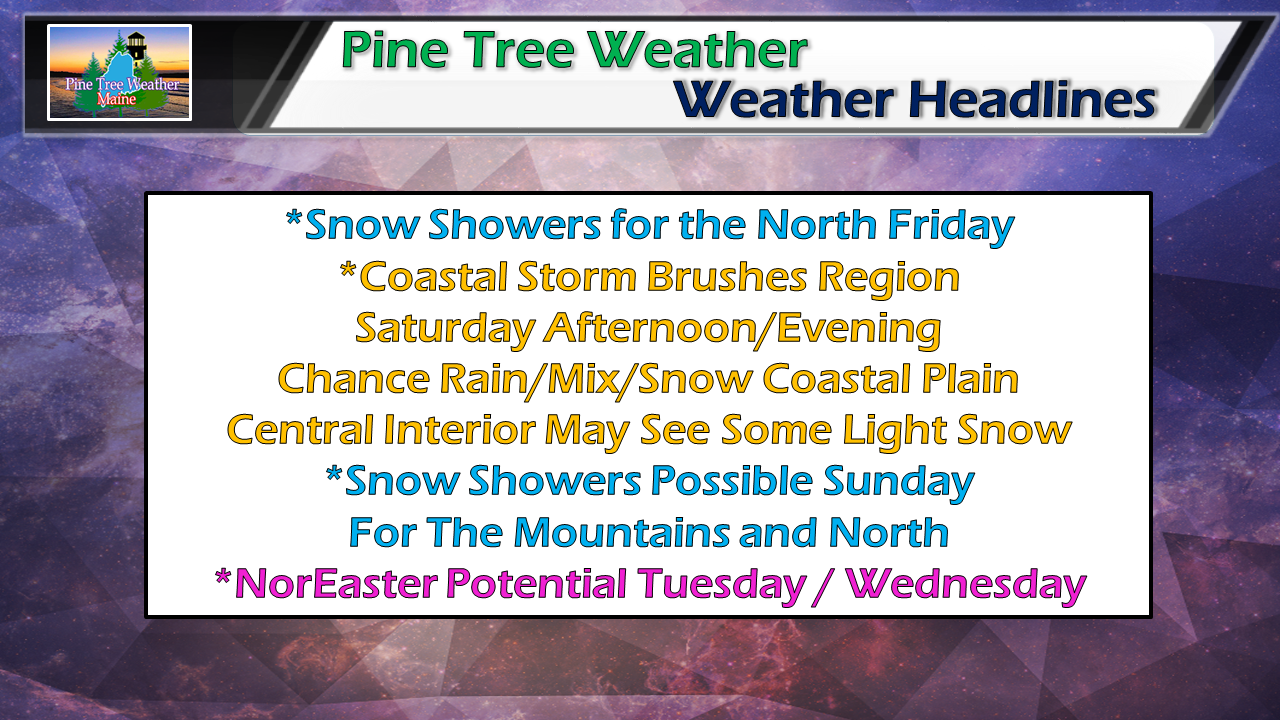 In the wake of the inversion that affected the region on Thursday comes a weak trough that will cross Southern Quebec on Friday and bring snow to the north. A coastal storm works northeast for Saturday. Another round of snow showers return for the mountains and north for Sunday. Cold air draws down for a breezy, chilly day Monday. That sets the table for what could be a decent snow event for much of the state Tuesday into Wednesday. Snow showers for the north Friday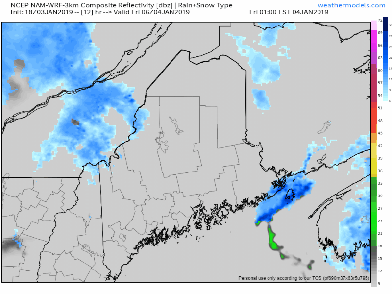 Not a whole lot of moisture with this system that will affect the Central Highlands and The County area primarily, but enough to slick the roads in areas. It could be a messy morning commute for the north, so be advised to plan accordingly. Some areas could see 1-3" out of this, perhaps a bit more for the higher elevations. After steadier snow showers in the morning, the weak trough heads east and taper off the activity heading into Friday afternoon and evening. Coastal brush to watch for Saturday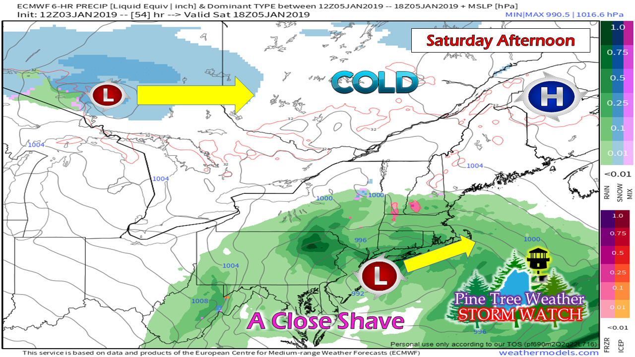 High pressure makes a brief visit Friday night and moves quickly to the east Saturday afternoon. A coastal storm tries to nose its way into the area. At one time, guidance had both the north and south streams merging together near Maine and looked very messy earlier in the week. Models even at 5 days out are a bit of an adventure right now. 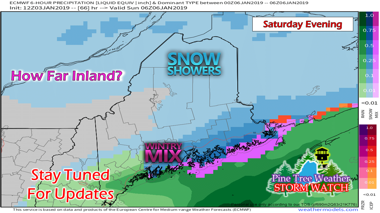 The game at this point is how much high pressure will play a factor in what happens Saturday afternoon into the evening. The Euro here suggests it will brush the coastline, whereas other guidance doesn't think so. It's safe to say the shoreline regions deal with some sort of precipitation. The question remains how far inland does it go? Word to the wise: plan on doing errands in the morning on Saturday. I will update on this. The first NorEaster of the year appears likely next week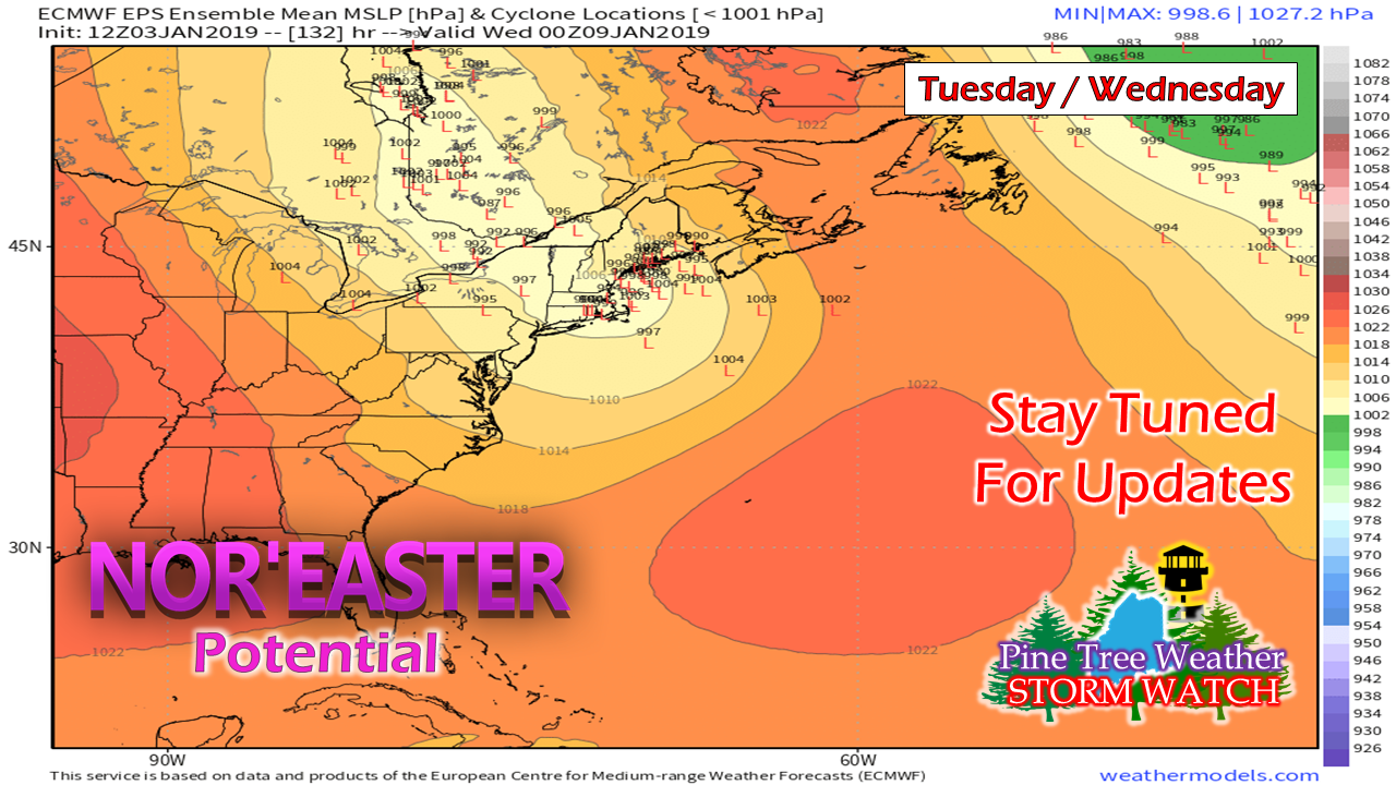 Confidence is increasing that the region will be dealing with a storm Tuesday / Wednesday. Chances are good that it will bring snow for the interior. The question at this point is what happens for the coast. For now the idea is for yet another coastal hugger, which if that verifies could bring a decent snow to the mountains and north, and potentially for the foothills and central interior regions. The coast is questionable for precipitation type. As I mentioned in the synopsis to start this update, cold air is going to be in place. Overnight lows for Tuesday morning in The County could be below zero. The key at this point is how quickly the storm can organize and the location where it occurs. With the upper level energy coming with it, it will likely intensify, and do so rapidly. In situations such as this, DownEast areas may see the heavier totals for precipitation and wind. For now, it's wait and see. There is plenty of time for changes. Outlook through Tuesday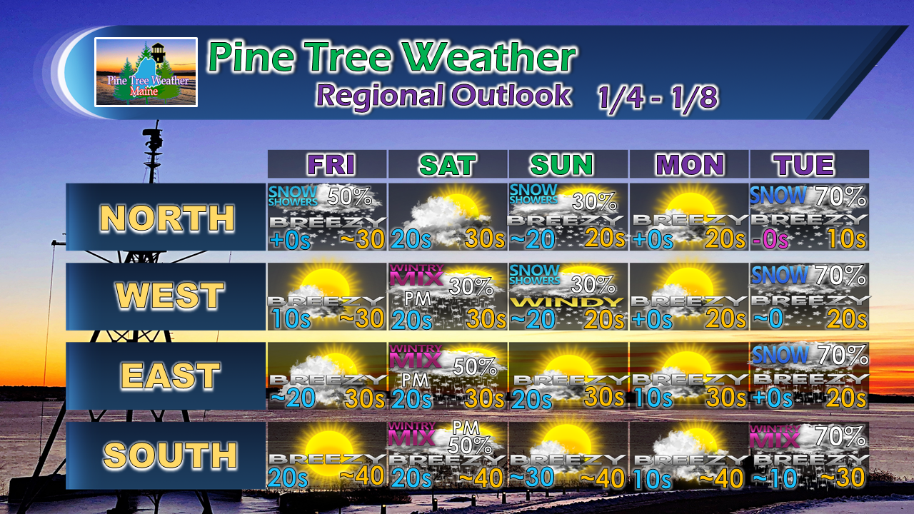 More updates to come. Stay tuned.
For the latest official forecasts, bulletins and advisories, please check in with the National Weather Service in Gray for western and southern areas, or Caribou for northern and eastern parts of Maine. For more information from me, please follow the Pine Tree Weather Facebook page and my Twitter feed. Your financial donations are much appreciated to keep this site funded and for further development. I sincerely appreciate your support. Always stay weather aware! - Mike |

Mike Haggett
|


