Pine Tree Weather
  • DISCUSSIONS
  • MAPS
  • BRIEFINGS
  • SATRAD
  • MARINE
  • RAIN OUTLOOK
  • SNOW / ICE OUTLOOK
  • CPC OUTLOOK
  • Kennebunk
  • Weather Geekdom
  • Who We Are
  • DONATE
  • My Photography
  • DISCUSSIONS
  • MAPS
  • BRIEFINGS
  • SATRAD
  • MARINE
  • RAIN OUTLOOK
  • SNOW / ICE OUTLOOK
  • CPC OUTLOOK
  • Kennebunk
  • Weather Geekdom
  • Who We Are
  • DONATE
  • My Photography

Unsettled period through the rest of the week; weekend outlook

6/18/2019

Comments


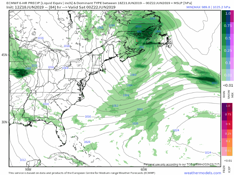
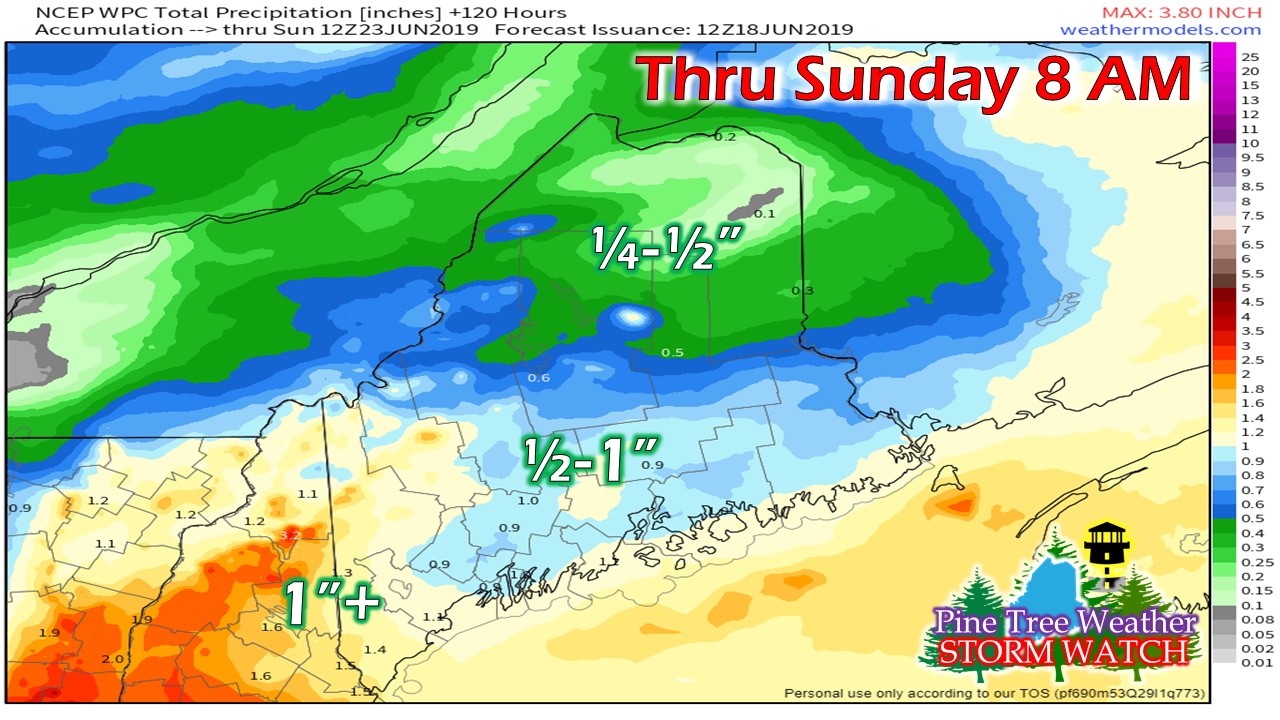
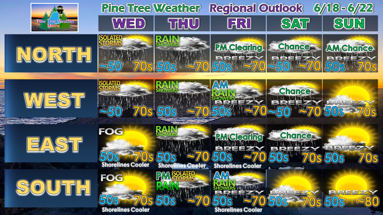
Showers and potential thunder north and mountains; fog concerns for the shorelines

Picture
A cold front attempts to drift southeast on Wednesday. A southwest flow ahead of it will raise humidity to muggy conditions over the south and east. The result of that brings showers with possible thunder for the north and western mountains, and fog for the coast.

As far as thunder for the north country is concerned, the severe threat appears isolated. Any storms that form may contain gusty winds and perhaps small hail.

Fog is expected to form along the shorelines. It could be stubborn in departure, and may hang around all day in coastal areas. A scant handful of miles may make the difference in areas that see sun and clouds with 70s, and who gets stuck with gray skies, potential drizzle, and 60s for high temperatures. 

Everyone gets rain Thursday into Friday

Picture
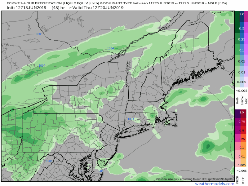
A ridge to the south attempts to move northeastward. The stalled front over southern New England & Mid-Atlantic moves into the region. Low pressure along it brings showers and periods of moderate to heavy rain Thursday night into Friday. Southern areas may stay dry until late day before the rain arrives. The north, mountains and DownEast areas may be dealing with off & on showers through the day. Rain could be heavy at times Thursday night for western and southern areas. The remaining showers appear to depart Friday morning for western and southern zones, by early afternoon for northern and DownEast areas by early Friday afternoon. 

A skunk in the barnyard
​for the first half of the weekend? 

Picture
I mentioned in Monday's post my concern about blocking over Greenland and how that may have impact on rain amounts and the forecast going into the weekend. I still have concerns.  As the storm departs on Friday, it appears that it may run into that block. The European model is picking up on a potential Fujiwara-effect scenario where areas of low pressure loop around one another. Under that possibility, showers may be possible for western, northern and eastern areas on Saturday as the pinwheel effect spins westward. For now, I am calling for a chance for showers in those regions. I will update on this as the weekend approaches.  

Rain amounts through Sunday holding firm for most

Picture
Southern and western areas continue to appear to get the most sky falling water through the period. The Weather Prediction Center backed off on rainfall over northern areas, but looking at guidance today caused me to note ¼ - ½" for The County remaining as possibility. 

This is a general idea only. Rain totals may vary with areas of downpours, and a shift in track. Flash flooding remains possible for the mountains. Standing water, hydroplaning and some minor urban street flooding remains possible for the bigger towns Thursday night into Friday morning. 

Regional outlook through Sunday

Picture
For now, Sunday appears the better half of the weekend, but it will likely be a bit breezy as high pressure slowly moves into region. The northwest breeze could cause temperatures to rise around 80° for southern areas. 

Stay tuned...

​► ► For the latest official forecasts, bulletins and advisories, please check in with the National Weather Service in Gray for western and southern areas, or Caribou for northern and eastern parts of Maine.

Please consider supporting Pine Tree Weather ► ► Your financial donations are much appreciated to keep this site funded and for further development. 

I sincerely appreciate your support not only financially, but also in sharing my efforts with others.

For more information from me, please check the Pine Tree Weather Facebook page as well as my Twitter feed. 

Always stay weather aware! 

​- Mike

Comments
    Picture

    Mike Haggett
    Kennebunk, ME

    Penn State
    Weather Forecast Certification '21.
    AMS / NWA
    Weather-Ready Nation 
    ​SKYWARN-CWOP

    Picture

    Alex Hatfield
    Wakefield,MA


    Penn State
    Meteorology and Atmospheric Science ‘21
    PSUBAMS
    Campus Weather Service
    PSU Storm Chase Team
    PSU College of Earth &  Mineral Sciences Ambassador

    Picture

    Kaitlyn Lardeo
    ​Syracuse, NY

    SUNY Oswego
    Atmospheric Science
    Lake Effect Storm Prediction and Research Center
    Northeastern Storm Conference Contributor

    DONATE
    Picture

    Archives

    January 2021
    December 2020
    November 2020
    October 2020
    September 2020
    August 2020
    July 2020
    June 2020
    May 2020
    April 2020
    March 2020
    February 2020
    January 2020
    December 2019
    November 2019
    October 2019
    September 2019
    August 2019
    July 2019
    June 2019
    May 2019
    April 2019
    March 2019
    February 2019
    January 2019
    December 2018
    November 2018
    October 2018
    September 2018
    August 2018
    July 2018
    June 2018
    May 2018
    April 2018
    March 2018
    February 2018
    January 2018
    December 2017
    November 2017
    October 2017

    Categories

    All
    Maine Weather
    Pine Tree Weather

    RSS Feed

Proudly powered by Weebly