
Personal update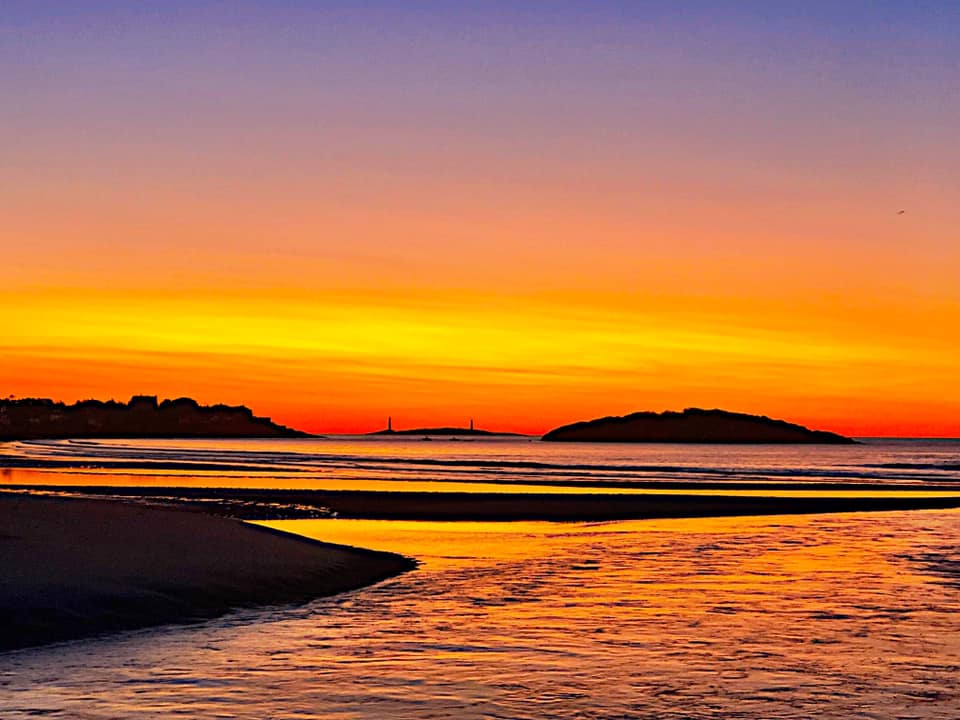 Good Harbor Beach, Gloucester, MA - Mike Haggett photo First of all, much appreciation to my financial donors who have faithfully made their monthly contributions on Patreon for a year now, as well as those who send me checks via the mail. The future of this operation depends on those who financially support it. So long as the cash rolls in to keep it going, I will keep doing it. I have a bit of bookkeeping to get caught up on and a few checks to deposit. For now it appears that I will start fundraising efforts in September to gear up for another winter and year ahead. If you would like to mail a check ahead of time or join Patreon with a monthly donation ($1 per month / $12 a year suggested), click on the DONATE button on the right for more information. Second, thanks for your patience with me through the summer. I know my updates have been a bit erratic. I am trying to enjoy this summer since this is my time to get outside, and also spend quality time with my family. We just spent a weekend in Gloucester, Massachusetts. Part of that was rest and relaxation, the other was the laying to rest my father-in-law's ashes from his death back in April. Those of you who have followed for a while know of the string of losses to my family dating back to November, 2016 when my sister-in-law unexpectedly passed away, followed by my brother-in-law in April, 2017, then my wife's aunt in September of last year, and then my father-in-law recently. I've had little time to get away for a fun. I will be going away for a weekend later in August to do just that. The juggling of my day job, addiction recovery, dealing with family matters that includes time with my wife and daughters has me running full tilt most days. My youngest is autistic, and that brings challenges, also. Doing Pine Tree Weather is a love of mine that I will continue to do, but it also has it's place in the demands of life. As always, if this site goes quiet, you can always check the Pine Tree Weather Facebook page and my Twitter feed for information. As winter approaches, you can expect that updates will come for frequently with more details. I don't expect to be your single source of weather, but to be used in addition to what you see on TV or through the National Weather Service. Humidity returns for a couple days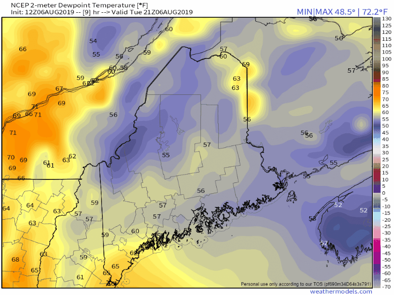 The sticky conditions return Tuesday night into Wednesday for the state as tropical air pumps in from the southwest. Some areas could see the dew points touch 70°. It will be a bit uncomfortable Wednesday and Thursday night. After the cold front passes through Friday morning, a gusty northwest wind will flush out this round of moist air and return the region to drier, cooler levels by Friday night and last through the weekend. With humidity rising, expect areas of fog in the morning. There could be a few places where it could be locally dense, and stubborn to depart. With the humidity, comes a storm threat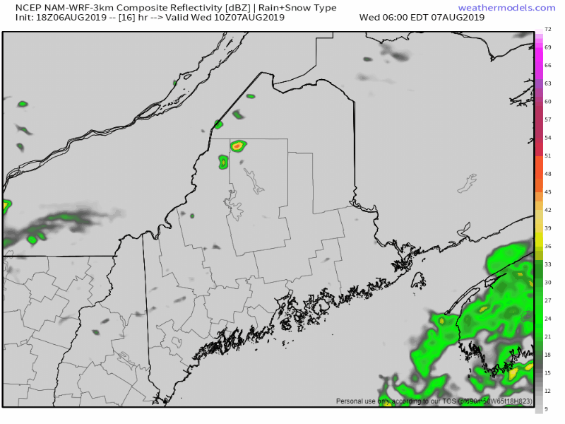 BFolks in the mountains and north should be on alert for showers and storms to form Wednesday. Southern areas may see a risk of a shower. Eastern areas may see some isolated activity, if anything happens there, during daylight hours. The storm threat diminishes overnight Wednesday into Thursday as the lack of heating diffuses any strong to severe storm potential. I can't rule out a clap of thunder to rattle the bed frame, but I suspect that will be remote. Thursday will be the main concern for much of the state as the cold front slowly works through the region. The activity is likely to be cloud dependent. At the very least, scattered showers with heavy rain are possible. Any isolated storms that do form could contain damaging wind, hail, and downpours. Expect reduced visibility and potential localized flash flooding and hydroplane potential. Tornado threat appears remote, but cannot be completely ruled out. By-in-large these are likely to be "garden variety" thunderstorms with little impact, but it would be wise to pay attention to the sun, and what you hear. Important to note here that the cold front is coming a bit slower than guidance provided here, this may alter the timing of activity. This could affect the outcome for better, or for worse. Hit or miss showers possible for the weekend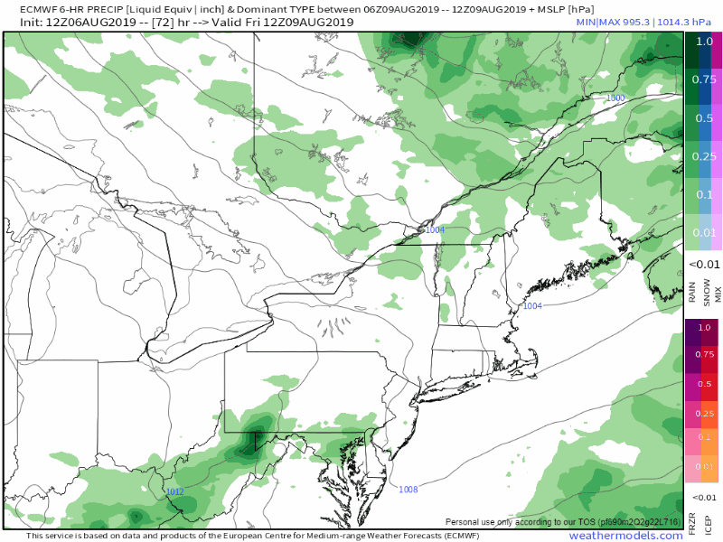 After the cold front heads off shore, we slip back into the zonal pattern. Low pressure cutting across central Quebec may bring a weak trailing frontal boundary through the area, and bring a risk of showers for much of the region on Saturday. Another wave passes through on Sunday, which may bring some clouds and a low chance for a shower for interior areas as we wrap up the weekend. 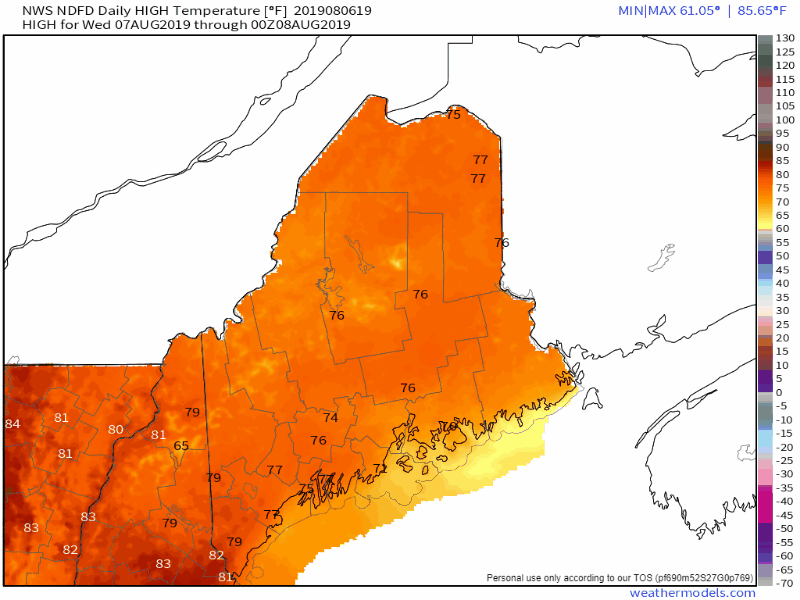 While it will be humid Wednesday and Thursday, cloud cover will dictate the high temperatures. While I don't expect a blast furnace to occur, I do expect if the sun comes out that the mercury could climb higher than expected for a period of time. By Friday, the humidity drops but the northwest breeze will keep the shorelines on the warm end. As for the weekend temperatures appear around normal or slightly cooler with widespread 70s for much of the state. Rain Outlook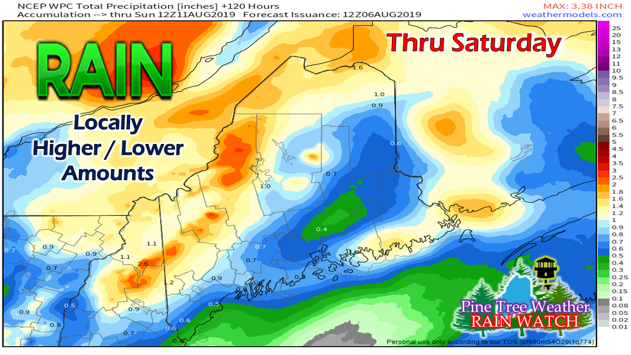 I must admit, I have a bit of hesitation showing this. I totally respect the work of the Weather Prediction Center and of the local National Weather Service offices. Why I hesitate, is there is bust potential for any rainfall outlook. Everywhere I go lately, it's "Hey Mike, when are we going to get some rain?!" I've noticed lawns are starting to burn up again, and weak trees are unloading some leaves a bit early. I sense a bit of concern by those dependent on the clouds supplying a watering source.
The best estimate at this point is the mountains, foothills in western areas, the rooftop of Aroostook and DownEast could see ¾-1" or more of rain. The rest of the state could be hit or miss, which I know isn't the news many are looking for at this point. Hopefully that changes, but for now, it's the best estimate. ► ► For the latest official forecasts, bulletins and advisories, please check in with the National Weather Service in Gray for western and southern areas, or Caribou for northern and eastern parts of Maine. Please consider supporting Pine Tree Weather ► ► Your financial donations are much appreciated to keep this site funded and for further development. FUNDRAISING FOR 2020 BEGINS SOON! I sincerely appreciate your support not only financially, but also in sharing my efforts with others. For more information from me, please check the Pine Tree Weather Facebook page as well as my Twitter feed. Always stay weather aware! |

Mike Haggett
|


