
Upper level low dictates pattern until Thursday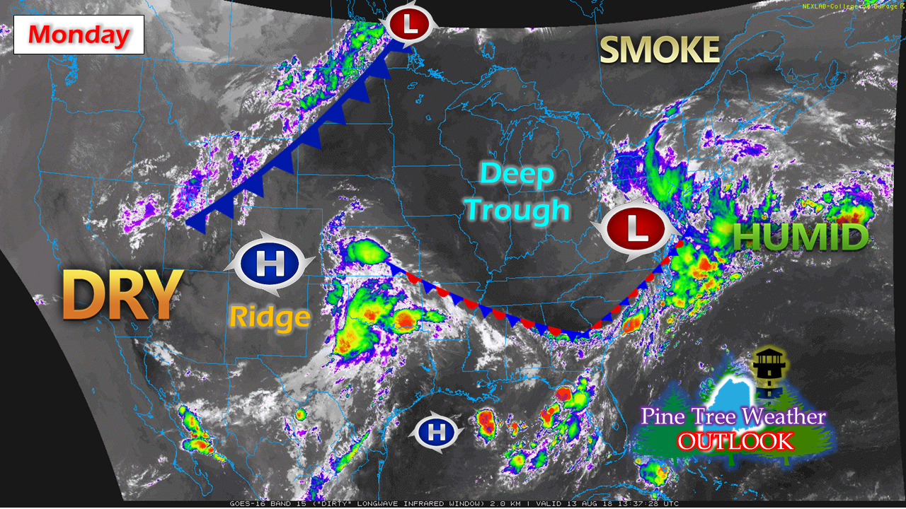 An upper level low and associated deep trough as settled in across the Midwest and won't move very far until Tuesday. It will remain rather sticky and unsettled over much of southern, eastern and western areas through Monday. Most areas will become unsettled Tuesday into Wednesday. Once the upper low exits the region Wednesday night, Thursday will be a mainly dry day. A surface low over Texas travels northeast late week, which will bring a chance for showers over western areas Friday, and then statewide Saturday. Sunday appears the better of the two weekend days as it appears for now. Stray shower possible through Tuesday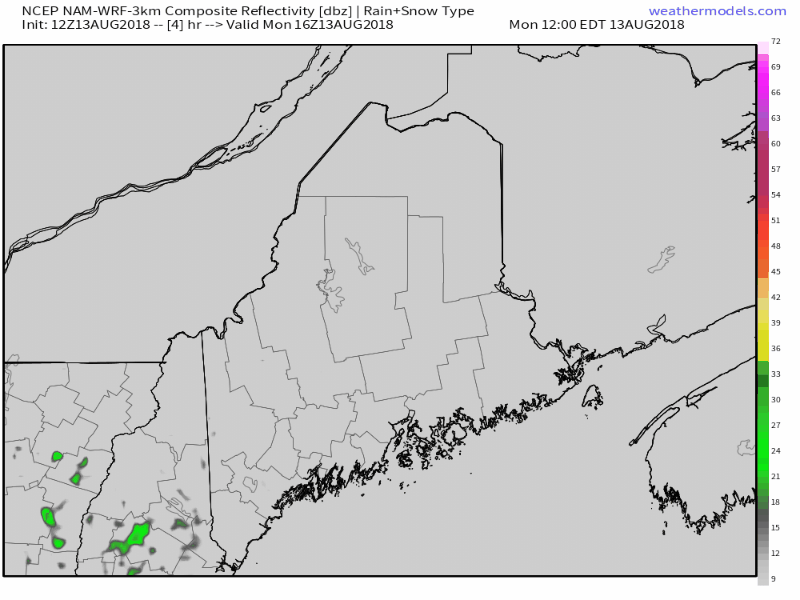 For the rest of Monday into Tuesday, there is just a slight chance for a shower or a renegade thunderstorm mainly over southern, western and eastern zones. While the atmosphere will contain convective energy from the uptick of humidity, there is not much in the way of trigger to touch off storms. That said, don't be surprised if a storm develops, and be prepared just in case. Wednesday brings the chance for severe weather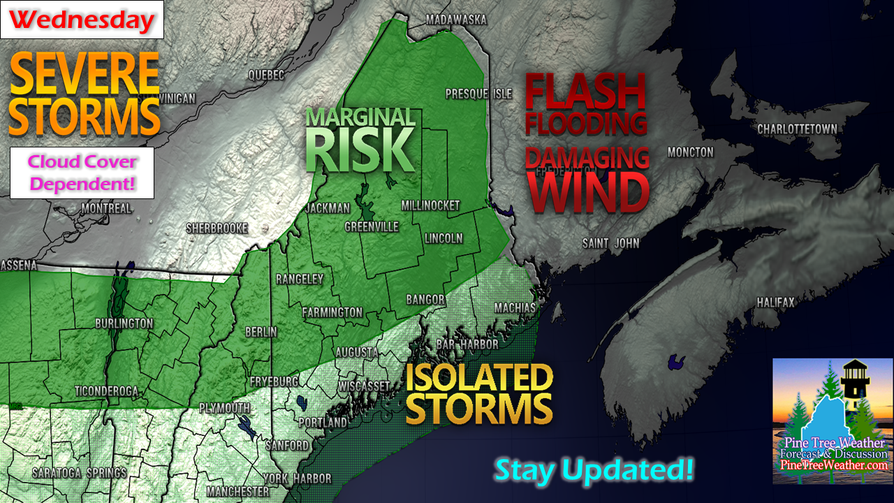 Wednesday will be a day to keep close watch on. It's rather rare that Storm Prediction Center puts the region in a Day 3 Outlook (time sensitive link) which tells me this could elevate or bust given the dynamics at play. There will be plenty of tropical moisture around, and as a result, convective energy to fuel storms will be an issue. With the upper level low moving northeast, there will certainly be a trigger in the atmosphere as long as the sun can get out. This is definitely a cloud cover dependent situation, and one to stay updated on. Past and future rainfall amounts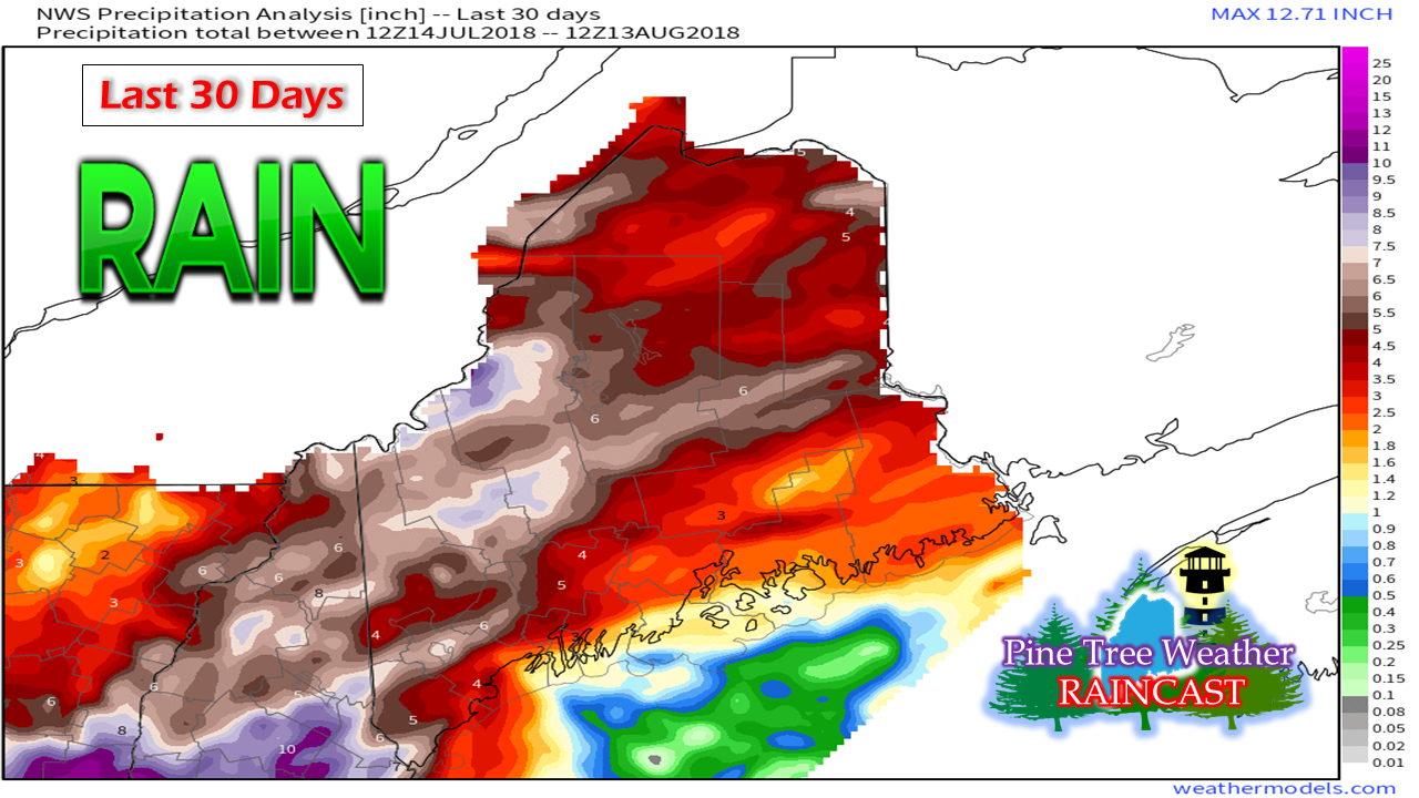 Rain analysis of the past 30 days from National Weather Service estimates is encouraging for the drought concern. We've had more rain in western and southern areas since July 4th than what fell in April through June, which was much needed. It may have cramped on vacation and outdoor plans, but it has been good to bring some green to the lawns, add to groundwater sources, and get the rivers and streams flowing again. 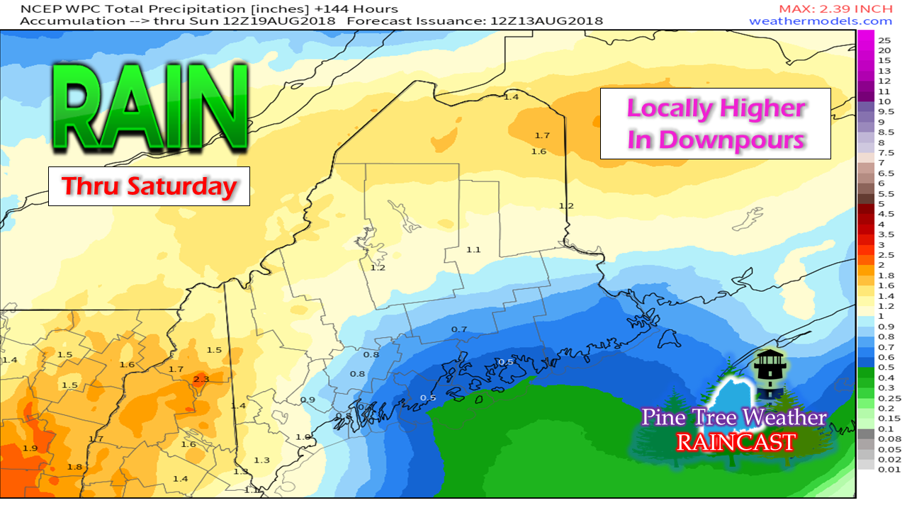 The pattern continues to be a relatively moist one through the remainder of the week. This estimate of rainfall from the Weather Prediction Center hints at an inch on the way between now and Sunday morning for the region. Some areas may see more or less pending on how the shower activity sets up. Temperature trend remains warm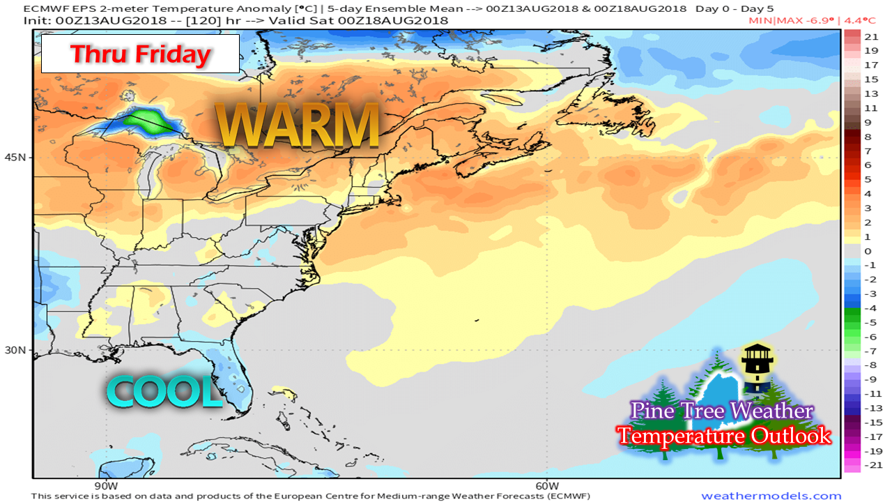 A five day running average of temperatures indicates the region will run a bit above normal, thanks to the tropical air mass that will be with us over the course of the week. We'll get a break from the humidity Thursday and Friday, and then appears to increase briefly on Saturday, before settling back down on Sunday. Thank you!A special thank you to those who passed along condolences, prayers and well wishes to my family as we've dealt with our recent loss. It's been a tough stretch for us over the past couple of years, but your words, encouragement and patience have been a great blessing to me. We still have some family related issues going on, so I will update when I have time. Thanks again!
As always, stay in touch with the National Weather Service for the latest bulletins, advisories and up to date forecast information. Check in with the Gray office for western and southern areas, and the Caribou office for eastern and northern zones. Always stay weather aware! - Mike |

Mike Haggett
|


