
Disturbances continue to roll through the region Wednesday will be mainly dry for most of the day. Showers advance into the southern three- quarters of the state in the afternoon. Interior areas may see a few flakes Wednesday night. Important to note here that behind this system, cooler air precedes the precipitation and may cause a few slick spots away from the coast Thursday morning. Clouds will be the dominant feature for most of the region Thursday as the remaining showers taper off. A few glimpses of sun for northern and eastern areas are possible Friday morning, but all areas of the state are likely to be damp by Friday afternoon into the evening. Showers continue Friday night, then taper from west to east towards daylight Saturday. Any showers early Saturday appear to end early in the day, and sun will try to make an appearance from time to time over southern, eastern and western areas. Sunday appears now to be the pick of the weekend, but another disturbance passing through southern New England may clip southwestern areas with a shower late in the day. Regional outlook through Sunday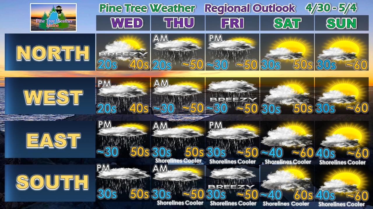 While the weekend rise in temperatures may want to encourage planting and gardening, I'd hold off for another week, if possible. Temperatures appear to cool back down next week. It may be the following weekend before the pattern shifts to more seasonable mercury levels.
Thanks for sticking with me here as my family and I get back into a regular routine from our latest loss. As always, you can check on Twitter and Facebook when the site is quiet. ► ► For the latest official forecasts, bulletins and advisories, please check in with the National Weather Service in Gray for western and southern areas, or Caribou for northern and eastern parts of Maine. ► ► Your financial donations are much appreciated to keep this site funded and for further development. I sincerely appreciate your support not only financially, but also in sharing my efforts with others. Always stay weather aware! - Mike |

Mike Haggett
|


