
Most of the region received -some- rainfall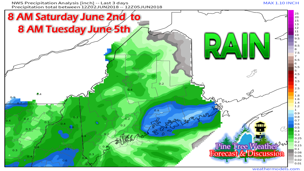 Since my last update the region received some needed rainfall with DownEast areas receiving the most and the northeast Crown receiving very little. These are rough estimates from station observations and spotter reports. I measured 0.63" of rainfall total at my home in Kennebunk, so locally higher amounts in areas would have been possible. More rainfall on the way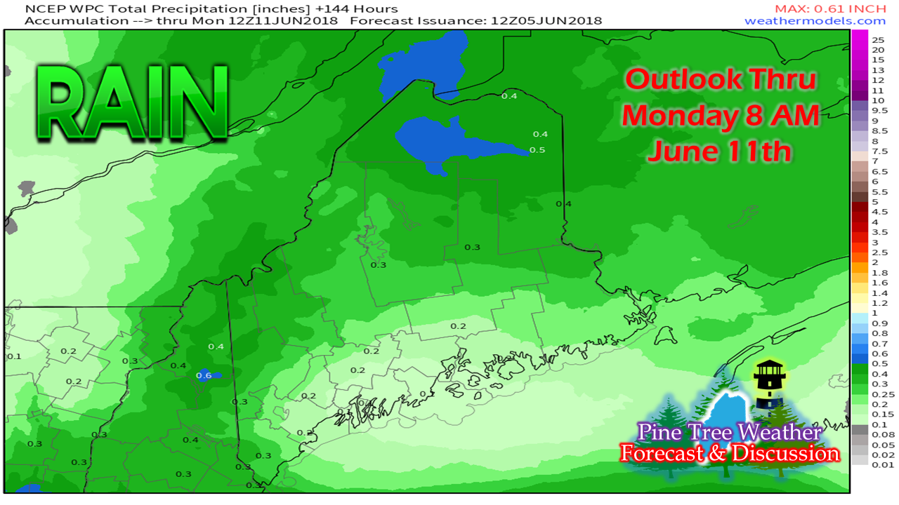 This estimate from the Weather Prediction Center through Monday shows projected rain accumulation on the way. Most of this will fall by Friday. In the big picture, it's not going to amount to a whole lot, and could be locally higher or lower pending on shower formation. Dry times to continue well into the month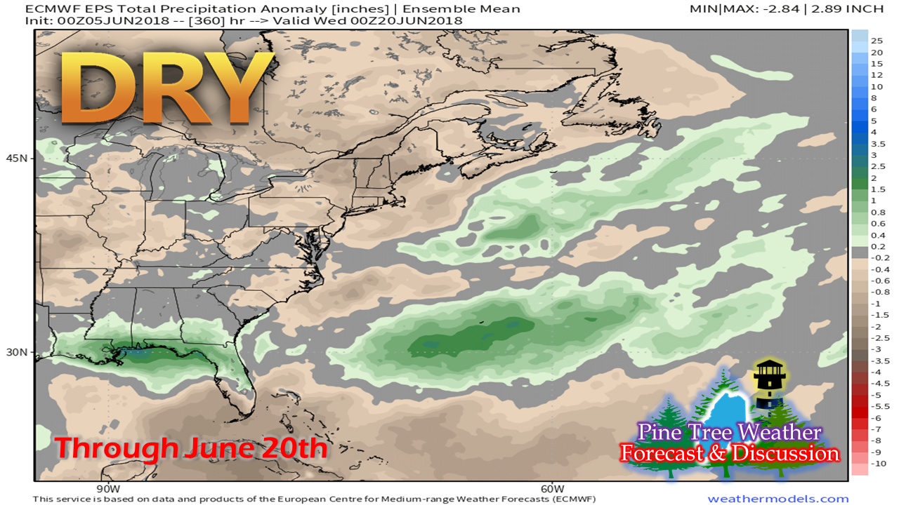 The outlook for rainfall amounts has not improved as we move into June. In fact, it may be a drier idea than what was posted in my previous updates. Many of the rivers, brooks and streams over the western and southern parts of the state are trickling, if that, even with the recent weekend rainfall. Folks who depend on groundwater supplies should be conserving usage if not already doing so. Conserve water, stay in touch with the Maine Forest Service, local park rangers, and/or your local fire department for burn permits and campfire usage. 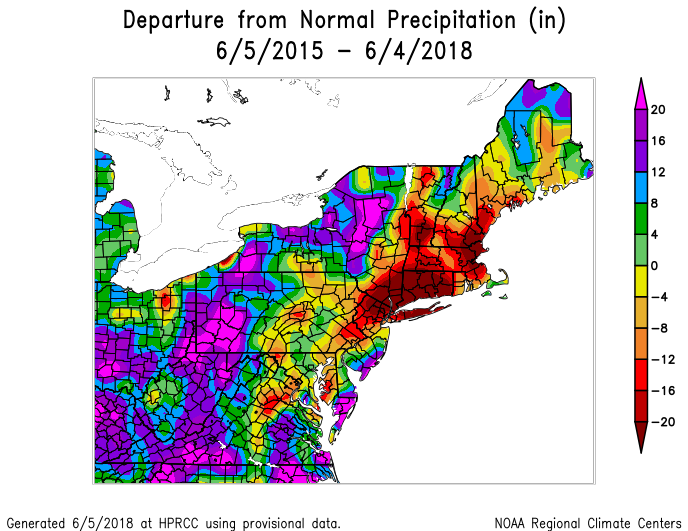 Roughly 50% of the state of Maine and a large portion of New England has been in a stealth drought for a number of years now. For those who have followed my observations for a while may remember this graphic from the past years. It hasn't changed much. If anything, this stealth drought has gone on for four years at least, and perhaps longer than that. The areas hasn't seen a super soaking tropical event for a number of years now. It may take one or two to put a dent in this deep deficit much of the region is in. Weather pattern unlikely to change much soon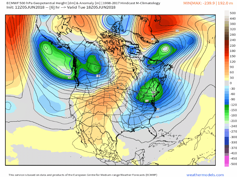 While a strong ridge will develop over the central parts of the continent as the week progresses, the trough continues to act as a block over the northeast. As the ridge to the west strengthens, the trough amplifies, keeping the heat and humidity away. Where parts of Newfoundland, Labrador and eastern Quebec saw as much as a foot of snow last week, those same areas could see another round or two of accumulating snow later this weekend and again next week. It may be the third week in June when summer arrives, not only astrologically, but actually. Regional outlook through the weekend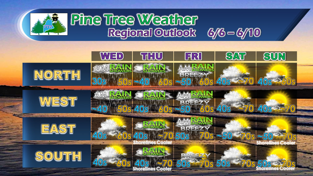 The outlook here is rather straightforward. As the weak troughs work through the region, they bring scattered light rain showers through the remainder of the week. Another trough pushes across northern and western areas on Saturday, which may bring a brief spot shower in areas. Sunday appears for now to be the pick of the weekend, with showers possible to return early next week. Temperatures average out to be close to seasonal normal values, perhaps a touch warmer, over the next five days.
As always, stay in touch with the National Weather Service offices in Gray for western and southern Maine and Caribou for eastern and northern Maine for the latest advisories and bulletins. Thank you as always for your support! - Mike |

Mike Haggett
|


