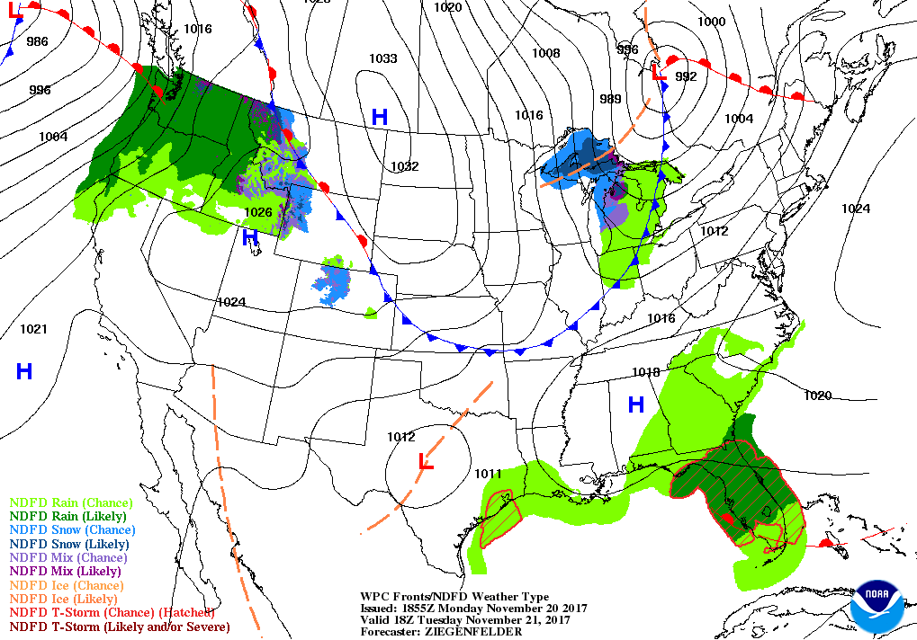
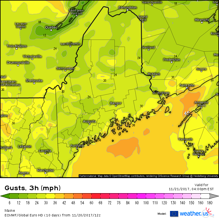
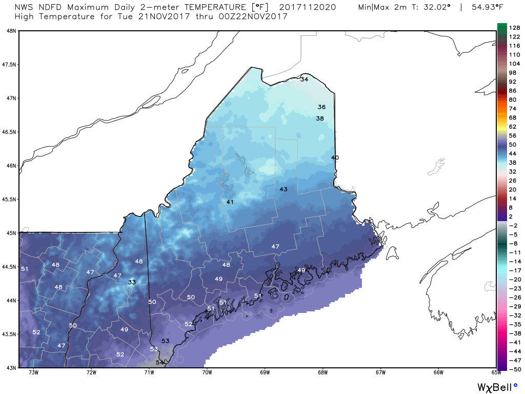
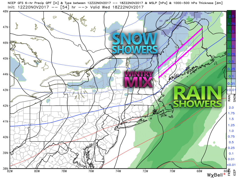
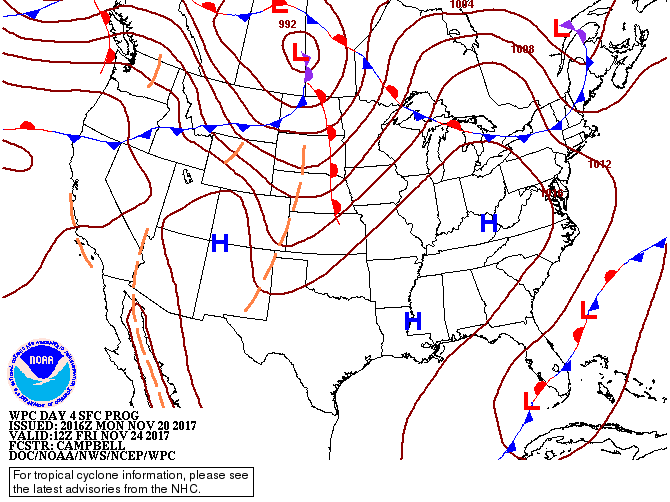
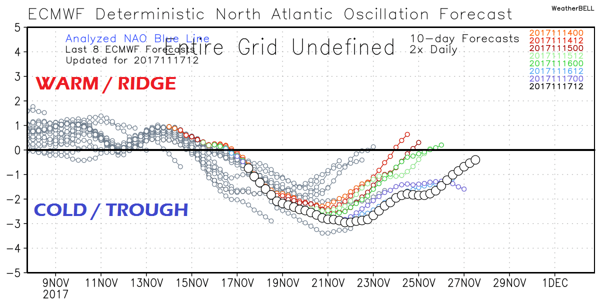
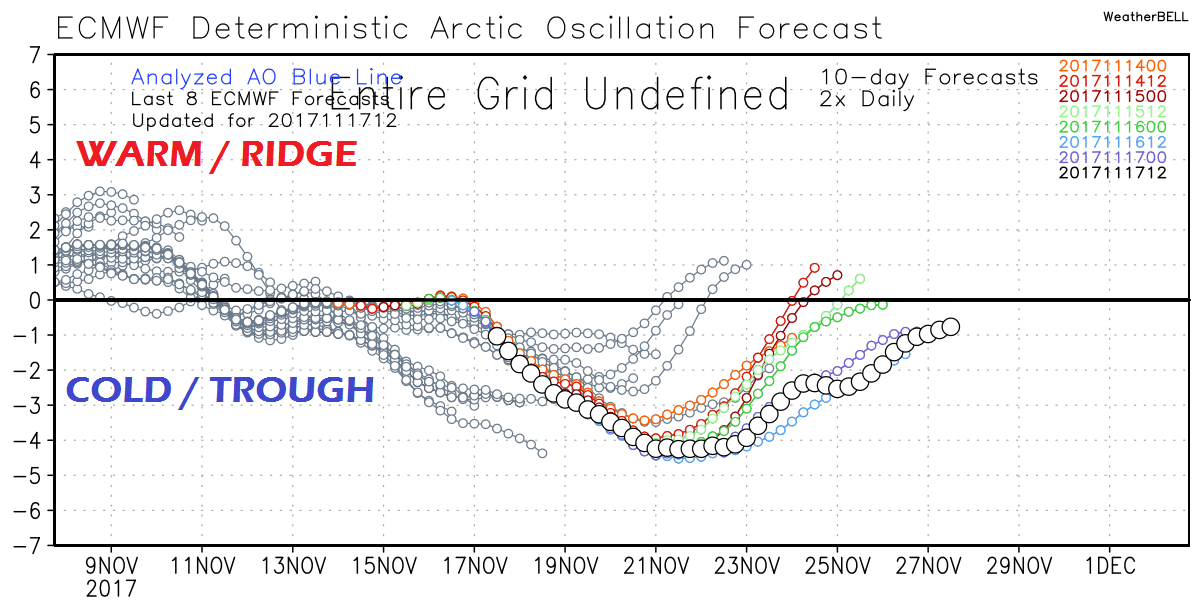
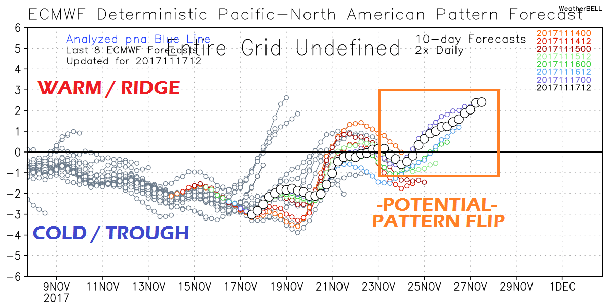
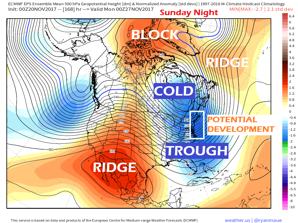
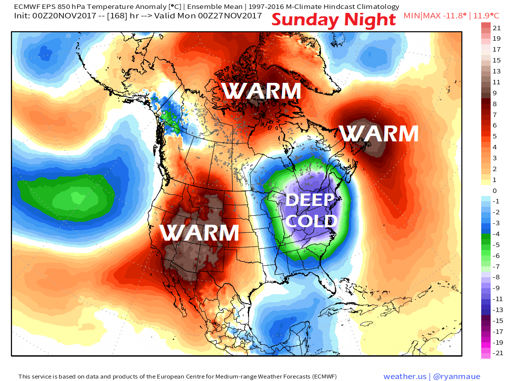
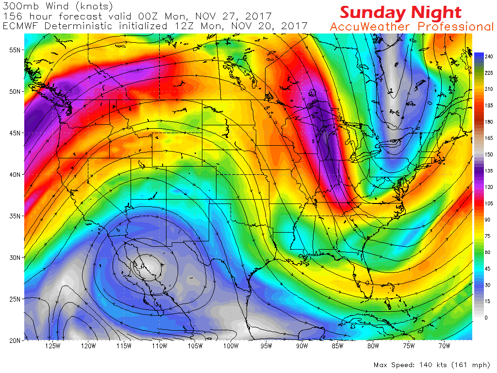
A bit warmer for TuesdayHigh pressure moves to the east allowing for a southwest flow to develop and will allow temperatures to rise a bit for Tuesday. The breeze that has impacted the region Sunday and Monday switches direction and could see gusts hit the 30 mph range in areas. Outside of the rooftop of the state, the mercury climbs into the 40s and 50s for much of the region. Overnight lows will be a bit warmer as well with 30s being the dominant reading heading to Wednesday morning. Wednesday unsettled, but negotiableFor folks hitting the road on Wednesday, it shouldn't be a big deal overall. This graphic shows the split in how I think it will break down for the state overall for discussion purposes only. The mountains and north see primarily snow showers, a light mix is possible for the foothills up into The County and rain appears to be the dominant feature for the coast. Rain could be steady along the coast for a period in the morning. Any snow that falls in the mountains is expected to be light. All areas may see a flake or two by the time it is over Wednesday afternoon when the cold front passes through. How quickly the temperature drops in conjunction with potential patchy ice formation will be updated as there are conflicts in model ideas. With the high volume of traffic on the highways and state roads, it would be wise to allow for some extra time and take it easy on speeds. Thanksgiving and Black Friday quietOutside of a chance of a flurry or snow shower for the mountains and north Thursday night into early Friday, the holiday looks void of any precipitation. High temperatures will be a bit on the cool side Thursday with 20s and 30s, and will only bump up a couple of degrees for Friday where southern areas may reach the low 40s. Potential pattern change this weekendFor you long time followers, you've read my rants about how operational / deterministic models have problems with cold, and how their reliability beyond 5 days are circumspect off and on for years. I usually spout off when ECMWF (Euro) deterministic models are spread around showing feet of snow in one particular model run. Another is the GFS model showing epic hurricanes developing 7 - 14 days out. It's this model "science fiction" that spreads like a windswept wildfire on social media that many times never comes to fruition. Then there is the flip side ... models show nothing, and if one isn't paying attention, a storm pops up out of nowhere and everyone is caught off guard. In either situation, meteorologists and forecasters (this includes me) get bombarded with inquiries and requests on what in the world is going on. Here's some inside baseball from the weather field that isn't talked about much publicly. Teleconnections are a tool used to help guide forecasts several days out. While teleconnections aren't without errors and biases, they usually do a decent job indicating potential pattern changes within a week or so out. I am going to define each of the three key teleconnections that are good indicators for the Maine region. Hang in there while I break this down ... The first is the NAO or North Atlantic Oscillation. This takes into consideration the entire north Atlantic region. This summarizes activity between the ridges and troughs going on and where the sum total of the balance of activity is going. You may see where someone chirps up saying, "Well, the NAO is negative, we should be getting snowstorms." Not so fast. In this situation, the indicator is headed negative BUT this is only one component. It will need help from other areas to produce snow events. The next key element is the AO or Arctic Oscillation. This is the cold piece. the more negative the indicator is, the deeper the cold. This is typical of winter. The AO usually runs negative this time of the year, because of winter. In this graphic, the AO is headed downward late week, which means cold air will be the dominant feature in the northern hemisphere weather patterns. With a negative NAO and AO, that sets up the potential for snow storms. The lower the negativity, the stronger the troughs, the stronger the cold. With all of that under consideration, there is one more key teleconnection ... This is the Pacific-North American Oscillation, also known as the PNA. This gauges amplification of the eastern Pacific region. Of the three teleconnections, the PNA is the one holding the cards right now. Currently, all three are running negative. This means west to east zonal flow, weak storms, relatively quiet pattern. Sound familiar? This summer from July onward, the PNA by-in-large has been negative. The NAO was positive which brought the strong ridges, and the AO was running neutral or negative which is why it was cool until September. It took two typhoons in the eastern Pacific in October to help break the pattern to get fall going in this area. What will aid the progress of winter is a strong ridge building in the eastern Pacific that will drive cold air down from the Arctic late week and into the weekend. And here it is. This is the Euro ensemble idea for Sunday night. A very deep trough bringing an Arctic blast to eastern Canada and the northeastern United States, and drives all the way to Florida. Meanwhile, the ridge grows in the west. This is a typical negative NAO/AO and positive PNA set up. This is recipe for action. A look at temperatures at ~5,000 feet shows the deep cold surrounded by anomalous warmth. With all of these players in the atmosphere, the signal is there for a change in the pattern. The big snows for the region come from storms that form along the DelMarVa region and move up the coast. In this scenario, the northern and southern jet split off. It's a timing game at this point. If energy can get organized, the Mid-Atlantic and Southern New England could see some action. How far north? Time will tell. Indications at this point IF anything happens, it would bring something to the coast. Operational models are pushing the storm threat out to sea, but it is still early. Models never handle the cold air well. Remember that.
Stay tuned. - Mike |
Mike Haggett
|

