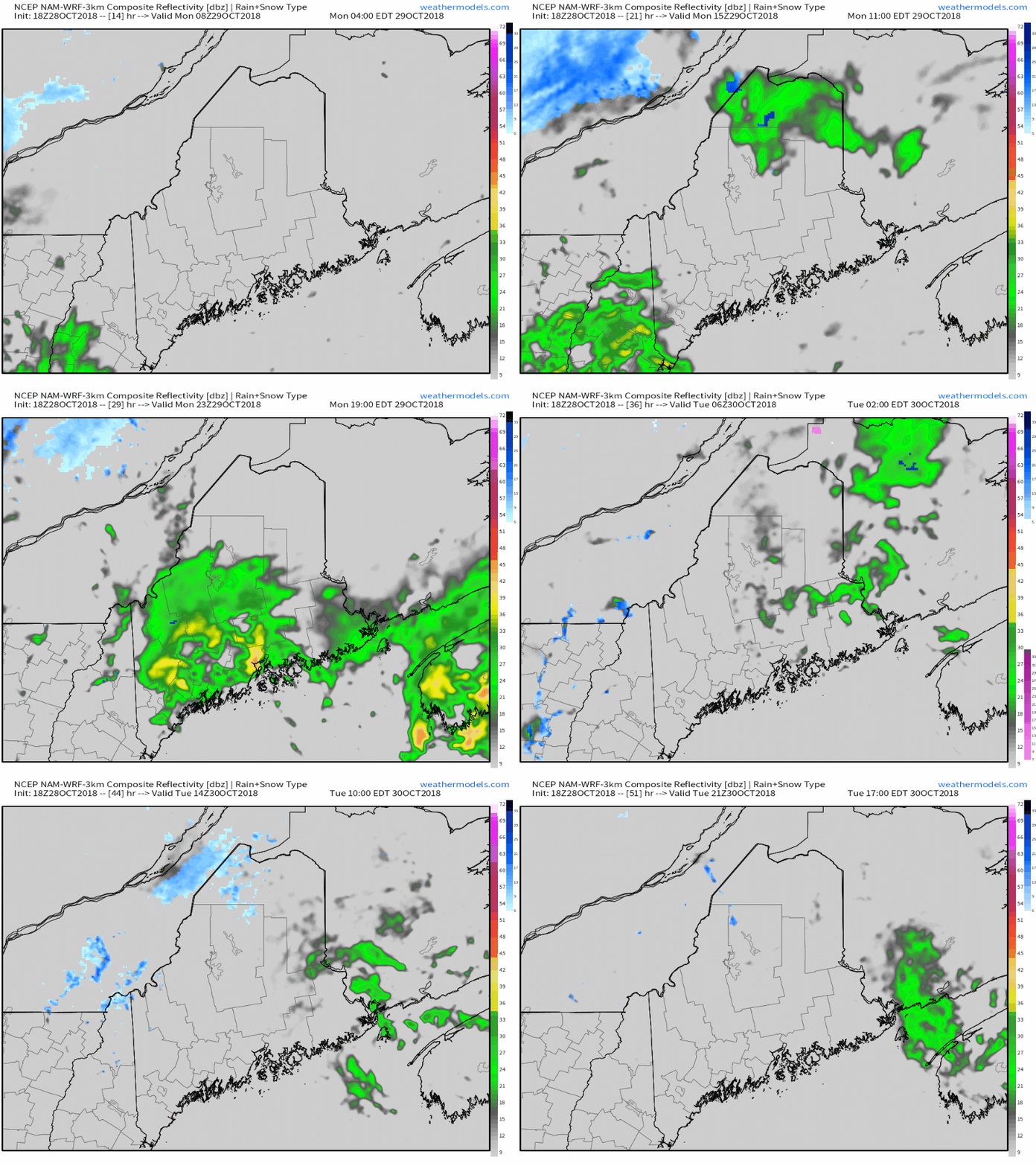
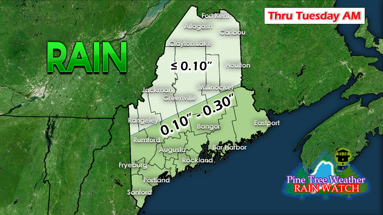
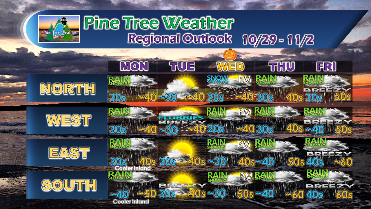
Monday showery at timesA couple waves of showers to deal with to start the work week courtesy of an upper level low that will be spinning over the region. A few widely scattered showers start us off in the morning followed with more numerous activity for in the afternoon and evening. After the upper low exits and drags a surface front through early Tuesday, some flurries are possible in the mountains through Tuesday morning. What little rain comes mainly for the coastNot a whole lot of rain here when all is said and done. The foothills and coastal plain will get the most, with just a smidge for the north country. Outlook through FridayTuesday will be the pick of the work week for sunshine. A frontal boundary approaches the region for Halloween which may dampen the trick-or-treaters. Showers will be off and on Thursday. Low pressure forms on the front and impacts the region on Friday. A Flying Trash Can Alert may be needed pending on the strength of the low. Saturday looks damp and Sunday is the better day of the weekend as it appears for now.
More updates to come. For the latest official forecasts, bulletins and advisories, please check in with the National Weather Service in Gray for western and southern areas, or Caribou for northern and eastern parts of Maine. For more information from me, please follow the Pine Tree Weather Facebook page and my Twitter feed. Thanks as always for your support! Please consider making a donation to keep Pine Tree Weather going through the year ahead. Check out the donate page on how to contribute. Always stay weather aware! - Mike |
Mike Haggett
|


