Pine Tree Weather
  • DISCUSSIONS
  • MAPS
  • BRIEFINGS
  • SATRAD
  • MARINE
  • RAIN OUTLOOK
  • SNOW / ICE OUTLOOK
  • CPC OUTLOOK
  • Kennebunk
  • Weather Geekdom
  • Who We Are
  • DONATE
  • My Photography
  • DISCUSSIONS
  • MAPS
  • BRIEFINGS
  • SATRAD
  • MARINE
  • RAIN OUTLOOK
  • SNOW / ICE OUTLOOK
  • CPC OUTLOOK
  • Kennebunk
  • Weather Geekdom
  • Who We Are
  • DONATE
  • My Photography

Update on Thursday and Saturday rain outlook

9/26/2019

Comments


A bit more rain for southern areas?

Picture
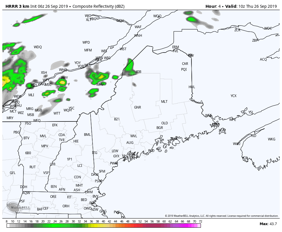
Timing posted here Wednesday evening remains on track. Showers move into western and northern areas around midday, then works southeast in the afternoon, reaching the coast by around the evening commute. Temperatures appear to be in the 60s north and mountains, 70s for most of the coastal plain (cooler 60s for MidCoast / DownEast shorelines with the onshore breeze) and perhaps an 80° reading for interior York County. Wind will be out of the southwest at 5-15 mph, with gusts in the 20 mph range as the front gets closer.
Picture
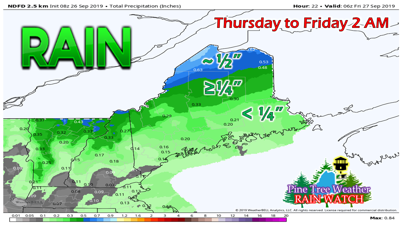
The southwest coast and interior remains a bit of a crapshoot on rain amounts. Mesoscale models are typically bullish on rain amounts due to the way they are wired, Operational model ideas vary. This may be the best case scenario for measurable rainfall, but I caution for bust potential for lesser amounts.

Saturday rainfall light to non-existent

Picture
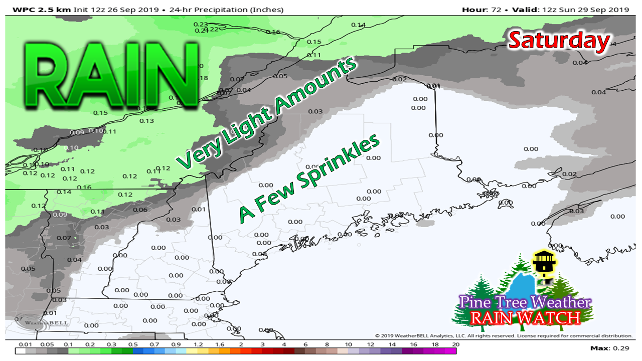
This idea has been pretty consistent all week. The Quebec border region has the best chance of getting any measurable rain on Saturday, and that may be a miniscule amount. A few sprinkles are possible over the foothills and central highlands, and maybe a drop or two for the coastal plain. 

We could have a multi-day rain event beginning Tuesday that may last into Thursday next week. It's a bit early to commit to that, but the idea is on the table.

Stay tuned for more on that. 

► ► For the latest official forecasts, bulletins and advisories, please check in with the National Weather Service in Gray for western and southern areas, or Caribou for northern and eastern parts of Maine.

Donations are needed for the future of Pine Tree Weather. Thank you for your support!   

For more information from me, please check the Pine Tree Weather Facebook page as well as my Twitter feed. 

Always stay weather aware!

​- Mike

Comments
    Picture

    Mike Haggett
    Kennebunk, ME

    Penn State
    Weather Forecast Certification '21.
    AMS / NWA
    Weather-Ready Nation 
    ​SKYWARN-CWOP

    Picture

    Alex Hatfield
    Wakefield,MA


    Penn State
    Meteorology and Atmospheric Science ‘21
    PSUBAMS
    Campus Weather Service
    PSU Storm Chase Team
    PSU College of Earth &  Mineral Sciences Ambassador

    Picture

    Kaitlyn Lardeo
    ​Syracuse, NY

    SUNY Oswego
    Atmospheric Science
    Lake Effect Storm Prediction and Research Center
    Northeastern Storm Conference Contributor

    DONATE
    Picture

    Archives

    January 2021
    December 2020
    November 2020
    October 2020
    September 2020
    August 2020
    July 2020
    June 2020
    May 2020
    April 2020
    March 2020
    February 2020
    January 2020
    December 2019
    November 2019
    October 2019
    September 2019
    August 2019
    July 2019
    June 2019
    May 2019
    April 2019
    March 2019
    February 2019
    January 2019
    December 2018
    November 2018
    October 2018
    September 2018
    August 2018
    July 2018
    June 2018
    May 2018
    April 2018
    March 2018
    February 2018
    January 2018
    December 2017
    November 2017
    October 2017

    Categories

    All
    Maine Weather
    Pine Tree Weather

    RSS Feed

Proudly powered by Weebly