
Timing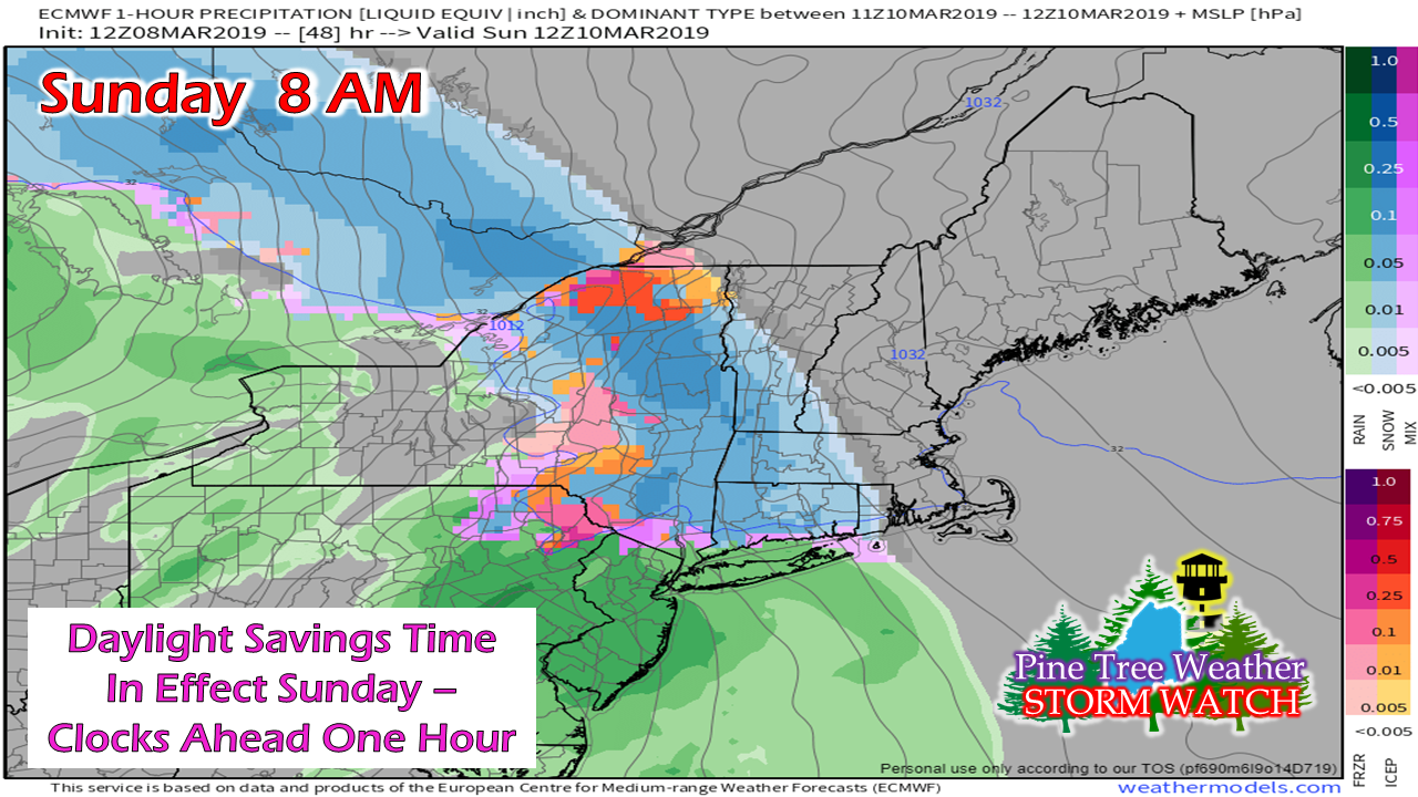 The region starts off cloudy and dry, but not for long. Conditions go downhill Sunday morning over western and southern areas as the morning progresses. 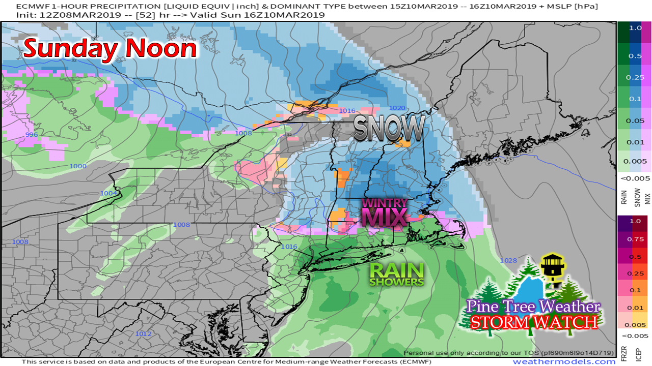 Snow over southern and western areas accumulates over western and southern areas by noon. MidCoast areas begin to see their first flakes. 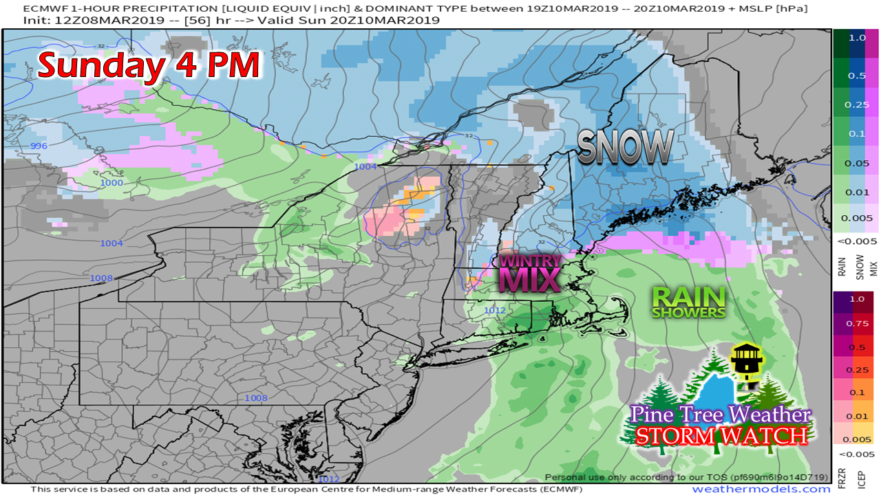 By late afternoon, the Bangor area and most of the DownEast region begin to see accumulations. Southern areas start to see a change over to a brief period of mixing. Eastern Aroostook begins to see their first flakes. 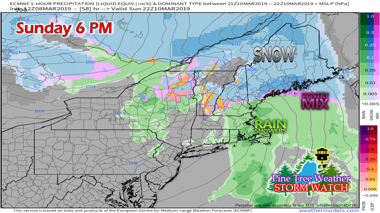 By evening, snow has overspread the north and east. MidCoast areas see a change to a mix. Southern areas transition to rain showers. 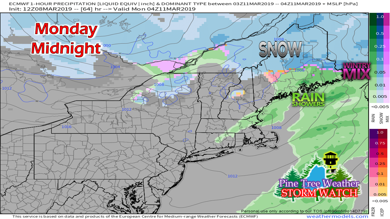 By midnight, precipitation begins to end over southern areas. Rain works through MidCoast and DownEast regions. Snow continues in northern areas. 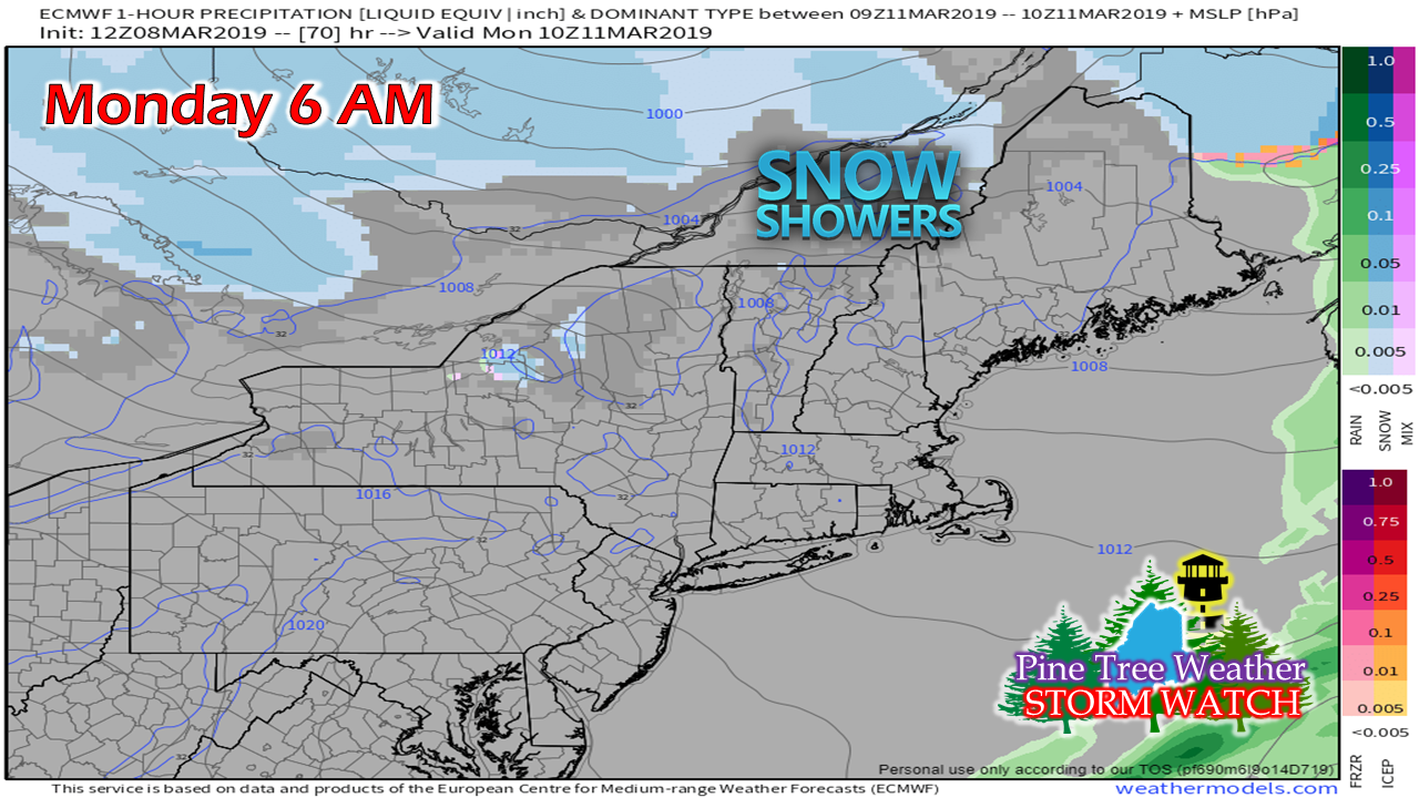 By daylight Monday, most of the steady precipitation has left the region. Snow showers break out over the western mountains and northern areas, and continue off and on through the day into Monday night. Expected snowfall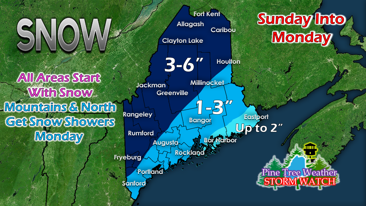 A slight adjustment to the map posted here Thursday, due to cold air over the region and a slower transition to rain over the coastal plain. The mountains and north may pick up another inch or so of accumulation with snow showers on Monday. Outlook through Wednesday Our next storm appears to come Friday, and for now, it appears to be a rainy event.
NOTE: Stay tuned to Facebook for updates through the weekend. My next post here will come Monday. ► ► For the latest official forecasts, bulletins and advisories, please check in with the National Weather Service in Gray for western and southern areas, or Caribou for northern and eastern parts of Maine. ► ► Your financial donations are much appreciated to keep this site funded and for further development. I sincerely appreciate your support not only financially, but also in sharing my efforts with others. Always stay weather aware! - Mike |

Mike Haggett
|


