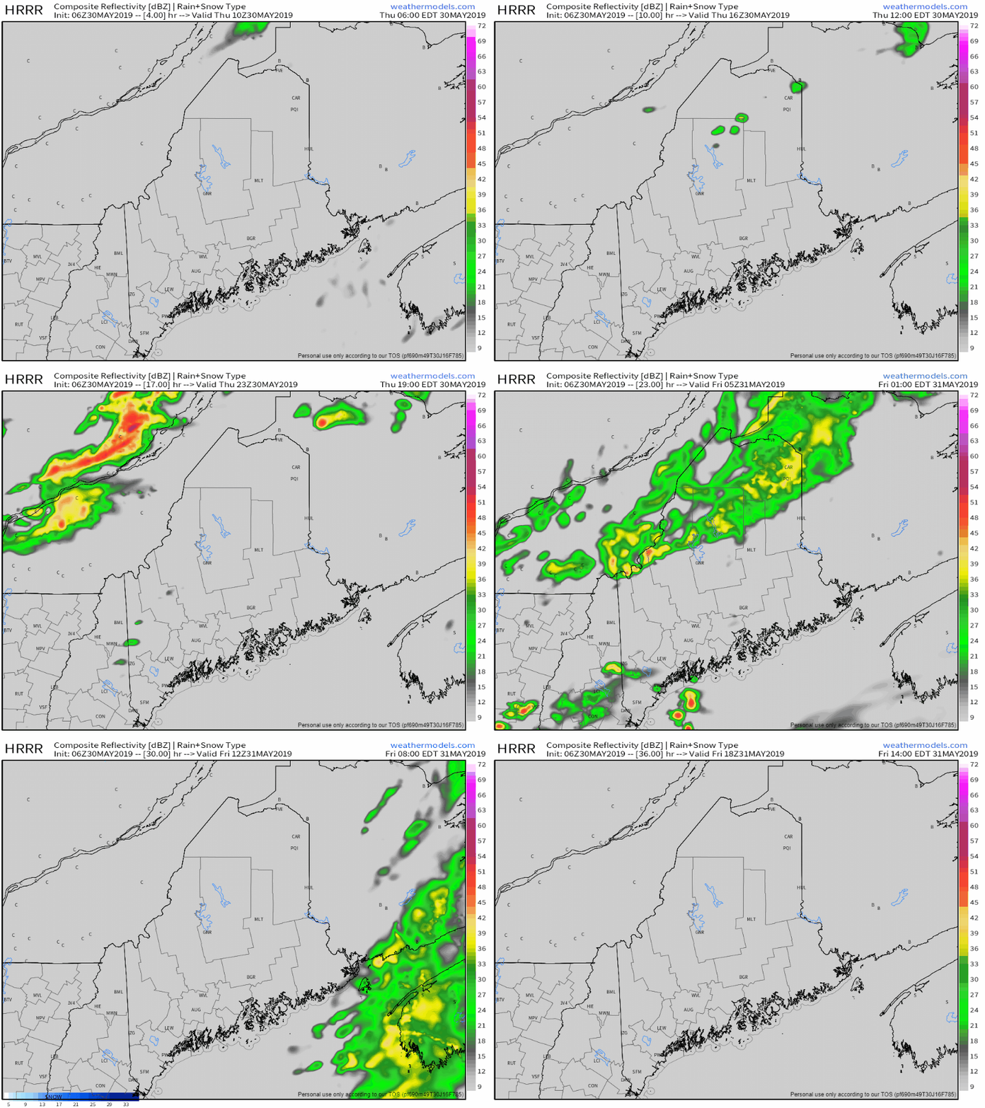
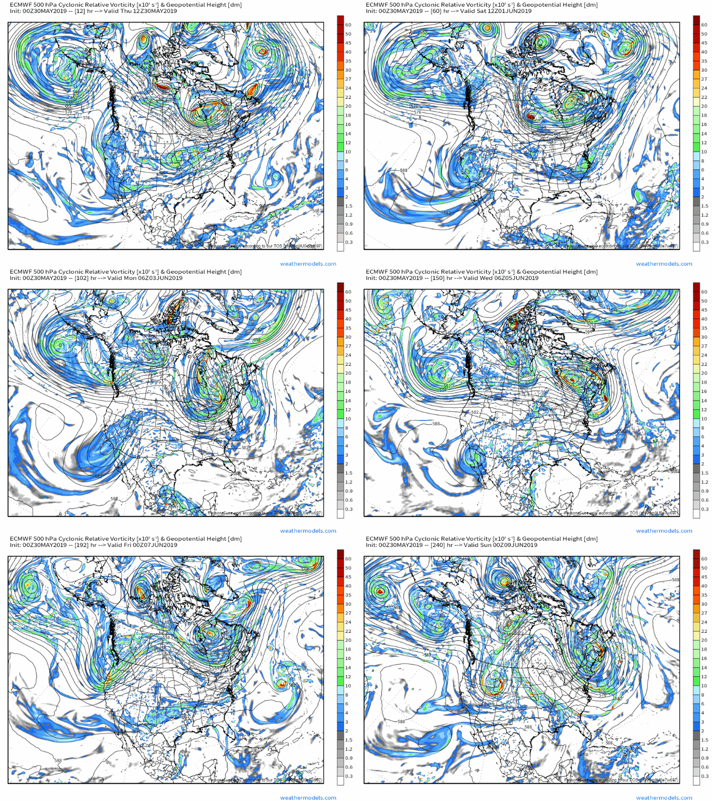
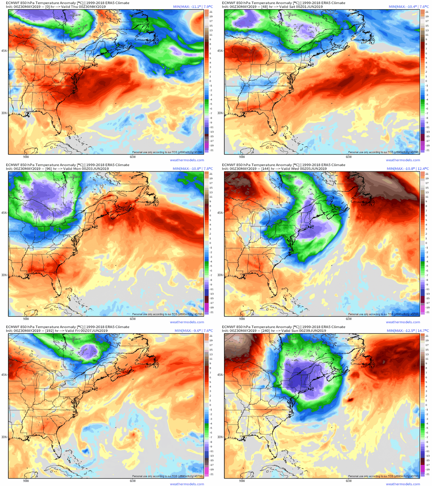
A few showers around through Friday morningA cold front approaches from Quebec and will pass through the region tonight. Clouds associated with the stalled ridge to the south and the approaching front will keep sun chances limited through the day. Northern areas have the best chance to daytime showers, with better chances for the rest of the region Thursday night into Friday morning. High temperatures for the day will be in the 60s for most areas, with 50s for Rockland, Penobscot Bay and coastal DownEast areas. A south/southwest breeze will keep the shorelines cooler through the day. Overnight lows fall back into the 40s for most, with 50s for southern areas. We'll keep our fingers crossed for a mainly sunny day for Friday. Enjoy it, because it may be few days before we see sun in any abundance. Upper low parked over Quebec to dictate patternLooking at upper level vorticity (energy) through the eyes of one model shows energy over eastern Canada virtually stuck through the next 10 days. What this translates into is below normal temperatures, repeated clipper systems and frontal boundaries that will bring clouds and showers with chances for thunderstorms. Looking at anomalous temperatures (variations from normal) at ~5,000 feet shows more cooler temperatures than warmer ones. Warmer air will nose in from time to time, but will be short lived. As we approach meteorological summer (June 1st), this pattern is concerning for two reasons. For one, the frost threat potential is still on the table. The other is severe weather chances. When the warm air does manage to get into the area, there will be some below normal cold that will drive it out. That is a classic set up for potentially nasty storms.
My next full update comes on Friday. ► ► For the latest official forecasts, bulletins and advisories, please check in with the National Weather Service in Gray for western and southern areas, or Caribou for northern and eastern parts of Maine. ► ► Your financial donations are much appreciated to keep this site funded and for further development. I sincerely appreciate your support not only financially, but also in sharing my efforts with others. For more information from me, please check the Pine Tree Weather Facebook page as well as my Twitter feed. Always stay weather aware! - Mike |
Mike Haggett
|


