
A Warm Weekend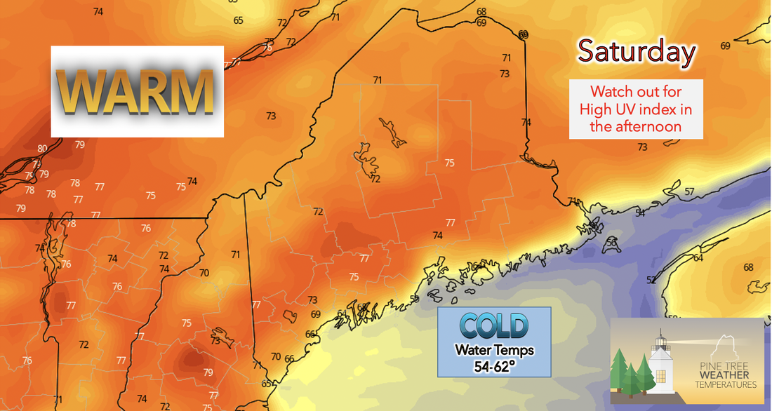 Saturday, sunny and clear skies allow for an increased amount of heating at the surface and so the highs for Saturday are likely to be significantly warmer than Friday’s. For both the interior southern and northern regions of Maine high temperatures will be in the 70’s with some areas reaching into the high 70's. As air from offshore is blown northward from the cool ocean (50’s) toward the coastal region of Maine high temperatures here are forecasted to be limited to the mid 60’s. The sun's UV rays can be very harmful to our health if exposed for an extended amount of time. Try to reduce time in the sun especially in the mid afternoon when UV index is high. 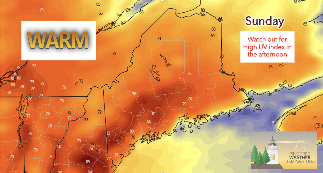 Sunday, a high-pressure system moves into the central region of the state bringing with it warm weather. Therefore, Sunday will continue the warm and dry trend from Saturday with some areas having the potential to reach into the low 80's. UV index will also be quite high for Sunday afternoon due to minimal cloud coverage, especially in the southern interior regions. While ocean temperatures will begin to increase into the 60's it is still important to remain cautious as these temperatures can still be harmful to the human body. Wet conditions for the first half of the week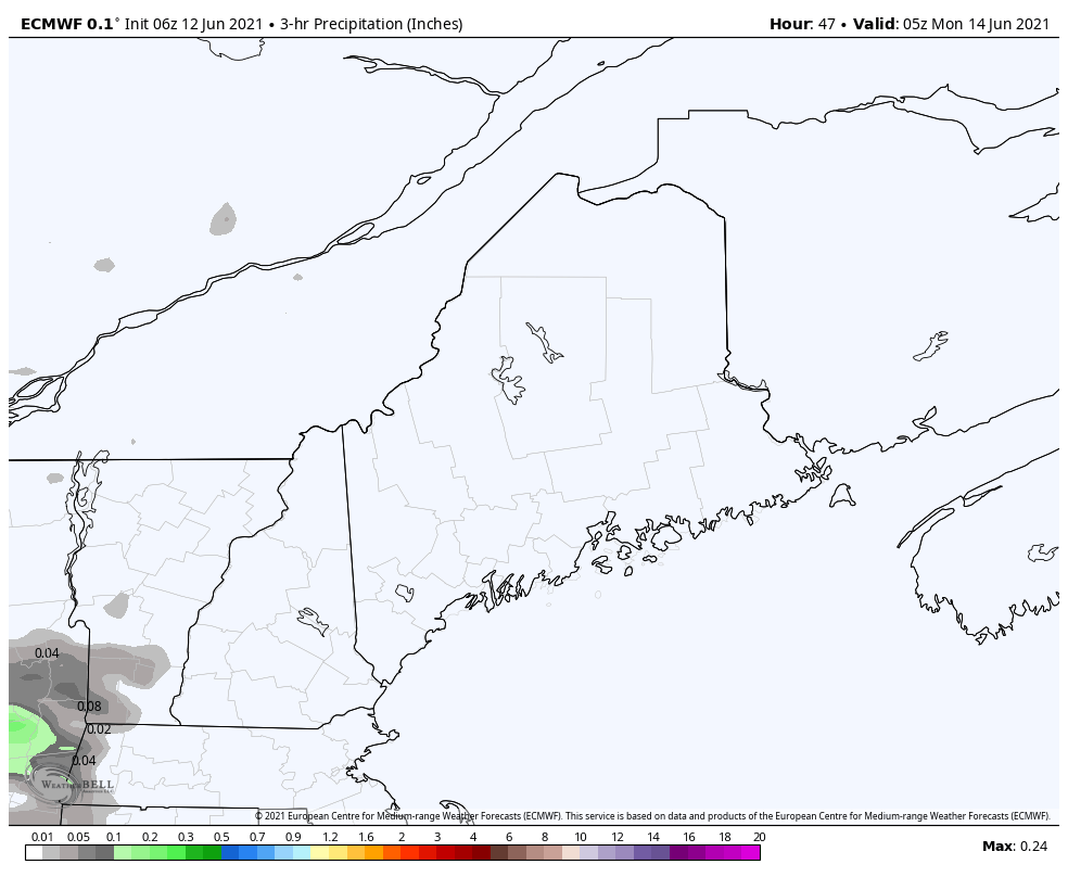 Monday is expected to be much wetter, as a weak surface low enters to the north of Maine. Plenty of moisture northward and ahead of the surface low coupled with an incoming shortwave trough later in the day Monday will cause the lifting that will be necessary to see potential for showers across the highlands and northern half of the state. Tuesday will likely be very rainy throughout the day for almost all of the region with areas in the north, like Caribou and even Bangor, seeing the potential for scattered thunderstorms. Temperatures are expected to drop down to the high 60's to low 70's from the weekend due to increased cloud coverage and precipitation. Precipitation is likely to slow down by Wednesday afternoon this week. End of the week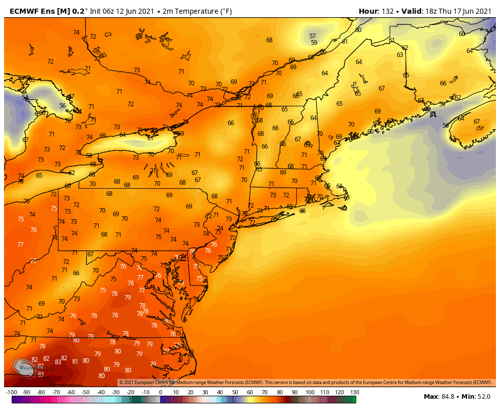 As Thursday comes about temperatures are expected to turn back around and we should see them begin to climb once again. High temperatures for the day Thursday are forecasted to fall between the mid 60's to low 70's for most of the state. Temperatures along the mid coast are likely to only reach into the low 60's due to onshore flow, as usual. As the low pressure system moves past Maine by Wednesday night moisture begins to decrease as the moist air mass is no longer present and the surface begins to dry as temperatures increase and cloud coverage decreases. 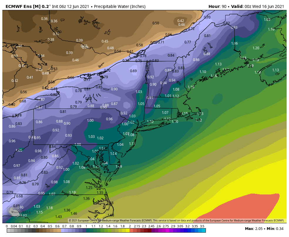 Heat can escalate quickly Warm temperatures can quickly rise to dangerous levels, especially in the summer and in parked cars. Stay Weather Ready and don’t underestimate the heat. weather.gov/safety/heat Temperature Outlook for the upcoming weekHigh temperatures from this Saturday and Sunday cool down starting Monday with the help of incoming precipitation. 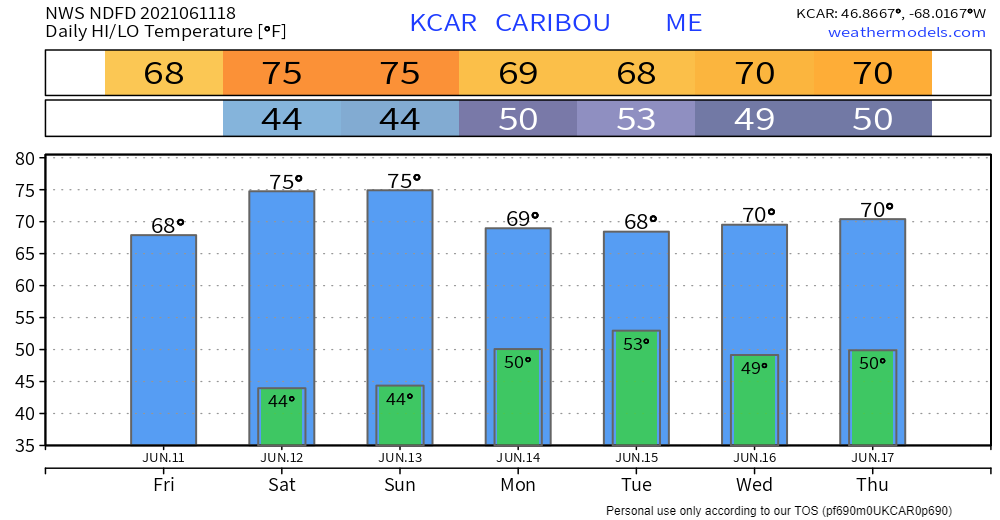 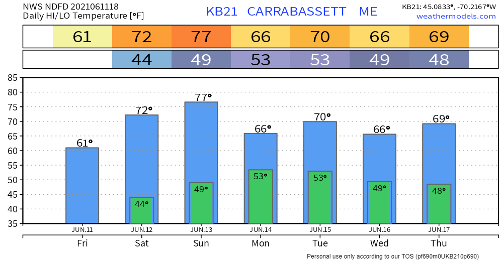 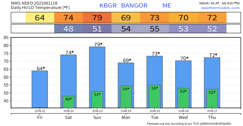 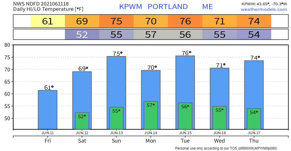 Be prepared to receive alerts and stay updated!BE PREPARED WITH A NOAA Weather Radio. For $20-$40, it could provide vital information to you when you need it. The weather bands are standard on most public safety scanners, and newer scanner models. Weather radios can be programmed for auto alert. Click here for more information.  ► ► For the latest official forecasts, bulletins, and advisories, please check in with the National Weather Service in Gray for western and southern areas, or Caribou for northern and eastern parts of Maine.  Thank you for your support! Check back on Facebook tomorrow for a morning update from Madelyn! -Angelina Find me on Twitter For more information in between posts, please follow Pine Tree Weather on Facebook and Twitter.
Thank you for supporting this community-based weather information source which operates by reader supported financial contributions. Stay updated, stay on alert, and stay safe! |

Mike Haggett
|


